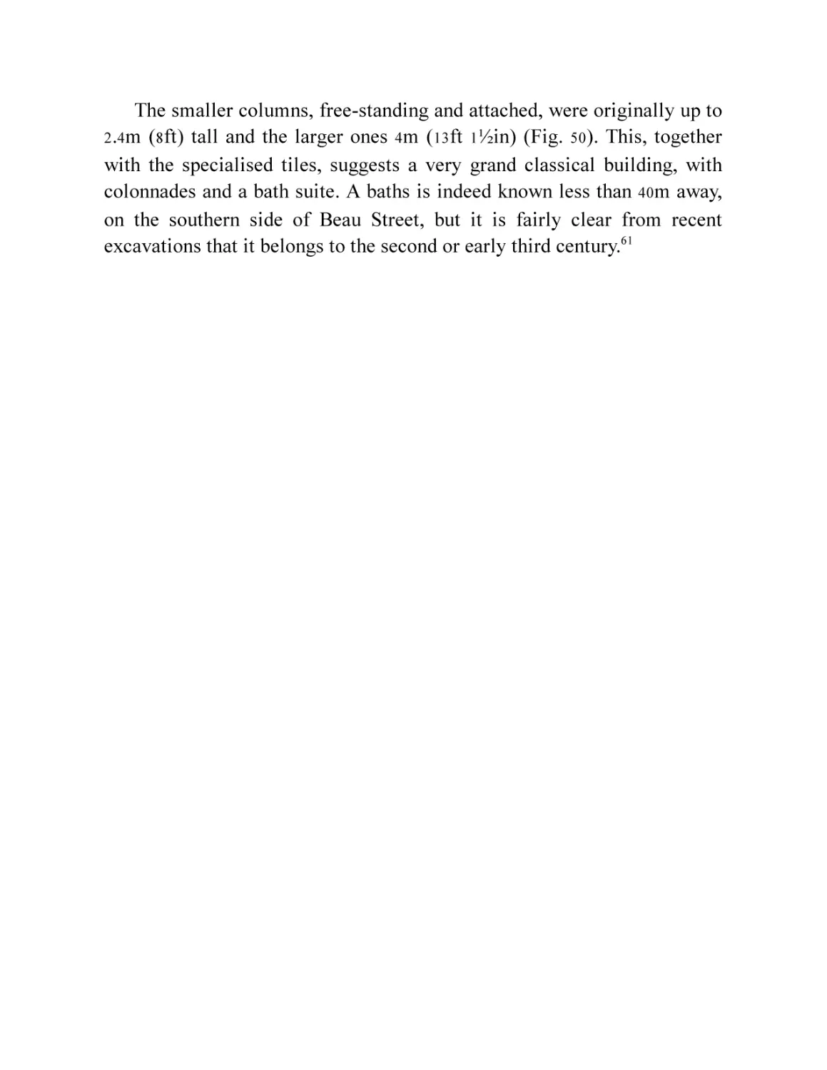
/


Текст
To Lisa, Sarah and Becca
and in memory of
John C. Clarke, amicus romanorum
First published 2021
The History Press
The Mill, Brimscombe Port
Stroud, Gloucestershire, GL5 2QG
www.thehistorypress.co.uk
© Peter Davenport, 2021
The right of Peter Davenport to be identified as the Author of this work has been asserted in
accordance with the Copyright, Designs and Patents Act 1988.
All rights reserved. No part of this book may be reprinted or reproduced or utilised in any form
or by any electronic, mechanical or other means, now known or hereafter invented, including
photocopying and recording, or in any information storage or retrieval system, without the
permission in writing from the Publishers.
British Library Cataloguing in Publication Data.
A catalogue record for this book is available from the British Library.
ISBN
978 0 7509 9643 3
Typesetting and origination by Typo•glyphix, Burton-on-Trent
Printed in Great Britain by TJ International Ltd, Padstow, Cornwall
eBook converted by Geethik Technologies
CONTENTS
1
2
3
4
5
6
7
8
9
10
11
12
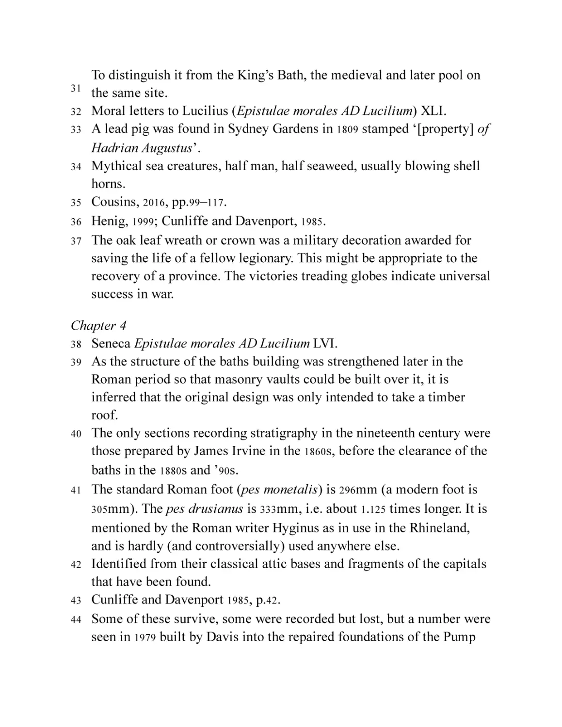
13
Acknowledgements
List of Illustrations
Foreword
Introduction
Prelude
The Romans Arrive
The Army at Walcot
Taming the Waters
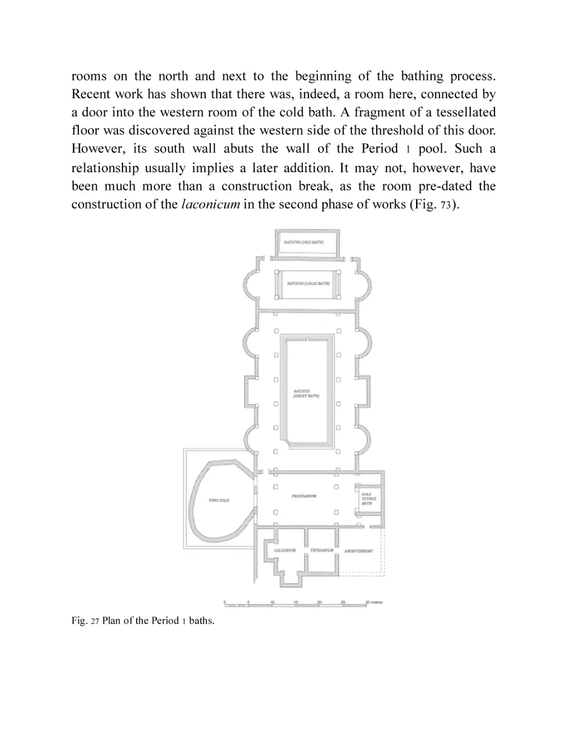
Early Baths and Temple
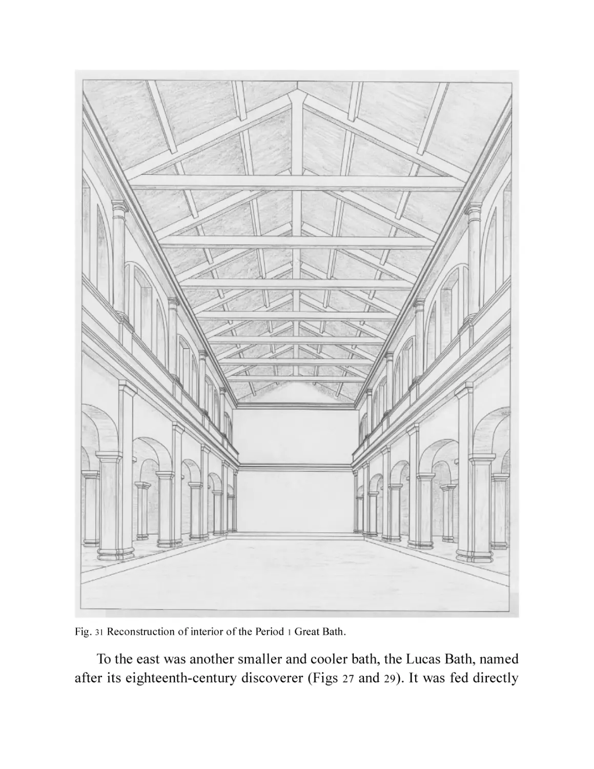
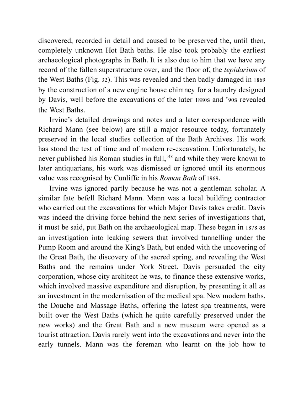
The First 100 Years Around the Temple and Baths
The First Town of Aquae Sulis
The Mid-Second Century: Another Beginning
The Monumental Centre
The Town Around the Baths
People of Aquae Sulis
The Countryside of Aquae Sulis
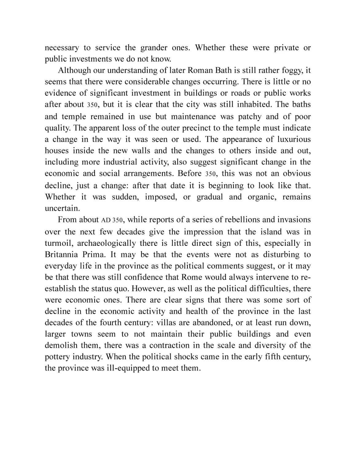
Late Roman Aquae Sulis
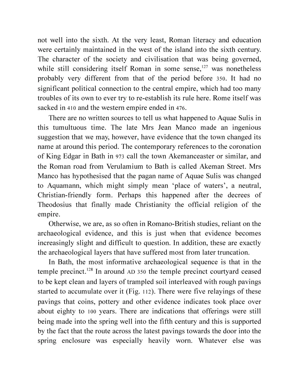
The End of Aquae Sulis
Afterword: The Three-Hundred-Year Dig
Bibliography
Notes
Index
ACKNOWLEDGEMENTS
I would first like to thank Stephen Clews, whose title of Roman Baths and
Pump Room Manager does not do justice to his academic knowledge and
interest in the archaeology of the Roman Baths. He asked if I would write
a new and up-to-date survey of the Roman town that owed its existence to
the baths and spring. His colleagues at the museum have been unfailingly
helpful, especially Susan Fox, collections manager and her assistant, Zofia
Matyjaskiewicz, in providing access to the museum’s archaeological
archives and images and providing new ones. I must also thank my
colleagues at the former Bath Archaeological Trust, especially Mark
Beaton, Robert Bell and Marek Lewcun, who ran or supervised nearly all
the archaeological investigations in the town between 1983 and 2005. Marek
has also been involved in most of the work since that latter date and has
helped fill in gaps in the visual record with images he had taken.
Photographs and other images are individually credited, except as
follows, and with the exception of Fig. 2, whose owner I have not been
able to trace. Should he or she come forward, proper credit will be given. I
should also like to thank Ian R. Cartwright, Chief Photographer of the
Oxford Institute of Archaeology, for providing images from the Institute’s
archive, and Oxford University School of Archaeology and the Library of
the National Museums Scotland for allowing the reproduction of images
without charge. The Ussher Society also allowed the use of Figs 5 and 6
free of charge. Cambridge University Collection of Aerial Photography
also kindly allowed reproduction without charge but were unable to
provide the image itself for reasons beyond their control. Other specific
permissions are as follows: Figs 24, 71 and 107 are reproduced by kind
permission of the Society of Antiquaries of London. Fig. 29 is reproduced
courtesy of the British Library and Fig. 100 of the British Museum. Fig. 92
is copyright West Air Photography, now part of the Historic England
Archive. As the archive has been completely closed during the Covid-19
pandemic, it has not been possible to formally acquire permission. The
situation will be regularised as soon as it becomes possible to do so.
My wife, Lisa Brown, acted as proofreader and added what elegance
there might be to the text. Finally, I have to acknowledge Emeritus
Professor Sir Barry Cunliffe, who brought his ex-student to Bath all those
years ago and generously provided the foreword to this edition.
LIST OF ILLUSTRATIONS
Chapter 1
Fig. 1
Fig. 2
Fig. 3
Fig. 4
Fig. 5
Fig. 6
Fig. 7
Fig. 8
Fig. 9
Fig. 10
Flints from the Hot Bath spring. (Roman Baths Museum)
The hot springs as they may have looked before the Romans came
(actually a spring in Armenia).
The causeway into the sacred spring (based on Cunliffe and
Davenport, 1985, Fig. 27).
Celtic coins from the spring. (© Bath and North East Somerset
Council, Roman Baths Museum)
The deep geology of the Bath area and the spring catchment
(redrawn from Gallois, 2006, Fig. 2).
The long-buried springs break through at Bath in the late
Pleistocene (redrawn from Gallois, 2006, Fig. 6).
The Dobunni and their neighbours.
Roman roads and the Avon Valley topography around Aquae
Sulis.
Bath, sitting in the Avon Valley, looking south-west from Solsbury
Hill. The valley continues towards the Severn on the right.
The Fosse Way road surfaces and roadside ditch exposed at Hat
and Feather Yard. (Marek Lewcun)
Chapter 2
Fig. 11 The tombstone of cavalry trooper Lucius Vitellius Tancinus.
(Roman Baths Museum)
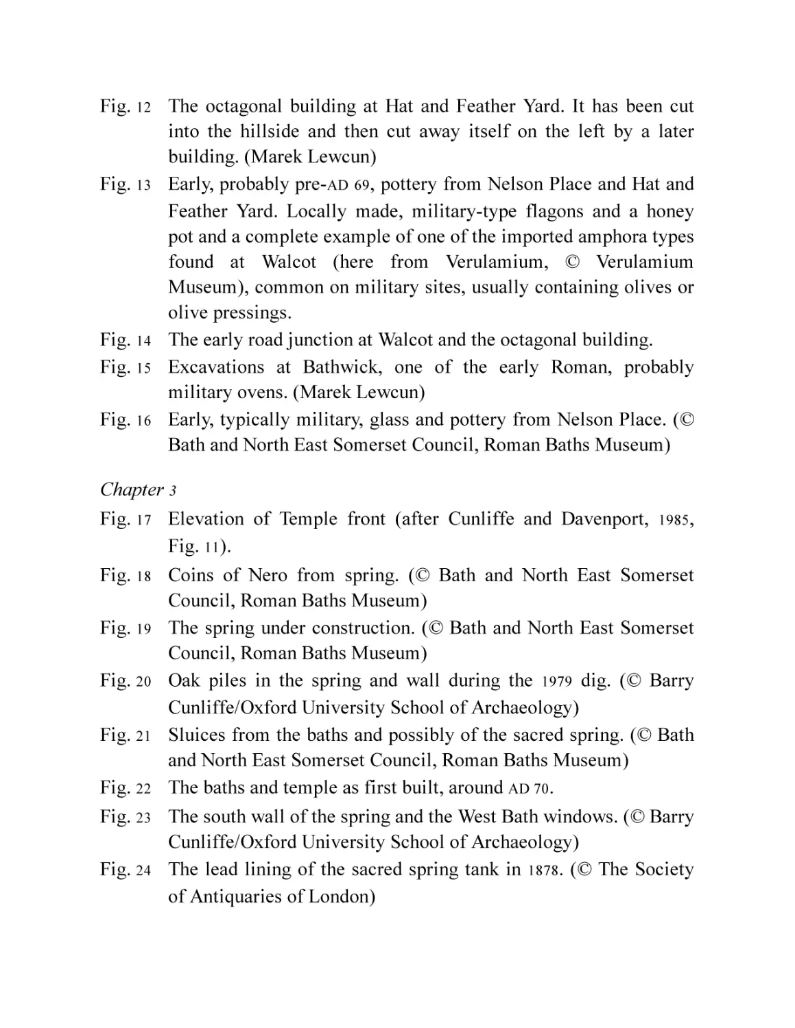
Fig. 12 The octagonal building at Hat and Feather Yard. It has been cut
into the hillside and then cut away itself on the left by a later
building. (Marek Lewcun)
Fig. 13 Early, probably pre-AD 69, pottery from Nelson Place and Hat and
Feather Yard. Locally made, military-type flagons and a honey
pot and a complete example of one of the imported amphora types
found at Walcot (here from Verulamium, © Verulamium
Museum), common on military sites, usually containing olives or
olive pressings.
Fig. 14 The early road junction at Walcot and the octagonal building.
Fig. 15 Excavations at Bathwick, one of the early Roman, probably
military ovens. (Marek Lewcun)
Fig. 16 Early, typically military, glass and pottery from Nelson Place. (©
Bath and North East Somerset Council, Roman Baths Museum)
Chapter 3
Fig. 17 Elevation of Temple front (after Cunliffe and Davenport, 1985,
Fig. 11).
Fig. 18 Coins of Nero from spring. (© Bath and North East Somerset
Council, Roman Baths Museum)
Fig. 19 The spring under construction. (© Bath and North East Somerset
Council, Roman Baths Museum)
Fig. 20 Oak piles in the spring and wall during the 1979 dig. (© Barry
Cunliffe/Oxford University School of Archaeology)
Fig. 21 Sluices from the baths and possibly of the sacred spring. (© Bath
and North East Somerset Council, Roman Baths Museum)
Fig. 22 The baths and temple as first built, around AD 70.
Fig. 23 The south wall of the spring and the West Bath windows. (© Barry
Cunliffe/Oxford University School of Archaeology)
Fig. 24 The lead lining of the sacred spring tank in 1878. (© The Society
of Antiquaries of London)
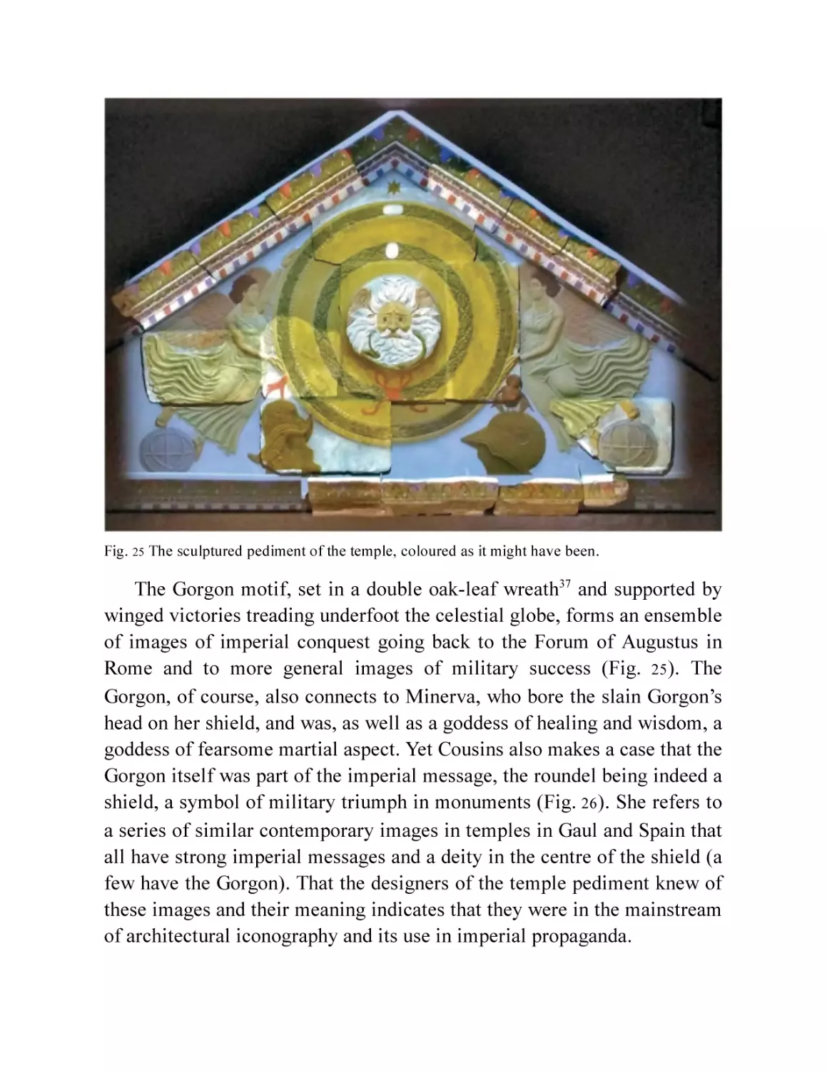
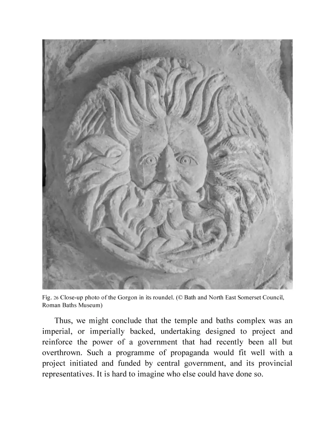
Fig. 25
Fig. 26
The sculptured pediment of the temple, coloured as it might have
been.
Close-up photo of the Gorgon in its roundel. (© Bath and North
East Somerset Council, Roman Baths Museum)
Chapter 4
Fig. 27 Plan of the Period 1 baths.
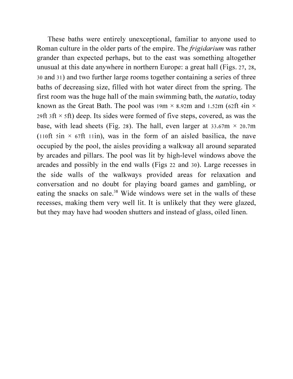
Fig. 28 Photo of the Great Bath drained. (© Bath and North East Somerset
Council, Roman Baths Museum)
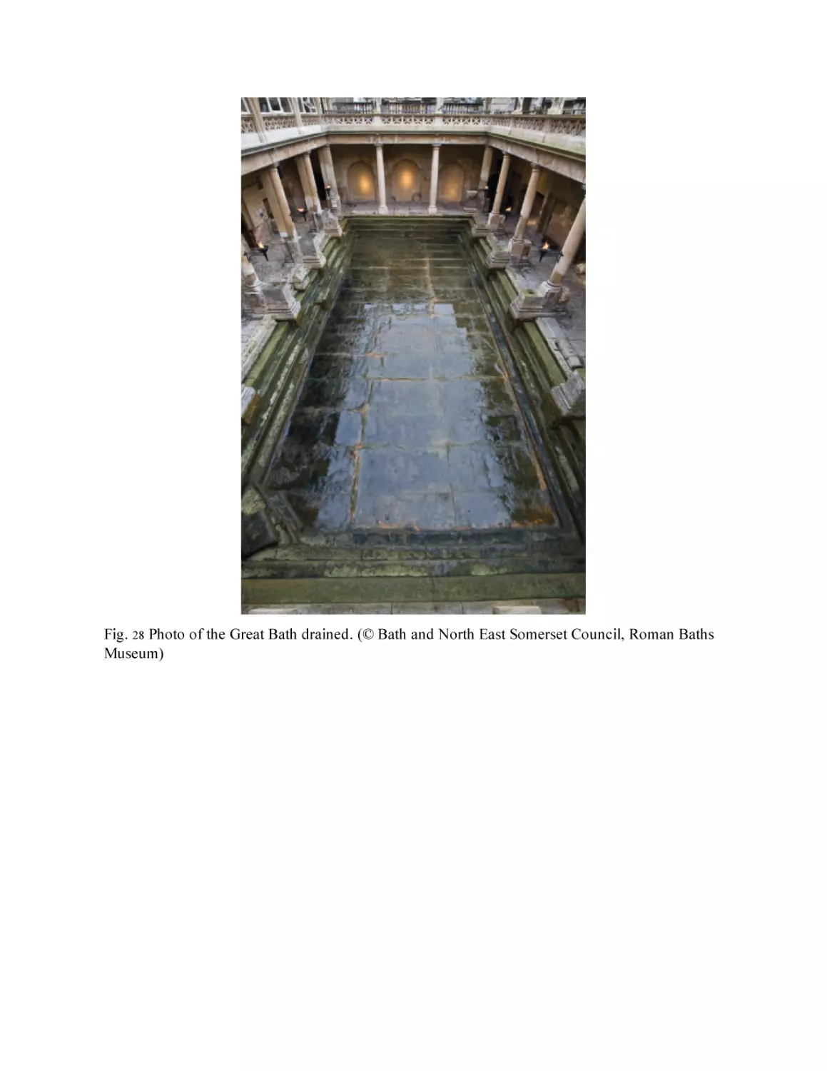
Fig. 29 Hoare’s depiction of the East Baths in 1754. (© The British Library
Board [Add. MS 21577b])
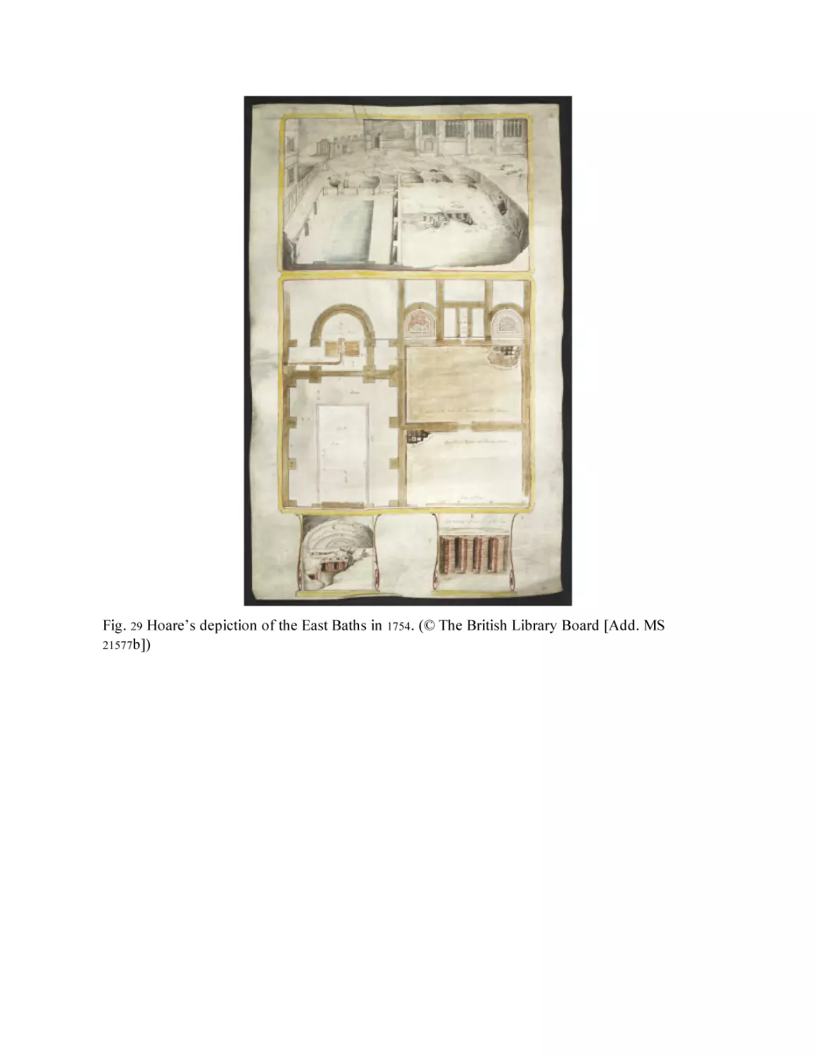
Fig. 30 Elevation and cross-section of the Great Bath (based on Cunliffe
1969 , Fig. 37 with modifications).
Fig. 31 Reconstruction of interior of the Period 1 Great Bath.
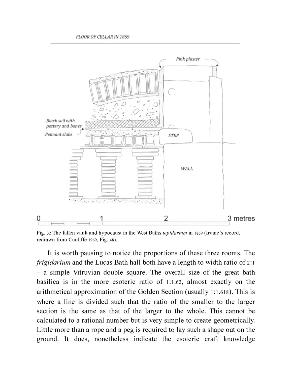
Fig. 32 The fallen vault and hypocaust in the West Baths tepidarium in
1869 (Irvine’s record, redrawn from Cunliffe 1969 , Fig. 48 ).
Fig. 33 Reconstruction of the temple precinct in the late period. (© Bath
and North East Somerset Council, Roman Baths Museum)
Fig. 34 Four of the deities on the altar corners, clockwise from top left:
Bacchus, Hercules, Apollo and Jupiter. (© Bath and North East
Somerset Council, Roman Baths Museum)
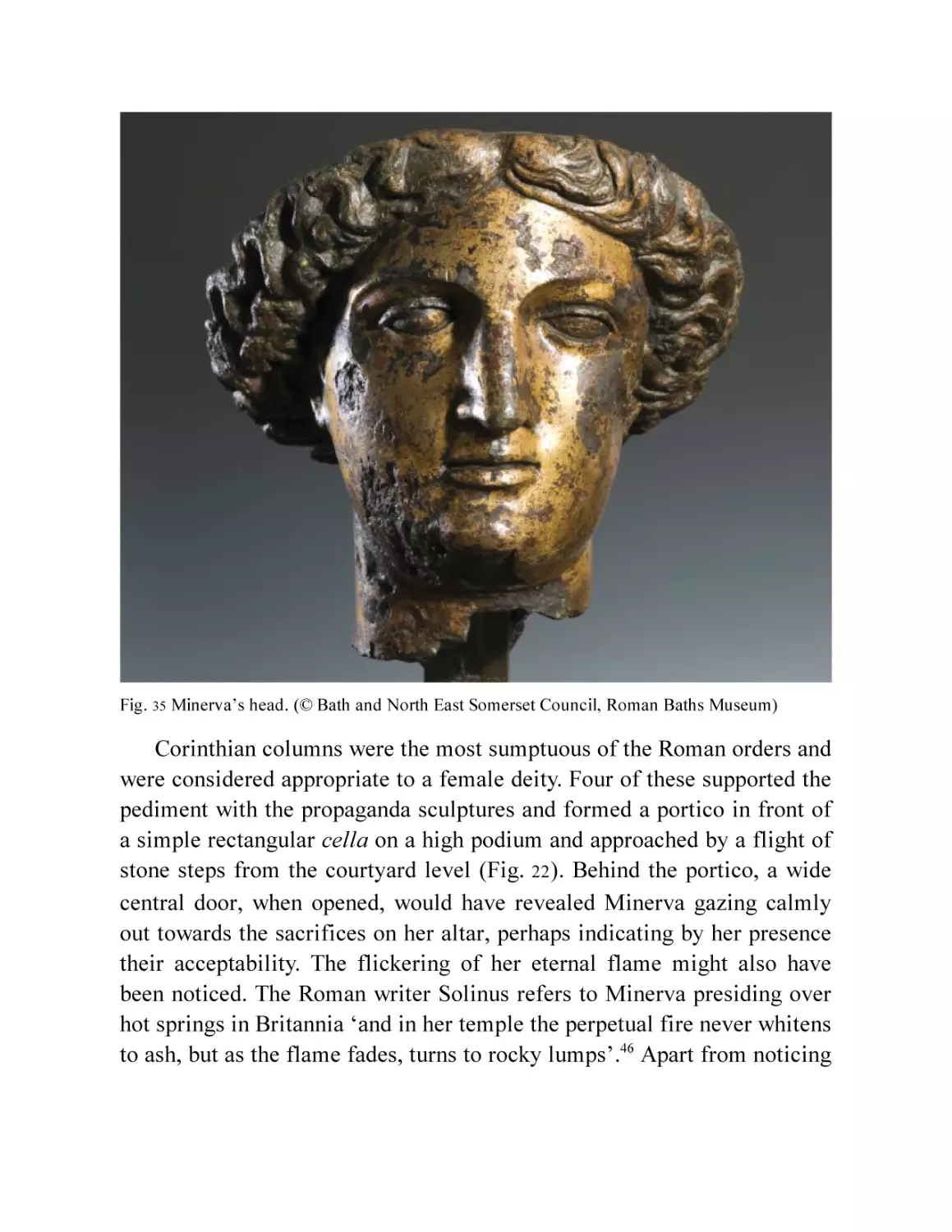
Fig. 35 Minerva’s head. (© Bath and North East Somerset Council,
Roman Baths Museum)
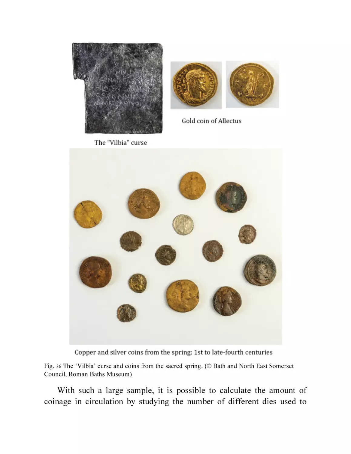
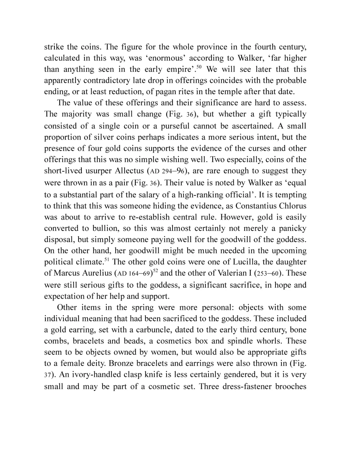
Fig. 36 The ‘Vilbia’ curse and coins from the sacred spring. (© Bath and
North East Somerset Council, Roman Baths Museum)
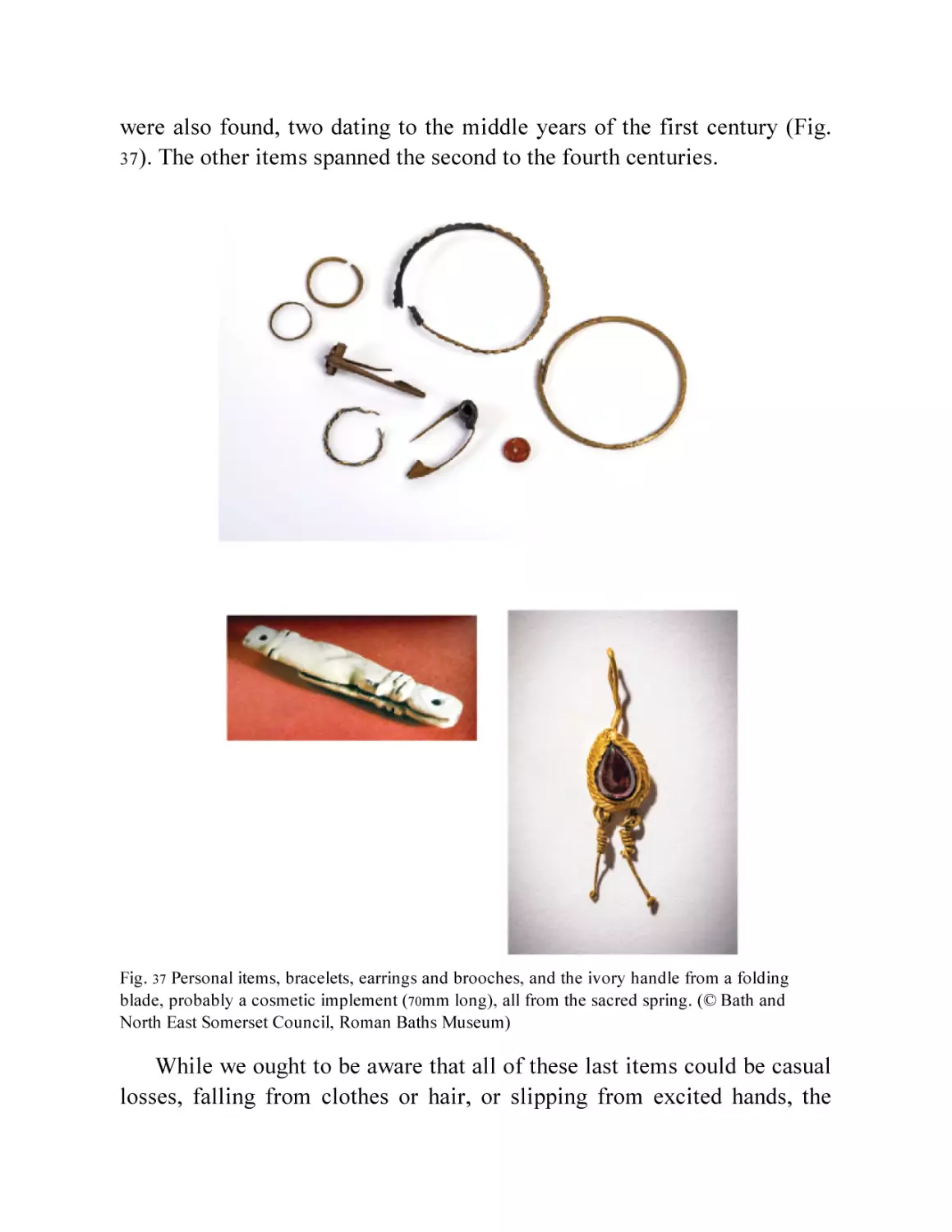
Fig. 37 Personal items, bracelets, earrings and brooches, and the ivory
handle from a folding blade, probably a cosmetic implement
(70mm long) all from the sacred spring. (© Bath and North East
Somerset Council, Roman Baths Museum)
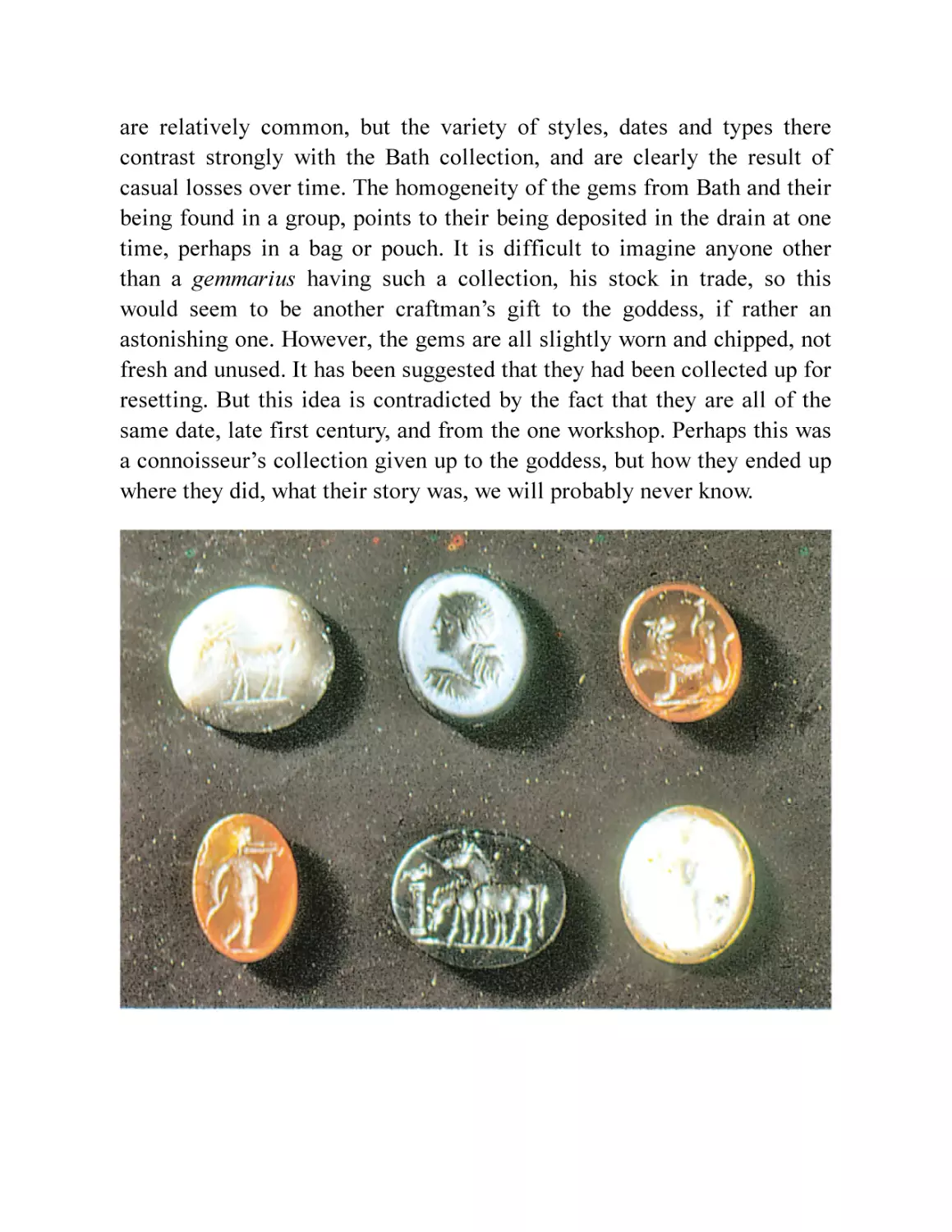
Fig. 38 The ballista washer (83mm diameter) and gemstones from the
sacred spring and the culvert. The gems are typically 10 × 12.5mm.
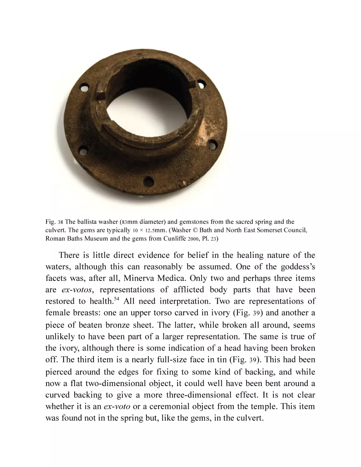
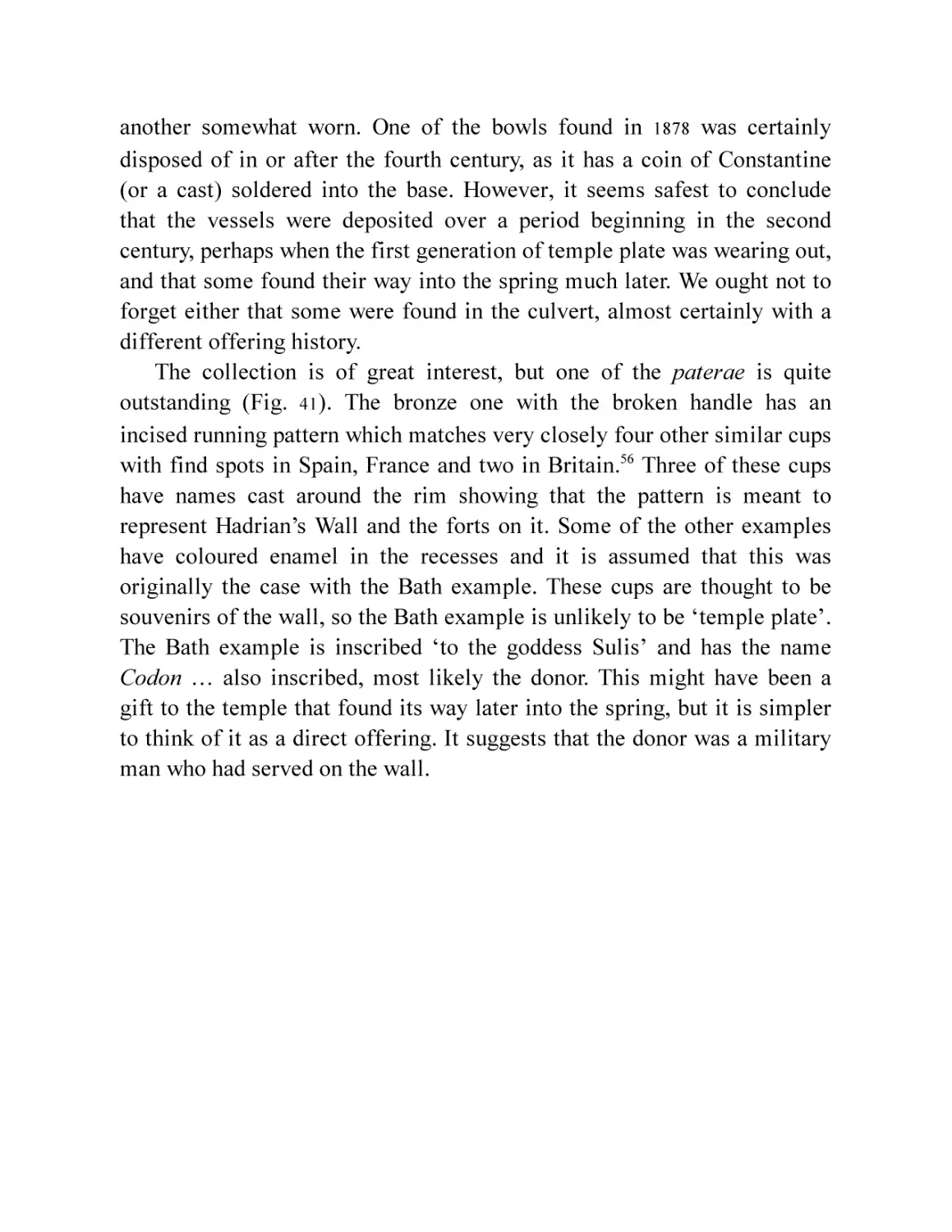
Fig. 39
Fig. 40
Fig. 41
Fig. 42
(washer © Bath and North East Somerset Council, Roman Baths
Museum and the gems from Cunliffe 2000, Pl. 23)
The tin mask from the drain (330mm high) and the ivory breast exvoto (70mm across) from the sacred spring. (© Bath and North
East Somerset Council, Roman Baths Museum)
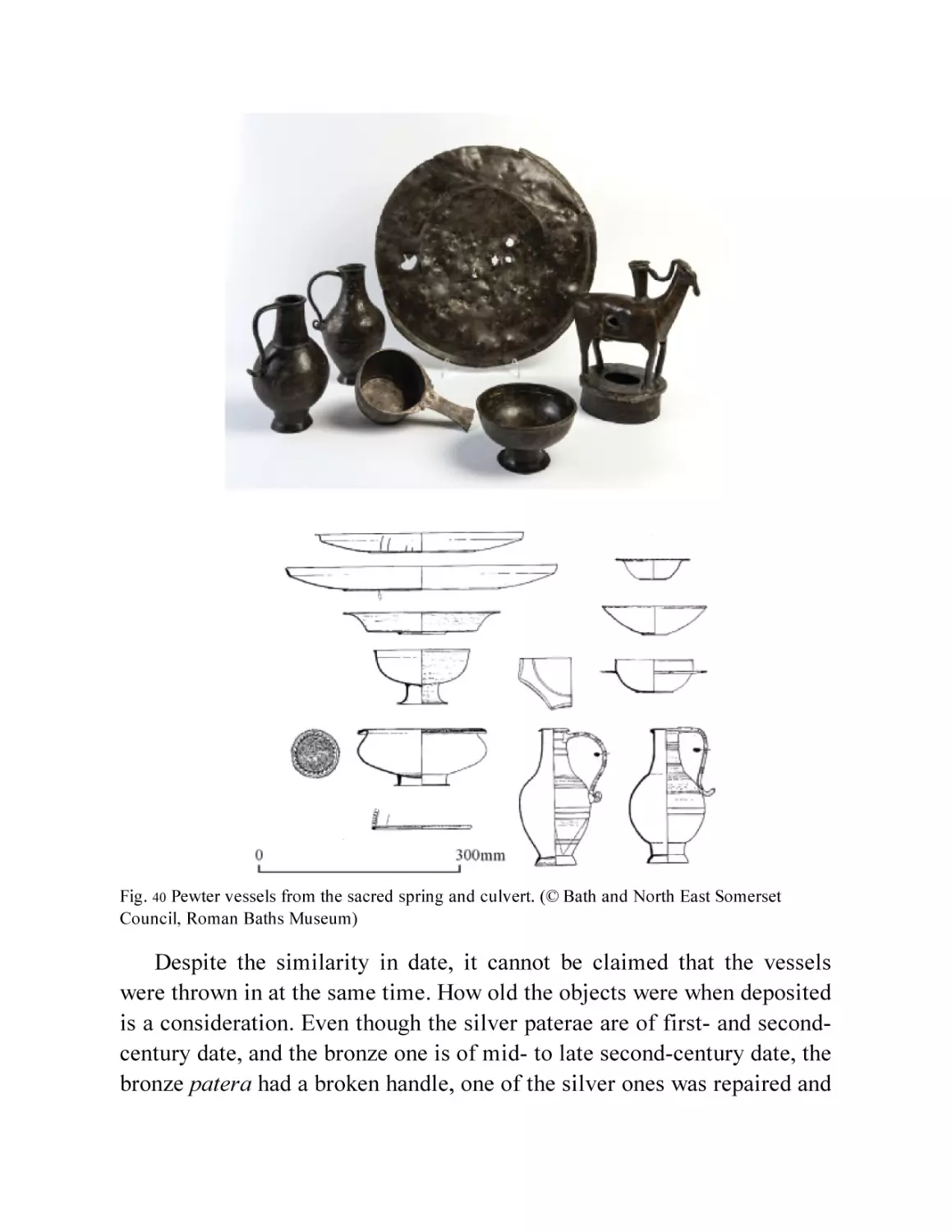
Pewter vessels from the sacred spring and culvert. (© Bath and
North East Somerset Council, Roman Baths Museum)
Paterae from the sacred spring, all inscribed ‘Deae Sulis
Minervae’ or variations. The bronze patera is the probable
Hadrian’s Wall souvenir. (© Bath and North East Somerset
Council, Roman Baths Museum)
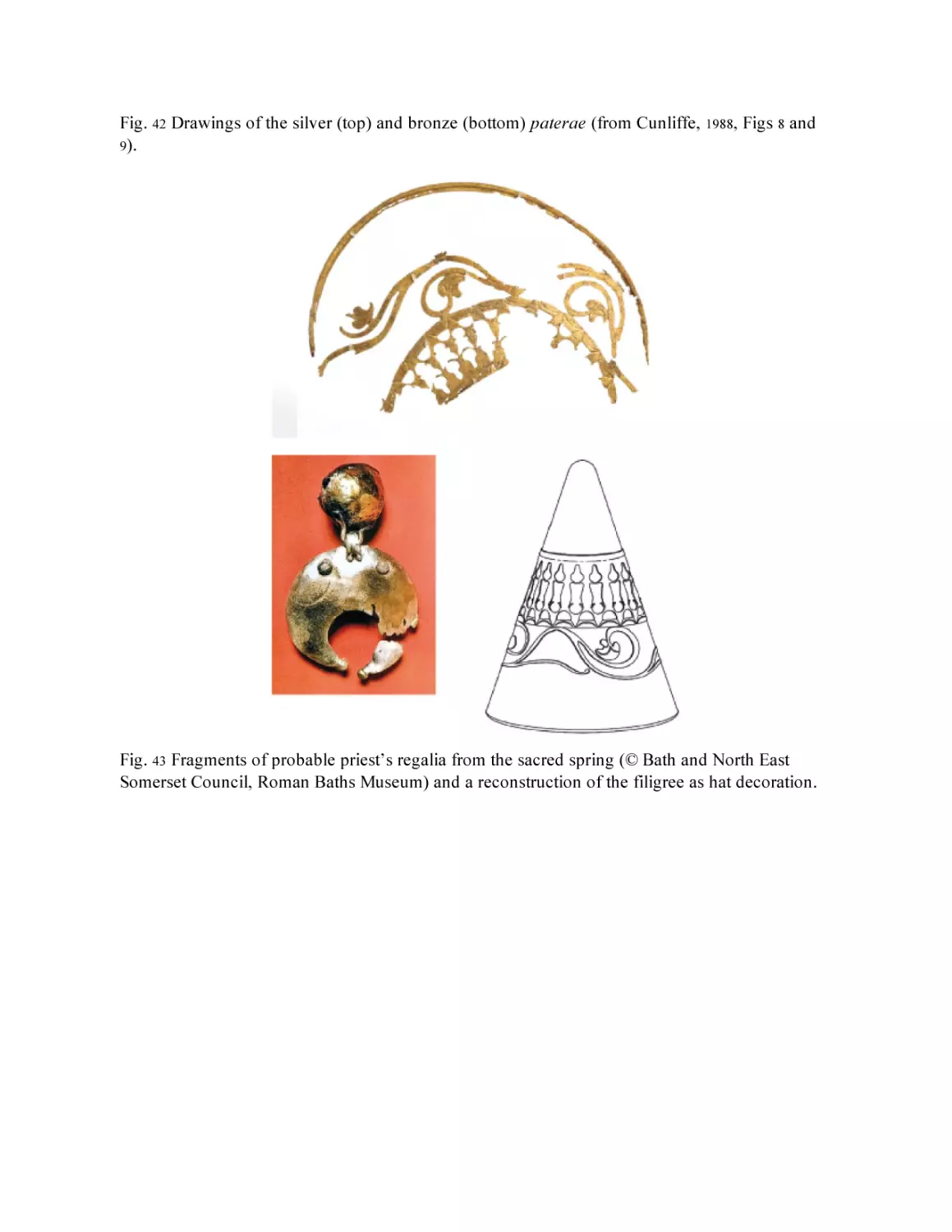
Drawings of the silver (top) and bronze (bottom) paterae (from
Cunliffe, 1988, Figs 8 and 9).
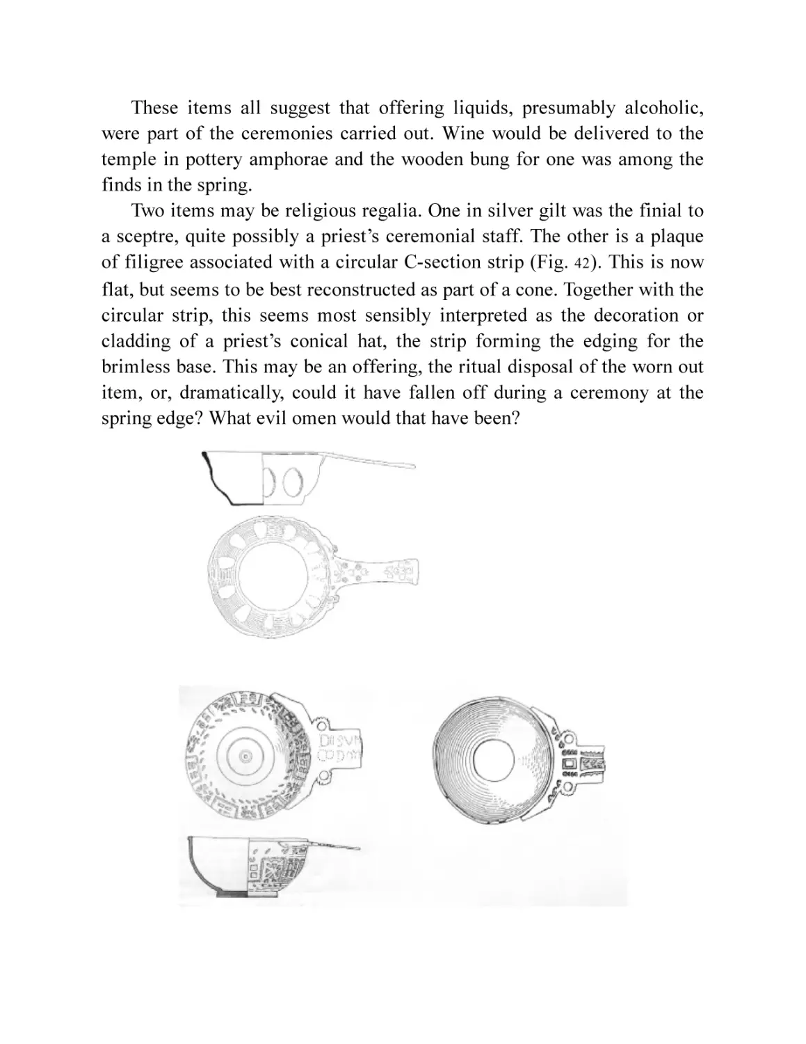
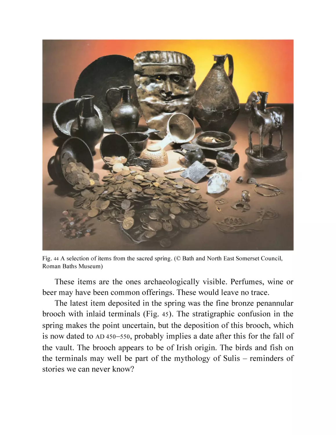
Fig. 43 Fragments of probable priest’s regalia from the sacred spring (©
Bath and North East Somerset Council, Roman Baths Museum)
and a reconstruction of the filigree as hat decoration.
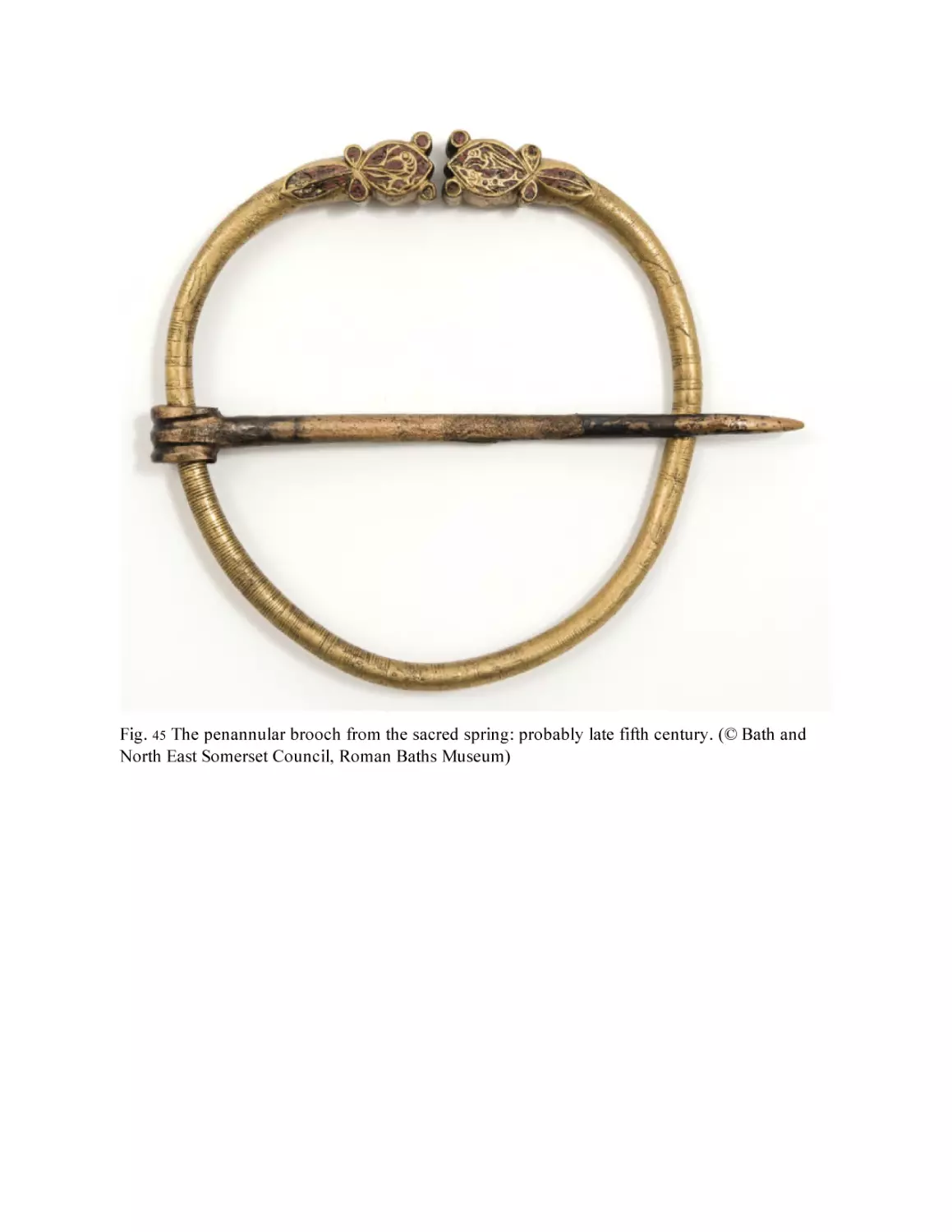
Fig. 44 A selection of items from the sacred spring. (© Bath and North
East Somerset Council, Roman Baths Museum)
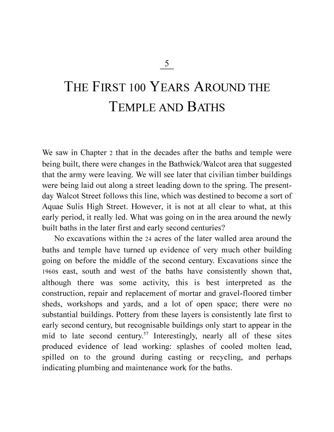
Fig. 45 The penannular brooch from the sacred spring: probably late fifth
century. (© Bath and North East Somerset Council, Roman Baths
Museum)
Chapter 5
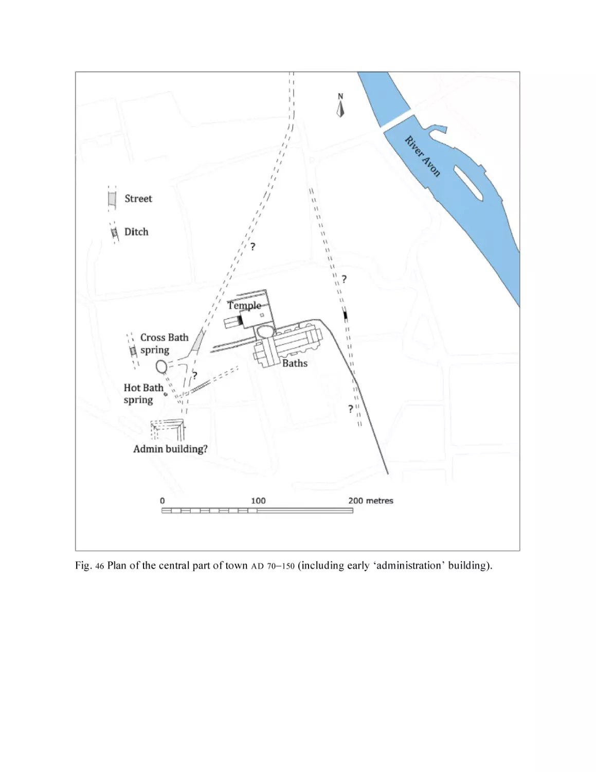
Fig. 46 Plan of the central part of town AD 70–150 (including early
‘administration’ building).
Fig. 47 The early road pre-dating the temple precinct, smoother surface,
top left and the junction with the rerouted section, more cobbly
surface, bottom right.
Fig. 48 Irvine’s plan of the later road around the precinct (the dark areas
show what he was able to see). (By kind permission of National
Museums Scotland)
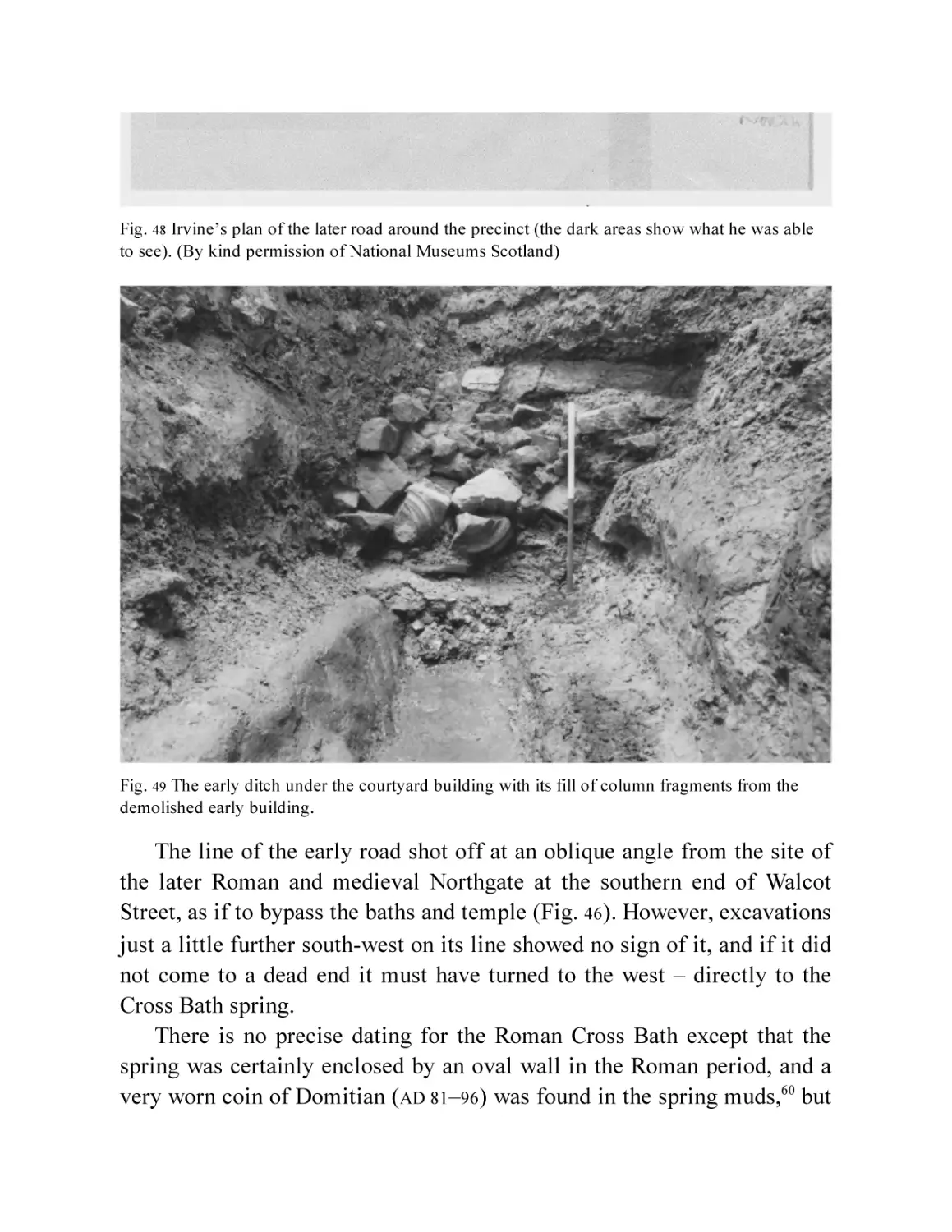
Fig. 49 The early ditch under the courtyard building with its fill of
column fragments from the demolished early building.
Fig. 50 The columns reconstructed from the fragments found in the ditch
under the courtyard building.
Chapter 6
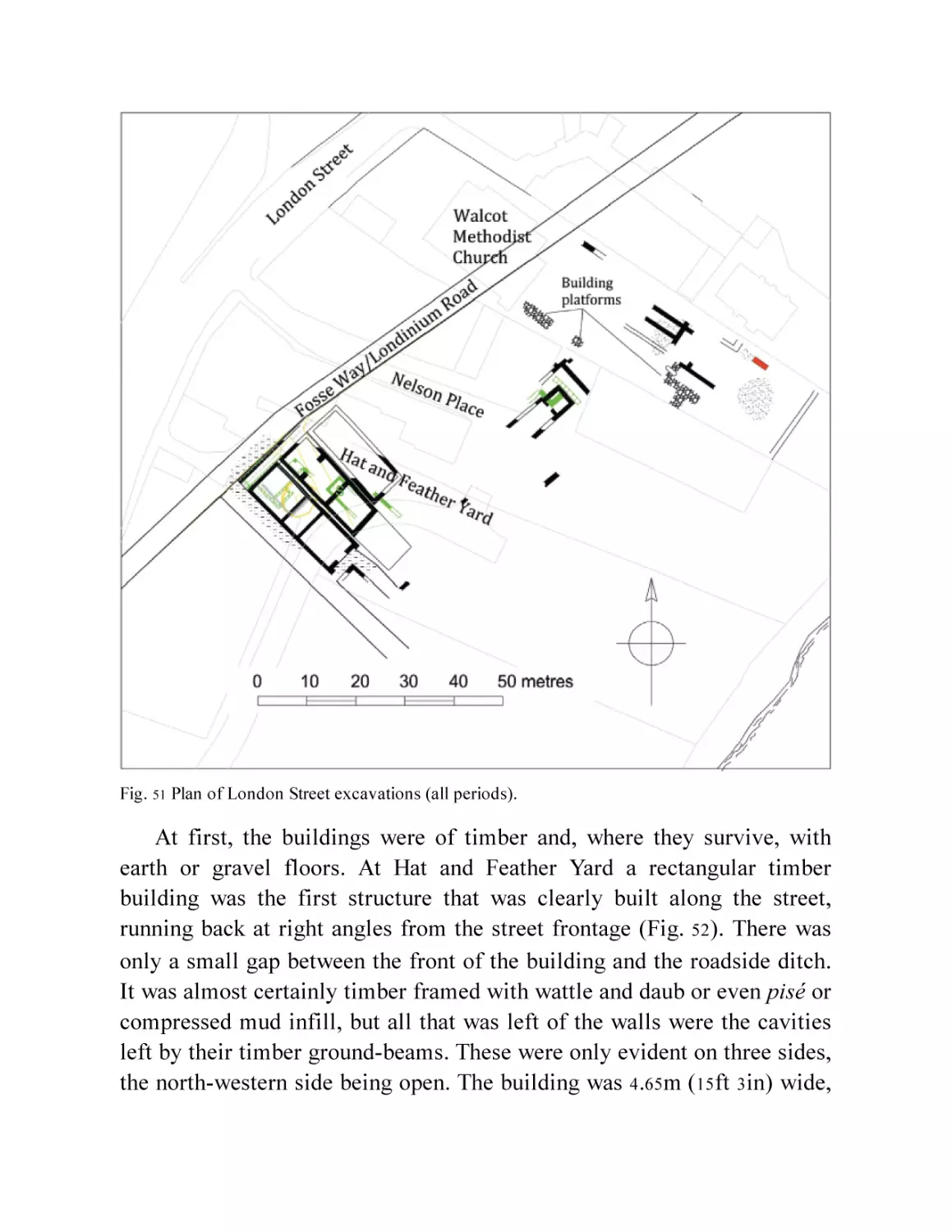
Fig. 51 Plan of London Street excavations (all periods).
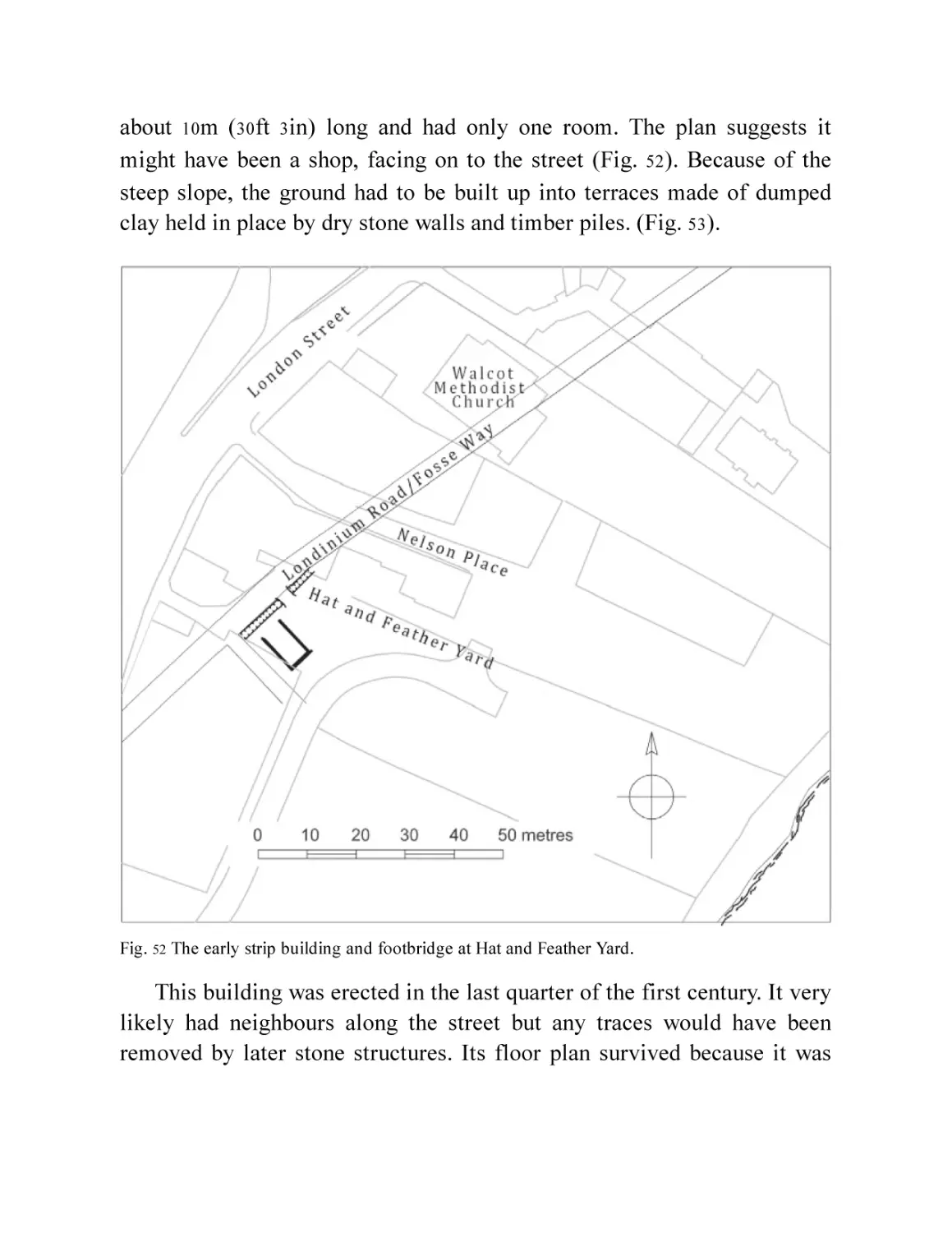
Fig. 52 The early strip building and footbridge at Hat and Feather Yard.
Fig. 53 The rear of the terrace for the first wooden strip building at Hat
and Feather Yard. (Marek Lewcun)
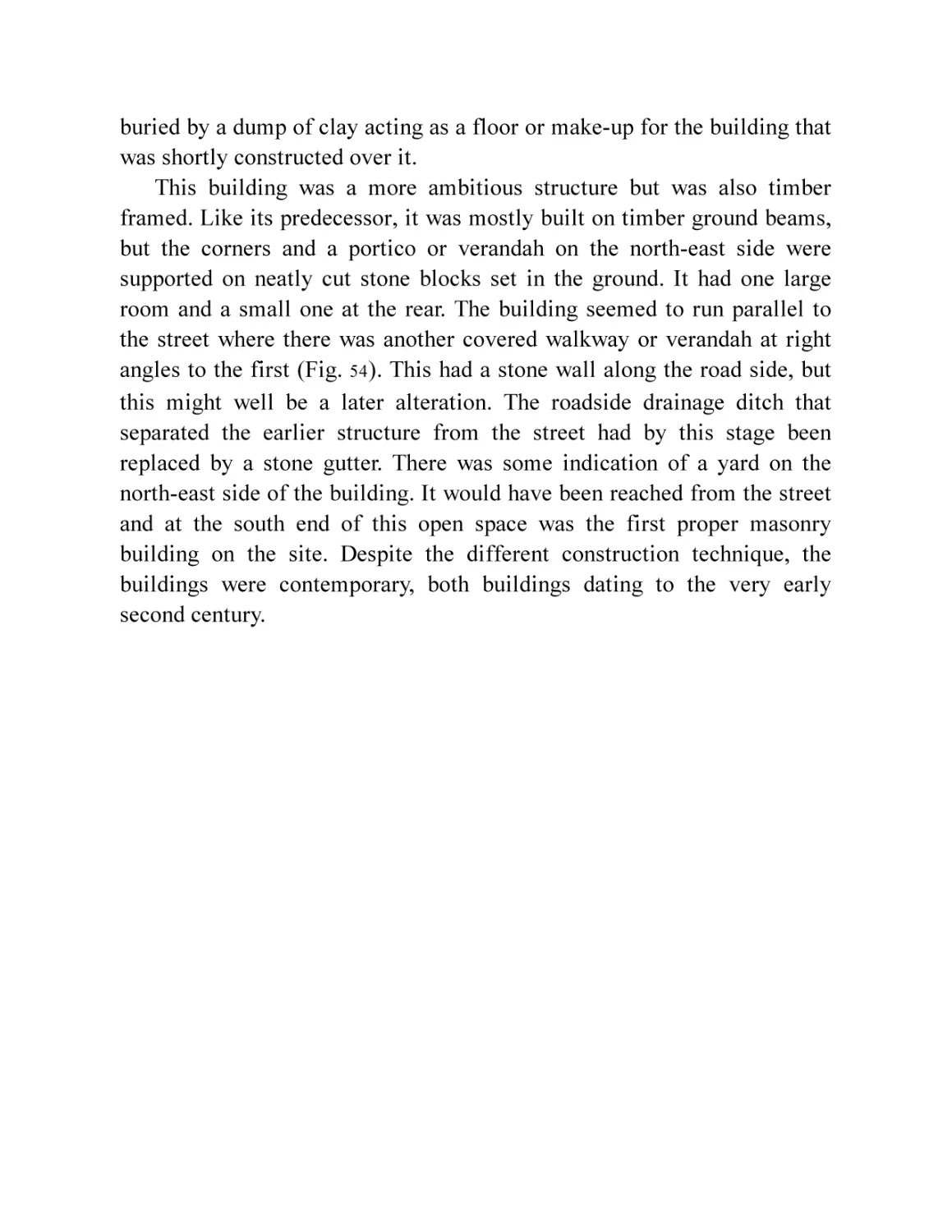
Fig. 54 Plan of the second phase of building at Hat and Feather Yard.
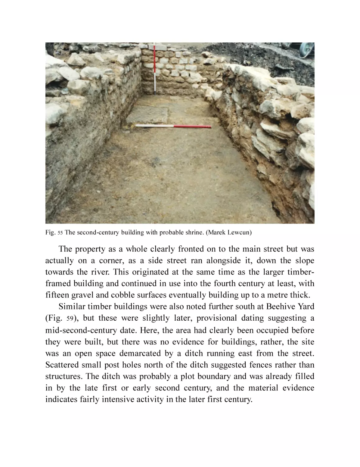
Fig. 55 The second century building with probable shrine. (Marek
Lewcun)
Fig. 56 The bust from Hat and Feather Yard. (© Bath and North East
Somerset Council, Roman Baths Museum)
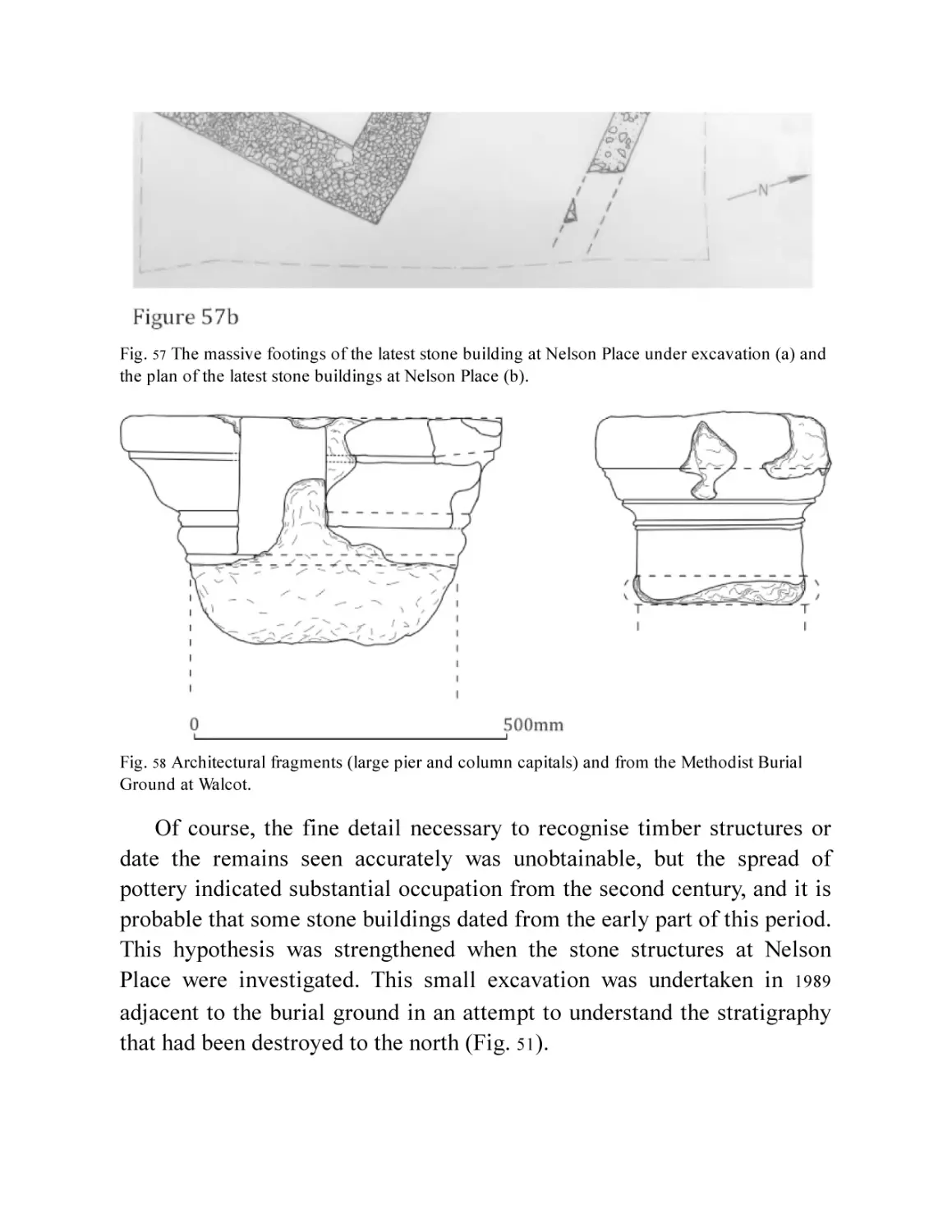
Fig. 57 The massive footings of the latest stone building at Nelson Place
under excavation (a) and the plan of the latest stone buildings at
Nelson Place (b).
Fig. 58 Architectural fragments (large pier and column capitals) from the
Methodist Burial Ground at Walcot.
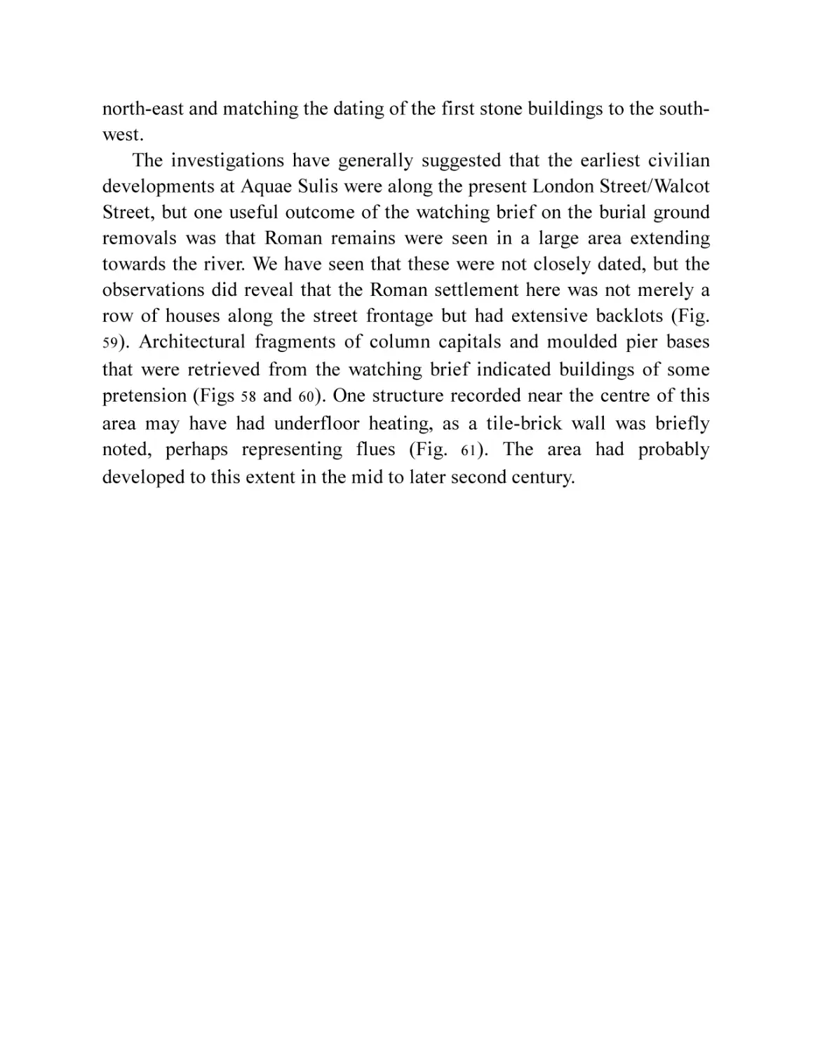
Fig. 59 Plan of Walcot Street/Bathwick settlement.
Fig. 60 Architectural fragments (colonnette and part of a frieze[?]) from
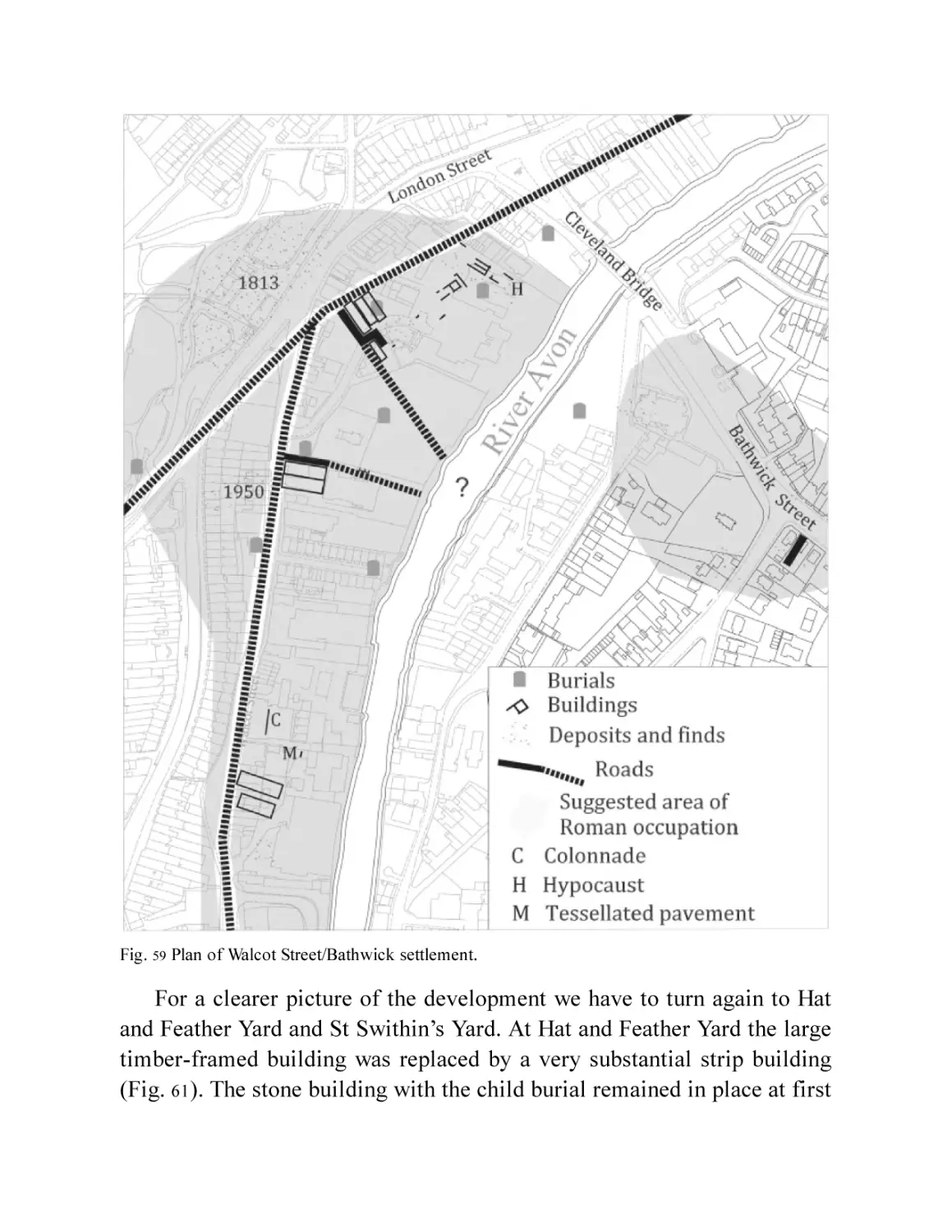
the Hat and Feather Yard excavations.
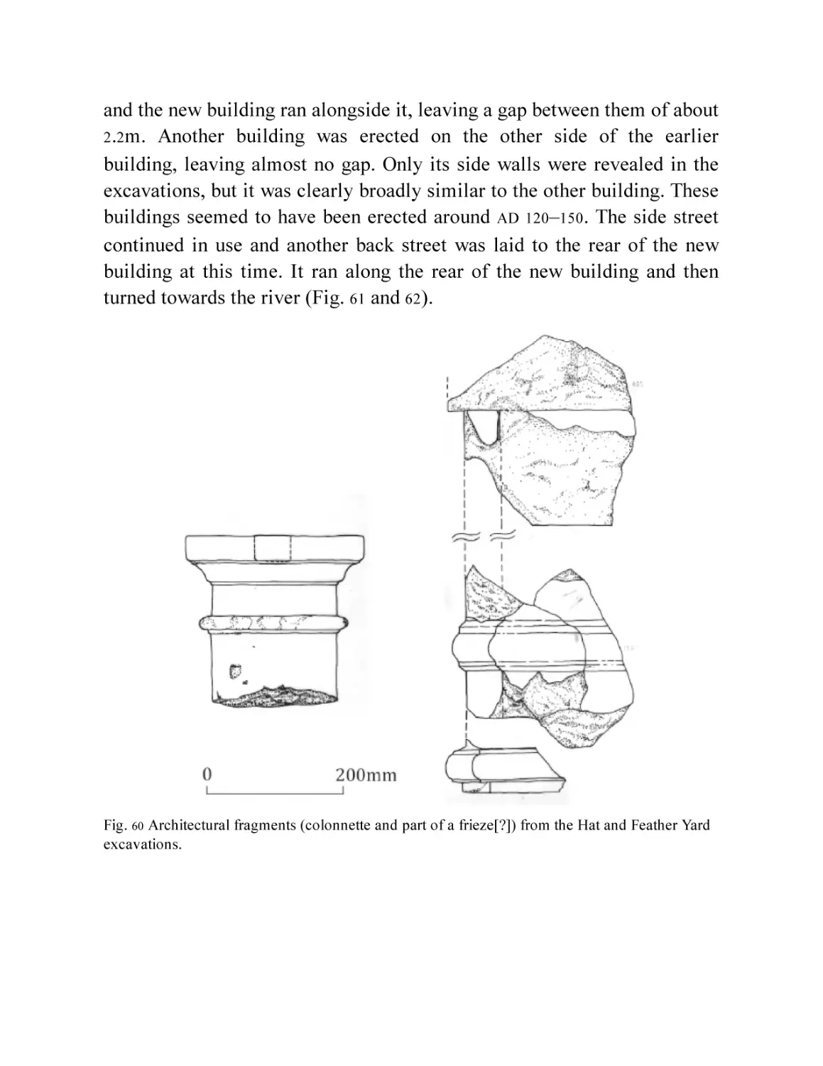
Fig. 61 Plan of the later stone buildings at Hat and Feather Yard.
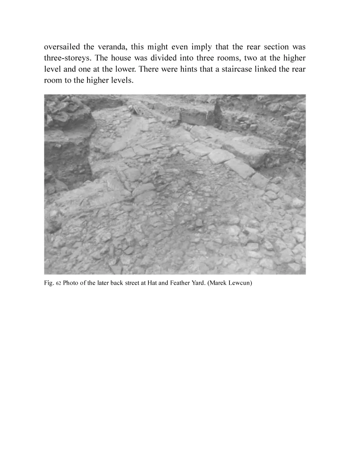
Fig. 62 Photo of the later back street at Hat and Feather Yard. (Marek
Lewcun)
Fig. 63 Reconstruction painting of the street frontage of Hat and Feather
Yard by Jane Brayne.
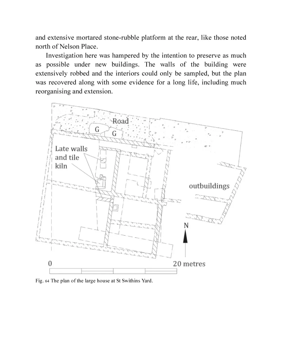
Fig. 64 The plan of the large house at St Swithin’s Yard.
Fig. 65 The side wall of the St Swithin’s Yard house and the lane
alongside.
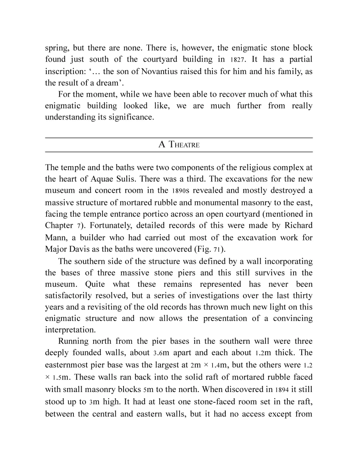
Chapter 7
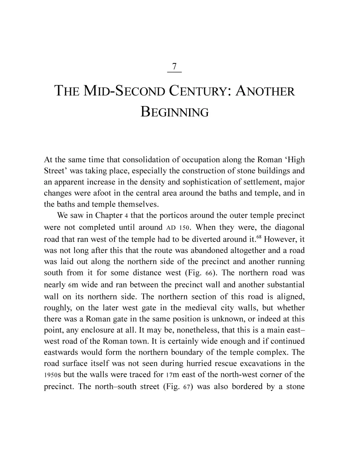
Fig. 66 The central area in the mid to late second century.
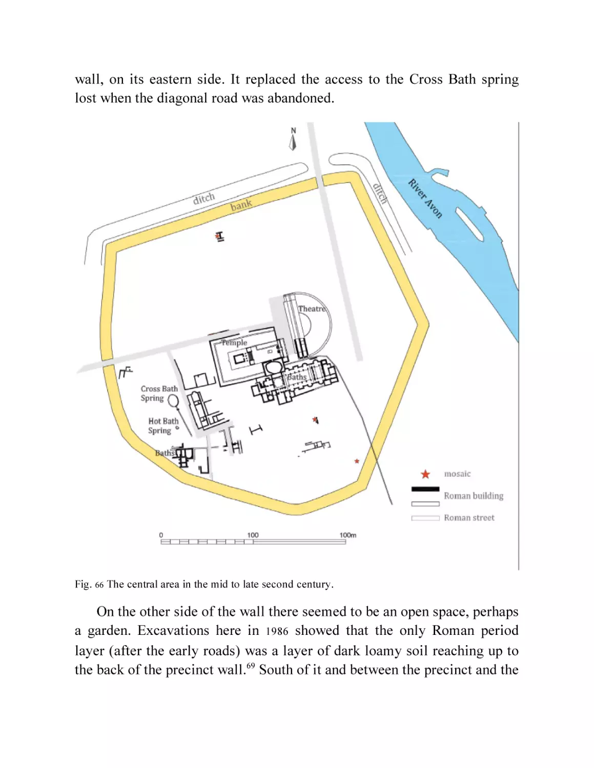
Fig. 67 The north-south road at the west end of the possible garden
beyond the temple precinct.
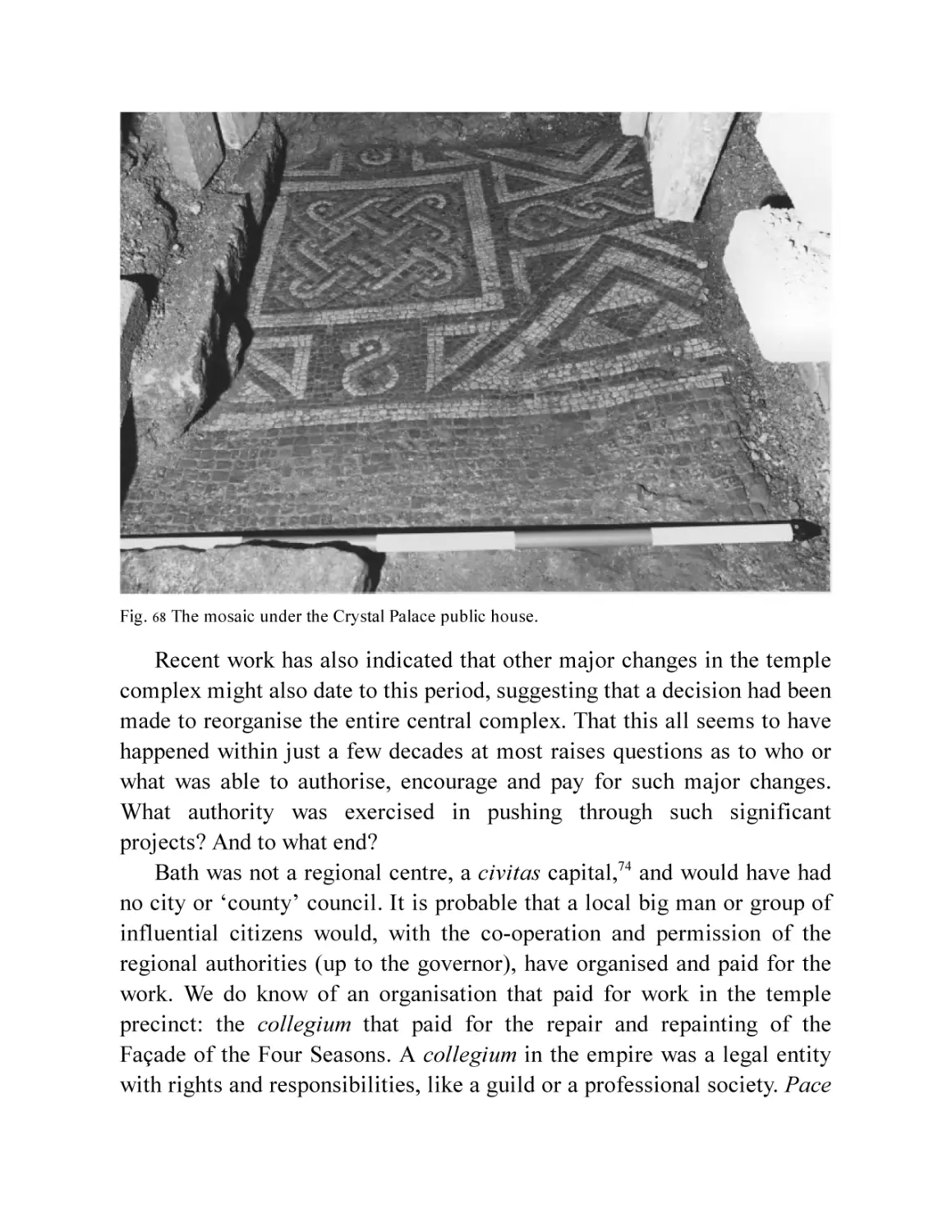
Fig. 68 The mosaic under the Crystal Palace public house.
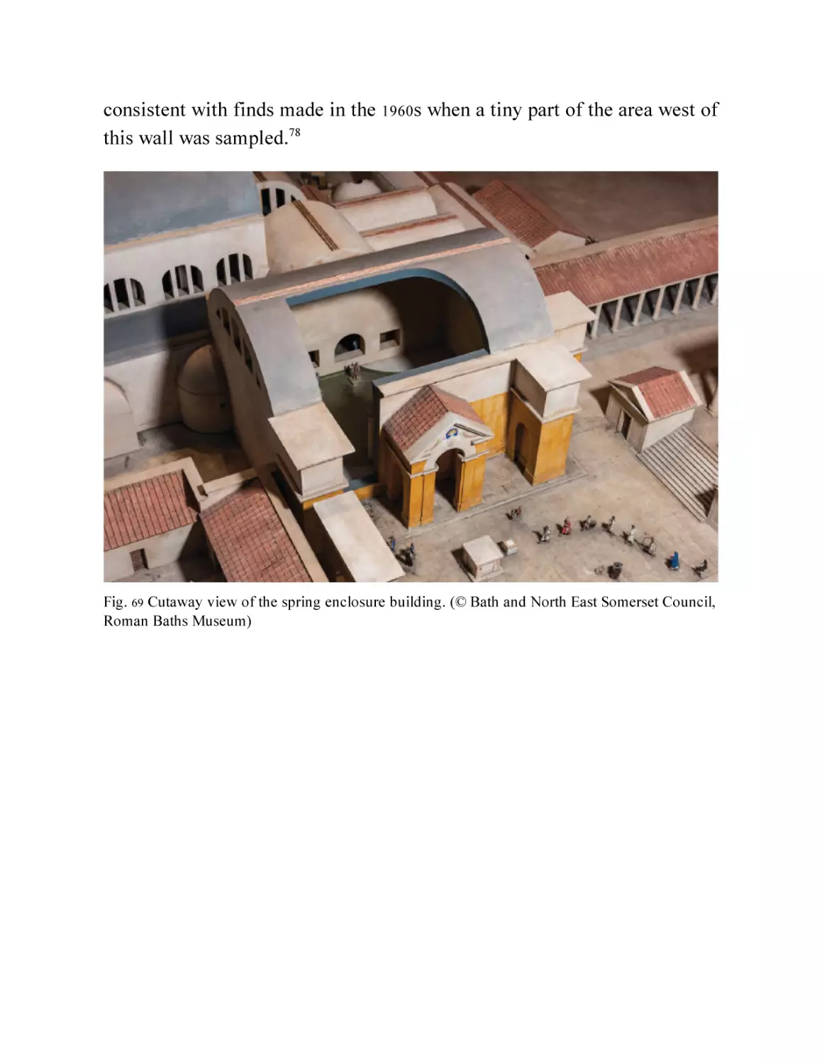
Fig. 69 Cutaway view of the spring enclosure building. (© Bath and North
East Somerset Council, Roman Baths Museum)
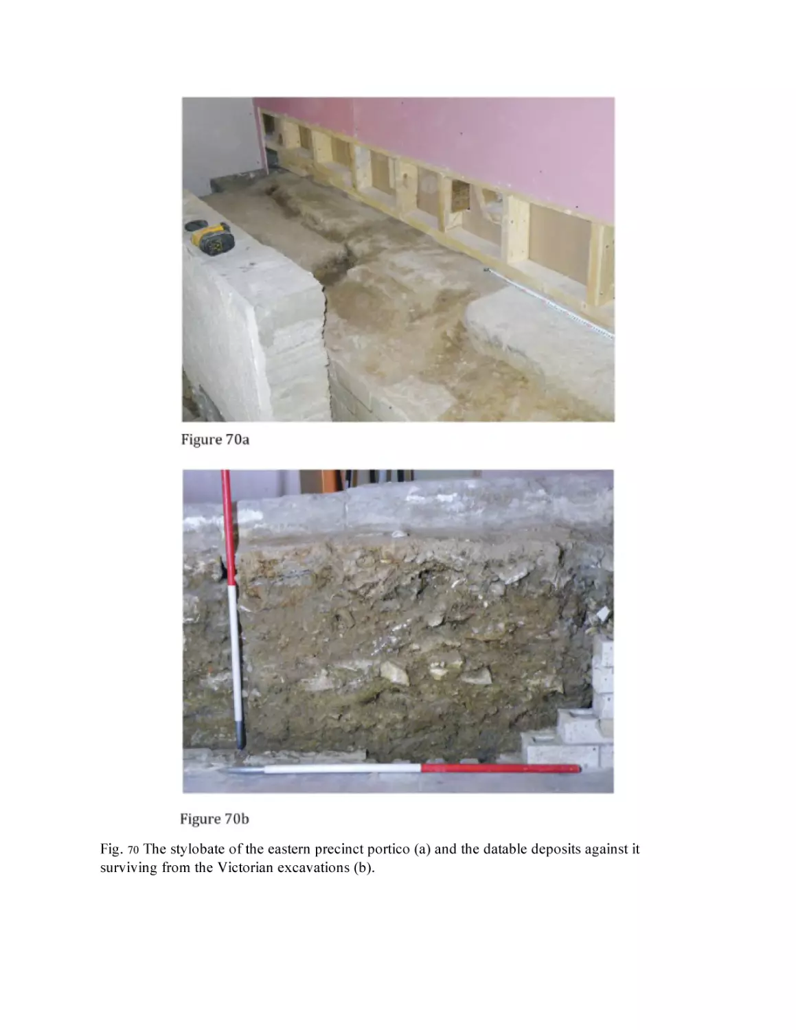
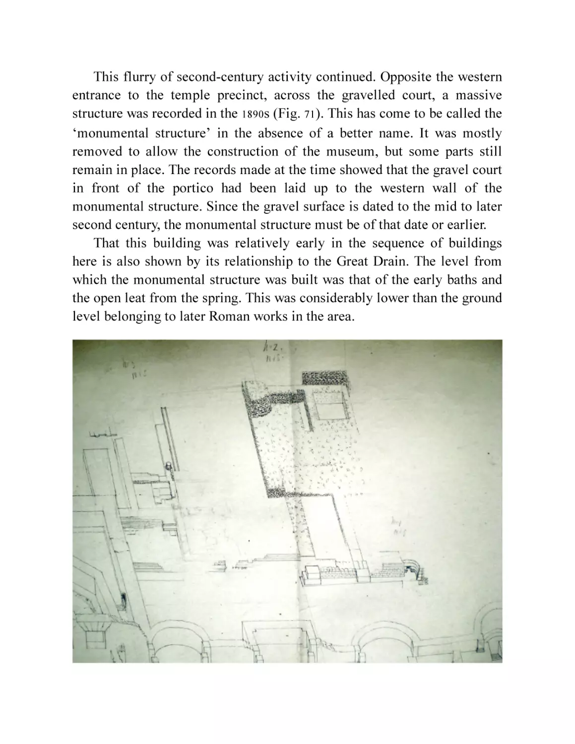
Fig. 70 The stylobate of the eastern precinct portico (a) and the datable
deposits against it surviving from the Victorian excavations (b).
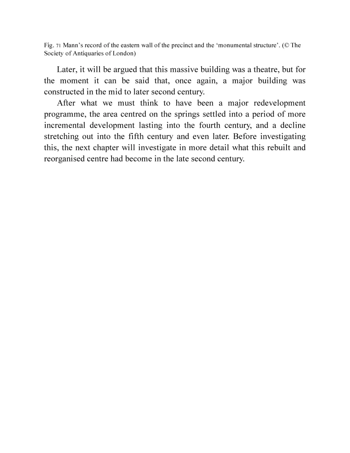
Fig. 71 Mann’s record of the eastern wall of the precinct and the
‘monumental structure’. (© The Society of Antiquaries of
London)
Chapter 8
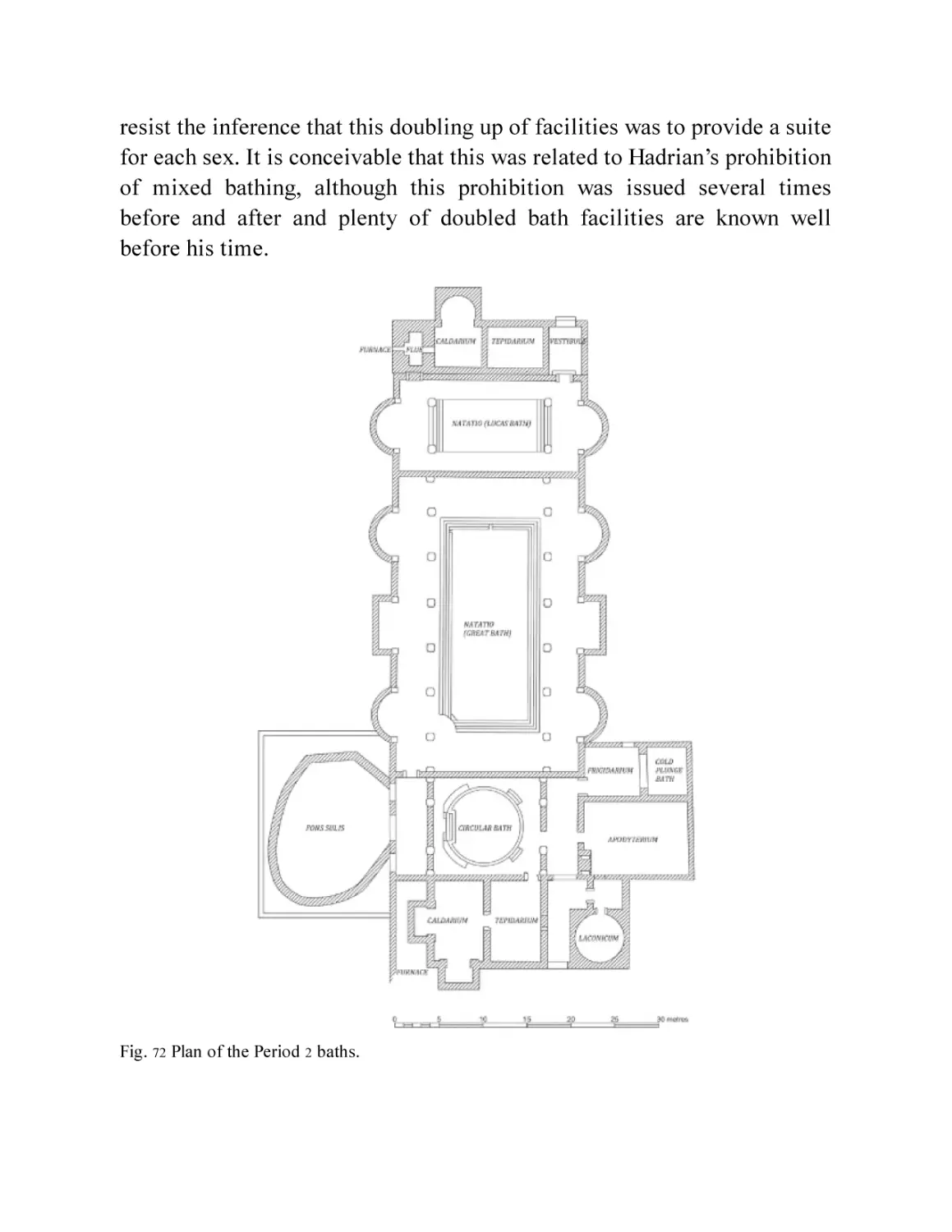
Fig. 72 Plan of the Period 2 baths.
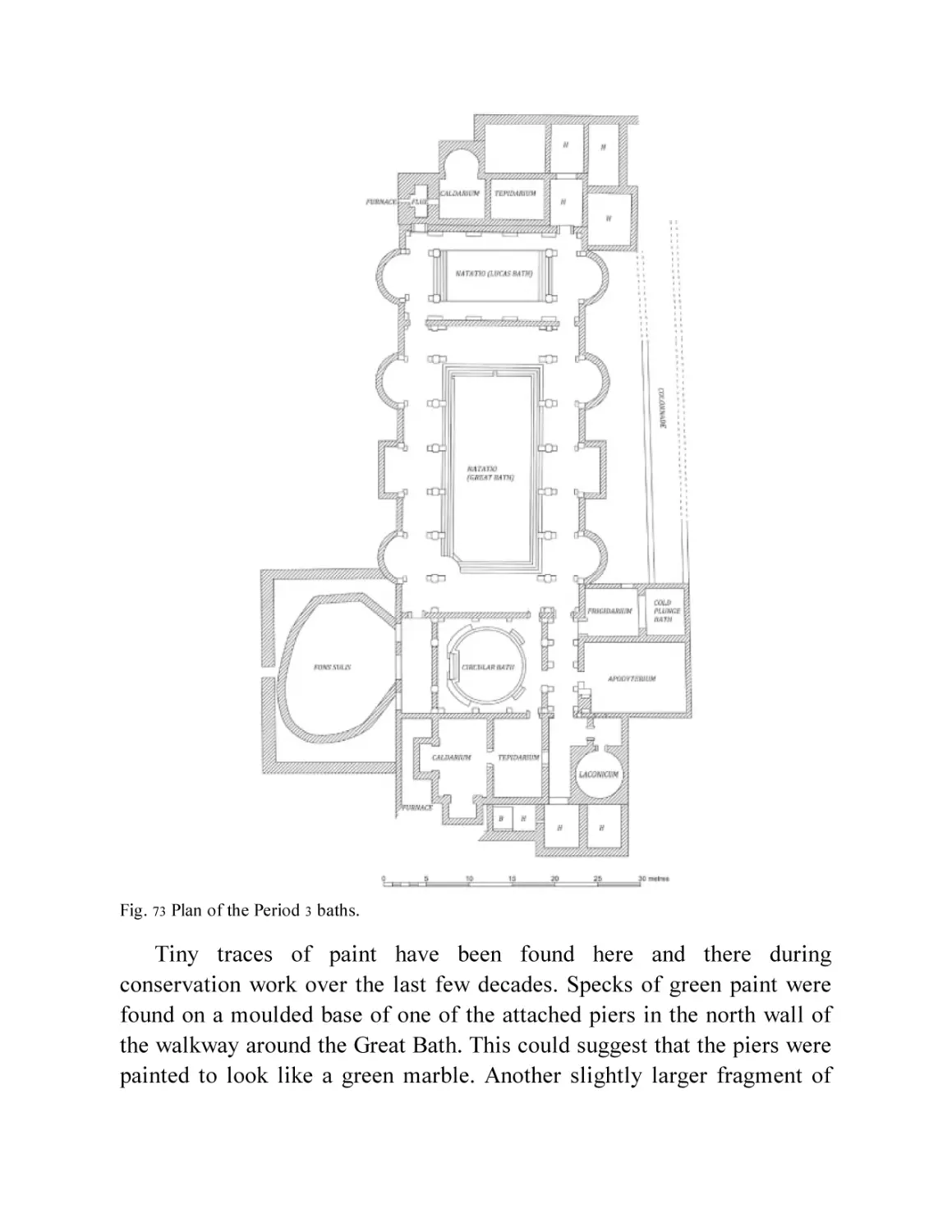
Fig. 73 Plan of the Period 3 baths.
Fig. 74 The fallen window arch at the west end of the Great Bath.
Fig. 75 Reconstruction of interior view of Period 3 Great Bath.
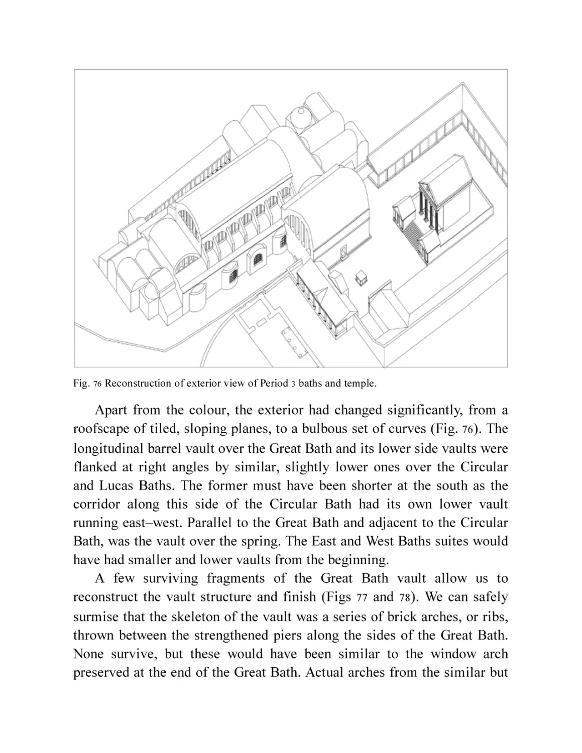
Fig. 76 Reconstruction of exterior view of Period 3 baths and temple.
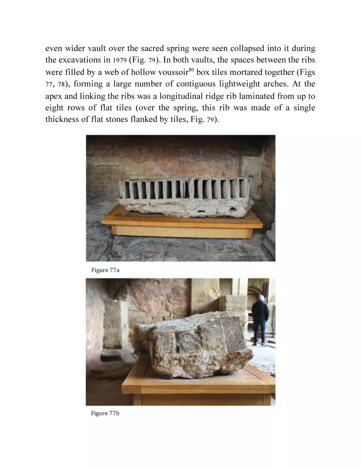
Fig. 77 A section of the box tile and concrete vault over the Great Bath,
displayed inverted.
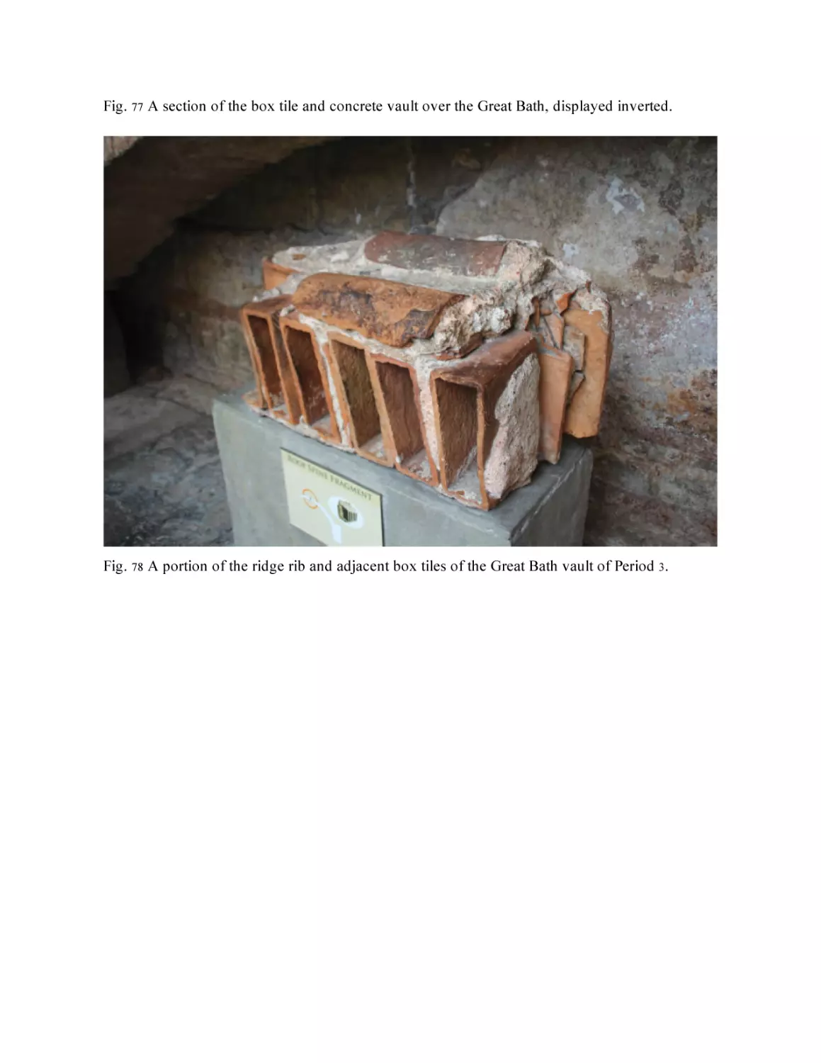
Fig. 78 A portion of the ridge rib and adjacent box tiles of the Great Bath
vault of Period 3.
Fig. 79 The collapsed vault in the spring. (© Barry Cunliffe/Oxford
University School of Archaeology)
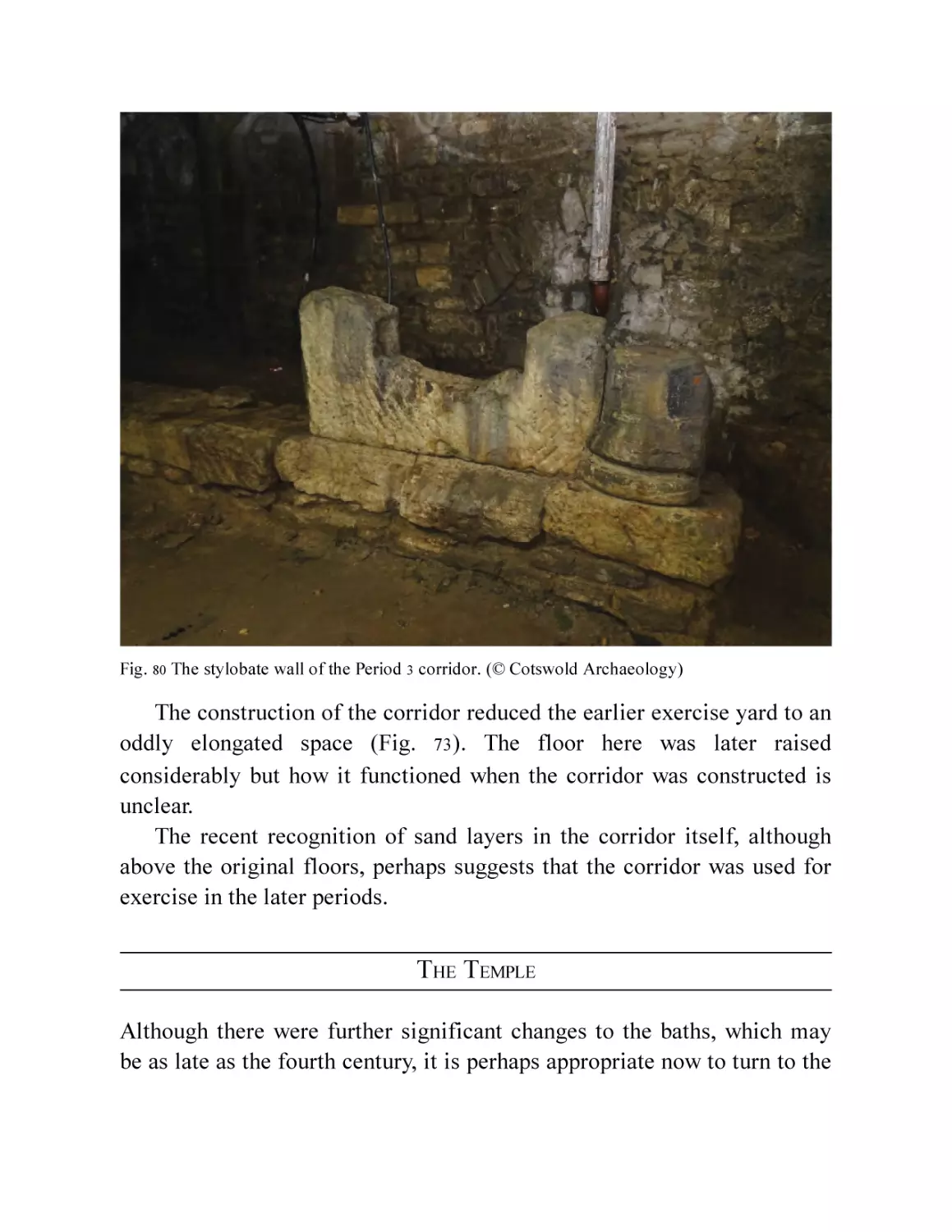
Fig. 80 The stylobate wall of the Period 3 corridor. (© Cotswold
Archaeology)
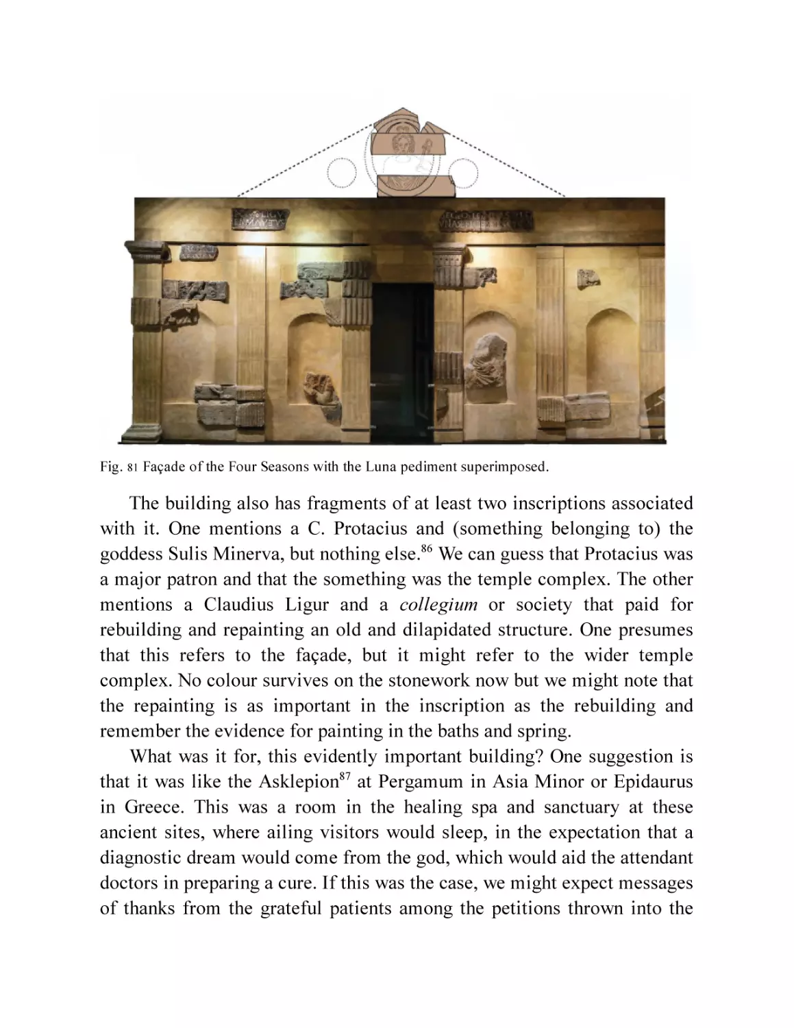
Fig. 81 Façade of the Four Seasons with the Luna pediment
superimposed.
Fig. 82 The theatre hypothesis: the evidence.
Fig. 83 The theatre hypothesis: possible reconstructions.
Chapter 9
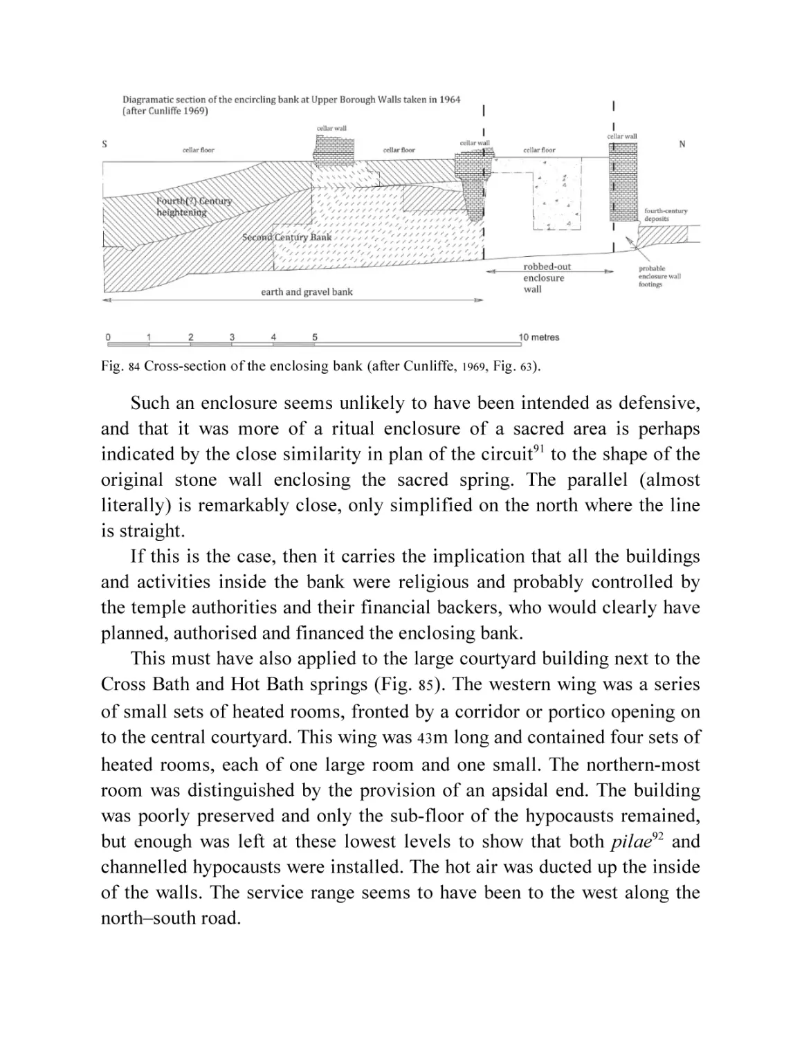
Fig. 84 Cross-section of the enclosing bank (after Cunliffe, 1969, Fig. 63).
Fig. 85 The courtyard building and its surroundings.
Fig. 86 Plan of the Hot Bath baths. (Based on Irvine’s 1864 drawing, by
kind permission of National Museums Scotland.)
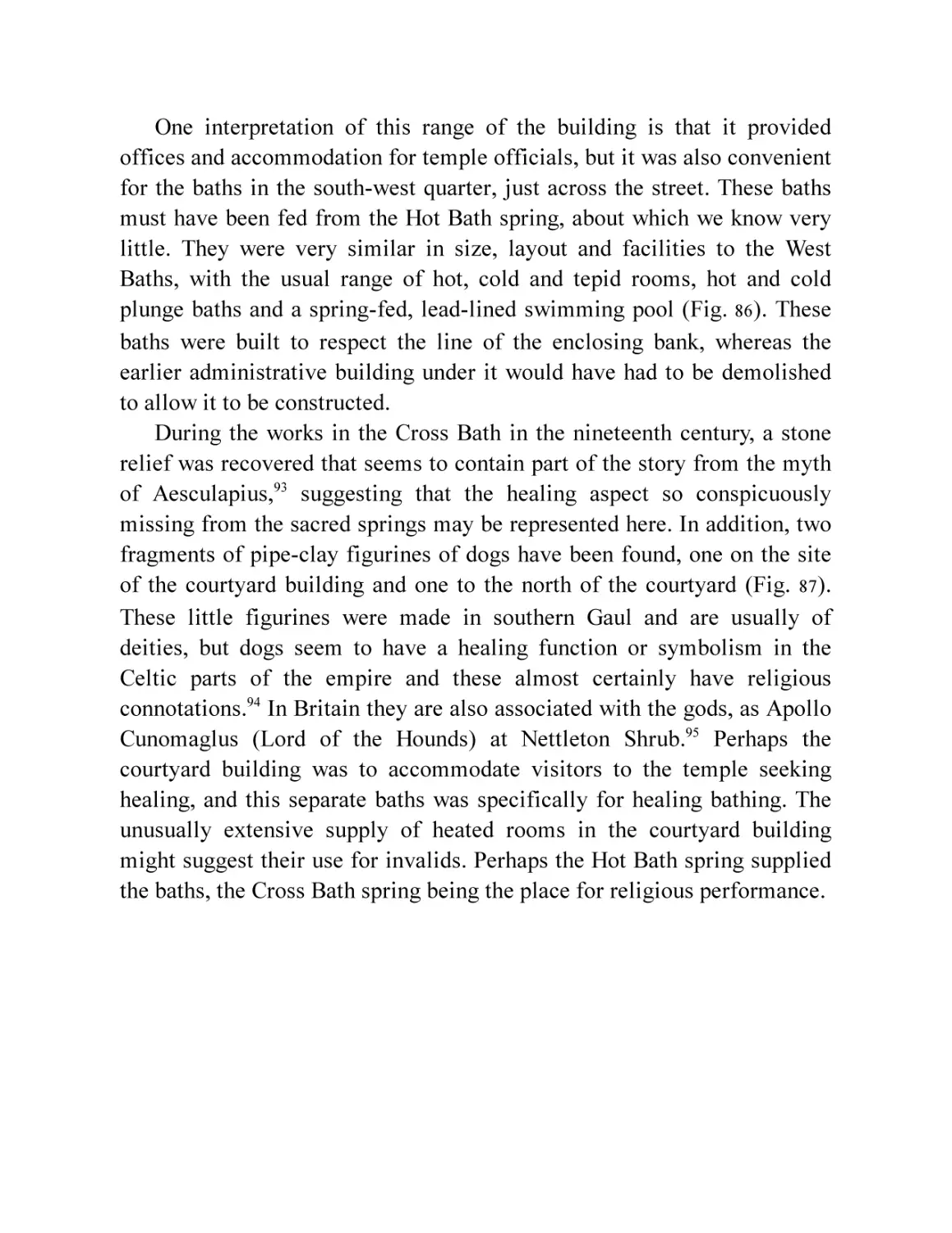
Fig. 87 Two dog figurines from the courtyard building and just north of it
(drawings from Davenport, 1999, Fig. 1.78 and photo © Bath and
North East Somerset Council, Roman Baths Museum).
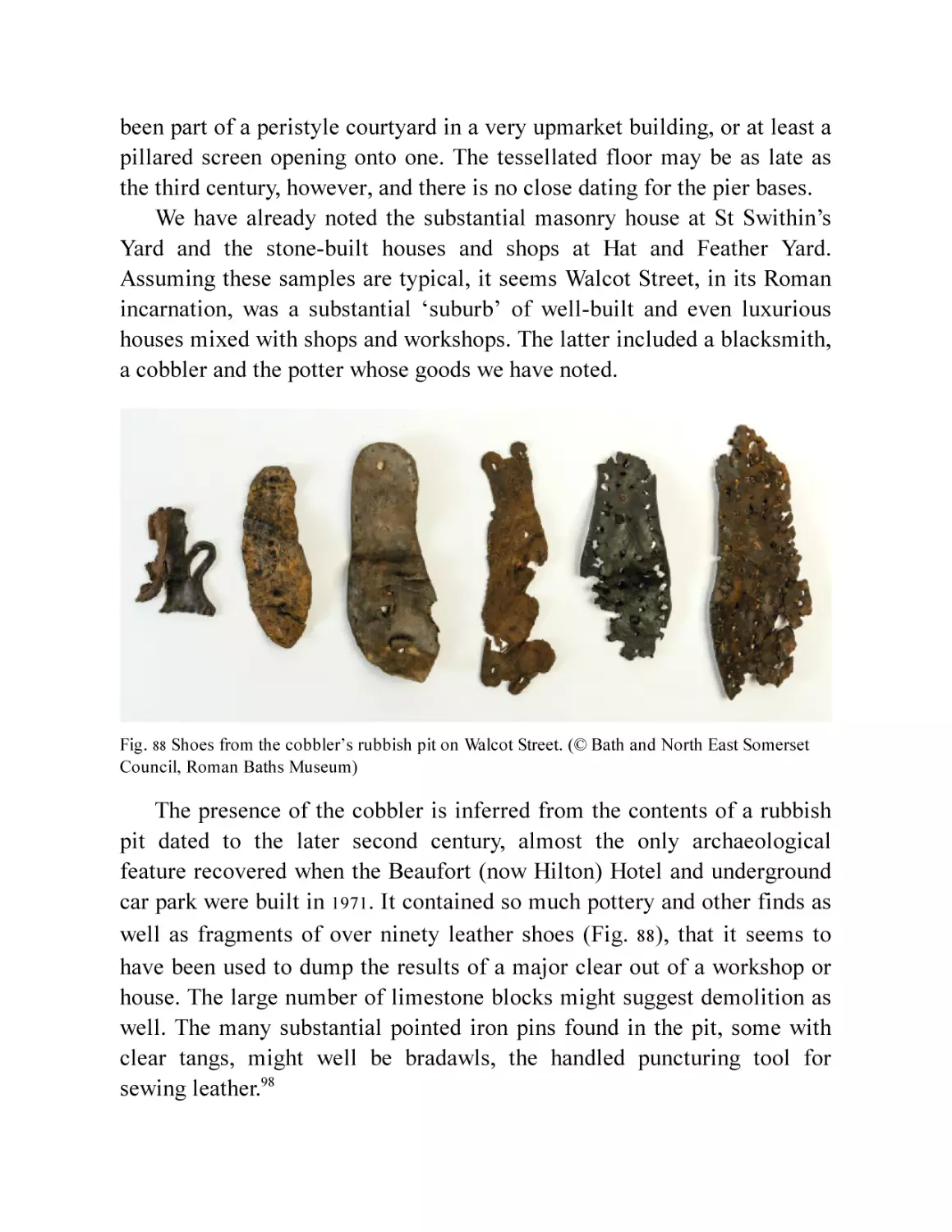
Fig. 88 Shoes from the cobbler’s rubbish pit on Walcot Street. (© Bath
and North East Somerset Council, Roman Baths Museum)
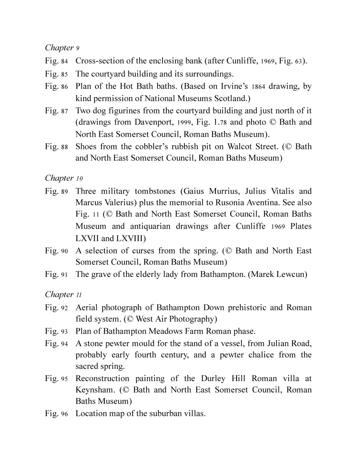
Chapter 10
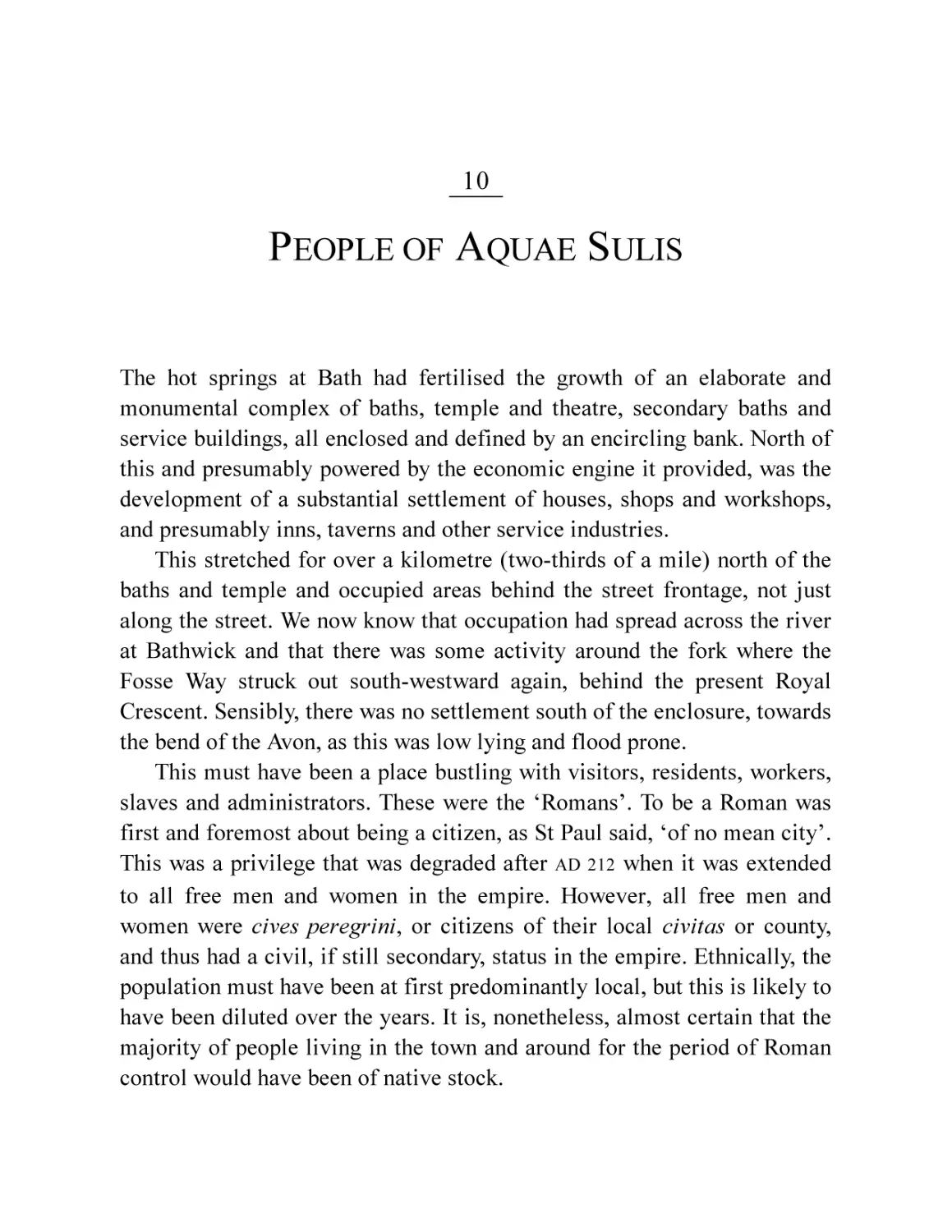
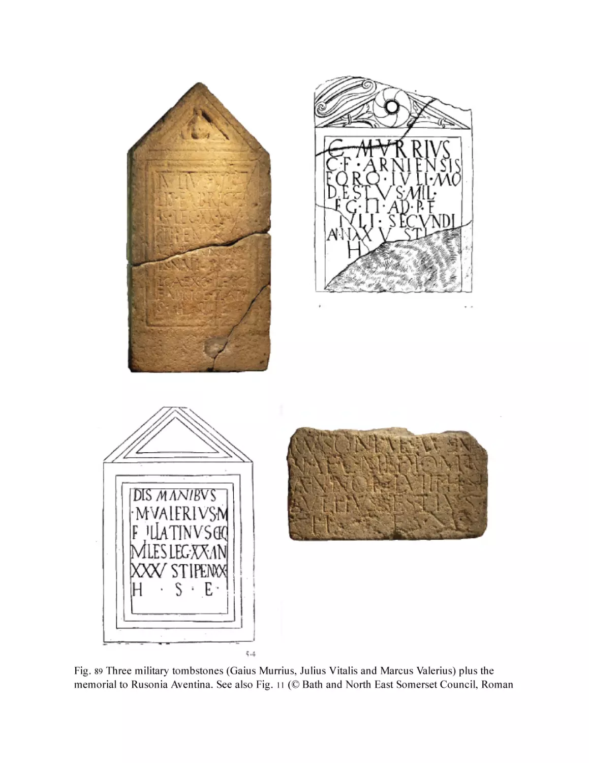
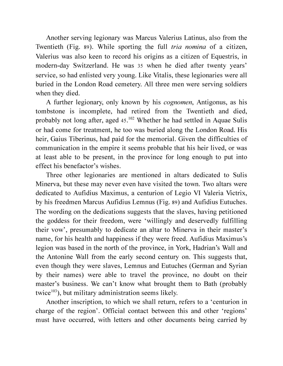
Fig. 89 Three military tombstones (Gaius Murrius, Julius Vitalis and
Marcus Valerius) plus the memorial to Rusonia Aventina. See also
Fig. 11 (© Bath and North East Somerset Council, Roman Baths
Museum and antiquarian drawings after Cunliffe 1969 Plates
LXVII and LXVIII)
Fig. 90 A selection of curses from the spring. (© Bath and North East
Somerset Council, Roman Baths Museum)
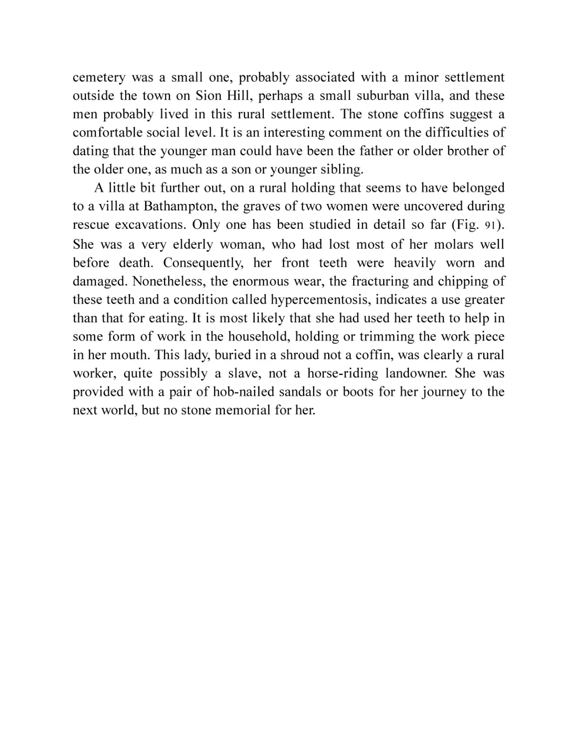
Fig. 91 The grave of the elderly lady from Bathampton. (Marek Lewcun)
Chapter 11
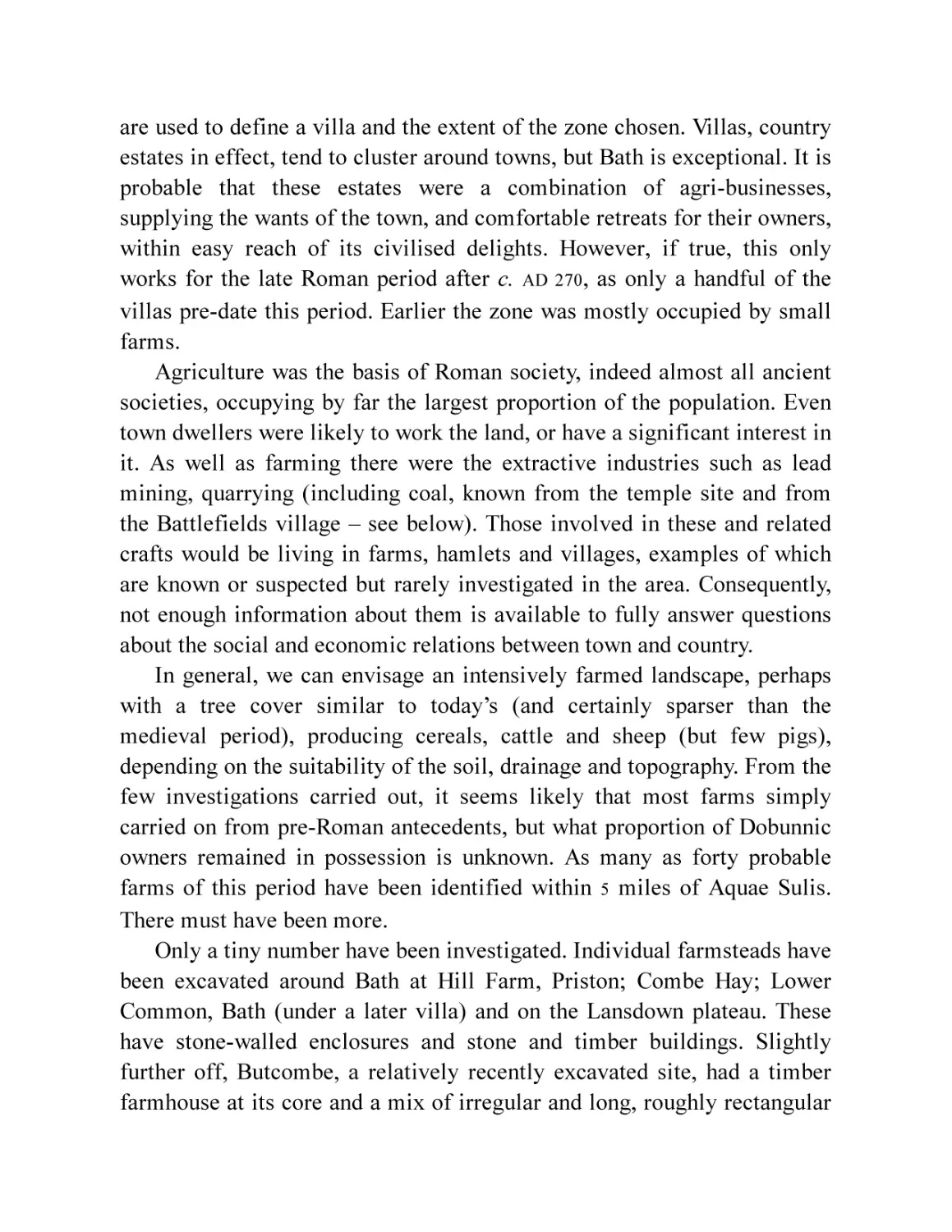
Fig. 92 Aerial photograph of Bathampton Down prehistoric and Roman
field system. (© West Air Photography)
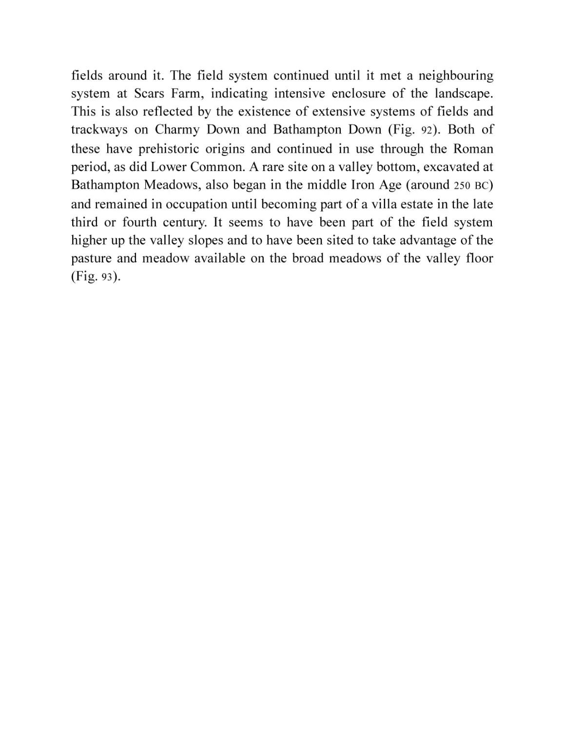
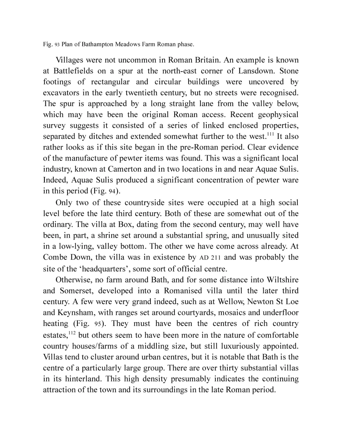
Fig. 93 Plan of Bathampton Meadows Farm Roman phase.
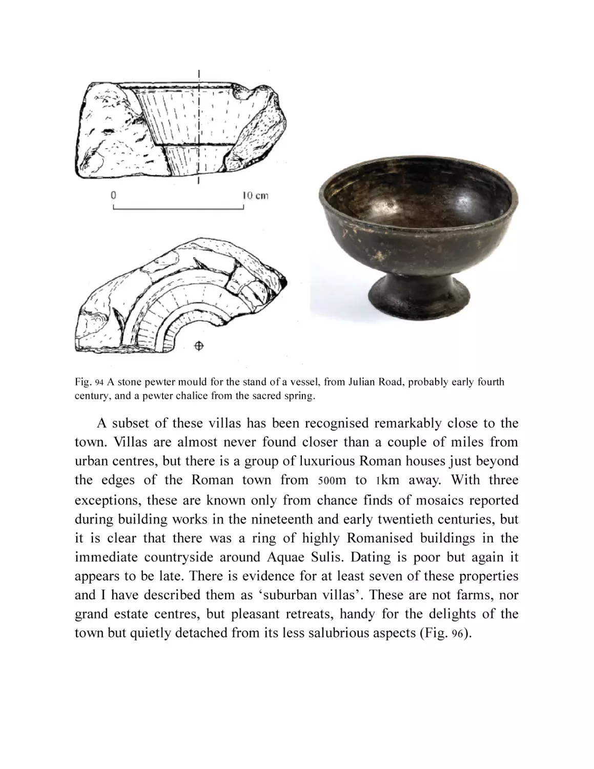
Fig. 94 A stone pewter mould for the stand of a vessel, from Julian Road,
probably early fourth century, and a pewter chalice from the
sacred spring.
Fig. 95 Reconstruction painting of the Durley Hill Roman villa at
Keynsham. (© Bath and North East Somerset Council, Roman
Baths Museum)
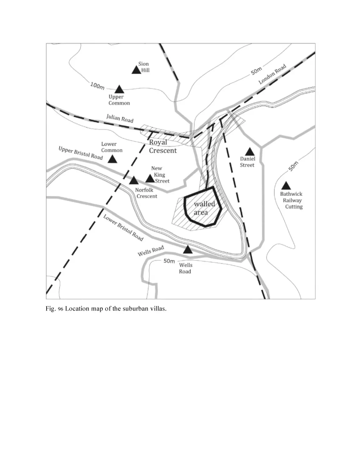
Fig. 96 Location map of the suburban villas.
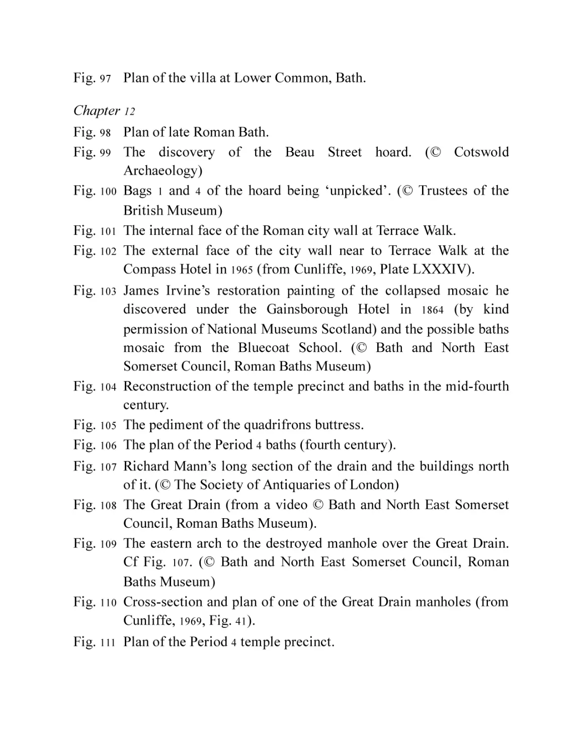
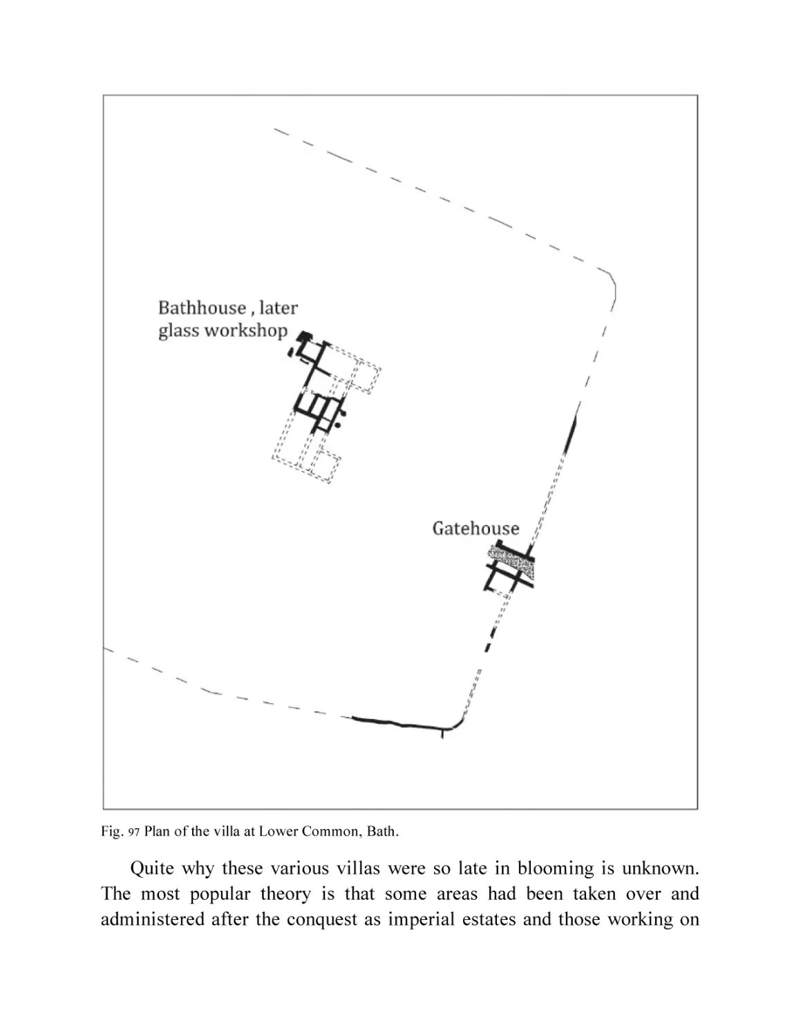
Fig. 97 Plan of the villa at Lower Common, Bath.
Chapter 12
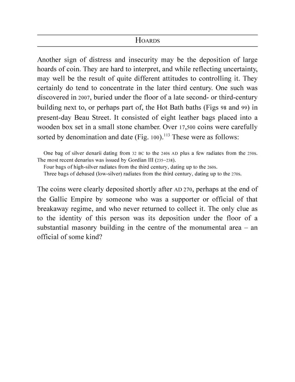
Fig. 98 Plan of late Roman Bath.
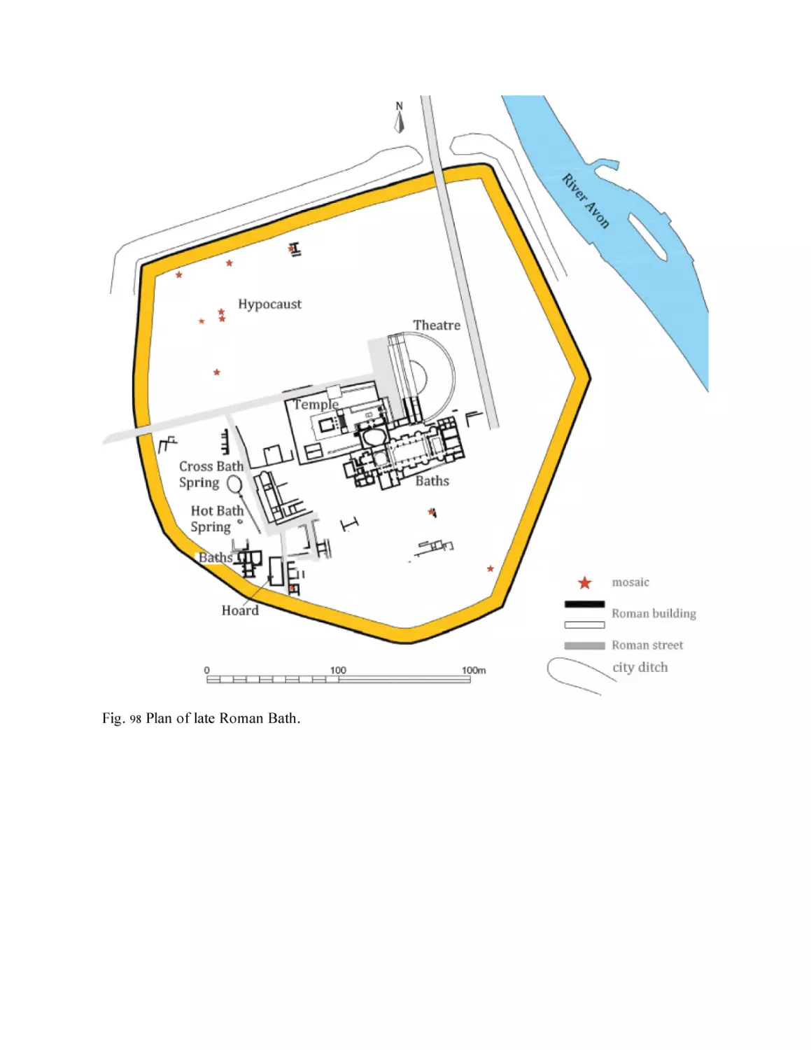
Fig. 99 The discovery of the Beau Street hoard. (© Cotswold
Archaeology)
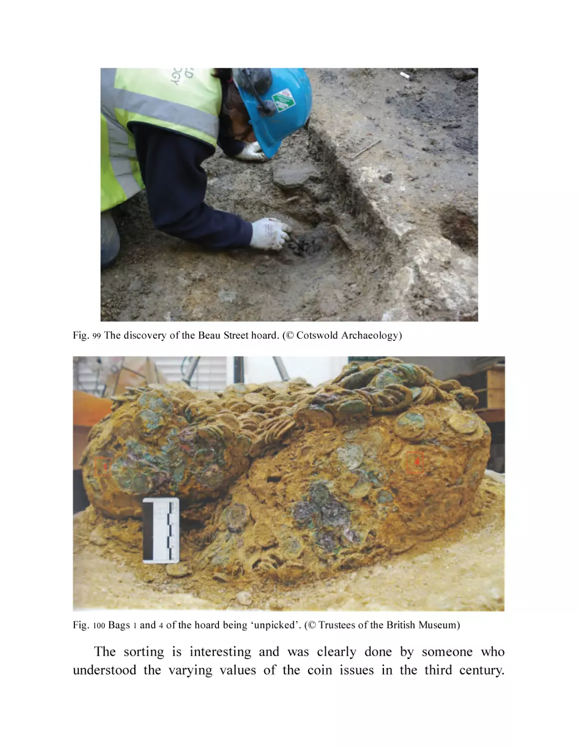
Fig. 100 Bags 1 and 4 of the hoard being ‘unpicked’. (© Trustees of the
British Museum)
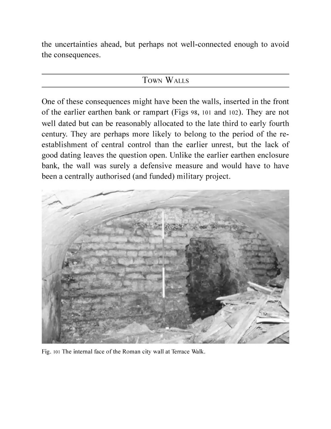
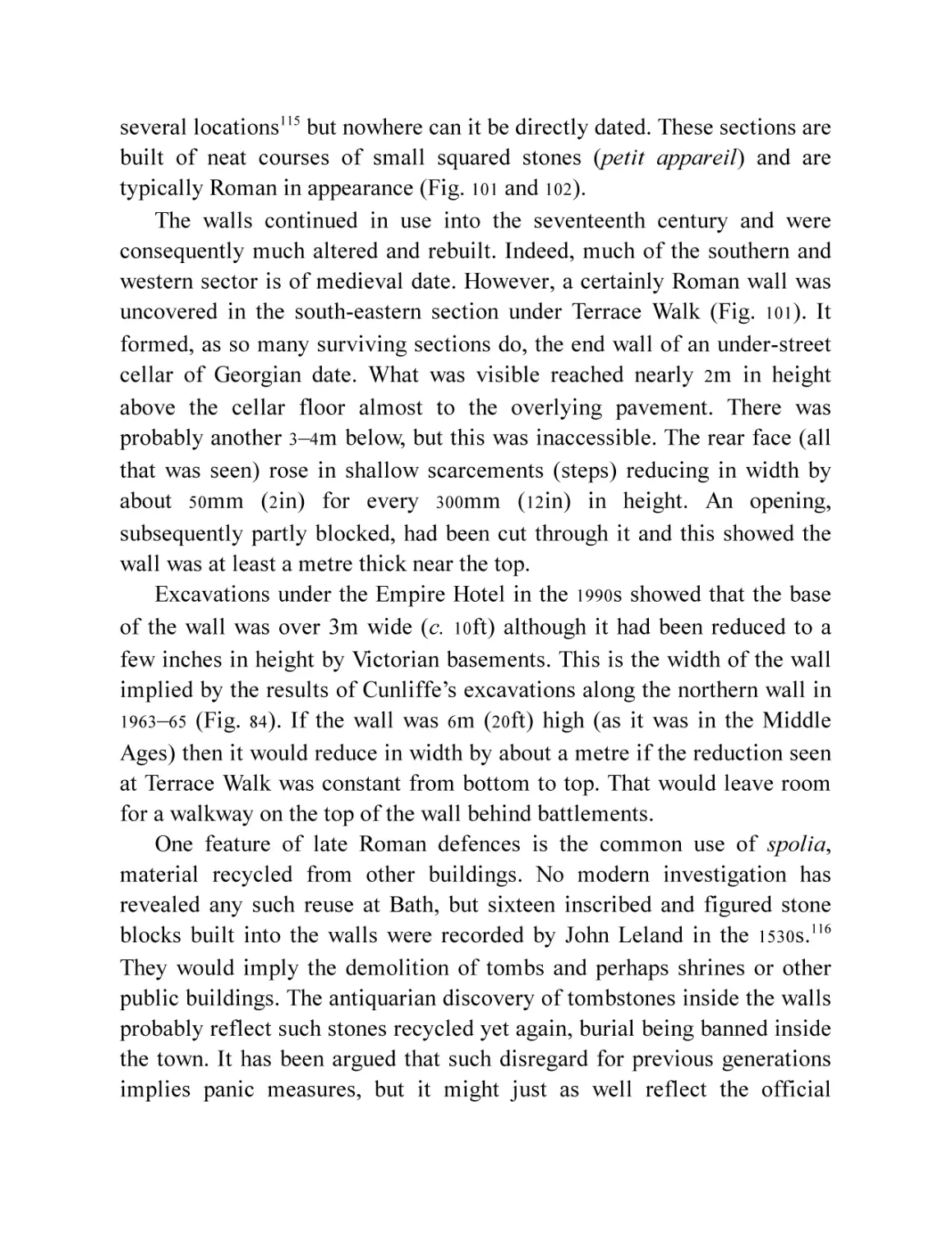
Fig. 101 The internal face of the Roman city wall at Terrace Walk.
Fig. 102 The external face of the city wall near to Terrace Walk at the
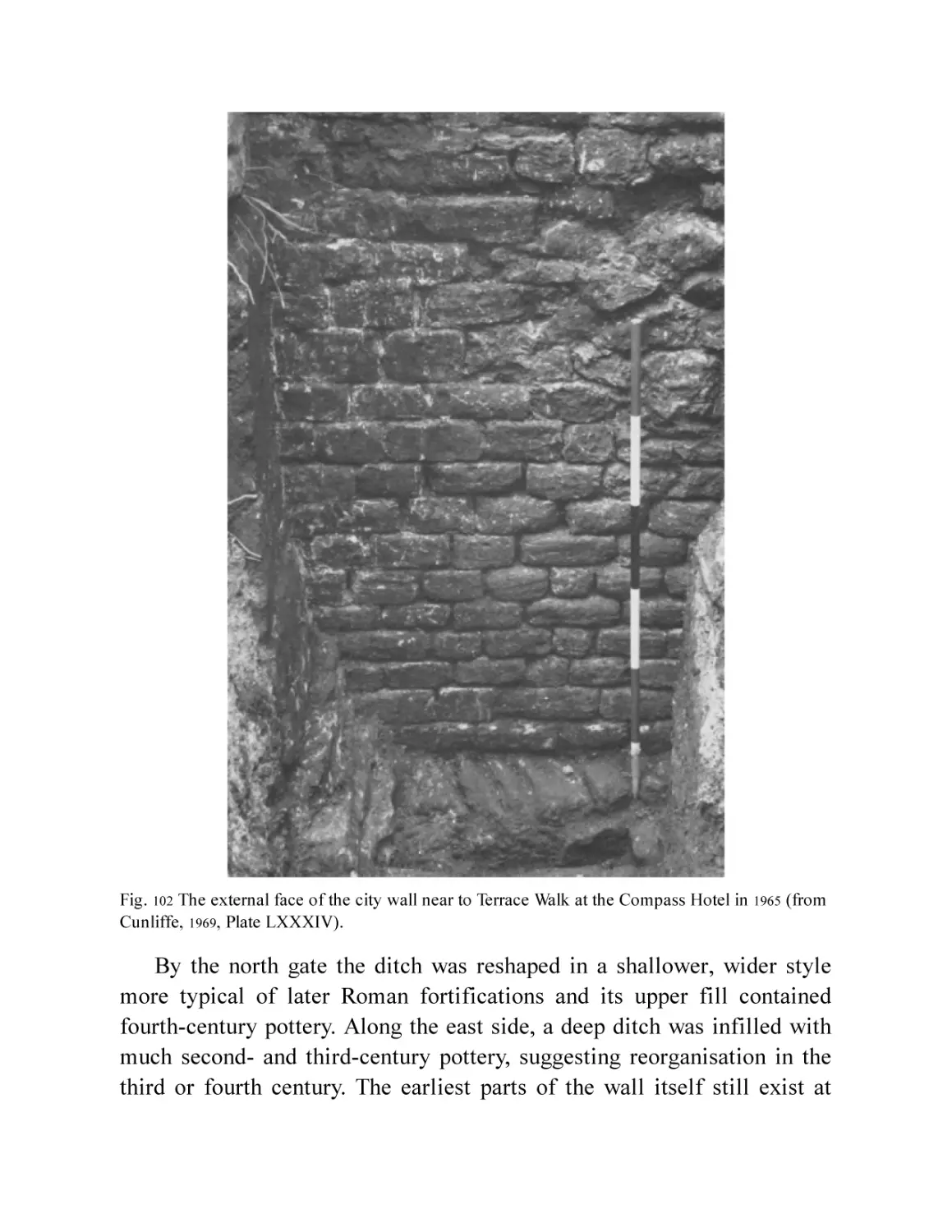
Compass Hotel in 1965 (from Cunliffe, 1969, Plate LXXXIV).
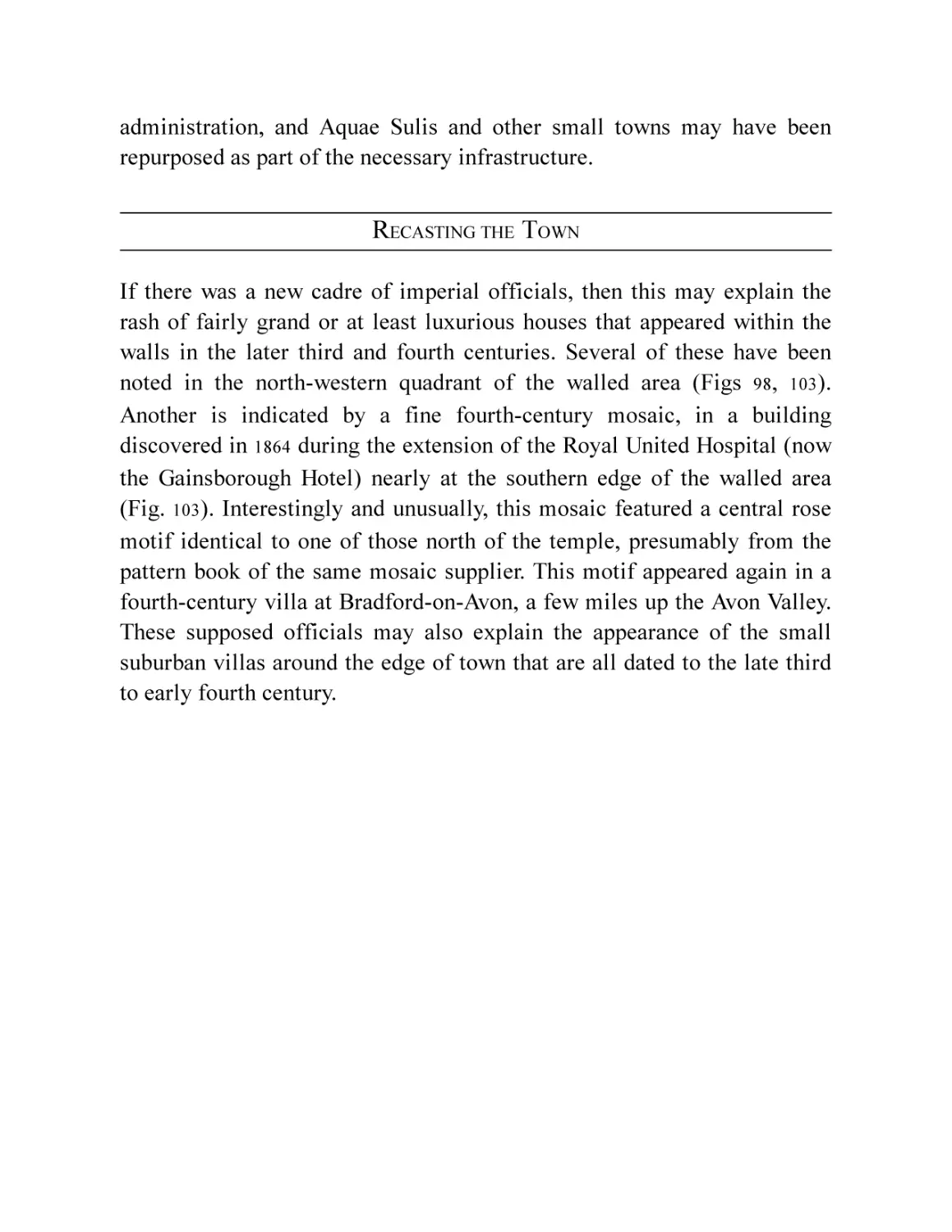
Fig. 103 James Irvine’s restoration painting of the collapsed mosaic he
discovered under the Gainsborough Hotel in 1864 (by kind
permission of National Museums Scotland) and the possible baths
mosaic from the Bluecoat School. (© Bath and North East
Somerset Council, Roman Baths Museum)
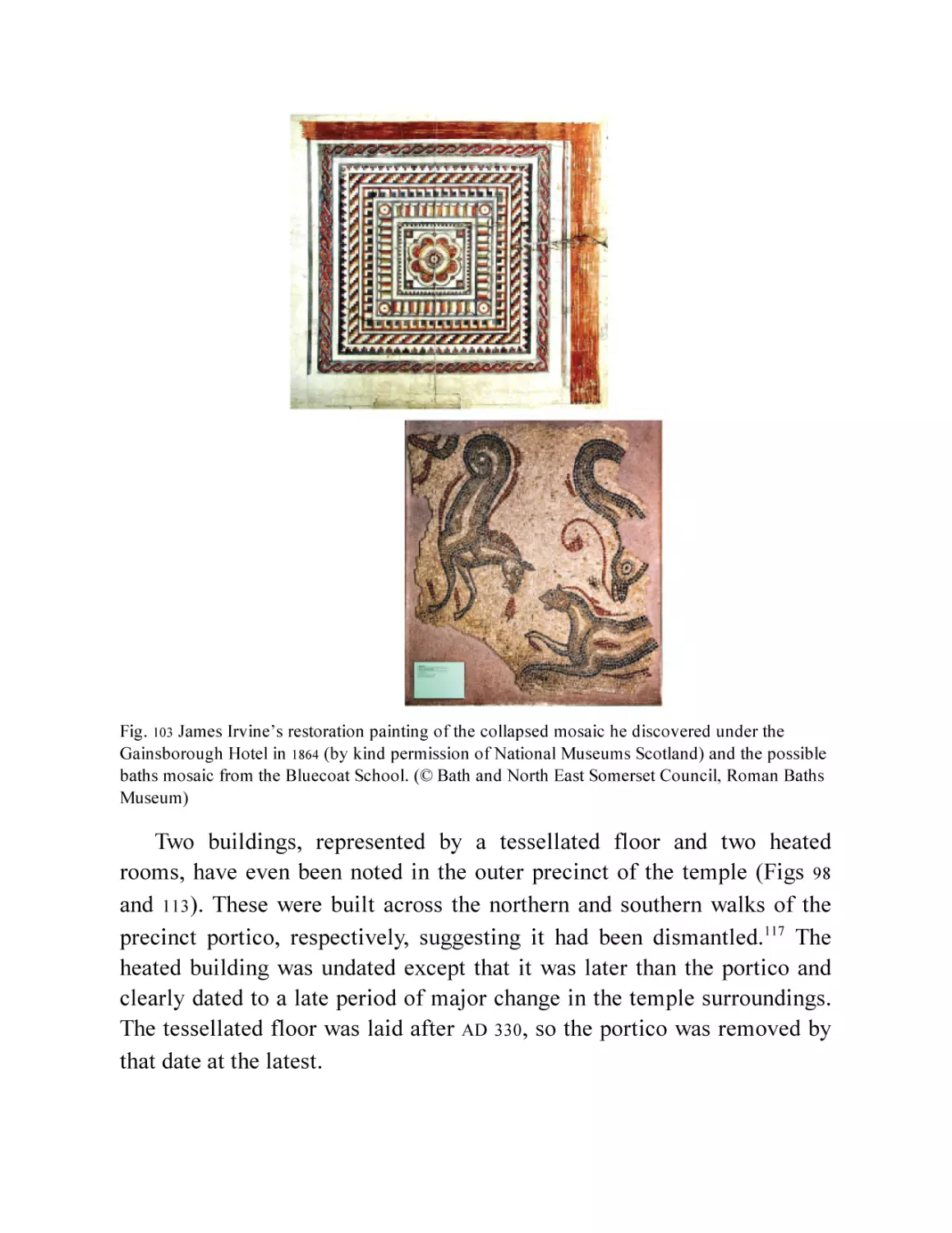
Fig. 104 Reconstruction of the temple precinct and baths in the mid-fourth
century.
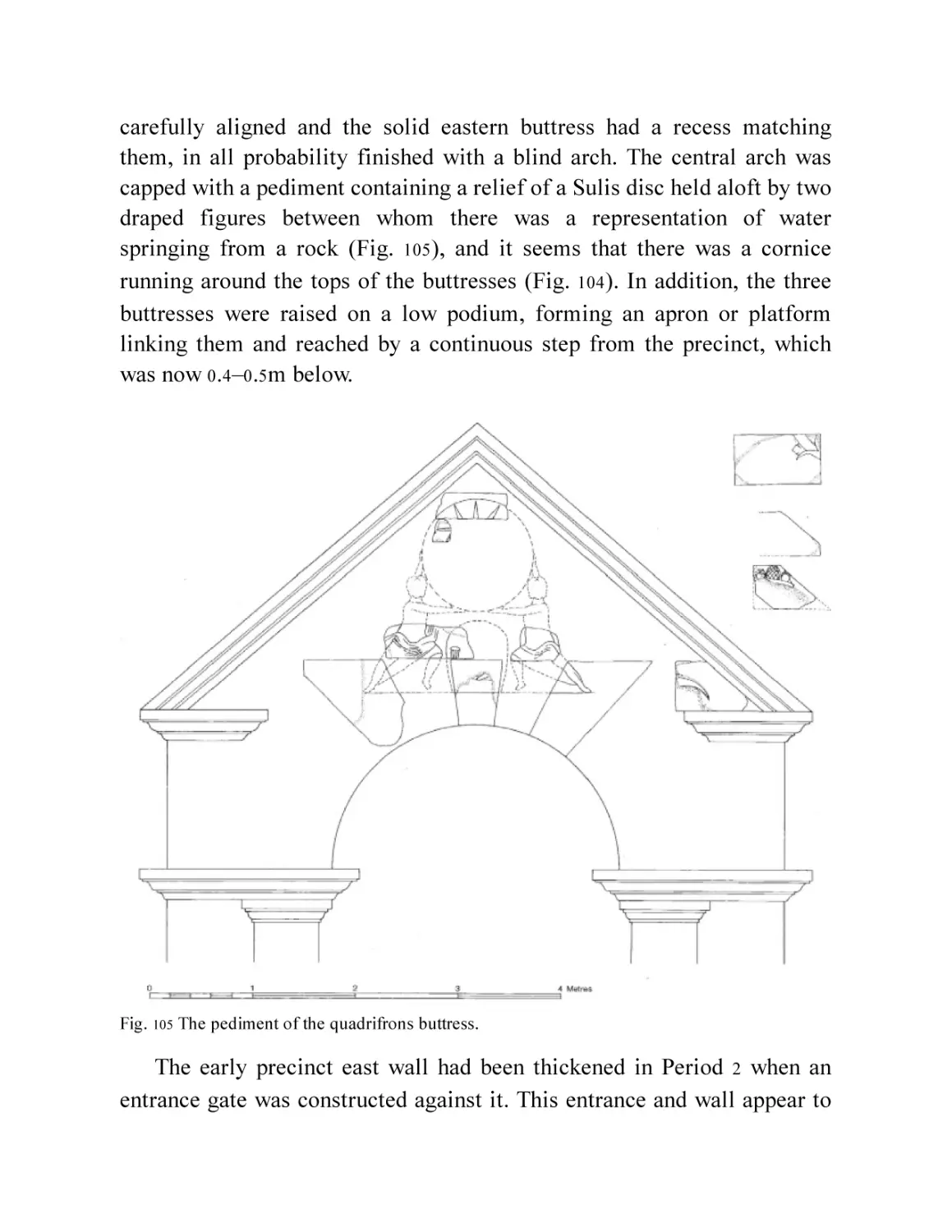
Fig. 105 The pediment of the quadrifrons buttress.
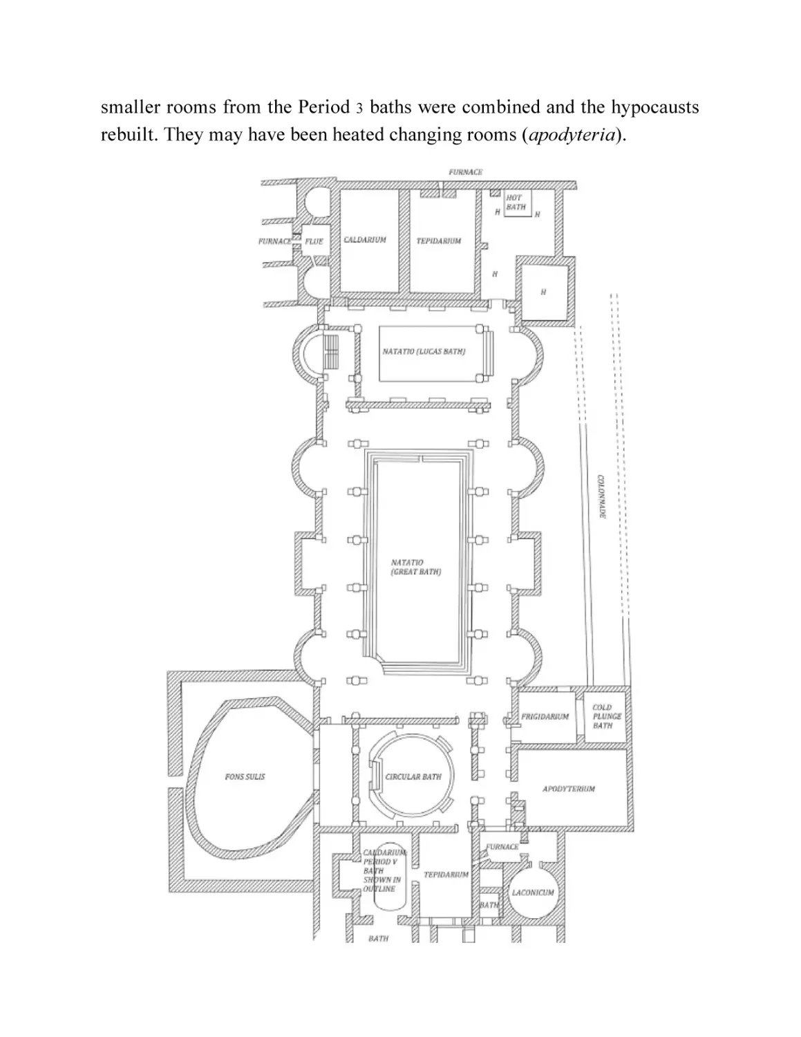
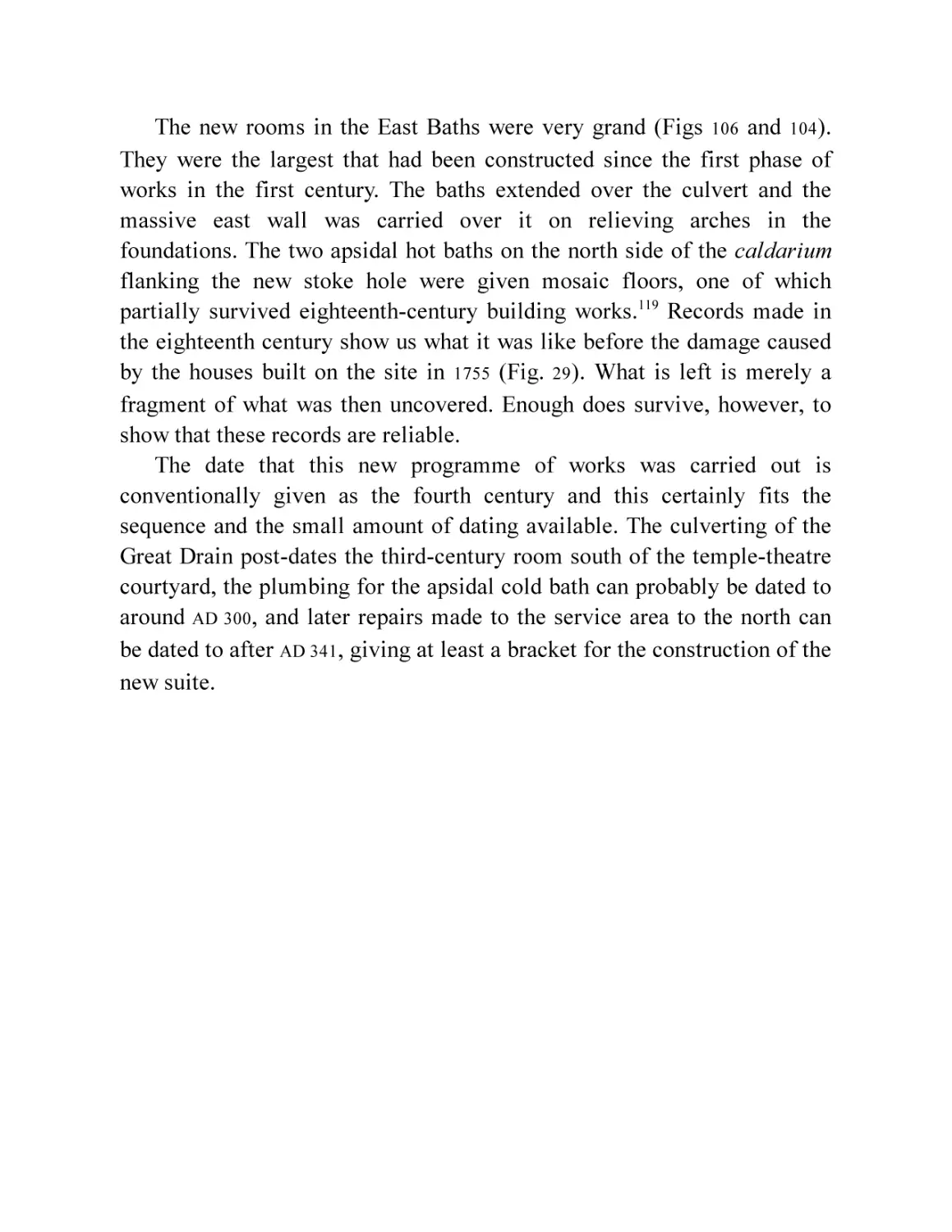
Fig. 106 The plan of the Period 4 baths (fourth century).
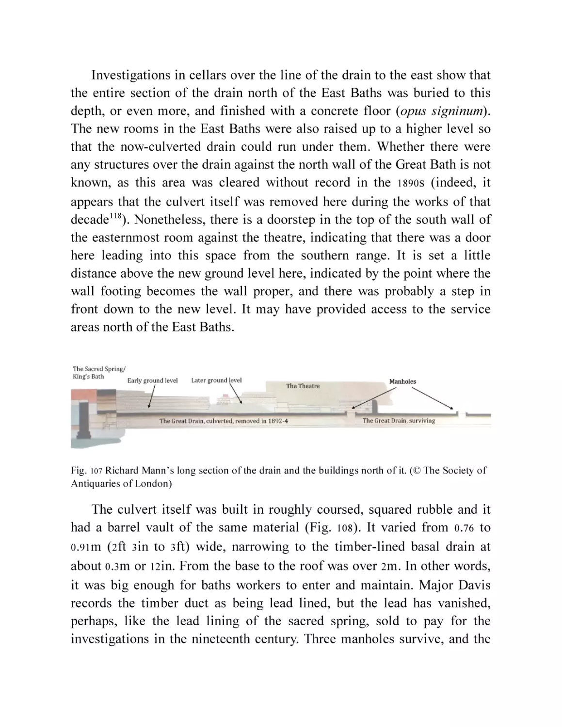
Fig. 107 Richard Mann’s long section of the drain and the buildings north
of it. (© The Society of Antiquaries of London)
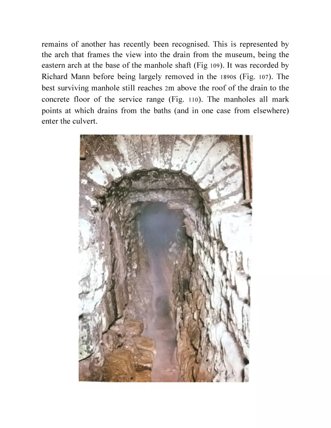
Fig. 108 The Great Drain (from a video © Bath and North East Somerset
Council, Roman Baths Museum).
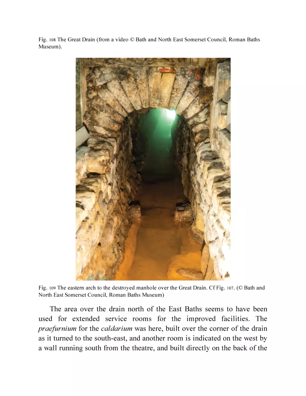
Fig. 109 The eastern arch to the destroyed manhole over the Great Drain.
Cf Fig. 107. (© Bath and North East Somerset Council, Roman
Baths Museum)
Fig. 110 Cross-section and plan of one of the Great Drain manholes (from
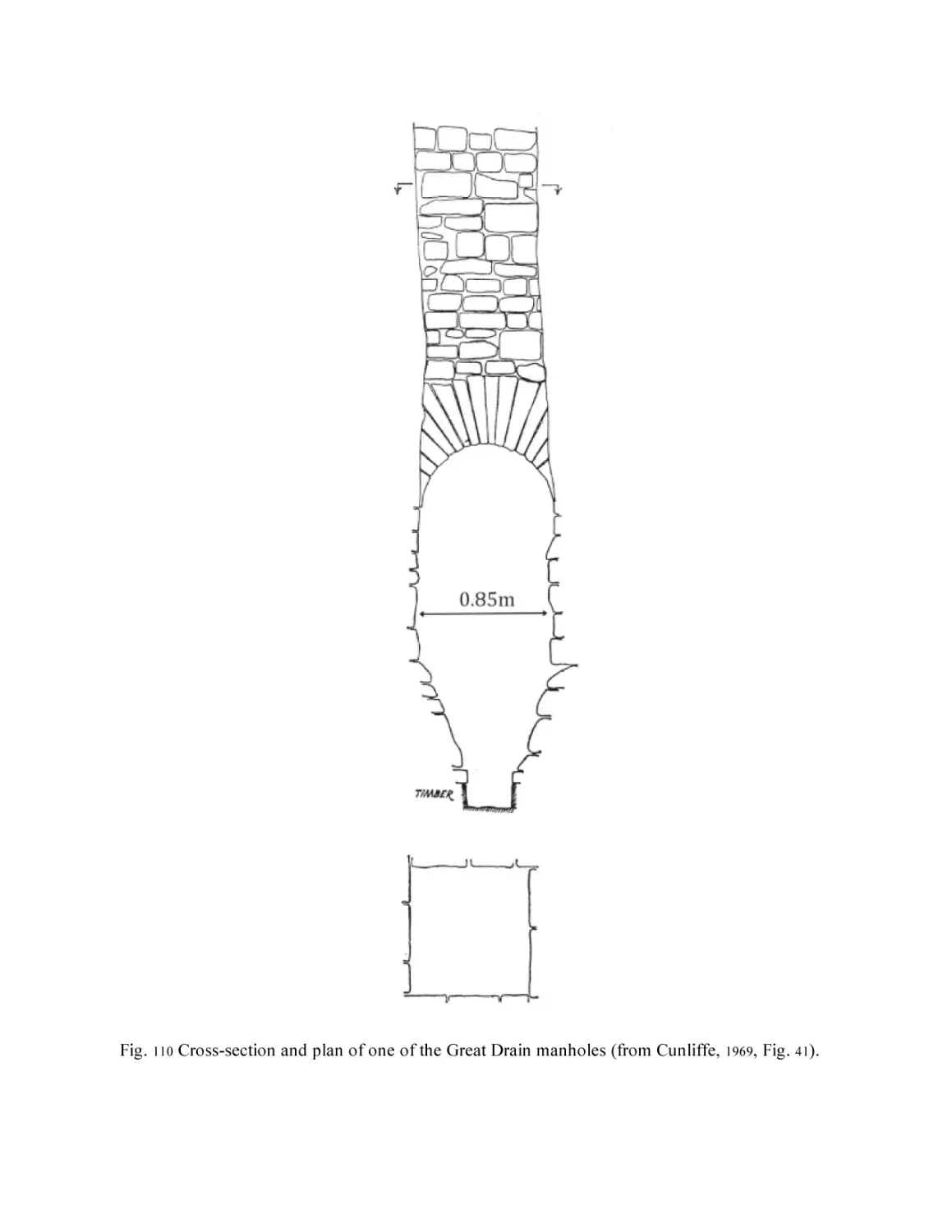
Cunliffe, 1969, Fig. 41).
Fig. 111 Plan of the Period 4 temple precinct.
Chapter 13
Fig. 112 Photo of late cobblings in the precinct. (© Barry Cunliffe/Oxford
University School of Archaeology)
Fig. 113 Reconstruction of the baths and precinct in the fifth century.
Fig. 114 The columned doorway and step of the entrance into the room
built between the quadrifrons arch and the eastern buttress in the
temple precinct. (© Barry Cunliffe/Oxford University School of
Archaeology)
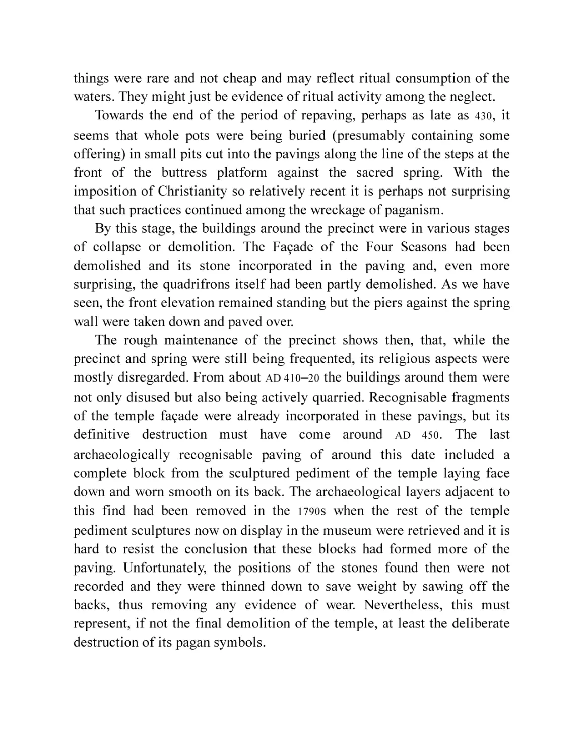
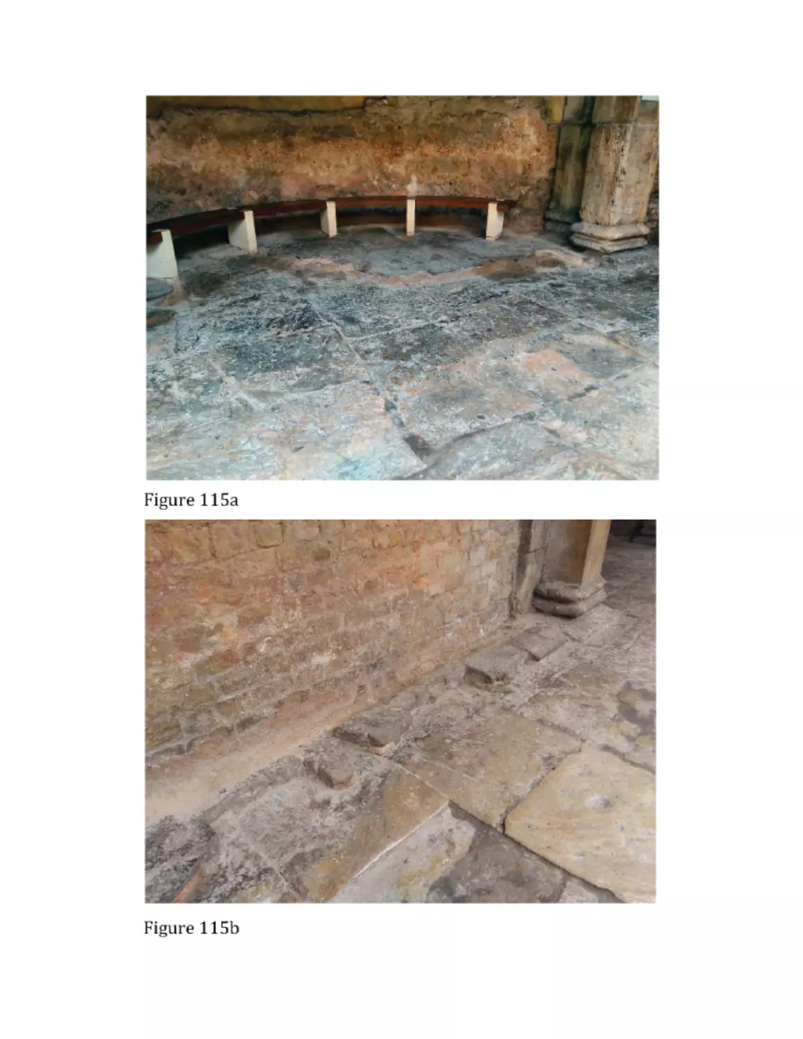
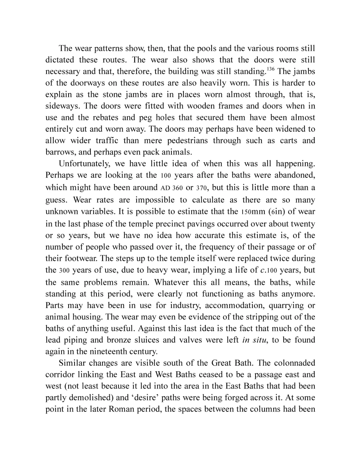
Fig. 115 Wear in the Great Baths walkways. a. Note the unworn early
paving under the partly removed later paving and the sharp edge
to the worn section where it was protected during erosion by the
overlying slabs. b. A remnant of later paving, its edges worn by
the wear through it.
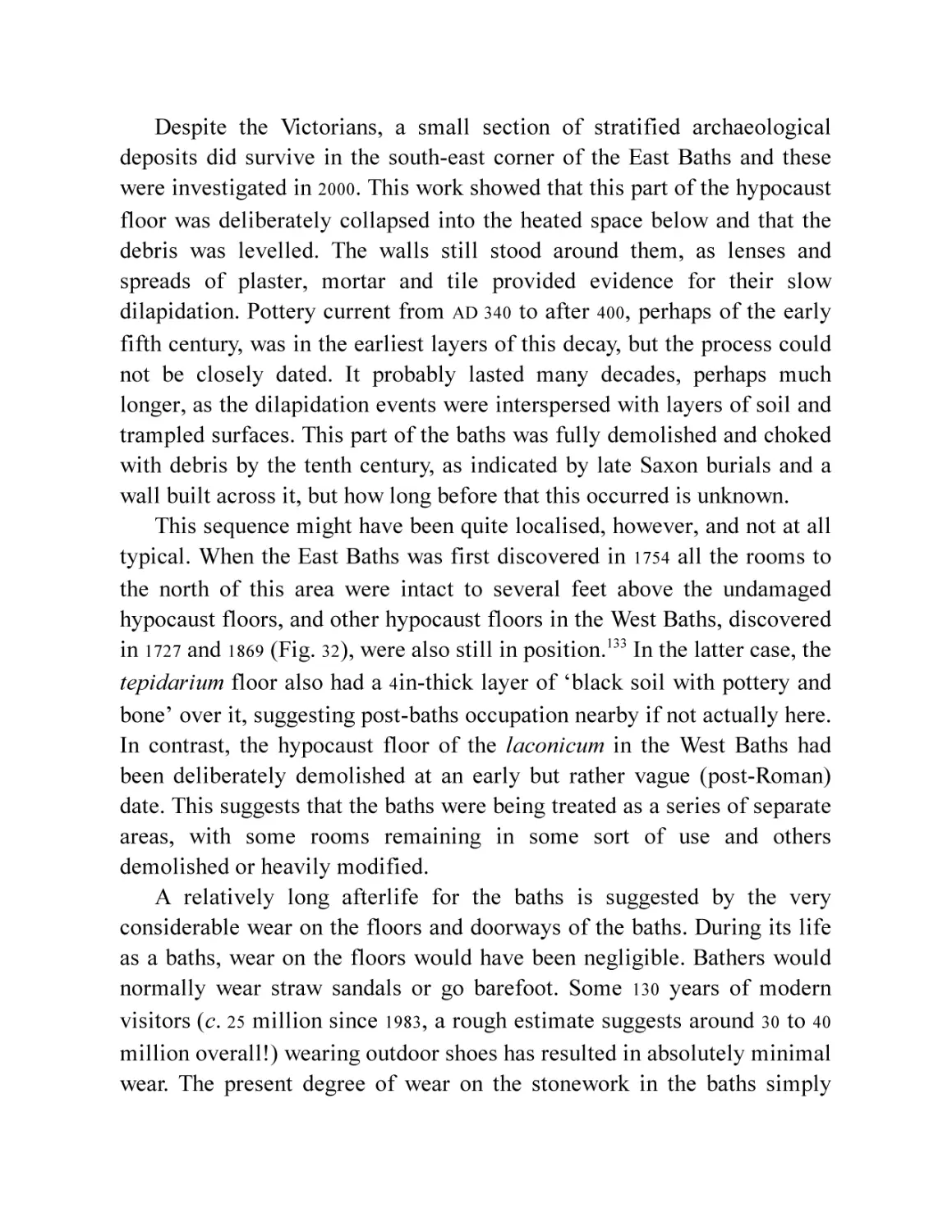
Fig. 116 Extreme wear in the paving around the Circular Bath.
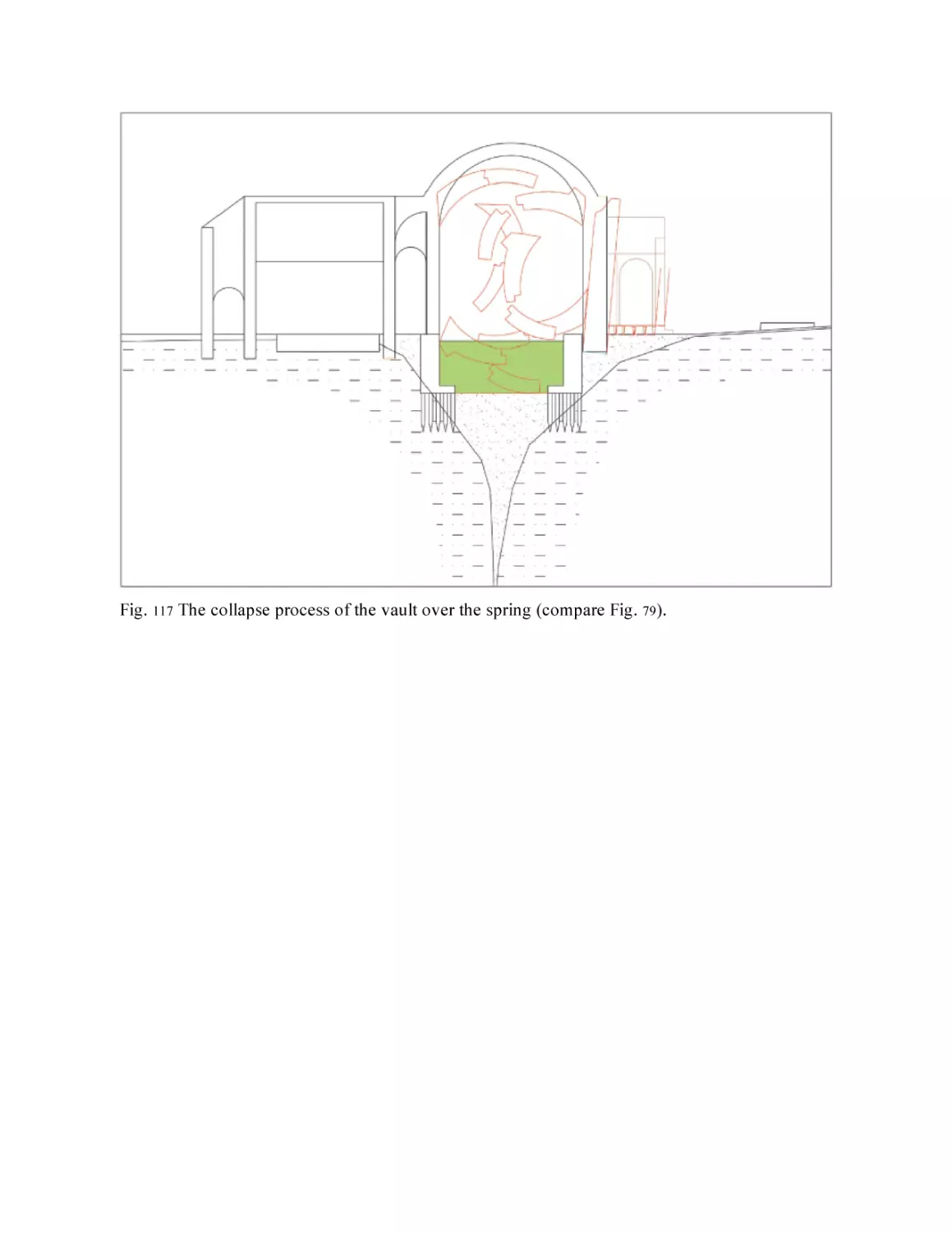
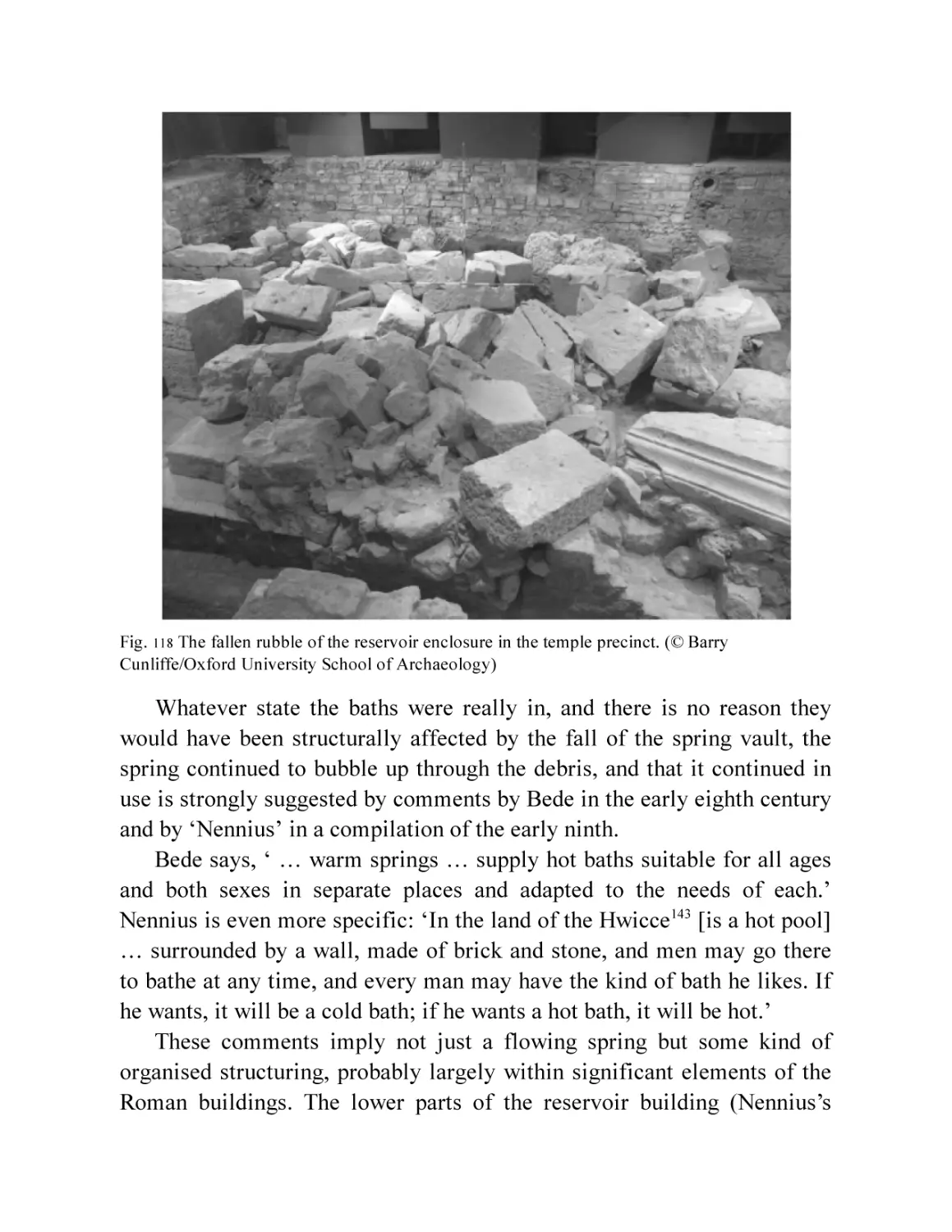
Fig. 117 The collapse process of the vault over the spring (compare Fig.
79 ).
Fig. 118 The fallen rubble of the reservoir enclosure in the temple
precinct. (© Barry Cunliffe/Oxford University School of
Archaeology)
FOREWORD
When workmen, digging a sewer trench along Stall Street in 1727,
uncovered the gilded bronze head of Minerva it heralded the beginning of
the long and exciting process leading to the discovery of the remarkable
Roman healing shrine of Sulis Minerva, deep beneath modern Bath. That
so much is now known of the Roman complex is a tribute to the many
who, over the last three centuries, have laboured in the mud, often in
dangerous conditions, to explore and to rescue the basic evidence upon
which Bath’s former glories can be reconstructed. That the process of
discovery continues, and new and surprising evidence may appear any
moment, is what makes archaeology such a satisfying pursuit.
Along with the privilege of discovery comes the responsibility to make
the new information available to the general public whose story this is. So
it was, in 1864, that the Rev. H.M. Scarth published his Aquae Solis or
Notices of Roman Bath, bringing together all previous finds including the
stunning remains of the temple façade found when the foundations of the
Pump Room were dug in 1790. In the years following the publication of
Scarth’s book, new finds came thick and fast. Remains of the temple
podium were being recorded during building work in the 1860s, soon to be
followed by the excavation of the Roman Baths – a hugely ambitious
programme driven forward by city architect, Major Charles Davis to the
lasting benefit of the city. More of the Baths was exposed in the 1920s but
thereafter things quietened down and little that was new was added for
several decades.
It was the foresight of Sir Ian Richmond, an archaeologist who had
made a study of the Baths, that inspired a renewed effort. In 1963
Richmond encouraged the setting up of the Bath Excavation Committee,
of which I was appointed director. Alongside carrying out rescue
excavations we decided to focus on completing Richmond’s work on the
Baths and to begin a new study of the Temple. The first stage of this
programme was published in a scholarly monograph, Roman Bath (1969),
and a popular account, Roman Bath Discovered (first edition, 1971). A few
years later, encouraged by the city’s farsighted chief executive, David
Beeton, we began a more ambitious programme – to excavate the entirety
of the temple precinct lying beneath the Pump Room and explore the
nearby sacred spring. One of my young colleagues, who played an active
part in the work, was Peter Davenport and together we published the
spectacular results in our volume The Temple of Sulis Minerva at Bath
(1985). To make this work and some later finds more available to the
general reader I updated Roman Bath Discovered, the third edition being
published in 2000.
In the forty years following the temple excavation, Peter Davenport
has continued to play an active role in the archaeology of Bath and has
been directly responsible for much of the excavation and publication work.
During this time a great deal that is new has come to light, particularly
about the town outside the boundary of the sanctuary, while work in and
around the Baths has clarified the picture, leading to a fuller understanding
and new interpretations. Perhaps the most important result of all this is
that it is now possible to present the development of Bath and its sanctuary
as a narrative of change spanning the Roman period – that is what the
present book sets out to do.
And what of the future? First and foremost there is the need for past
excavations to be published – it is the professional duty of archaeologists
to do so. Much has been done, but there are still some significant
excavations of the last twenty-five years awaiting full analysis and
publication. We also need a change in attitude to excavation in the city. It
is customary to argue that archaeological deposits should be preserved
wherever possible and there is much good sense in this. But such an
attitude can hinder research. Every new building proposal offers an
archaeological opportunity. That opportunity should be taken in full if
there are sound research reasons for doing so, even if it means excavating
archaeological deposits that would not otherwise need to be removed.
Only in this way will future generations be able to add to our
understanding of the remarkable remains of Roman Bath in the way that
our predecessors have done so effectively over the last three centuries.
Barry Cunliffe, 2020
INTRODUCTION
As this book is being completed, it has been twenty years since the last
edition of the standard book on Roman Bath was published.1 Several
important excavations and smaller investigations that have taken place
since then, along with some re-evaluation of older work, mean that we are
justified in producing ‘yet another book on Roman Bath’. Stephen Clews,
the manager of the Roman Baths Museum complex, has christened the
growth in our understanding of the Roman town of Aquae Sulis ‘The
Three-Hundred-Year Dig’, underlining the point that the discovery is a
continuous process, never completed. In fact it is nearly 500 years since
John Leland noted Roman antiquities built into the ancient walls of Bath,
and since the mythical foundation stories of Bath were first challenged. I
have outlined this process in the Afterword.
The rate of discovery has varied, as has the degree of interest, but has
never completely flagged since the dramatic discovery of the gilded
bronze head of Minerva in 1727 (Fig. 35). It is not a linear progression and
for much of this period investigation was based on chance discoveries, and
even more on the presence of someone capable and willing to recognise
and record them. Where this happened, the degree of competence and
understanding varied enormously. The clearance of the baths in the 1880s
and ’90s under the City Architect, Major Davis, was extensive but not
archaeological, although great pains were taken by his assistant, Richard
Mann, to record the structures uncovered. Professional excavations only
started in the 1920s on a limited scale, followed by targeted investigations
in the Baths in the 1950s and ’60s. There has been some kind of
investigative work in the Baths and Temple in every decade since. In the
rest of the town opportunistic ‘rescue excavations’ started in the 1950s and
continued into the ’70s. Professional provision has been available to record
and even preserve archaeological remains since the early 1980s. The
excavation report on this three-hundred-year dig must be revised every so
often; ideas change and old models are questioned or revived. This book is
the latest interim.
PRELUDE
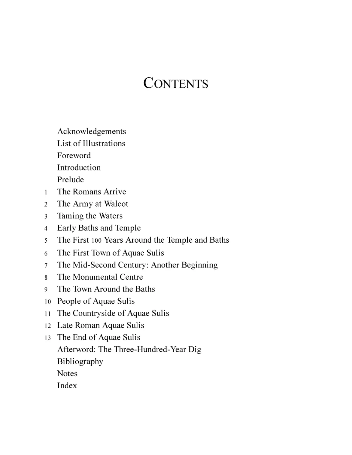
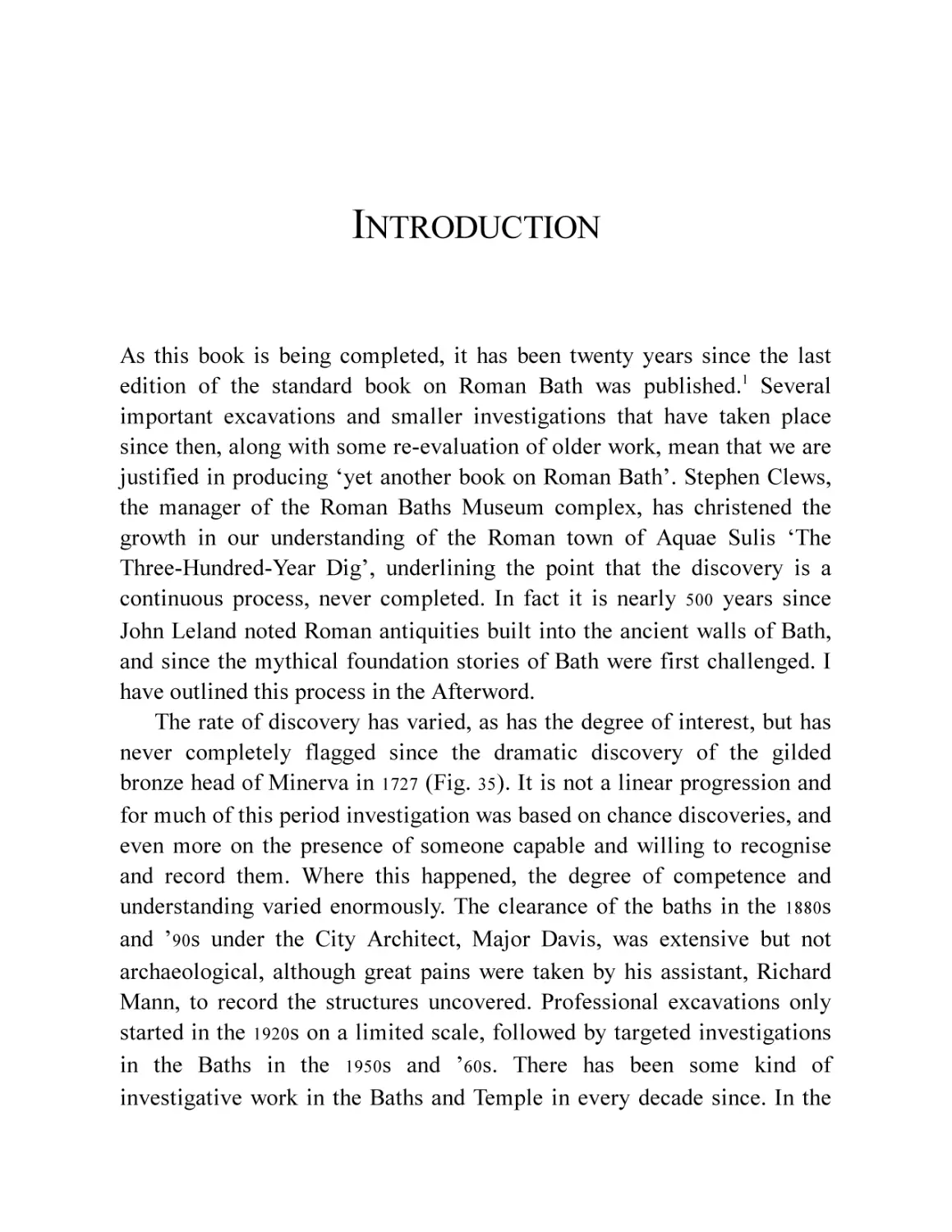
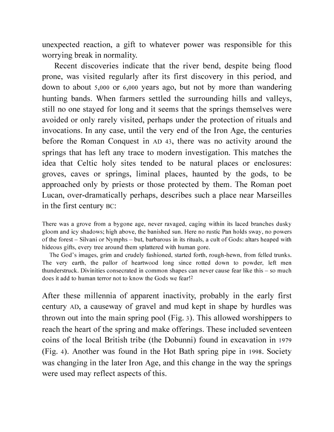
In 1998 geological drilling into the sediments of the Hot Bath spring was
monitored by archaeologists, who recovered a remarkable collection of 494
high-quality stone tools dating from the early Mesolithic period (Fig. 1).
They were as much as 9,500 years old. The tools showed virtually no signs
of wear and were an unusual selection of types in carefully selected raw
material. The numbers from the narrow sample (a 100mm diameter
borehole) implied that there were as many as 1,700 artefacts per cubic
metre in the muds in the spring. Whether or not this was the result of one
event or several, we are almost certainly looking at the earliest known act
of veneration or propitiation at the hot springs in which supplicants
deliberately threw offerings into the hot water at what was to become the
World Heritage Site of Bath.
Fig. 1 Flints from the Hot Bath spring. (Roman Baths Museum)
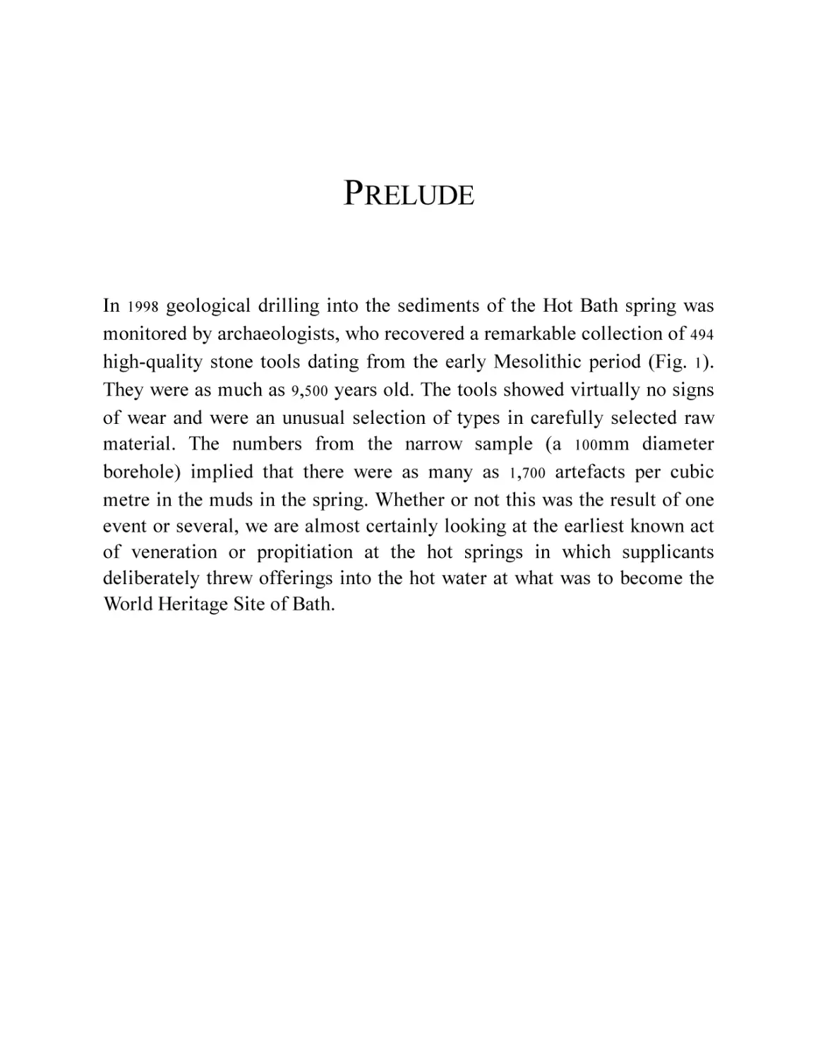
This was a time when hunter-gatherers, people who had not yet
adopted farming, were just beginning to colonise Britain, free of ice and
still not yet an island. Spreading across southern England along wooded
river valleys and tree-covered downland, small groups followed game,
exploiting plant foods as they came into season, reaching further and
further west; and, one year, they came to a bend in the river, wooded with
alder and willow and rich in wildfowl, fish and other game. And they
found the springs (Fig. 2).
Fig. 2 The hot springs as they may have looked before the Romans came (this is actually a spring
in Armenia).
It must have been a shocking discovery. The nearest hot springs were
over 200 miles away in Belgium; it is very unlikely that our wanderers had
ever seen anything like it. If it was a cool day, the wooded valley bottom
would have been sliced by a band of mist drifting through the foliage and
spreading down to the river. As they drew closer, the slight metallic smell
would be noticed and then the weird orange and emerald green colours of
the algae that grows around the hot waters would become apparent. If they
dared to come even closer they would see the three pools of hot water
bubbling and steaming and streaming down to the river.
We have little idea of the spiritual beliefs of the Mesolithic huntergatherers, but it is hard to imagine that their reaction to the springs was
not one of wonder, if not awe and fear. The deposition of a group of highquality flint tools, of a few restricted types, made of carefully selected
flint from as much as 20 miles away, might not, therefore, be an
unexpected reaction, a gift to whatever power was responsible for this
worrying break in normality.
Recent discoveries indicate that the river bend, despite being flood
prone, was visited regularly after its first discovery in this period, and
down to about 5,000 or 6,000 years ago, but not by more than wandering
hunting bands. When farmers settled the surrounding hills and valleys,
still no one stayed for long and it seems that the springs themselves were
avoided or only rarely visited, perhaps under the protection of rituals and
invocations. In any case, until the very end of the Iron Age, the centuries
before the Roman Conquest in AD 43, there was no activity around the
springs that has left any trace to modern investigation. This matches the
idea that Celtic holy sites tended to be natural places or enclosures:
groves, caves or springs, liminal places, haunted by the gods, to be
approached only by priests or those protected by them. The Roman poet
Lucan, over-dramatically perhaps, describes such a place near Marseilles
in the first century BC:
There was a grove from a bygone age, never ravaged, caging within its laced branches dusky
gloom and icy shadows; high above, the banished sun. Here no rustic Pan holds sway, no powers
of the forest – Silvani or Nymphs – but, barbarous in its rituals, a cult of Gods: altars heaped with
hideous gifts, every tree around them splattered with human gore.
The God’s images, grim and crudely fashioned, started forth, rough-hewn, from felled trunks.
The very earth, the pallor of heartwood long since rotted down to powder, left men
thunderstruck. Divinities consecrated in common shapes can never cause fear like this – so much
does it add to human terror not to know the Gods we fear!2
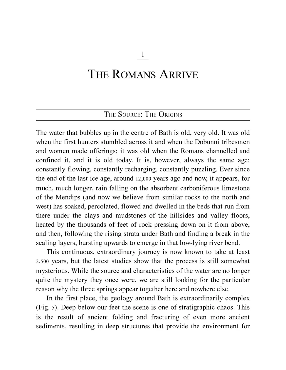
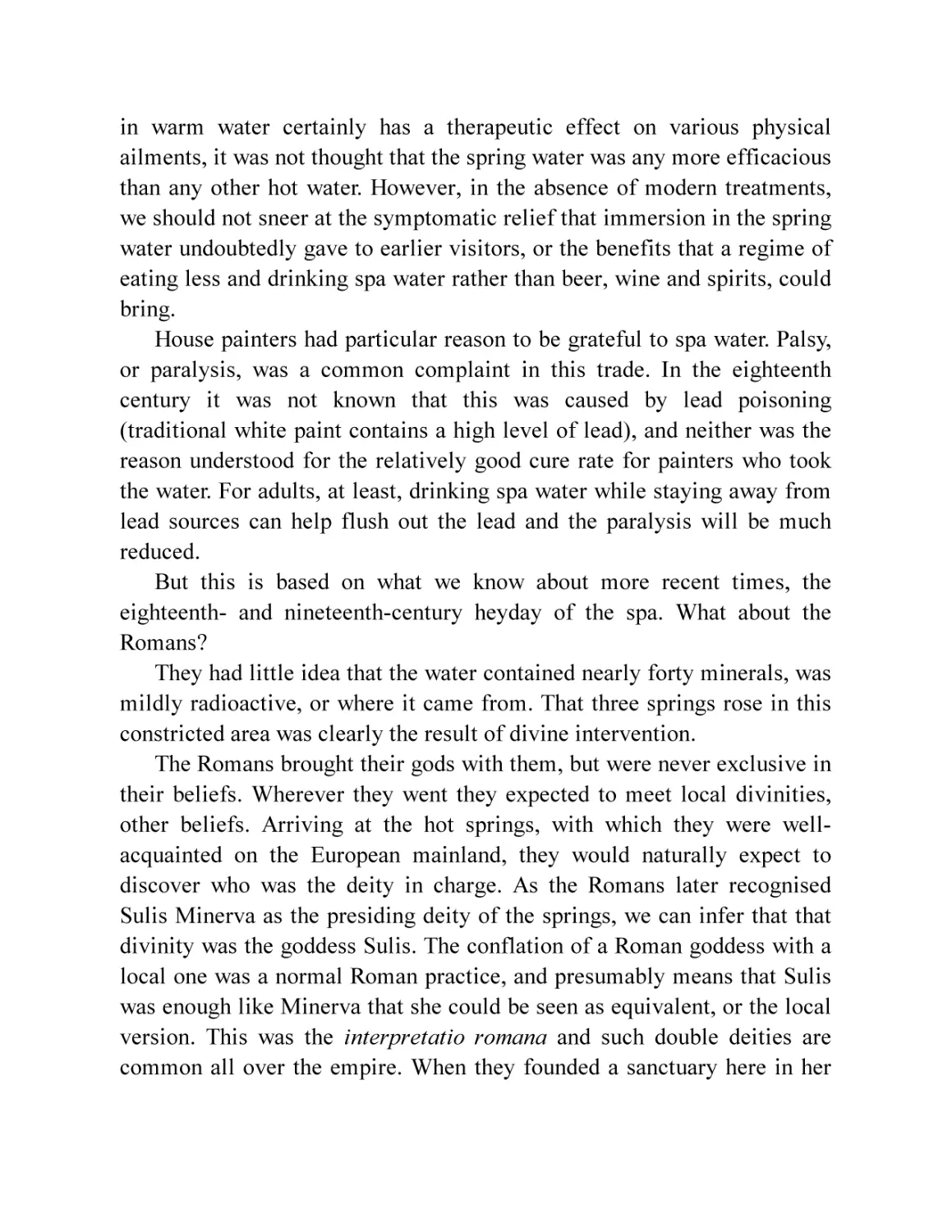
After these millennia of apparent inactivity, probably in the early first
century AD, a causeway of gravel and mud kept in shape by hurdles was
thrown out into the main spring pool (Fig. 3). This allowed worshippers to
reach the heart of the spring and make offerings. These included seventeen
coins of the local British tribe (the Dobunni) found in excavation in 1979
(Fig. 4). Another was found in the Hot Bath spring pipe in 1998. Society
was changing in the later Iron Age, and this change in the way the springs
were used may reflect aspects of this.
Fig. 3 The causeway into the sacred spring (based on Cunliffe and Davenport, 1985, Fig. 27).
Fig. 4 Celtic coins from the spring. (© Bath and North East Somerset Council, Roman Baths
Museum)
A few rare sherds of pre-Roman pottery have been found in the
vicinity of the springs, but no Iron Age settlement has been found closer
than 0.7km away, and these, sensibly, on the lower slopes and terraces of
the Avon Valley, not its floor. It was the Romans who had the presumption
to build on the springs, to tame and enclose them and to found a town
based on their exploitation.
1
THE ROMANS ARRIVE
THE SOURCE: THE O RIGINS
The water that bubbles up in the centre of Bath is old, very old. It was old
when the first hunters stumbled across it and when the Dobunni tribesmen
and women made offerings; it was old when the Romans channelled and
confined it, and it is old today. It is, however, always the same age:
constantly flowing, constantly recharging, constantly puzzling. Ever since
the end of the last ice age, around 12,000 years ago and now, it appears, for
much, much longer, rain falling on the absorbent carboniferous limestone
of the Mendips (and now we believe from similar rocks to the north and
west) has soaked, percolated, flowed and dwelled in the beds that run from
there under the clays and mudstones of the hillsides and valley floors,
heated by the thousands of feet of rock pressing down on it from above,
and then, following the rising strata under Bath and finding a break in the
sealing layers, bursting upwards to emerge in that low-lying river bend.
This continuous, extraordinary journey is now known to take at least
2 ,500 years, but the latest studies show that the process is still somewhat
mysterious. While the source and characteristics of the water are no longer
quite the mystery they once were, we are still looking for the particular
reason why the three springs appear together here and nowhere else.
In the first place, the geology around Bath is extraordinarily complex
(Fig. 5). Deep below our feet the scene is one of stratigraphic chaos. This
is the result of ancient folding and fracturing of even more ancient
sediments, resulting in deep structures that provide the environment for
the capture and transport of the waters beneath, but which also make
modelling the flow of water extremely difficult. The latest theory is that
the springs are, in fact, many millions of years old, first bubbling out of a
limestone pavement or karst in a knoll in the carboniferous limestones
now buried at around 50m under central Bath (Fig. 6).3 The spring was then
buried by around 250m of marine mudstones and limestones of the Triassic
and Jurassic periods (250 to 65 million years ago) and the waters were
confined to the deep geology. Much later, the cutting down of the Avon
Valley brought the frozen ground of the last ice age close enough to the
buried hot waters so that they could melt their way through the permafrost
to establish permanent ‘pipes’ to the surface. In our current warm phase
the pipes remain open due to the water pressure (Fig. 6).
Fig. 5 The deep geology of the Bath area and the spring catchment (redrawn from Gallois, 2006,
Fig. 2).
Fig. 6 The long-buried springs break through at Bath in the late Pleistocene (redrawn from
Gallois, 2006, Fig. 6).
The three springs still pump 1.44 million litres (over 300,000 British
gallons) of water to the surface every twenty-four hours, all within a
radius of little more than 100m. They vary slightly in temperature, the Hot
Bath spring being a few degrees warmer than the others, but all are at a
constant 44–46°C, or around 111–115°F. It is the temperature that makes
Bath unique in the British Isles: they are the only truly hot springs in these
islands.
They are mineral springs as well as thermal, and contain at least thirtyeight minerals. These include calcium, sodium, potassium, magnesium,
hydrogen carbonate and chlorine. The others are mostly traces, with
calcium and sodium together making up 35 per cent of the total.4 Iron is
present and its oxides are the source of the bright orange colouration. The
waters are also mildly radioactive and when this was discovered in 1908,
the Radium cure was promoted. It was discontinued when the hazards of
radiation became better appreciated. Nonetheless, the levels in the water
are so low that it is doubtful any harm was ever done, even in
concentration.
The rise of modern medicine led to a decline of confidence in the value
of taking or bathing in the waters during the twentieth century, until the
National Health Service stopped funding treatment in 1976. While bathing
in warm water certainly has a therapeutic effect on various physical
ailments, it was not thought that the spring water was any more efficacious
than any other hot water. However, in the absence of modern treatments,
we should not sneer at the symptomatic relief that immersion in the spring
water undoubtedly gave to earlier visitors, or the benefits that a regime of
eating less and drinking spa water rather than beer, wine and spirits, could
bring.
House painters had particular reason to be grateful to spa water. Palsy,
or paralysis, was a common complaint in this trade. In the eighteenth
century it was not known that this was caused by lead poisoning
(traditional white paint contains a high level of lead), and neither was the
reason understood for the relatively good cure rate for painters who took
the water. For adults, at least, drinking spa water while staying away from
lead sources can help flush out the lead and the paralysis will be much
reduced.
But this is based on what we know about more recent times, the
eighteenth- and nineteenth-century heyday of the spa. What about the
Romans?
They had little idea that the water contained nearly forty minerals, was
mildly radioactive, or where it came from. That three springs rose in this
constricted area was clearly the result of divine intervention.
The Romans brought their gods with them, but were never exclusive in
their beliefs. Wherever they went they expected to meet local divinities,
other beliefs. Arriving at the hot springs, with which they were wellacquainted on the European mainland, they would naturally expect to
discover who was the deity in charge. As the Romans later recognised
Sulis Minerva as the presiding deity of the springs, we can infer that that
divinity was the goddess Sulis. The conflation of a Roman goddess with a
local one was a normal Roman practice, and presumably means that Sulis
was enough like Minerva that she could be seen as equivalent, or the local
version. This was the interpretatio romana and such double deities are
common all over the empire. When they founded a sanctuary here in her
honour and a town grew up, it was naturally named Aquae Sulis, the
waters of Sulis.
A SENSE OF PLACE
We have uncritically talked about ‘the Romans’ and later (Chapters 2 and
10 ) we will consider who we mean when we do: but, for now, we should
ask, ‘Why were the Romans, what brought them here?’
In the broader political sense, it was the desire of the Emperor
Claudius (AD 41–54) to cement his recently acquired and shaky hold on the
imperial power by demonstrating his military prowess in the traditional
way. The Roman army invaded the island in the summer of AD 43 and
quickly conquered the dominant tribes in the south-east of the country.
With a combination of military might and diplomacy, the southern half
what is now England was brought under political control within a year or
two at most, although we do not know the timetable of the first part of the
conquest with any precision.
With the exception of the Durotriges of modern-day Dorset and south
Somerset, the western tribes in England rapidly made peace or even allied
themselves with the invaders. Britannia was not a country, merely an
island divided into many tribal groups, some politically sophisticated,
other perhaps less so.
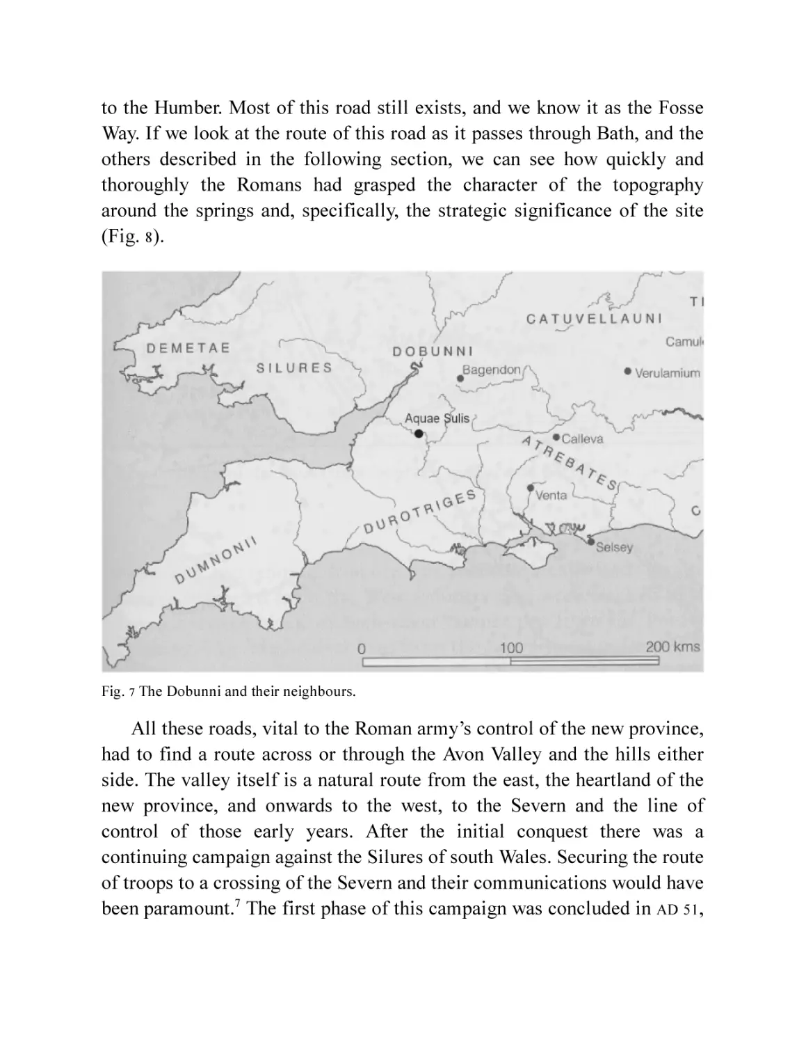
The springs fell into the territory of the Dobunni, which spread across
modern-day Gloucestershire and Worcestershire, parts of Oxfordshire and
down into north Somerset (Fig. 7). It is thought that they saw the invaders
as a useful ally against the tribes east and south. The latter fought hard
against the Roman army; there is no evidence that the Dobunni did.
Indeed, we hear that the Dobunni were among tribes who hastened to make
peace with the Romans before their neighbours had been defeated.5
By AD 48 the Romans had set up a province with its de facto western
and northern boundaries along the rivers Severn and Trent.6 Inside this
border a limes, that is, a military road, was laid out, linking the south coast
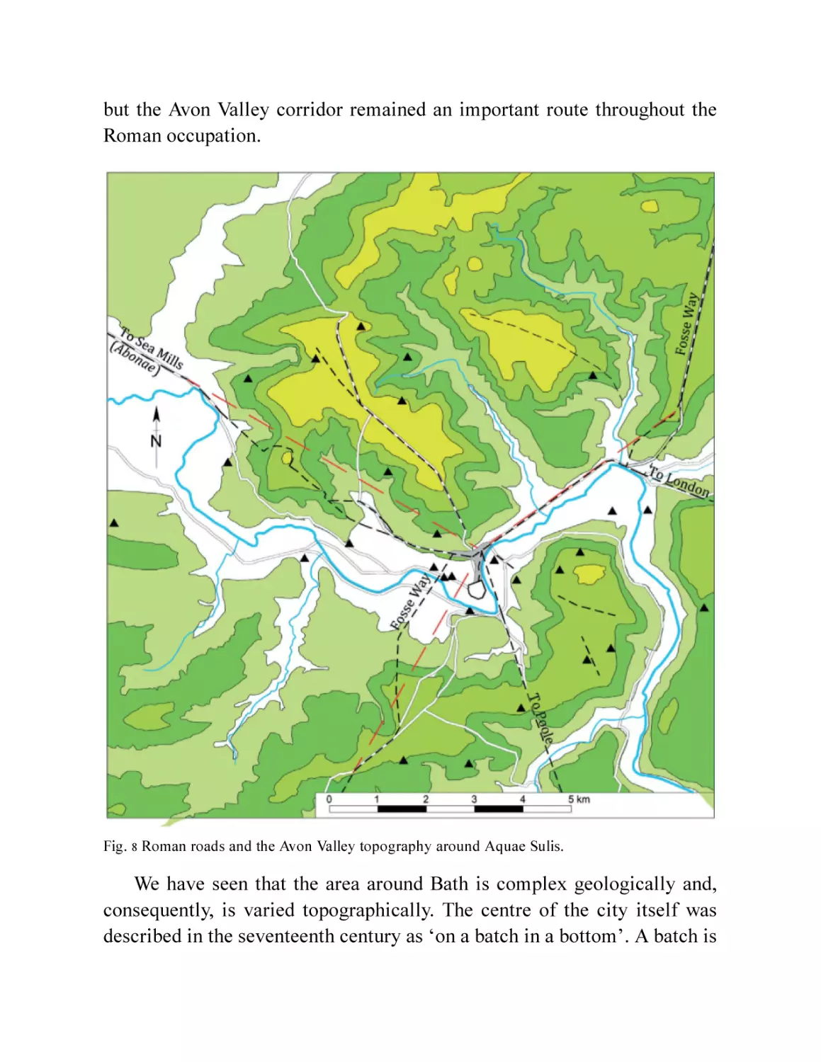
to the Humber. Most of this road still exists, and we know it as the Fosse
Way. If we look at the route of this road as it passes through Bath, and the
others described in the following section, we can see how quickly and
thoroughly the Romans had grasped the character of the topography
around the springs and, specifically, the strategic significance of the site
(Fig. 8).
Fig. 7 The Dobunni and their neighbours.
All these roads, vital to the Roman army’s control of the new province,
had to find a route across or through the Avon Valley and the hills either
side. The valley itself is a natural route from the east, the heartland of the
new province, and onwards to the west, to the Severn and the line of
control of those early years. After the initial conquest there was a
continuing campaign against the Silures of south Wales. Securing the route
of troops to a crossing of the Severn and their communications would have
been paramount.7 The first phase of this campaign was concluded in AD 51,
but the Avon Valley corridor remained an important route throughout the
Roman occupation.
Fig. 8 Roman roads and the Avon Valley topography around Aquae Sulis.
We have seen that the area around Bath is complex geologically and,
consequently, is varied topographically. The centre of the city itself was
described in the seventeenth century as ‘on a batch in a bottom’. A batch is
a local term for a ridge or raised area, in this case a gravel and clay patch
somewhat above the flood plain of the Avon. This is where the hot springs
rise and is in part created by them. The ‘bottom’ is the valley floor. This is
at c. 17m OD (c. 76ft). The valley sides rise steeply to 229m (751ft) on the
north and 200m (656ft) on the south, so that the valley is very constricted
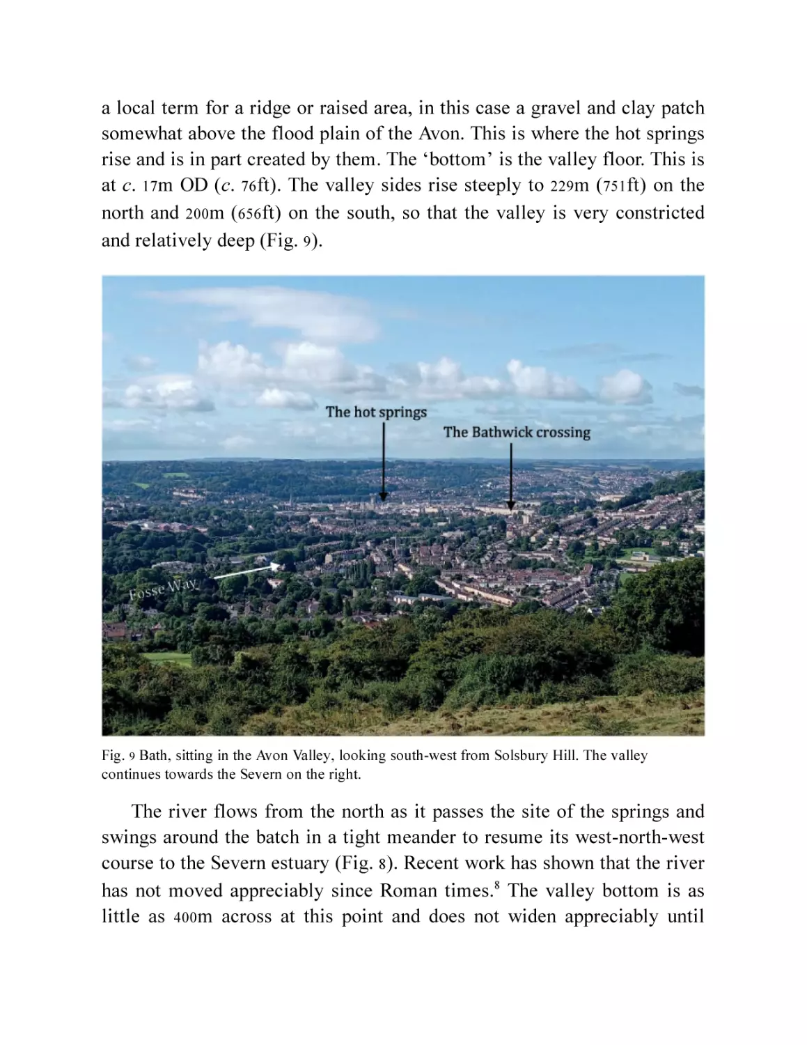
and relatively deep (Fig. 9).
Fig. 9 Bath, sitting in the Avon Valley, looking south-west from Solsbury Hill. The valley
continues towards the Severn on the right.
The river flows from the north as it passes the site of the springs and
swings around the batch in a tight meander to resume its west-north-west
course to the Severn estuary (Fig. 8). Recent work has shown that the river
has not moved appreciably since Roman times.8 The valley bottom is as
little as 400m across at this point and does not widen appreciably until
some 4.1 miles (6.5km) downstream. At that point the hills to the south are
noticeably lower but the topography is very dissected. On the north side
the valley opens out as the western flank of Lansdown runs north-west to
form the southern end of the Cotswold scarp, the eastern edge of the broad
Severn Valley or Berkeley Vale.
In the other direction, 2½ miles (4km) upstream from the springs (Fig.
9 ), the valley, still quite narrow, turns sharply southwards along the eastern
side of Bathampton and Claverton Downs and stretches south for some
miles before swinging back towards the east and north and its source. On
its eastern flank is the high but relatively level plateau of the southern
Cotswolds, merging into the Wiltshire and Berkshire downs.
The Roman road from London (Londinium) and Silchester (Calleva
Atrebatum), both early sites of some importance to the Romans,
approached Bath across this plateau. Its straight course can still be traced
from Silbury Hill, near Marlborough (some 25 miles or 40km away), where
it leaves the modern A4 trunk road, aiming straight for the site of Aquae
Sulis. As it approached the steep sides of the Avon Valley it swung off
course, still on a straight line, to make the steep but negotiable route down
to the valley floor along the side of the tributary Bybrook Valley, through
the site of the later village of Bathford (Fig. 8). The road then crossed the
Bybrook, a small stream, presumably by the ford that gave the village its
name, and by very clever planning, continued on the same straight line
along the north-east side of the Avon as it began to turn south-west. Just
before crossing another small stream it was joined by the Fosse Way. Like
the Silchester road, the Fosse Way diverted from its straight line across the
top of Bannerdown to find a reasonable but still fairly direct route down a
col to the London Road and the valley floor, or more accurately, just above
it.9 Sharing the route and one small stream crossing, both roads then
turned around the head of the river bend and continued in a straight line to
Aquae Sulis without having to cross the Avon (Fig. 8).
Another road approaching from the Gloucester direction ran across the
top of Lansdown, again changing course in straight sections to negotiate
the shape of the hill top and the best way down.
All these roads were aligned on a point just north-west of where the
present Cleveland Bridge crosses the river, linking modern Walcot to
Bathwick. We’ll call it the Bathwick crossing.
A length of the Roman London Road/Fosse Way was noted here in the
1870 s and again a little further south-west in excavations in the 1990 s (Figs
10 and 52 ). Had the road from the east continued on this alignment it would
have missed the springs by two-thirds of a mile (roughly a kilometre), but
would have arrived at the point where it actually does cross the river after
a diversion, west of the springs. As it happens, the road changed its
alignment, not south towards the springs, but westwards even further away
from them, along the lower slopes of the valley side. This alignment was
that of the road to the port of Abonae (modern-day Sea Mills) on the Avon
estuary, from where the crossing of the Severn could be organised. A few
hundred metres along this stretch of road (now called Julian Road in a fit
of nineteenth century antiquarian enthusiasm) the Fosse Way branched off
from the road to Abonae and turned south-west to cross the river exactly at
the point indicated by its earlier alignment, and continued its route to the
south-west (Fig. 8).
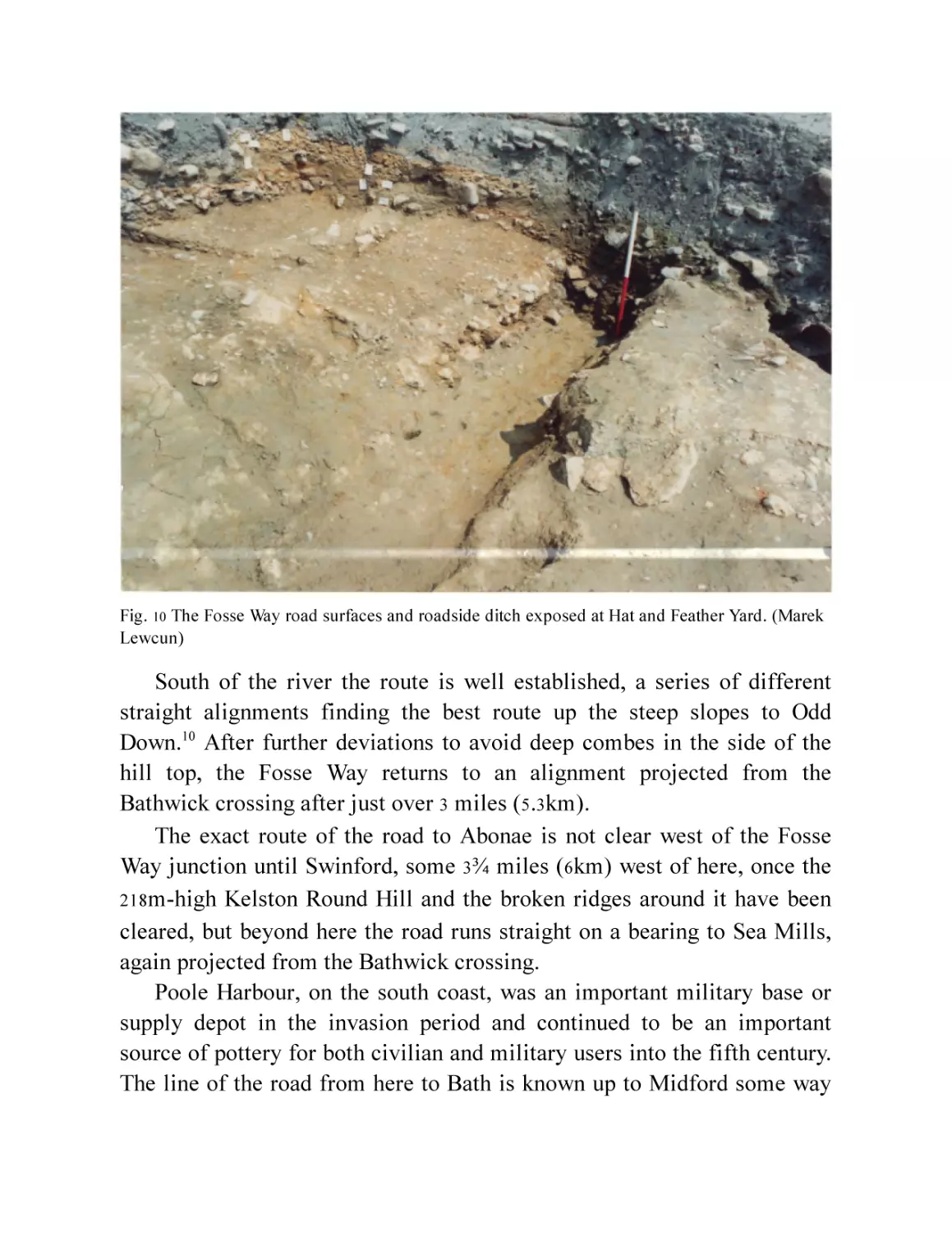
Fig. 10 The Fosse Way road surfaces and roadside ditch exposed at Hat and Feather Yard. (Marek
Lewcun)
South of the river the route is well established, a series of different
straight alignments finding the best route up the steep slopes to Odd
Down.10 After further deviations to avoid deep combes in the side of the
hill top, the Fosse Way returns to an alignment projected from the
Bathwick crossing after just over 3 miles (5.3km).
The exact route of the road to Abonae is not clear west of the Fosse
Way junction until Swinford, some 3¾ miles (6km) west of here, once the
218 m-high Kelston Round Hill and the broken ridges around it have been
cleared, but beyond here the road runs straight on a bearing to Sea Mills,
again projected from the Bathwick crossing.
Poole Harbour, on the south coast, was an important military base or
supply depot in the invasion period and continued to be an important
source of pottery for both civilian and military users into the fifth century.
The line of the road from here to Bath is known up to Midford some way
south of the modern city, but again, is lost nearer the town as sensible
routes across the difficult topography are hard to predict and the road has
never been seen archaeologically this close in. Nevertheless, the
alignment, as far as we know it, is once again headed directly for the
Cleveland Bridge area.
The Bathwick crossing seems, then, to have been a focal point for the
Roman road surveyors. They evidently had a clear grasp of both the local
and the regional topography. It is also apparent that the engineers of these
first roads were not particularly concerned with the hot springs; these were
strategic routes designed to link the garrisons controlling the new province
and speed and ensure the communications so essential to that control. The
boggy valley bottom and the hot springs were almost entirely avoided. The
Bathwick river crossing was chosen because there was no muddy
floodplain on the west and, on the east, the existence of a hard ridge of
gravel formed a natural causeway across the flood plain there: a ready
foundation for the road south. A wooden bridge must have early on
provided dry passage.
The large- and small-scale understanding of the topography of the
area, as well as the technical surveying skills that were necessary to plan
and survey these roads, were obviously of a high order. They would also be
extremely useful when attention did turn to the springs themselves.
However, we will see in the next chapter that that did not occur
immediately.
2
THE ARMY AT WALCOT
The Bathwick crossing was not a lonely crossroads. Finds and
observations over the last 200 years and especially in the last thirty, have
suggested an early military presence of some substance around the river
crossing.11 We saw in the last chapter how nodal this point was. As long
ago as the 1820s John Skinner, the antiquarian Vicar of Camerton, south of
Bath, suggested that there was a fort at Bathwick:12 the gravel peninsula on
the Bathwick side would be the perfect place for it.
In the immediate aftermath of the conquest, it would be normal to
guard the occupier’s communications, even if the natives were friendly. A
small detachment of soldiers at the crossing would be a minimum. Events
in the late 40s, however, meant there may have been more serious work to
do. Soon after the arrival in AD 48 of the second governor of the new
province, Ostorius Scapula, the tribes from across the Severn, roused up
by the British prince Caratacus, were raiding across the new frontier.
Details are sparse, but disruption was significant and led to a major
campaign by the new legate against the Silures and Ordovices of what is
now southern and central Wales (Fig. 7). Caratacus was captured and order
restored east of the frontier by AD 51. Nevertheless, further uncertainty to
the west and major campaigns continued through the 50s. In this
atmosphere, guarding the river crossing and route junction had become a
real job, not a rest and recreation posting, and the numbers would have had
to have been more than just a token presence. We can only guess at the
actual size of the garrison. An ala or troop of cavalry was about 400 men
and a detachment or vexillatio of legionaries could have been up to a
thousand. The numbers likely varied as the tension eased and heightened.
The main centres of Roman military control in the west after AD 51
were Usk, in south Wales, home to Legio XX, and Exeter, in Devon, the
base of Legio II Augusta. There is evidence for the presence of auxiliaries
at Usk and they would be expected at Exeter. These are the likely sources
for the early garrison at what was to become Aquae Sulis. We know that
both legionaries and auxiliary cavalrymen on active service were buried
here.13
In this early period the only ‘Romans’ in the area would have been the
army (and some camp followers and traders). But these were not Romans
from Rome or Latium. The legionaries that we know of, all Roman
citizens by definition, came from Forum Julii (Frèjus in Provence),
Equestris (Nyon in Switzerland) and Nicopolis14 and one may just have
been a local recruit. The auxiliaries were Spanish, Gaulish (from modern
day France) and of no known origin. Auxiliaries gained their citizenship
after completing 20 years (more or less) but some distinguished regiments
conferred citizenship on joining. One of these was the Ala Vettonum.
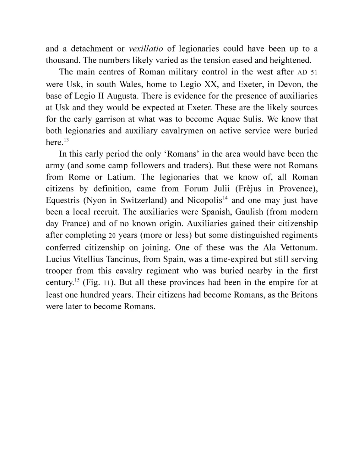
Lucius Vitellius Tancinus, from Spain, was a time-expired but still serving
trooper from this cavalry regiment who was buried nearby in the first
century.15 (Fig. 11). But all these provinces had been in the empire for at
least one hundred years. Their citizens had become Romans, as the Britons
were later to become Romans.
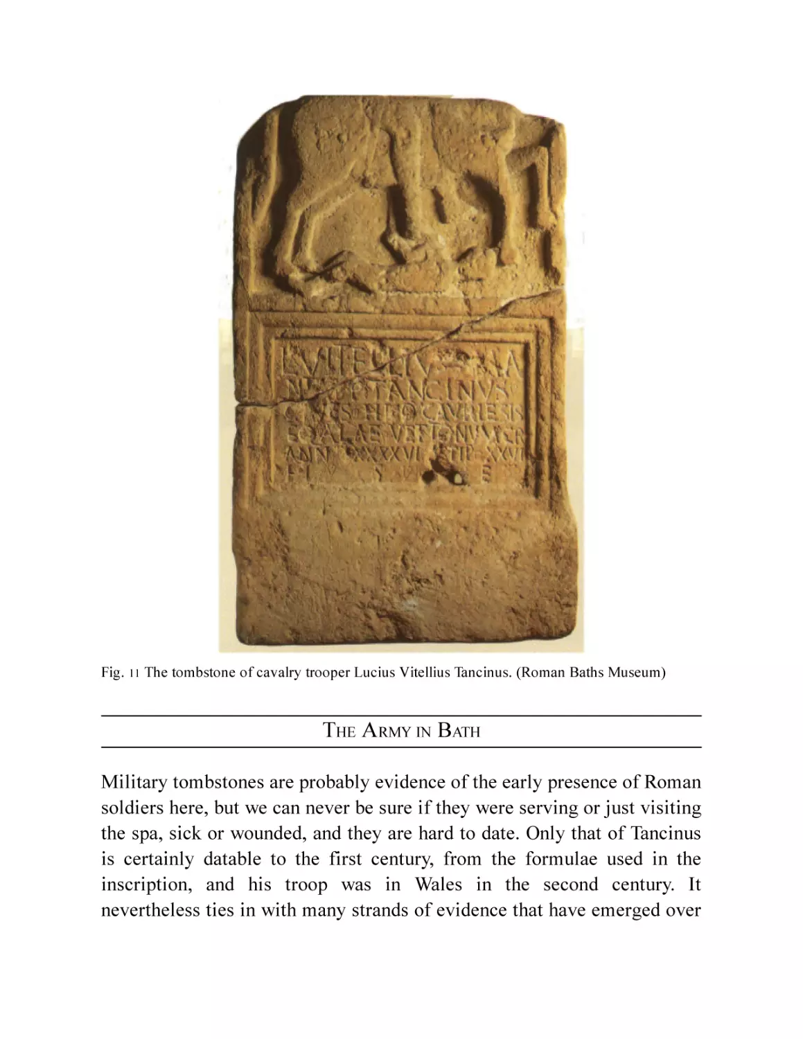
Fig. 11 The tombstone of cavalry trooper Lucius Vitellius Tancinus. (Roman Baths Museum)
THE A RMY IN BATH
Military tombstones are probably evidence of the early presence of Roman
soldiers here, but we can never be sure if they were serving or just visiting
the spa, sick or wounded, and they are hard to date. Only that of Tancinus
is certainly datable to the first century, from the formulae used in the
inscription, and his troop was in Wales in the second century. It
nevertheless ties in with many strands of evidence that have emerged over
the past few decades that point ever more firmly to a military presence
around the crossing in the third quarter of the first century and beyond.
Despite Skinner’s prescience, the fort still eludes us, but the evidence from
recent observations has suggested he was on the right track.
A small amount of pottery from the conquest period has long been
known from rare chance finds from the Walcot/Bathwick area.16
Excavations in the 1990s and more recently have revealed much more. On
the Walcot side the digging of terraces to provide level platforms in the
steep slope towards the river, downslope of the London Road, was dated to
the 50s or possibly even the 40s AD. On one, at Nelson Place, a pit was dug,
filled in and the area around it trampled before AD 69. Gullies were dug,
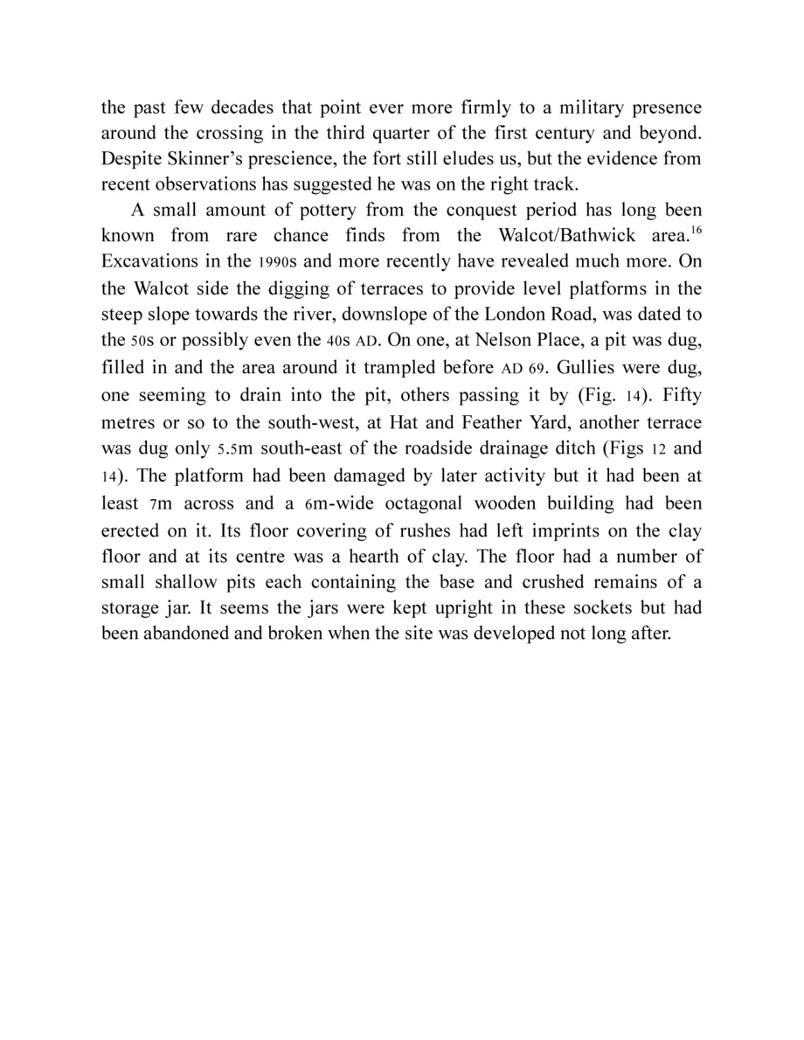
one seeming to drain into the pit, others passing it by (Fig. 14). Fifty
metres or so to the south-west, at Hat and Feather Yard, another terrace
was dug only 5.5m south-east of the roadside drainage ditch (Figs 12 and
14 ). The platform had been damaged by later activity but it had been at
least 7m across and a 6m-wide octagonal wooden building had been
erected on it. Its floor covering of rushes had left imprints on the clay
floor and at its centre was a hearth of clay. The floor had a number of
small shallow pits each containing the base and crushed remains of a
storage jar. It seems the jars were kept upright in these sockets but had
been abandoned and broken when the site was developed not long after.
Fig. 12 The octagonal building at Hat & Feather Yard. It has been cut into the hillside and then cut
away itself on the left by a later building. (Marek Lewcun)
This was indeed a short-lived building and it went out of use before
construction of the earliest proper road surfaces of the London and Poole
roads. It looks rather like a native roundhouse, though few of those are
true octagons. In any case it is very unmilitary. It was fairly well built,
however. It appears to have been constructed on wooden beams about 5–6in
square (12–150mm) laid in the deep foundation trench, although only their
impressions in the ground were left. The Roman storage jars set in the
floor perhaps hint that this was a storeroom rather than a house, although
the central hearth does not support this idea. Perhaps it belonged to a
trader taking advantage of the presence of the Roman soldiery.
Their presence is indicated because the pottery found in these early
layers and the pit was of a type predominantly associated with the Roman
army, pottery that is also found at forts and fortresses in Cirencester,
Gloucester and Exeter and in forts of the conquest period across the
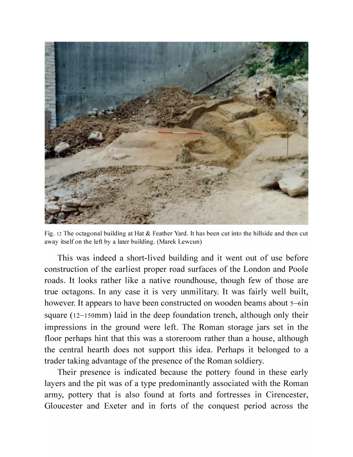
Channel. The types included drinking beakers, honey pots, storage and
cooking jars, bowls and platters and particularly, flagons, a characteristic
military vessel type (Fig. 13).17 A number of these flagons were being
made very locally, as kiln wasters were among the debris. The honey pots
were from the same kiln. The army were evidently established here long
enough to set up or sponsor a workshop to supply what they couldn’t get
from elsewhere.
What they were getting from elsewhere included Samian and other fine
tableware from Gaul, mortaria from Gaul (for preparing vegetables in the
Roman way) and amphorae from the Rhône Valley (Peacock and Williams
Type 59) which had contained olives or olive oil (Fig. 13). At this early date
only the army was using this stuff in any quantity.
The analysis of the coins from these early layers has shown that the
composition of the collection is also typical of the pattern of coin types
from known military sites of the period.18 The cash element of a
legionary’s or auxiliary’s pay had to be in coin, and it was brought here
from the continent essentially to pay the army. It must have come over in
chests on regular supply ships, and these will also have brought the goods
that the army needed and desired.
Supplying these wants would have been a mammoth task, as the
invasion and occupation army would have amounted to over 20,000
legionaries, and to these were added the auxiliaries, which may have
doubled the number. It would clearly be impossible to supply the
occupying forces entirely from outside. As soon as it became possible,
local supplies and services would be called on. This could be by trade or
by requisition. As the area around Bath was probably considered friendly,
the opportunities for commerce were likely soon taken up. The army
would be signing contracts with anyone who could provide their wants. At
first these are likely to have been the usual traders from the empire who
followed campaigning armies. These might have acted as middlemen with
the farmers and producers around Bath, or provided the sorts of products
the locals could not, such as the pottery.
Fig. 13 Early, probably pre-AD 69, pottery from Nelson Place and Hat and Feather Yard. Locally
made, military-type flagons and a honey pot and a complete example of one of the imported
amphora types found at Walcot (here from Verulamium, © Verulamium Museum), common on
military sites, usually containing olives or olive pressings.
Following the destruction of the octagonal building, the first proper
road surfaces had been put down. The routes of the military roads were
normally set out and used before any special surfacing was in place. The
precise local alignment and the surfacing were then engineered by the
army, perhaps with local impressed or paid labour, as soon as convenient,
but not necessarily immediately. In any case, the terrace was partly buried
and the road metalling laid.
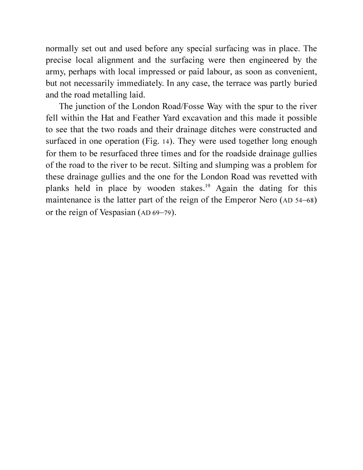
The junction of the London Road/Fosse Way with the spur to the river
fell within the Hat and Feather Yard excavation and this made it possible
to see that the two roads and their drainage ditches were constructed and
surfaced in one operation (Fig. 14). They were used together long enough
for them to be resurfaced three times and for the roadside drainage gullies
of the road to the river to be recut. Silting and slumping was a problem for
these drainage gullies and the one for the London Road was revetted with
planks held in place by wooden stakes.19 Again the dating for this
maintenance is the latter part of the reign of the Emperor Nero (AD 54–68)
or the reign of Vespasian (AD 69–79).
Fig. 14 The early road junction at Walcot and the octagonal building.
The road to the river must have led to a crossing, but changes in the
river regime since Roman times, including flood prevention schemes in
the twentieth century, will have removed all evidence for it. However,
there is now evidence for early activity across the river, in Bathwick, not
just burials, where, as we have seen, a fort has been suspected for a long
time.
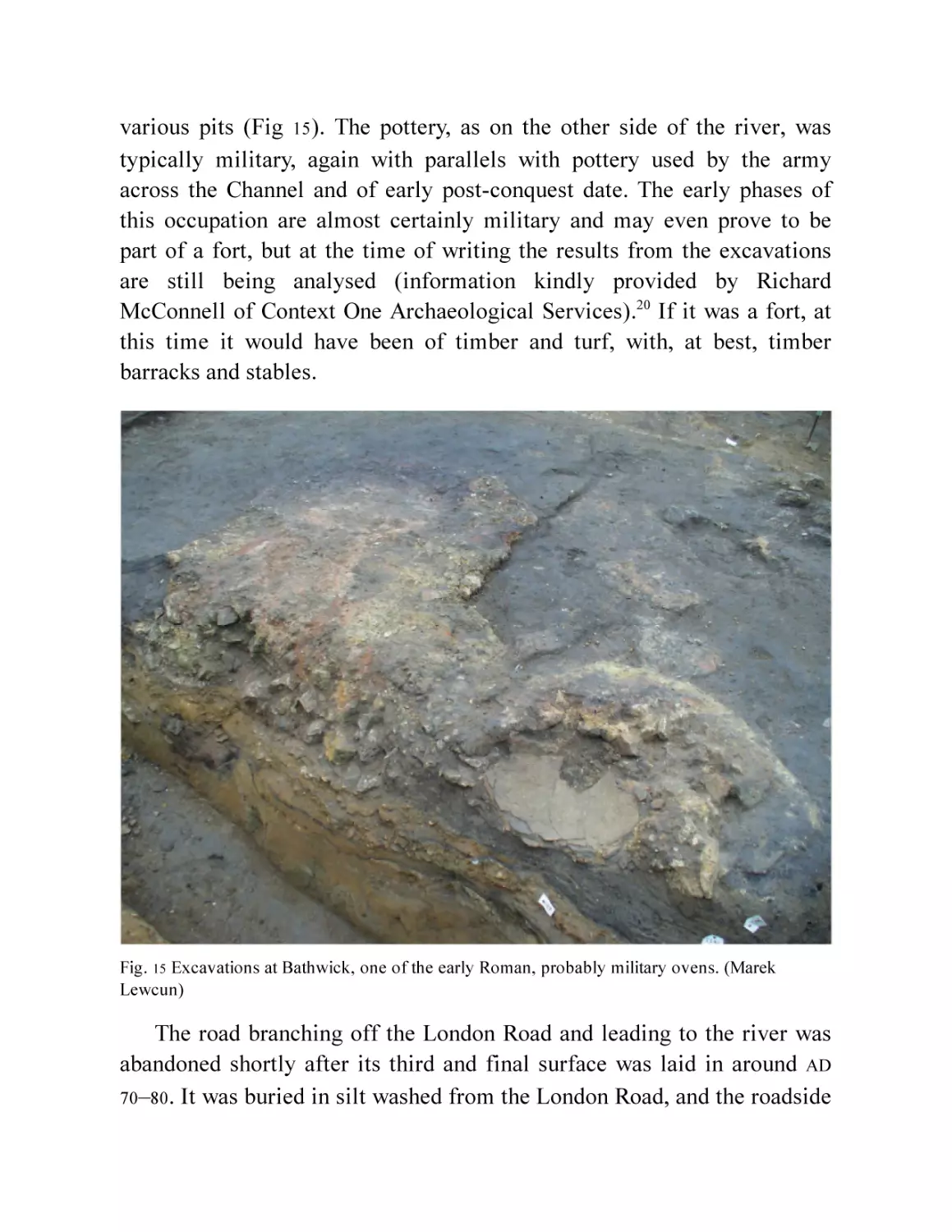
Quite large-scale excavations in 2012 200m east of the river showed
very substantial occupation starting early in the Roman period. This took
the form of spreads of dark occupation material, hearths or ovens and
various pits (Fig 15). The pottery, as on the other side of the river, was
typically military, again with parallels with pottery used by the army
across the Channel and of early post-conquest date. The early phases of
this occupation are almost certainly military and may even prove to be
part of a fort, but at the time of writing the results from the excavations
are still being analysed (information kindly provided by Richard
McConnell of Context One Archaeological Services).20 If it was a fort, at
this time it would have been of timber and turf, with, at best, timber
barracks and stables.
Fig. 15 Excavations at Bathwick, one of the early Roman, probably military ovens. (Marek
Lewcun)
The road branching off the London Road and leading to the river was
abandoned shortly after its third and final surface was laid in around AD
70 –80 . It was buried in silt washed from the London Road, and the roadside
ditch of that road, which remained in use, was re-cut across it. Timber
settings in the ditch seem to indicate a footbridge across the new ditch
(only c. 1.5m across, Fig. 52). This was presumably to reach a property
being set up south of the road. A dump of soil and clay indeed levelled up
this area, marking the first stage in setting out buildings alongside the
London Road and probably the end or decline of the military occupation of
the area. These buried the earlier octagonal building.
The river crossing must have remained in use, as another road was
constructed to replace the early one, laid out a little to the south-west,
passing alongside the first house that had been built here (see Chapter 6).
The construction layers of this building were relatively sparsely dated but
a date in the last quarter of the first century is confirmed by pottery from
the new road’s lowest layers.
The unrest in Wales was under control by the late 50s and the province
may have appeared to be settling down. Then came the rebellion of the
Iceni under Boudica in AD 60 or 61. There was probably no direct impact in
the south-west, the rampage and battles taking place in the east and the
midlands, but any troops in the area would surely have been gathered
together to make up the ad hoc force created by the Governor Suetonius
Paulinus after the early defeats of part of the army and the failure of the
commander of the Exeter garrison to react. After Paulinus had put down
the rebellion, there would be every reason to re-establish and perhaps
redesign the network of military control. The near loss of the new province
must have concentrated minds considerably. Changes included the
movement of the Usk garrison to a new fortress at Wroxeter in the mid-60s
AD, the closure of the Exeter fortress and the movement of its garrison to
Caerleon in the next decade, and may have involved further changes or
reductions in the presence at Bath and other subsidiary forts.
It was at this time, or a little later, that the terrace at Nelson Place was
being deliberately filled in and, as at Hat and Feather, timber buildings
erected over it. Pottery of the early period (especially Terra Nigra and
Barbotine ware, used by the army in the Claudian and Neronian years) was
found mixed up with slightly later pottery in this backfill. That the
majority of the material was Flavian (AD 69–96) with just a small
admixture of later material in the upper layers of dump suggests that this
also happened around about AD 70–100.
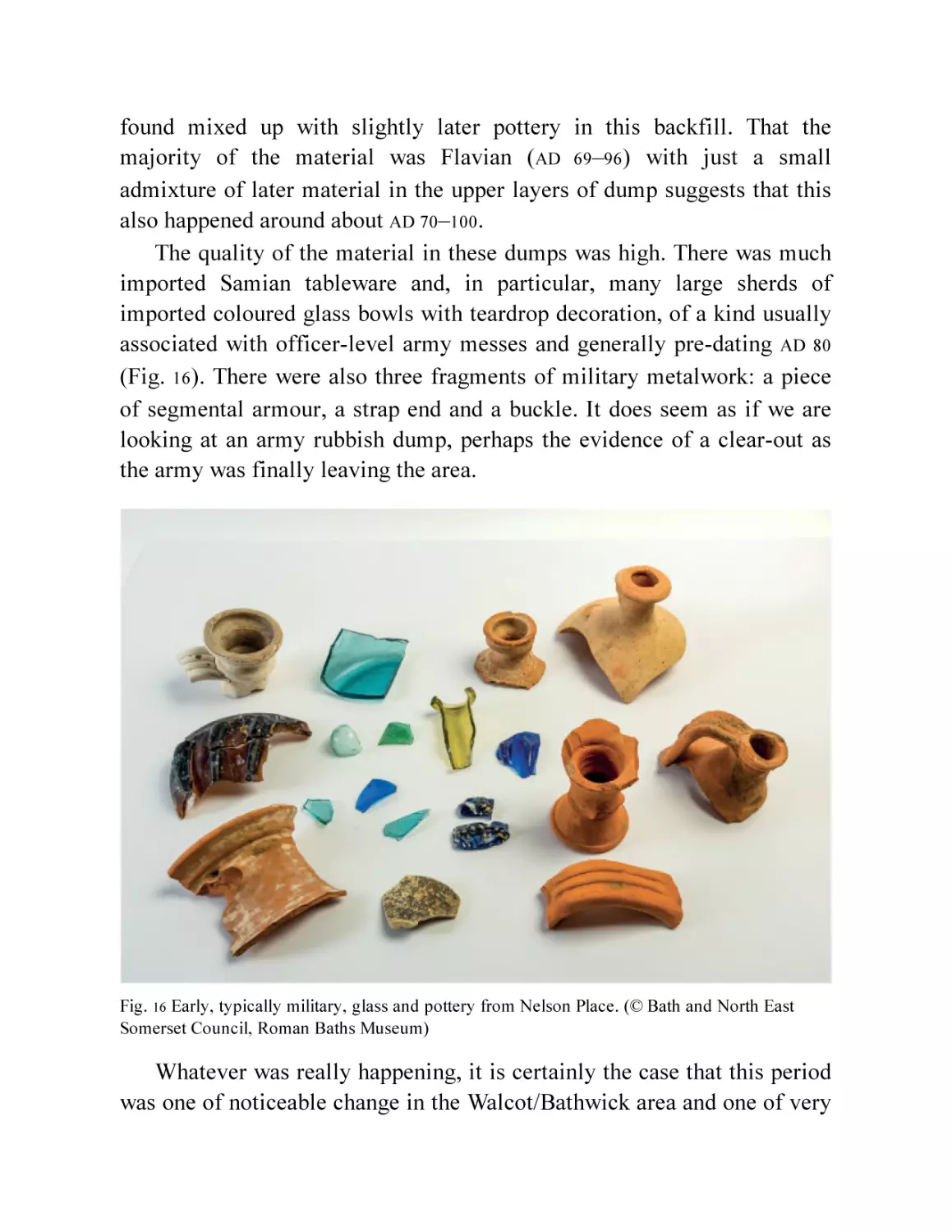
The quality of the material in these dumps was high. There was much
imported Samian tableware and, in particular, many large sherds of
imported coloured glass bowls with teardrop decoration, of a kind usually
associated with officer-level army messes and generally pre-dating AD 80
(Fig. 16). There were also three fragments of military metalwork: a piece
of segmental armour, a strap end and a buckle. It does seem as if we are
looking at an army rubbish dump, perhaps the evidence of a clear-out as
the army was finally leaving the area.
Fig. 16 Early, typically military, glass and pottery from Nelson Place. (© Bath and North East
Somerset Council, Roman Baths Museum)
Whatever was really happening, it is certainly the case that this period
was one of noticeable change in the Walcot/Bathwick area and one of very
considerable upheaval in the area around the springs. It was also in the late
60 s or early 70 s AD that a beginning was made on a Roman-style baths and
temple there.
3
TAMING THE WATERS
How the Romans, or indeed the locals, referred to the area in the early
days of settlement and control is unknown. The name Aquae Sulis does not
appear until the Antonine Itinerary,21 probably compiled in the early third
century. Ptolemy, writing in the second,22 simply calls it Aquae Calidae
(Hot Waters). The site was probably never actually formally named, not
least because the administrative status of the settlement was quite low: as
far as we know, it was never more than a small town, despite its hot
springs. However, the sanctuary that developed around the hot springs
would have been the templum or fanum deae suli minervae23 and the waters
were certainly hers. For Latin speakers, Aquae Sulis would arise naturally,
either because Sulis was the more important in local people’s minds, or
more probably, Aquae Deae Suli Minervae was too much of a mouthful.24
It is interesting that the grammatically correct form seems to be Suli not
Sulis, conceivably not a point of great importance in most people’s minds.
Despite the activity around the river crossing, there is no evidence of
any Roman presence or intervention in the area immediately around the
hot springs until the 60s AD. It is impossible to imagine that the soldiers
and their civilian camp followers ignored the hot springs just a kilometre
down the valley, but there is no sign of anything more than casual visits
being made in those first decades. The pre-conquest wattle-revetted rubble
and gravel platform that was built out into the spring pool must have
allowed whatever rituals were normal before the Romans came to be
performed (Fig. 3), but nothing else was found to certainly suggest nonnative activity in this period when the spring was excavated in 1979 and
1980 .
The area was perhaps not so different from the pool first stumbled
upon thousands of years before.
However, in the last years of Nero’s reign or perhaps the very first
years of Vespasian’s, a major campaign to transform the steaming swamp
into the most Roman monument in the province was instigated. How was
this done, when and why?
When, is reasonably clear. Given the upheavals of the rebellion and its
aftermath, a date earlier than the later 60s seems unlikely. The new broom
represented by Vespasian (AD 69–79), and the swift conclusion of the wars
of succession that followed Nero’s death in AD 68, perhaps makes a date
after AD 70 seem most probable. That the project began no later than very
soon after that date is indicated from two sources. The temple itself was in
a style so closely related to buildings of this period in Roman Gaul that it
is generally accepted that masons from northern France were brought over
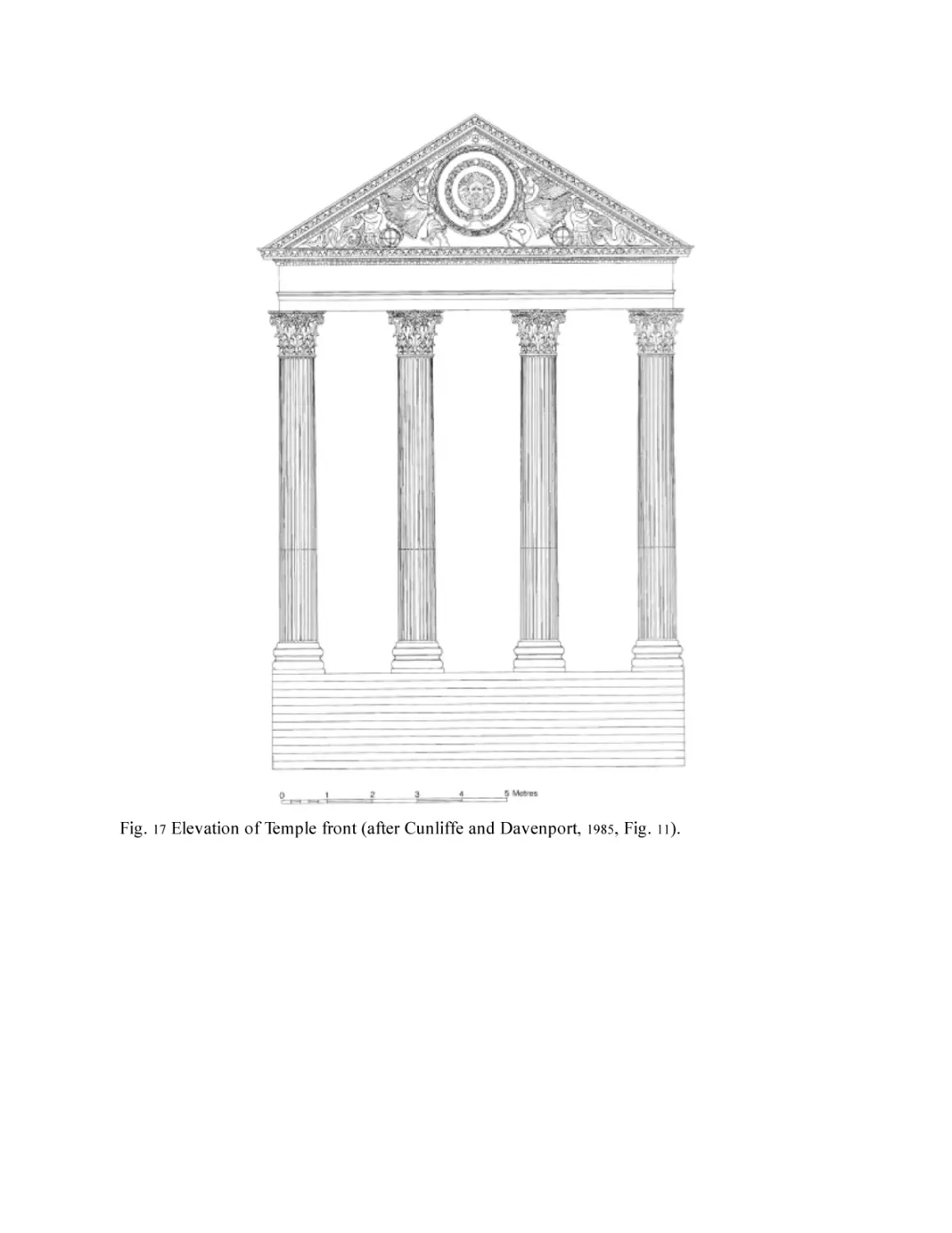
to carry out the work, and most probably in the years around 60–70 (Fig.
25
17 ). There was, after all, no tradition of masonry building in Britain at
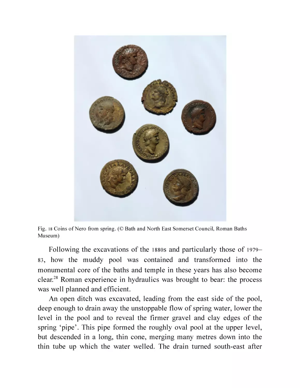
this time. The earliest Roman coins in any number, of the many recovered
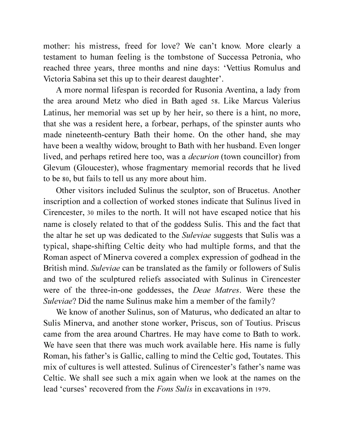
from the spring, are of the later years of Nero, and from their condition,
none had been long in circulation (Fig. 18).26 These coins were thrown in
after the spring had been enclosed with the stone wall described below, and
give a date range for the building programme around the springs.
Confirmation of these inferences is provided by the discovery of a
fragmentary inscription that refers to the seventh consulship of the
Emperor Vespasian, i.e. AD 75.27 This is most probably from a small altar
set up in the temple precinct. Its exact find spot in the complex was not
recorded when it was first published in 1906, but it is evident that the
temple and baths were up and running by that year.
Fig. 17 Elevation of Temple front (after Cunliffe and Davenport, 1985, Fig. 11).
Fig. 18 Coins of Nero from spring. (© Bath and North East Somerset Council, Roman Baths
Museum)
Following the excavations of the 1880s and particularly those of 1979–
83 , how the muddy pool was contained and transformed into the
monumental core of the baths and temple in these years has also become
clear.28 Roman experience in hydraulics was brought to bear: the process
was well planned and efficient.
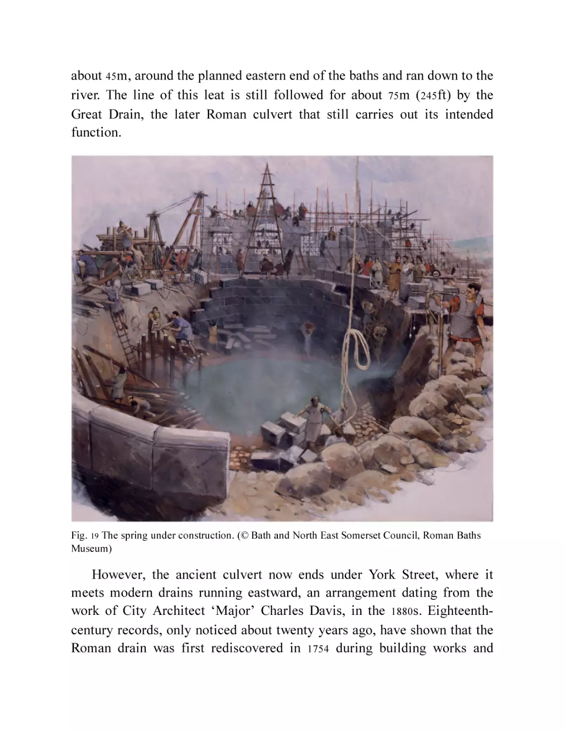
An open ditch was excavated, leading from the east side of the pool,
deep enough to drain away the unstoppable flow of spring water, lower the
level in the pool and to reveal the firmer gravel and clay edges of the
spring ‘pipe’. This pipe formed the roughly oval pool at the upper level,
but descended in a long, thin cone, merging many metres down into the
thin tube up which the water welled. The drain turned south-east after
about 45m, around the planned eastern end of the baths and ran down to the
river. The line of this leat is still followed for about 75m (245ft) by the
Great Drain, the later Roman culvert that still carries out its intended
function.
Fig. 19 The spring under construction. (© Bath and North East Somerset Council, Roman Baths
Museum)
However, the ancient culvert now ends under York Street, where it
meets modern drains running eastward, an arrangement dating from the
work of City Architect ‘Major’ Charles Davis, in the 1880s. Eighteenthcentury records, only noticed about twenty years ago, have shown that the
Roman drain was first rediscovered in 1754 during building works and
traced south-eastwards for another 50 or 60m, presumably heading straight
to the river (it was then forgotten).29 To reach the river in this direction,
the leat must have been around 350m long (1,150ft). It is of interest to note
that the medieval leat, the Bum Ditch, ran along this line south of the
walls.
Fig. 20 Oak piles in the spring and wall during the 1979 dig. (© Barry Cunliffe/Oxford University
School of Archaeology)
The next step was to clear out the mud and sand in the top of the pipe
and put in the foundations of the stone tank that would encircle the top of
the pipe and contain the spring, forming a pool from which the baths could
be fed. These consisted of dozens of oak piles driven into the edge of the
drained pool (Fig. 20). They had two functions: to support the massive
stone blocks of the wall of the tank; and to consolidate the mud in front of
the base of the wall.
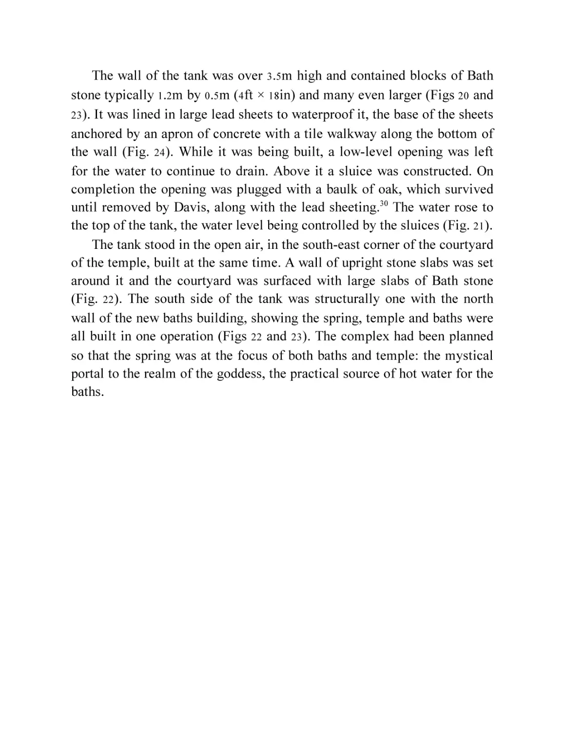
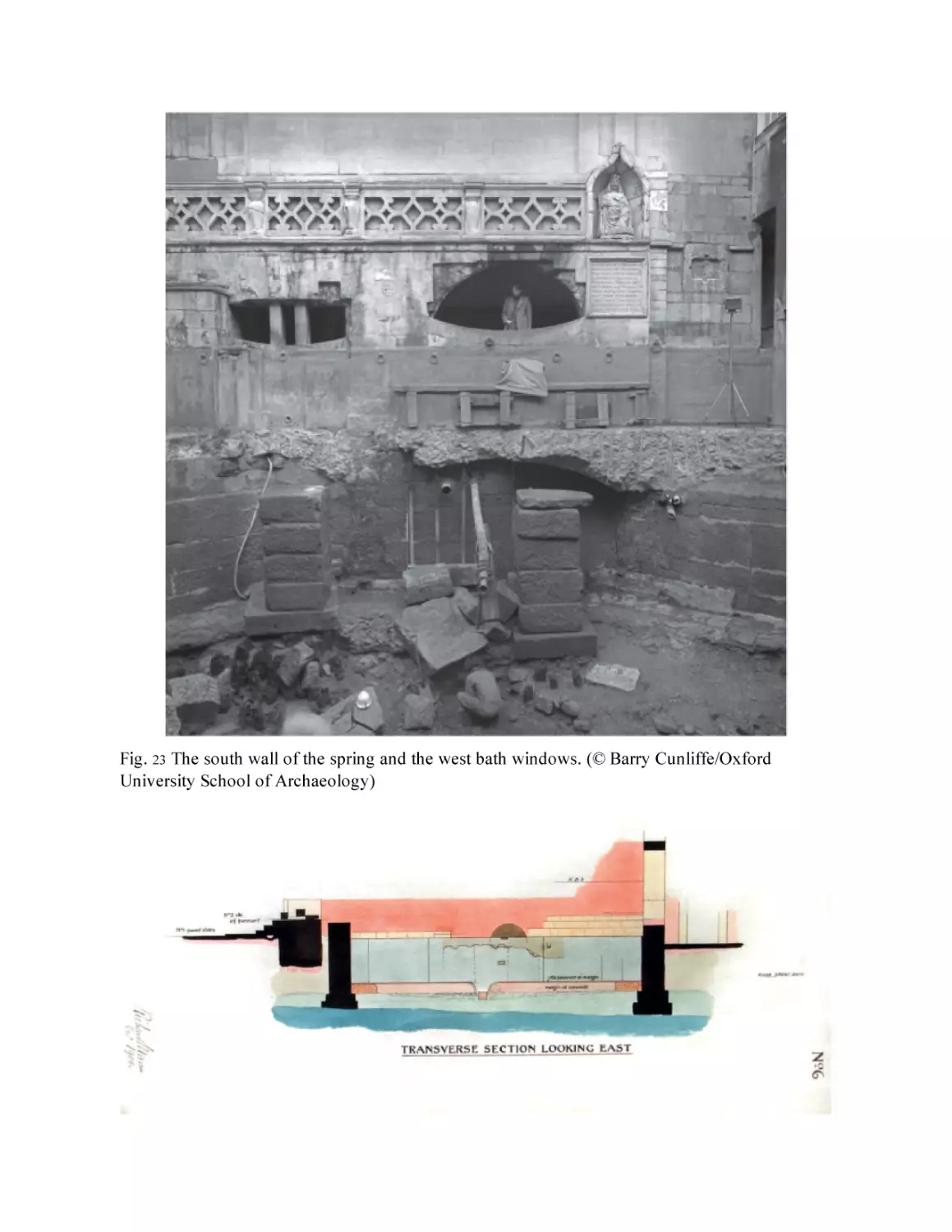
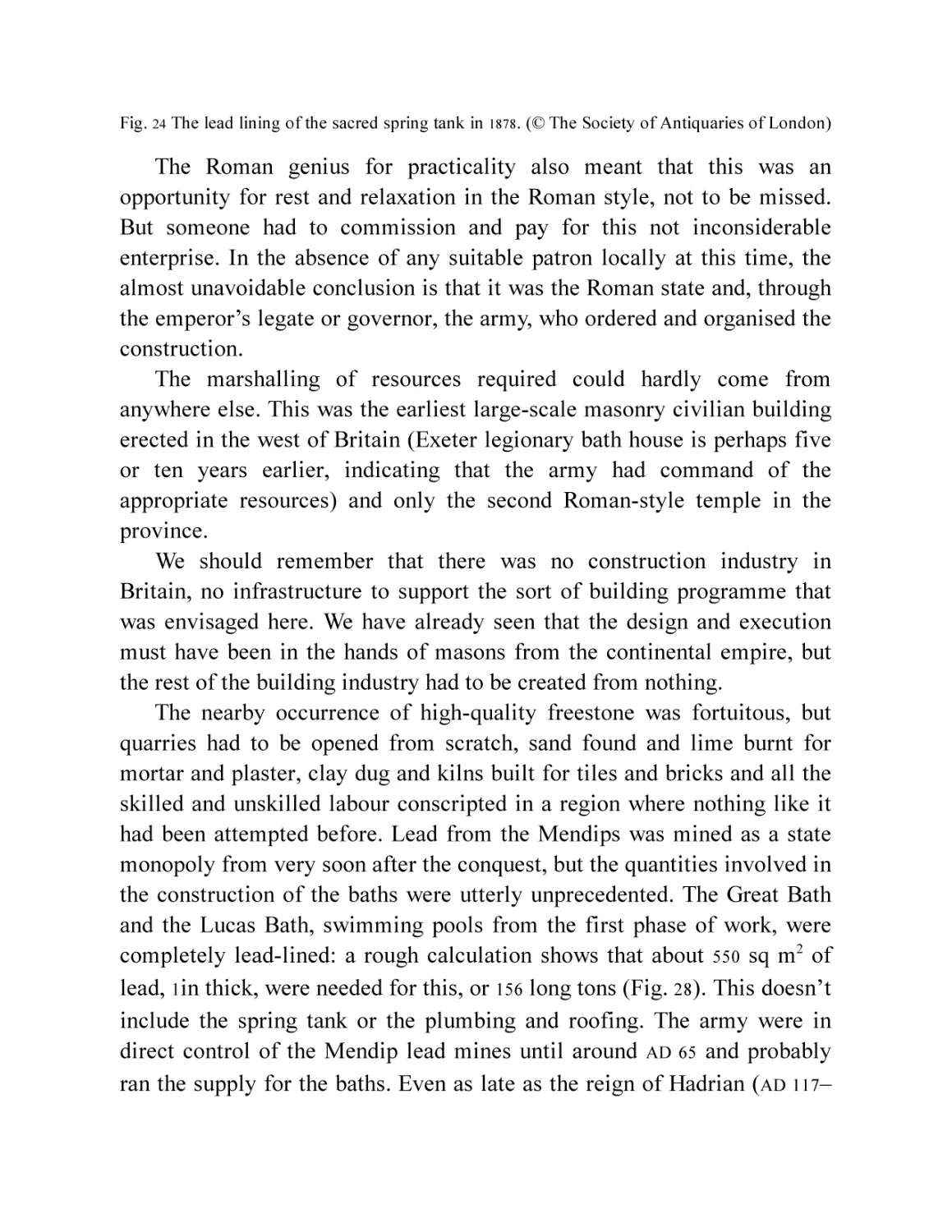
The wall of the tank was over 3.5m high and contained blocks of Bath
stone typically 1.2m by 0.5m (4ft × 18in) and many even larger (Figs 20 and
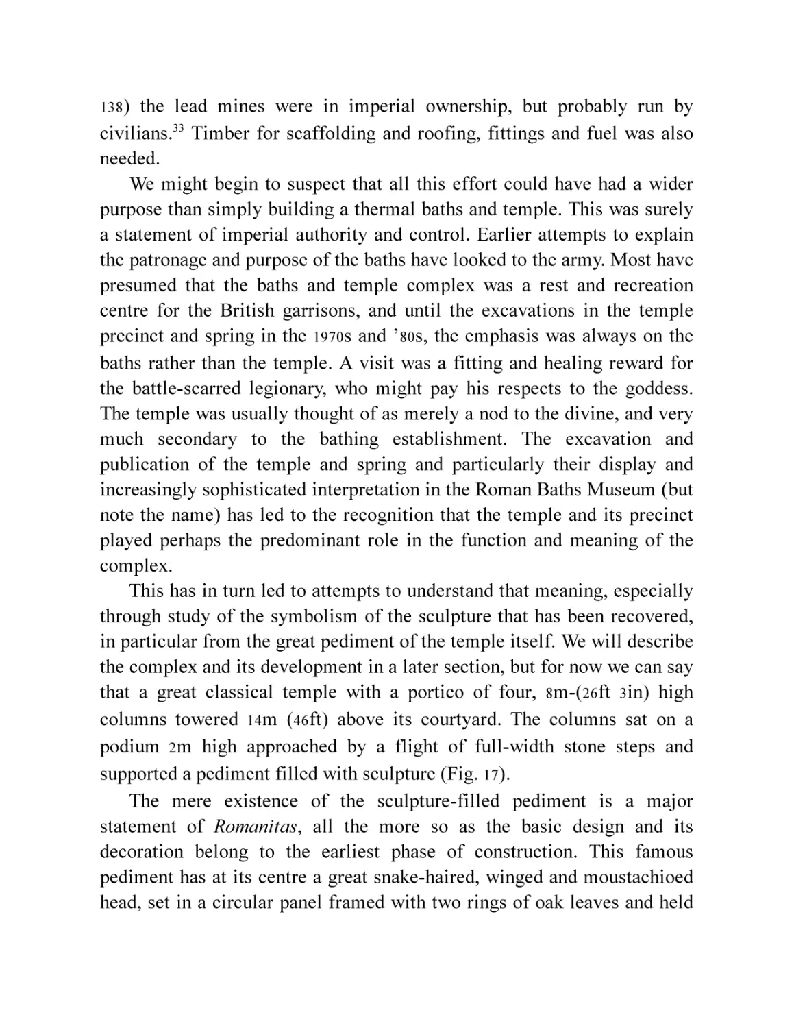
23 ). It was lined in large lead sheets to waterproof it, the base of the sheets
anchored by an apron of concrete with a tile walkway along the bottom of
the wall (Fig. 24). While it was being built, a low-level opening was left
for the water to continue to drain. Above it a sluice was constructed. On
completion the opening was plugged with a baulk of oak, which survived
until removed by Davis, along with the lead sheeting.30 The water rose to
the top of the tank, the water level being controlled by the sluices (Fig. 21).
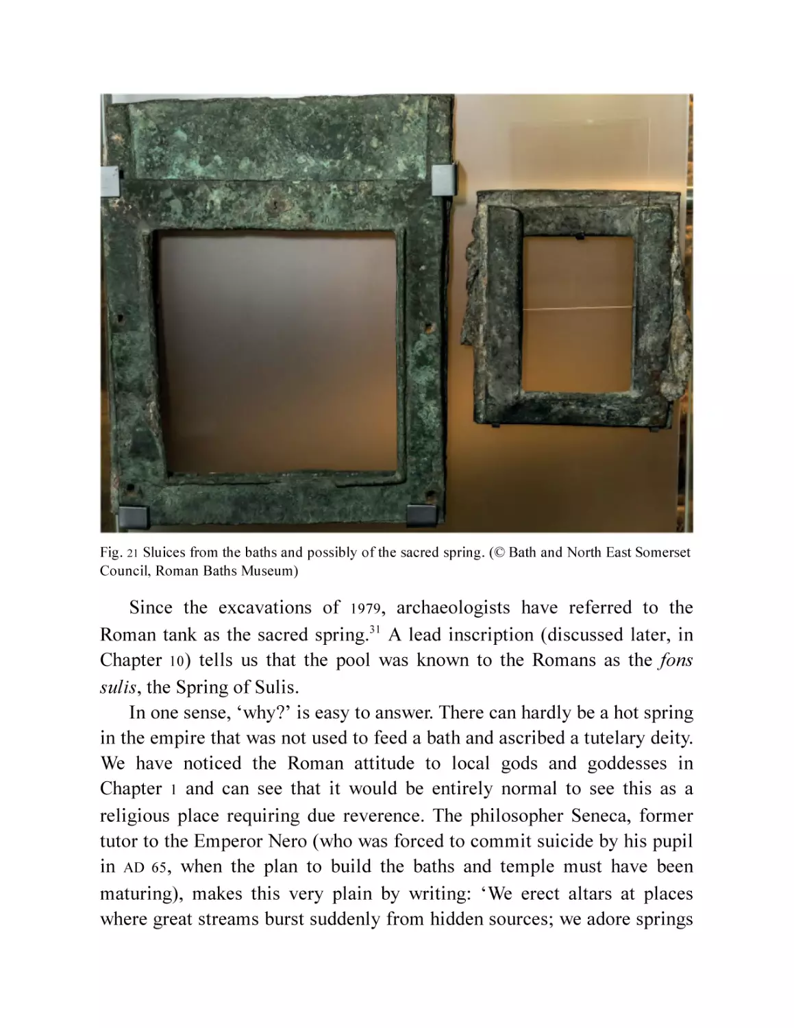
The tank stood in the open air, in the south-east corner of the courtyard
of the temple, built at the same time. A wall of upright stone slabs was set
around it and the courtyard was surfaced with large slabs of Bath stone
(Fig. 22). The south side of the tank was structurally one with the north
wall of the new baths building, showing the spring, temple and baths were
all built in one operation (Figs 22 and 23). The complex had been planned
so that the spring was at the focus of both baths and temple: the mystical
portal to the realm of the goddess, the practical source of hot water for the
baths.
Fig. 21 Sluices from the baths and possibly of the sacred spring. (© Bath and North East Somerset
Council, Roman Baths Museum)
Since the excavations of 1979, archaeologists have referred to the
Roman tank as the sacred spring.31 A lead inscription (discussed later, in
Chapter 10) tells us that the pool was known to the Romans as the fons
sulis, the Spring of Sulis.
In one sense, ‘why?’ is easy to answer. There can hardly be a hot spring
in the empire that was not used to feed a bath and ascribed a tutelary deity.
We have noticed the Roman attitude to local gods and goddesses in
Chapter 1 and can see that it would be entirely normal to see this as a
religious place requiring due reverence. The philosopher Seneca, former
tutor to the Emperor Nero (who was forced to commit suicide by his pupil
in AD 65, when the plan to build the baths and temple must have been
maturing), makes this very plain by writing: ‘We erect altars at places
where great streams burst suddenly from hidden sources; we adore springs
of hot water as divine, and consecrate certain pools because of their dark
waters or their immeasurable depth.’32
Fig. 22 The baths and temple as first built, around
AD 70.
Fig. 23 The south wall of the spring and the west bath windows. (© Barry Cunliffe/Oxford
University School of Archaeology)
Fig. 24 The lead lining of the sacred spring tank in
1878.
(© The Society of Antiquaries of London)
The Roman genius for practicality also meant that this was an
opportunity for rest and relaxation in the Roman style, not to be missed.
But someone had to commission and pay for this not inconsiderable
enterprise. In the absence of any suitable patron locally at this time, the
almost unavoidable conclusion is that it was the Roman state and, through
the emperor’s legate or governor, the army, who ordered and organised the
construction.
The marshalling of resources required could hardly come from
anywhere else. This was the earliest large-scale masonry civilian building
erected in the west of Britain (Exeter legionary bath house is perhaps five
or ten years earlier, indicating that the army had command of the
appropriate resources) and only the second Roman-style temple in the
province.
We should remember that there was no construction industry in
Britain, no infrastructure to support the sort of building programme that
was envisaged here. We have already seen that the design and execution
must have been in the hands of masons from the continental empire, but
the rest of the building industry had to be created from nothing.
The nearby occurrence of high-quality freestone was fortuitous, but
quarries had to be opened from scratch, sand found and lime burnt for
mortar and plaster, clay dug and kilns built for tiles and bricks and all the
skilled and unskilled labour conscripted in a region where nothing like it
had been attempted before. Lead from the Mendips was mined as a state
monopoly from very soon after the conquest, but the quantities involved in
the construction of the baths were utterly unprecedented. The Great Bath
and the Lucas Bath, swimming pools from the first phase of work, were
completely lead-lined: a rough calculation shows that about 550 sq m2 of
lead, 1in thick, were needed for this, or 156 long tons (Fig. 28). This doesn’t
include the spring tank or the plumbing and roofing. The army were in
direct control of the Mendip lead mines until around AD 65 and probably
ran the supply for the baths. Even as late as the reign of Hadrian (AD 117–
138 )
the lead mines were in imperial ownership, but probably run by
civilians.33 Timber for scaffolding and roofing, fittings and fuel was also
needed.
We might begin to suspect that all this effort could have had a wider
purpose than simply building a thermal baths and temple. This was surely
a statement of imperial authority and control. Earlier attempts to explain
the patronage and purpose of the baths have looked to the army. Most have
presumed that the baths and temple complex was a rest and recreation
centre for the British garrisons, and until the excavations in the temple
precinct and spring in the 1970s and ’80s, the emphasis was always on the
baths rather than the temple. A visit was a fitting and healing reward for
the battle-scarred legionary, who might pay his respects to the goddess.
The temple was usually thought of as merely a nod to the divine, and very
much secondary to the bathing establishment. The excavation and
publication of the temple and spring and particularly their display and
increasingly sophisticated interpretation in the Roman Baths Museum (but
note the name) has led to the recognition that the temple and its precinct
played perhaps the predominant role in the function and meaning of the
complex.
This has in turn led to attempts to understand that meaning, especially
through study of the symbolism of the sculpture that has been recovered,
in particular from the great pediment of the temple itself. We will describe
the complex and its development in a later section, but for now we can say
that a great classical temple with a portico of four, 8m-(26ft 3in) high
columns towered 14m (46ft) above its courtyard. The columns sat on a
podium 2m high approached by a flight of full-width stone steps and
supported a pediment filled with sculpture (Fig. 17).
The mere existence of the sculpture-filled pediment is a major
statement of Romanitas, all the more so as the basic design and its
decoration belong to the earliest phase of construction. This famous
pediment has at its centre a great snake-haired, winged and moustachioed
head, set in a circular panel framed with two rings of oak leaves and held
aloft by winged victories, standing on astronomical globes. A star appears
in the apex of the pediment and the corners are filled with tritons.34 An owl
appears at the bottom right of the circular panel apparently perched on an
arm, only the hand of which survives. A strange, eared helmet occupies the
opposite position (Fig 25).
The owl must refer to Minerva, but the iconography of the rest of the
pediment is complex and difficult to understand. A recent attempt at
interpretation is perhaps the most convincing.35 This takes the basic
message of the pediment as that of imperial success, the total victory of
the emperor and the Roman power, in the establishment of the province.
The detailed arguments are laid out by Cousins, but contra Henig, and
Cunliffe and Davenport,36 seem to suggest that, far from being any kind of
conciliatory gift to the local population, or the recently pacified province
generally, the project shows ‘an imperial power placing beyond question
or challenge its appropriation of an indigenous sacred spot, rather than
coming to a harmonious understanding with earlier tradition’. This might
be thought to be especially apt in the wake of the so nearly successful
rebellion by Boudica in AD 60–61, once the possibility of retreat from the
province was abandoned.
Fig. 25 The sculptured pediment of the temple, coloured as it might have been.
The Gorgon motif, set in a double oak-leaf wreath37 and supported by
winged victories treading underfoot the celestial globe, forms an ensemble
of images of imperial conquest going back to the Forum of Augustus in
Rome and to more general images of military success (Fig. 25). The
Gorgon, of course, also connects to Minerva, who bore the slain Gorgon’s
head on her shield, and was, as well as a goddess of healing and wisdom, a
goddess of fearsome martial aspect. Yet Cousins also makes a case that the
Gorgon itself was part of the imperial message, the roundel being indeed a
shield, a symbol of military triumph in monuments (Fig. 26). She refers to
a series of similar contemporary images in temples in Gaul and Spain that
all have strong imperial messages and a deity in the centre of the shield (a
few have the Gorgon). That the designers of the temple pediment knew of
these images and their meaning indicates that they were in the mainstream
of architectural iconography and its use in imperial propaganda.
Fig. 26 Close-up photo of the Gorgon in its roundel. (© Bath and North East Somerset Council,
Roman Baths Museum)
Thus, we might conclude that the temple and baths complex was an
imperial, or imperially backed, undertaking designed to project and
reinforce the power of a government that had recently been all but
overthrown. Such a programme of propaganda would fit well with a
project initiated and funded by central government, and its provincial
representatives. It is hard to imagine who else could have done so.
4
EARLY BATHS AND TEMPLE
Having contained the spring in the stone tank, keeping the pool under
control at a chosen level, it was a relatively simple process, given the vast
resources we described in the last chapter, to design and build the temple
on one side and the baths on the other. Both were fairly straightforward as
first constructed, although both evolved over the following centuries into
complex monuments.
The baths were laid out on the south side of the spring with the
construction drain, now taking the surplus water from the spring, running
along their northern side. The layout was rather simple (Fig. 27). A basic
Roman baths consisted of three rooms visited in series: the frigidarium, or
cold room; the tepidarium, or warm room, and then the caldarium, the
hottest room. After a soak in the hot room, the journey was reversed and
completed with a plunge in the cold bath to close the pores. The progress
began and ended in the changing room, the apodyterium.
Immediately south of the spring was a large hall and this seems to
have functioned as a frigidarium, particularly because it had a cold water
plunge pool on its south side, flanked by two smaller rooms. West of the
hall were the two other components, a caldarium, with two small, heated,
plunge baths opening from it, and a tepidarium. The furnace and service
rooms of this period have not survived later changes but seem to have
been on the north and west sides of the caldarium, as a flue enters in this
area. Where the clientele entered is not known but it has been suggested
that the entrance was somewhere to the south-west of the frigidarium, and
this would be the logical site for the apodyterium, away from the service
rooms on the north and next to the beginning of the bathing process.
Recent work has shown that there was, indeed, a room here, connected by
a door into the western room of the cold bath. A fragment of a tessellated
floor was discovered against the western side of the threshold of this door.
However, its south wall abuts the wall of the Period 1 pool. Such a
relationship usually implies a later addition. It may not, however, have
been much more than a construction break, as the room pre-dated the
construction of the laconicum in the second phase of works (Fig. 73).
Fig. 27 Plan of the Period 1 baths.
These baths were entirely unexceptional, familiar to anyone used to
Roman culture in the older parts of the empire. The frigidarium was rather
grander than expected perhaps, but to the east was something altogether
unusual at this date anywhere in northern Europe: a great hall (Figs. 27, 28,
30 and 31 ) and two further large rooms together containing a series of three
baths of decreasing size, filled with hot water direct from the spring. The
first room was the huge hall of the main swimming bath, the natatio, today
known as the Great Bath. The pool was 19m × 8.92m and 1.52m (62ft 4in ×
29 ft 3 ft × 5 ft) deep. Its sides were formed of five steps, covered, as was the
base, with lead sheets (Fig. 28). The hall, even larger at 33.67m × 20.7m
(110ft 5in × 67ft 11in), was in the form of an aisled basilica, the nave
occupied by the pool, the aisles providing a walkway all around separated
by arcades and pillars. The pool was lit by high-level windows above the
arcades and possibly in the end walls (Figs 22 and 30). Large recesses in
the side walls of the walkways provided areas for relaxation and
conversation and no doubt for playing board games and gambling, or
eating the snacks on sale.38 Wide windows were set in the walls of these
recesses, making them very well lit. It is unlikely that they were glazed,
but they may have had wooden shutters and instead of glass, oiled linen.
Fig. 28 Photo of the Great Bath drained. (© Bath and North East Somerset Council, Roman Baths
Museum)
Fig. 29 Hoare’s depiction of the East Baths in
21577b])
1754.
(© The British Library Board [Add. MS
Fig. 30 Elevation and cross-section of the Great Bath (based on Cunliffe 1969, Fig. 37 with
modifications).
Fig. 31 Reconstruction of interior of the Period 1 Great Bath.
To the east was another smaller and cooler bath, the Lucas Bath, named
after its eighteenth-century discoverer (Figs 27 and 29). It was fed directly
from the Great Bath, its base and steps of fine stonework. There is no
surviving evidence of a lead lining but as the 1923 Bath to the east has
evidence of lead lining and a later reworking of this bath was probably
lead-lined, this is likely. The water flowed through it to a smaller and still
cooler bath, called the 1923 Bath after the year of its discovery. The water
then flowed away to the east to join the main drain.
The pools thus reflected the sweat baths at the west end in the
graduation of heat, but which way the visit was taken is unclear. Either
side of the 1923 Bath there were two doors, seeming to lead directly to the
exterior. What was beyond the east end of the baths in this early period is
not known, but there seems to have been a street running north–south a
little further east and this may have been one of the access points to the
baths. The thermal inefficiency of this arrangement was recognised later
when a vestibule was added to the southern doorway and the northern one
blocked.
This description has so far concentrated on the functioning of the
baths, but the building was no less impressive than the facilities it
contained. We have seen that the temple was designed by architects
brought over from Gaul and the baths were every bit as classical. It is
impossible to think that the same designers were not responsible (Figure
30 ). As was common practice with baths at this period, not much effort
was expended on the exterior (Fig. 22). The walls were rendered and
painted red, but inside, the baths would have been stunning.
The first period baths was, in effect, a long aisled hall divided into
three by cross walls. The central section containing the Great Bath was a
classical basilica that would not have been out of place in the rest of the
empire, or even Rome (Fig. 31). The aisles extended around all four sides
and were separated on the long sides from the bath by the arcades that
supported an upper zone of large windows, the whole covered by a wooden
roof.39 It has been suggested in the past that there could have been a
coffered ceiling, but it seems more probable that the roof was open, and
this has been shown in Fig. 31.
The hall is often thought to have extended east and west to cover the
Lucas Bath and the frigidarium. It is possible, however, that these sections
were roofed separately, perhaps at a lower level (Fig. 22). Direct evidence
does not survive, but the orientation of both rooms is more north–south
than east–west and the spacing of the piers is different. The three openings
in the north arcade of the frigidarium align exactly with the windows in
the north wall, adjoining the sacred spring, and the south arcade aligns
with the bath and the two small rooms flanking it (Fig. 27). A north–south
aligned roof could easily have been extended to include these.
How the 1923 Bath was roofed is unclear, but it was probably a lean-to
against the east end of the Lucas Bath (Fig. 22). The caldarium and
tepidarium attached to the west end would been provided with vaulting
from the beginning, a necessary heat-retaining feature of such baths and
easy to construct over their much smaller spans. That they were vaulted, in
hollow voussoir tiles rendered inside and out, is shown by a section of
fallen vault found in the tepidarium in 1869 (Fig. 32).40
Fig. 32 The fallen vault and hypocaust in the West Baths tepidarium in
redrawn from Cunliffe 1969, Fig. 48).
1869
(Irvine’s record,
It is worth pausing to notice the proportions of these three rooms. The
frigidarium and the Lucas Bath hall both have a length to width ratio of 2:1
– a simple Vitruvian double square. The overall size of the great bath
basilica is in the more esoteric ratio of 1:1.62, almost exactly on the
arithmetical approximation of the Golden Section (usually 1:1.618). This is
where a line is divided such that the ratio of the smaller to the larger
section is the same as that of the larger to the whole. This cannot be
calculated to a rational number but is very simple to create geometrically.
Little more than a rope and a peg is required to lay such a shape out on the
ground. It does, nonetheless indicate the esoteric craft knowledge
possessed by the Roman masons and surveyors designing and constructing
this building.
The actual units involved would be assumed to be the standard Roman
foot, the pes monetalis, but the length of the Great Bath hall is actually 100
pedes drusiani.41This seems compelling but may be a coincidence. The
other room measurements do not come out to any convincing numbers.
The architectural detail of the building raised up on these dimensions
can be reconstituted to some degree. The lower parts of the building
survive in places as much as 3m high and show that the arcades were
supported on Doric pilasters42 attached to the piers, similarly treated, that
rose between the arches to a cornice running above them (Fig. 30). This
basic formula of arches rising from pilasters and framed by a taller
classical colonnade was in the mainstream of Roman architectural design.
It was used in the exactly contemporary Colosseum, but had become a
norm after its use in the Tabularium in Rome in the early first century BC
and the Theatre of Marcellus in the early first century AD. As well as the in
situ remains, capitals and bases of half-columns and pilasters, column
fragments and architraves of classical style found during excavations can
be assembled to indicate the architectural treatment of the upper storey.
The most likely reconstruction is still that of Cunliffe made in 1969, of a
clerestory of large windows framed by half columns reflecting the arcade
below and flooding the room with light. This is the basis of Figs 30 and 31.
The piers and architectural details were built from large blocks of
beautifully cut Bath stone. The walls themselves were built in typically
military style of petit appareil, small, roughly but regularly squared stone
blocks set in lime mortar, hidden behind waterproof plaster, opus
signinum, reddened by the crushed brick added to make it water repellent.
Whether the arches themselves were of stone or brick is not known.
The complete absence of stone voussoirs from these arches among the
blocks recovered anywhere in the baths over the years rather suggests the
latter. They would, if so constructed, be plastered and painted. Tiny and
rare fragments of colour found in conservation work suggest that some
areas were painted to represent marble. That the walls were painted in
some fashion is certain and red paint has been recently confirmed on the
south external wall of the Great Bath.
There were, indeed, arches of large, well-cut stone voussoirs in the
monumental ashlar wall between the frigidarium and the sacred spring but
this perhaps reflects the nature of this interface between cleanliness and
godliness, that part of the baths seen across the sacred spring from the
temple precinct and forming a grand backdrop to the steaming waters (Fig.
23 ). Similarly, the use of expensive monumental stonework when seen
from the baths’ side would signal the presence of the sacred just the other
side of the wall. Huge Bath stone slabs were also employed to pave the
walkways around the baths and the floor of the frigidarium.
It is possible that, cleaned, refreshed (and purified?) the visitor to the
baths would then proceed to pay his or her respects to the goddess. The
temple, its courtyard and the sacred spring were the fitting stage for these
ceremonies.
THE TEMPLE AND ITS PRECINCT
North of the sacred spring a rectangular courtyard aligned east–west was
laid out and paved in the same Bath stone slabs as the baths. The courtyard
had at its western end the temple of Sulis Minerva, housing the cult statue
of the goddess (Fig. 22). A low step in the paving defined a rectangular
area in front of the temple that then extended around the spring and up to
the walls of the baths. At the eastern end was a wall with a simple doorway
in it, enlivened merely by an external stone porch. The wall extended
south to the baths wall but its further extent to north and west is lost under
later work. It is hard to imagine that the outer precinct, despite its
enclosing porticos and paving not being completed until the mid-second
century (see Chapter 7), was not already defined at this early period. How
is difficult to say. It may have been simply a fenced off area, but all
Roman temples had a sacred precinct or fanum whose boundaries were
rigidly defined.
The pool of the sacred spring was open to the air, but Cunliffe has
pointed out that it was probably enclosed by a wall of tall upright slabs
with openings,43 built against the north wall of the baths. These slabs,
around 0.3m thick (1ft), were not found in situ, but fallen into the spring,
and recovered in the recent and the nineteenth-century excavations.44
The openings in the slabs have a cill height of c. 1.07m (3ft 6in), and
some have jambs that extend upwards a short distance, but no slabs were
recognised from the upper parts of the openings. Nevertheless, it is clear
that the openings had a rounded cill and were framed with a shallow recess
all around. Several have settings for an iron grille, suggesting that some of
the openings were barred. One slab recorded from the old excavations is
only perhaps 0.6m (2ft) tall and has no recess. It might have been the
threshold for a lower opening, perhaps a door providing limited access
into the enclosure. Thirty linear metres of these slabs have been recorded
and, as the perimeter of the sacred spring, excluding that abutting the
baths wall, is 37m, this interpretation is compelling. However, if this wall
of slabs followed the sinuous shape of the pool, the curved wall would
block off the western window from the pool. In addition, none of the slabs
recorded have an angled edge: all are square-cut all round. This suggests
that the enclosure may have been rectangular. If so, its eastern wall would
be so close to the precinct wall that it may simply have used it as its third
side. Such a shape would also allow all the three windows in the south wall
to open into the walled-off spring. Two sides of such an enceinte
(enclosure) would require around 32 linear metres (Figs 22 and 27).
We might envisage, therefore, even at this early date, an enclosed,
monumentalised, still easily visible spring, but one to which closer access
was tightly controlled. It was, perhaps, available only to those who had
carried out the appropriate rituals and made donations.
The most important of these rituals would be carried out around the
altar, situated in the open air at the intersection of the axis that ran
northwards from the spring with that running east from the temple to the
precinct entrance. Ceremonies and sacrifice here could face the goddess in
her temple and her manifestation in the spring and connect them both (Fig.
33 ). Proceeding to the spring would then bring the worshipper or
supplicant, properly prepared, into that liminal space where prayers and
acknowledgements for answers could be offered up. These took the form
of gifts and written petitions flung into the pool. These are some of the
most important finds made in the temple and baths and we will discuss
them in more detail later.
Fig. 33 Reconstruction of the temple precinct in the late period. (© Bath and North East Somerset
Council, Roman Baths Museum)
The altar was a tall, square, stone platform, with eight deities from the
Roman pantheon carved into the four corner blocks, two on each corner
(Fig. 34). Three of these corners have been recovered, most recently in 1968
just where it had fallen. Another was found in 1790, its exact find spot not
recorded. However, as it was retrieved from the trench dug for the footing
of the Pump Room, which crossed the site of the altar, it is reasonable to
assume that it too had been left where it fell in antiquity. In contrast, the
third was recognised in the nineteenth century where it was built into the
wall of a medieval church 10 miles away. It was brought back to the
museum in the early 2000s.45
Fig. 34 Four of the deities on the altar corners, clockwise from top left: Bacchus, Hercules, Apollo
and Jupiter. (© Bath and North East Somerset Council, Roman Baths Museum)
The four sides of the altar, not recovered in excavations, may have
been decorated with four more deities, completing the classic twelve of
the Olympian gods. A fragment found next to the altar, of a hand grasping
a trident, set in to a sunken panel, may be the last traces of Neptune, one of
the four senior gods and goddesses who could have been represented here.
These deities emphasise the romanitas of the temple. Syncretism with the
native goddess might well be assumed, but this fane was dedicated to the
Roman gods: and the chief of these was Minerva.
The temple erected at the end of the paved courtyard and in the centre
of the outer enclosure was designed to house and honour her cult statue
(Fig. 35). It was literally domus deam, the house of the goddess, and the
cult statue was where she manifested herself to the few who were allowed
to enter. It was important that it was an adequate abode. What was built
was certainly what a Roman goddess would recognise: a lavish, prostyle,
tetrastyle, classical temple in the Corinthian order.
Fig. 35 Minerva’s head. (© Bath and North East Somerset Council, Roman Baths Museum)
Corinthian columns were the most sumptuous of the Roman orders and
were considered appropriate to a female deity. Four of these supported the
pediment with the propaganda sculptures and formed a portico in front of
a simple rectangular cella on a high podium and approached by a flight of
stone steps from the courtyard level (Fig. 22). Behind the portico, a wide
central door, when opened, would have revealed Minerva gazing calmly
out towards the sacrifices on her altar, perhaps indicating by her presence
their acceptability. The flickering of her eternal flame might also have
been noticed. The Roman writer Solinus refers to Minerva presiding over
hot springs in Britannia ‘and in her temple the perpetual fire never whitens
to ash, but as the flame fades, turns to rocky lumps’.46 Apart from noticing
the contradiction in a perpetual fire fading, we can assume that the temple
had a regular supply of coal, easily available nearby.
This temple was not large by imperial standards but it towered over the
temple courtyard and was unlike anything in Britain at the time, except for
the much larger Temple of Claudius in Colchester. This had been burnt in
Boudica’s rebellion and must have been undergoing restoration at about
the same time. Minerva’s temple was very probably highly coloured (Figs
25 and 33 ) and perhaps gilded. We are extremely fortunate that the head of
the cult statue of Minerva survives (Fig. 35). The gilded bronze head,
slightly more than life-size, has been chopped from the body, which would
seem to imply that the rest of it was also of bronze, although it could have
been a composite construction.47 This would have been a dazzling thing to
glimpse in the lamp- and firelit interior of the temple, and it is tempting to
assume that the rest of the building must have been as elaborately
decorated.
The artistic and technical quality of this sculpture is outstanding and
has not the slightest hint of local or Celtic influence. This is hardly likely
to have been made in Britain at this time, and is comparable to work of the
same period from the centre of the empire. Imperial patronage is again
suggested.
It is possible that sacrifices at the main altar in full view of the
goddess were restricted to official ceremonies carried out by the priest of
the temple. We have seen that very early on there was a small altar erected
somewhere in the temple precinct, and evidence of seven such altars has
survived, a small sample of what must eventually have lined the walls of
the temple precincts. The dedication of such an altar by private individuals
was in itself a religious act and was probably officially approved by the
temple authorities and accompanied by offerings into the spring, or to the
temple treasury.
Some of these offerings were found in the early excavations in the
sacred spring in 1878 and many more in the excavations of 1979–80. They
are described below, but can be summarised here as coins, of all
denominations and values, jewels and metalwork, symbolic offerings,
worn-out temple plate, possibly disposed of ritualistically, and famously,
curses (Figs 36 and 90). The latter were, strictly, petitions to the goddess
for help and were probably the last element of a series of rituals in the
temple, designed to win the goddess’s favour.
Not only was this a highly Romanised building complex: the religious
devotions being carried out were also utterly Roman.
THE O FFERINGS IN THE SPRING (FIGS 36–45)
As far as the spring was concerned, however, they were also utterly
human. It seems to be a universal impulse to throw things into bodies of
water, from richly worked prehistoric metalwork in rivers and lakes, to
pennies in wishing wells at fairy grottoes, and often with the expectation
that the giver will get something back: health, wealth, escape from
misfortune. This impulse was fully exploited at the sacred spring of Sulis
Minerva.
Excavations in the spring head below the King’s Bath in 1878 and more
fully and scientifically in 1979 and 1980, revealed the extent to which
offerings to the goddess were made during Roman times. Objects were
thrown into the spring from the time of Nero until the fifth or sixth
centuries, but it appears that the phenomenon has to be considered broadly
as one relatively consistent activity.48
This is partly because, while the collapse of the spring vault sealed the
Roman period offerings, any true stratigraphic sequence was obscured by
the churning of the spring waters. Closer dating depends on the coinage
and other intrinsically datable items.
By number, by far the most common offerings were coins: nearly
13 ,000 have been recovered. These ranged from the smallest change to gold
coins worth a substantial amount (Fig. 36). The detailed study of these
coins showed that they were deposited from the first years of the sanctuary
to the end of Roman province in the early fifth century.49 Despite the
swirling waters of the spring, one small group of coins all pre-dating AD
were noted, protected by some rubble, perhaps from the building works
of Period 3. The great majority of coins were from the period up to AD 260,
but the lack of stratigraphic sequence means that detailed analysis of coin
deposition over time was not possible. It is noticeable, nonetheless, that
coin numbers fell off drastically after that date. Although the late third
century was a time of change, confusion and reform in Roman coinage, the
reduction in offerings continued into the fourth century, when the coinage
had been stabilised, and particularly after c. 360. This was not due to a lack
of coin, as coins of this period are quite numerous in general.
150
Fig. 36 The ‘Vilbia’ curse and coins from the sacred spring. (© Bath and North East Somerset
Council, Roman Baths Museum)
With such a large sample, it is possible to calculate the amount of
coinage in circulation by studying the number of different dies used to
strike the coins. The figure for the whole province in the fourth century,
calculated in this way, was ‘enormous’ according to Walker, ‘far higher
than anything seen in the early empire’.50 We will see later that this
apparently contradictory late drop in offerings coincides with the probable
ending, or at least reduction, of pagan rites in the temple after that date.
The value of these offerings and their significance are hard to assess.
The majority was small change (Fig. 36), but whether a gift typically
consisted of a single coin or a purseful cannot be ascertained. A small
proportion of silver coins perhaps indicates a more serious intent, but the
presence of four gold coins supports the evidence of the curses and other
offerings that this was no simple wishing well. Two especially, coins of the
short-lived usurper Allectus (AD 294–96), are rare enough to suggest they
were thrown in as a pair (Fig. 36). Their value is noted by Walker as ‘equal
to a substantial part of the salary of a high-ranking official’. It is tempting
to think that this was someone hiding the evidence, as Constantius Chlorus
was about to arrive to re-establish central rule. However, gold is easily
converted to bullion, so this was almost certainly not merely a panicky
disposal, but simply someone paying well for the goodwill of the goddess.
On the other hand, her goodwill might be much needed in the upcoming
political climate.51 The other gold coins were one of Lucilla, the daughter
of Marcus Aurelius (AD 164–69)52 and the other of Valerian I (253–60). These
were still serious gifts to the goddess, a significant sacrifice, in hope and
expectation of her help and support.
Other items in the spring were more personal: objects with some
individual meaning that had been sacrificed to the goddess. These included
a gold earring, set with a carbuncle, dated to the early third century, bone
combs, bracelets and beads, a cosmetics box and spindle whorls. These
seem to be objects owned by women, but would also be appropriate gifts
to a female deity. Bronze bracelets and earrings were also thrown in (Fig.
37 ). An ivory-handled clasp knife is less certainly gendered, but it is very
small and may be part of a cosmetic set. Three dress-fastener brooches
were also found, two dating to the middle years of the first century (Fig.
37 ). The other items spanned the second to the fourth centuries.
Fig. 37 Personal items, bracelets, earrings and brooches, and the ivory handle from a folding
blade, probably a cosmetic implement (70mm long), all from the sacred spring. (© Bath and
North East Somerset Council, Roman Baths Museum)
While we ought to be aware that all of these last items could be casual
losses, falling from clothes or hair, or slipping from excited hands, the
presence of other items in the spring that can only be interpreted as
deliberate gifts to the goddess do strongly suggest that these personal
objects were also deposited intentionally. The ‘curses’, mostly in the form
of petitions and requests to the goddess Sulis Minerva, are discussed in
more detail later (Chapter 10) but they clearly show that the spring was
seen as the door to communication with the deity, and as we might expect
of ancient attitudes, these communications were, at least in part, seen as
transactional. Gifts to Sulis were in anticipation of or gratitude for favours
obtained.
There is one small category that seems to represent the offering of
items associated with craftsmen. These include an ingot of lead, another of
pewter, a whetstone and, not at first obviously in this group, a bronze
washer from a ballista, a kind of crossbow (Fig. 37). These weapons were
powered, not from a drawn string, but from arms sprung by two twisted
cords held at each end of a rigid crosspiece. These were held in place
under tension by iron or bronze bars fitted in slots in these washers.
Ballistae were long-range military weapons, but this example is very small
and, more or less, a one-man weapon. It has even been suggested it might
have been used for hunting. Only one smaller example is known. Like the
other objects, it is perhaps an offering representing the craft of the
worshipper, in this case, soldier or, less probably, huntsman. This kind of
ballista is dated to after AD 100, but this example showed signs of wear so
might have been deposited some time later.
Much more difficult to interpret are the gemstones found in the culvert
(Fig. 38). These were all cut to fit a signet ring and engraved with
mythological scenes. Most were of cornelian, but onyx, agate, jasper, sard
and chalcedony were also present. The thirty-three semi-precious stones
and one glass one were all from one workshop and were found together in
a group, near the east end of the Great Bath, at the same place as a pewter
vessel. The gemcutter was highly skilled and his characteristic style
indicates he was trained in Aquileia in northern Italy in the first century.53
Finds of signet stones in bath culverts, for example at Caerleon and Dover,
are relatively common, but the variety of styles, dates and types there
contrast strongly with the Bath collection, and are clearly the result of
casual losses over time. The homogeneity of the gems from Bath and their
being found in a group, points to their being deposited in the drain at one
time, perhaps in a bag or pouch. It is difficult to imagine anyone other
than a gemmarius having such a collection, his stock in trade, so this
would seem to be another craftman’s gift to the goddess, if rather an
astonishing one. However, the gems are all slightly worn and chipped, not
fresh and unused. It has been suggested that they had been collected up for
resetting. But this idea is contradicted by the fact that they are all of the
same date, late first century, and from the one workshop. Perhaps this was
a connoisseur’s collection given up to the goddess, but how they ended up
where they did, what their story was, we will probably never know.
Fig. 38 The ballista washer (83mm diameter) and gemstones from the sacred spring and the
culvert. The gems are typically 10 × 12.5mm. (Washer © Bath and North East Somerset Council,
Roman Baths Museum and the gems from Cunliffe 2000, Pl. 23)
There is little direct evidence for belief in the healing nature of the
waters, although this can reasonably be assumed. One of the goddess’s
facets was, after all, Minerva Medica. Only two and perhaps three items
are ex-votos, representations of afflicted body parts that have been
restored to health.54 All need interpretation. Two are representations of
female breasts: one an upper torso carved in ivory (Fig. 39) and another a
piece of beaten bronze sheet. The latter, while broken all around, seems
unlikely to have been part of a larger representation. The same is true of
the ivory, although there is some indication of a head having been broken
off. The third item is a nearly full-size face in tin (Fig. 39). This had been
pierced around the edges for fixing to some kind of backing, and while
now a flat two-dimensional object, it could well have been bent around a
curved backing to give a more three-dimensional effect. It is not clear
whether it is an ex-voto or a ceremonial object from the temple. This item
was found not in the spring but, like the gems, in the culvert.
Fig. 39 The tin mask from the drain (330mm high) and the ivory breast ex-voto (70mm across)
from the sacred spring. (© Bath and North East Somerset Council, Roman Baths Museum)
This was true of five of the pewter vessels found in 1878, four just at
the beginning of the drain and another 30m away. It is usually assumed that
the items found in the culvert were somehow washed out of the spring
during maintenance, but this is not very likely. Some of the metal vessels
might have floated for a while, but would have been well below the level
of the Roman sluice in short order. Richard Mann’s drawing of the east
wall of the reservoir before the lead was removed (Fig. 24) shows two
rather small openings, the lower and larger perhaps 380mm × 178mm (15in
× 7in) and nearly 0.93m (3ft) above the tile surround at the base of the wall.
It is most unlikely that any but the smallest and most buoyant of items
would find their way through here during routine maintenance. The normal
flow of water through the drain is not enough to send one of the pewter
vessels (it is not clear from Davis’s records which one) 30m (100ft) down
the drain. In fact we now know that, as the drain was not covered over
until the later Roman period, perhaps around AD 300, offerings could have
been made into any part of the drain until then.
The vessels found in 1878 and 1979 (twenty-one in pewter, two silver
and one bronze) are usually interpreted as vessels belonging to the temple.
This seems likely as most of the paterae, or small-handled dishes, are
inscribed with some form of the words Deae Suli Minervae, ‘to, or of the
goddess Sulis Minerva’, and several are broken or worn. One was rather
crudely repaired. They may have been ritually disposed of at the end of
their useful life (Fig. 41).
The pewter vessels consist of a tall ewer, a slightly smaller and more
elegant one, a number of bowls and dishes and two paterae.55 There is an
inkwell and a candlestick in the form of a deer (Fig. 40). Most pewter in
Britain is found in fourth-century contexts and is thought to be a late
fashion. The evidence for local pewter manufacture is indeed late in the
period (Fig. 94). However, there is evidence for second-century pewter in
the province, and the stylistic affinities of the pewter paterae and a
pedestal bowl here suggest a second-century date. The more elegant of the
two ewers also has a second-century quality about it. The uncertainty
around the dating of these vessels is highlighted by the plate that was used
to inscribe a petition to the goddess. It is conventionally a fourth-century
type, but the script is in Old Roman Cursive – of the second century. This
is at least one piece of plate that was probably not temple property.
Fig. 40 Pewter vessels from the sacred spring and culvert. (© Bath and North East Somerset
Council, Roman Baths Museum)
Despite the similarity in date, it cannot be claimed that the vessels
were thrown in at the same time. How old the objects were when deposited
is a consideration. Even though the silver paterae are of first- and secondcentury date, and the bronze one is of mid- to late second-century date, the
bronze patera had a broken handle, one of the silver ones was repaired and
another somewhat worn. One of the bowls found in 1878 was certainly
disposed of in or after the fourth century, as it has a coin of Constantine
(or a cast) soldered into the base. However, it seems safest to conclude
that the vessels were deposited over a period beginning in the second
century, perhaps when the first generation of temple plate was wearing out,
and that some found their way into the spring much later. We ought not to
forget either that some were found in the culvert, almost certainly with a
different offering history.
The collection is of great interest, but one of the paterae is quite
outstanding (Fig. 41). The bronze one with the broken handle has an
incised running pattern which matches very closely four other similar cups
with find spots in Spain, France and two in Britain.56 Three of these cups
have names cast around the rim showing that the pattern is meant to
represent Hadrian’s Wall and the forts on it. Some of the other examples
have coloured enamel in the recesses and it is assumed that this was
originally the case with the Bath example. These cups are thought to be
souvenirs of the wall, so the Bath example is unlikely to be ‘temple plate’.
The Bath example is inscribed ‘to the goddess Sulis’ and has the name
Codon … also inscribed, most likely the donor. This might have been a
gift to the temple that found its way later into the spring, but it is simpler
to think of it as a direct offering. It suggests that the donor was a military
man who had served on the wall.
Fig. 41 Paterae from the sacred spring, all inscribed ‘Deae Sulis Minervae’ or variations. The
bronze patera is the probable Hadrian’s Wall souvenir. (© Bath and North East Somerset Council,
Roman Baths Museum)
These items all suggest that offering liquids, presumably alcoholic,
were part of the ceremonies carried out. Wine would be delivered to the
temple in pottery amphorae and the wooden bung for one was among the
finds in the spring.
Two items may be religious regalia. One in silver gilt was the finial to
a sceptre, quite possibly a priest’s ceremonial staff. The other is a plaque
of filigree associated with a circular C-section strip (Fig. 42). This is now
flat, but seems to be best reconstructed as part of a cone. Together with the
circular strip, this seems most sensibly interpreted as the decoration or
cladding of a priest’s conical hat, the strip forming the edging for the
brimless base. This may be an offering, the ritual disposal of the worn out
item, or, dramatically, could it have fallen off during a ceremony at the
spring edge? What evil omen would that have been?
Fig. 42 Drawings of the silver (top) and bronze (bottom) paterae (from Cunliffe, 1988, Figs 8 and
9).
Fig. 43 Fragments of probable priest’s regalia from the sacred spring (© Bath and North East
Somerset Council, Roman Baths Museum) and a reconstruction of the filigree as hat decoration.
Fig. 44 A selection of items from the sacred spring. (© Bath and North East Somerset Council,
Roman Baths Museum)
These items are the ones archaeologically visible. Perfumes, wine or
beer may have been common offerings. These would leave no trace.
The latest item deposited in the spring was the fine bronze penannular
brooch with inlaid terminals (Fig. 45). The stratigraphic confusion in the
spring makes the point uncertain, but the deposition of this brooch, which
is now dated to AD 450–550, probably implies a date after this for the fall of
the vault. The brooch appears to be of Irish origin. The birds and fish on
the terminals may well be part of the mythology of Sulis – reminders of
stories we can never know?
Fig. 45 The penannular brooch from the sacred spring: probably late fifth century. (© Bath and
North East Somerset Council, Roman Baths Museum)
5
THE FIRST 100 YEARS AROUND THE
TEMPLE AND BATHS
We saw in Chapter 2 that in the decades after the baths and temple were
being built, there were changes in the Bathwick/Walcot area that suggested
that the army were leaving. We will see later that civilian timber buildings
were being laid out along a street leading down to the spring. The presentday Walcot Street follows this line, which was destined to become a sort of
Aquae Sulis High Street. However, it is not at all clear to what, at this
early period, it really led. What was going on in the area around the newly
built baths in the later first and early second centuries?
No excavations within the 24 acres of the later walled area around the
baths and temple have turned up evidence of very much other building
going on before the middle of the second century. Excavations since the
1960 s east, south and west of the baths have consistently shown that,
although there was some activity, this is best interpreted as the
construction, repair and replacement of mortar and gravel-floored timber
sheds, workshops and yards, and a lot of open space; there were no
substantial buildings. Pottery from these layers is consistently late first to
early second century, but recognisable buildings only start to appear in the
mid to late second century.57 Interestingly, nearly all of these sites
produced evidence of lead working: splashes of cooled molten lead,
spilled on to the ground during casting or recycling, and perhaps
indicating plumbing and maintenance work for the baths.
Nonetheless, excavations north of Bath Street in 1989 and on the site of
the new spa in 1998–99 showed that there was some sort of structure in this
early scruffiness (Fig. 46). At Bath Street c. 32m of metalled road was
found, aligned at 45 degrees to the baths and built in similar style to the
early roads at Walcot (Figs 46 and 47). The road was at the beginning of the
archaeological sequence in the centre and dated to the period around AD
70 –100 . This road ran across the north-west corner of the temple outer
precinct and its existence is one of the reasons we know that the outer
precinct of the temple was not completed until well into the second
century. It must have been well-used, as, when the portico was finally
completed, the road was realigned to pass around it (Fig. 48).58
Fig. 46 Plan of the central part of town
AD 70– 150
(including early ‘administration’ building).
Fig. 47 The early road pre-dating the temple precinct, smoother surface, top left and the junction
with the rerouted section, more cobbly surface, bottom right.
Following a similar alignment and of equally early date was a deep
ditch south-west of the baths and temple (Figs 46 and 49). A 15m length of
this was excavated but it was not possible to say if the two were really
related. It was considerably further south and the road may not have
continued in this direction (see below).
They were both associated with more of those early shapeless spreads
of grit and clay we have seen elsewhere. The upcast from the ditch was
spread widely to the north and south, indicating open ground either side.
The ditch seemed to be coming from the West Baths and drained off to the
south-west. It may have been part of an early drainage system, an open
leat, like the Great Drain. It must have been so for some time: evidence
was recovered that an elm tree had established itself on the lip of the ditch
and had reached a reasonable size.59
Fig. 48 Irvine’s plan of the later road around the precinct (the dark areas show what he was able
to see). (By kind permission of National Museums Scotland)
Fig. 49 The early ditch under the courtyard building with its fill of column fragments from the
demolished early building.
The line of the early road shot off at an oblique angle from the site of
the later Roman and medieval Northgate at the southern end of Walcot
Street, as if to bypass the baths and temple (Fig. 46). However, excavations
just a little further south-west on its line showed no sign of it, and if it did
not come to a dead end it must have turned to the west – directly to the
Cross Bath spring.
There is no precise dating for the Roman Cross Bath except that the
spring was certainly enclosed by an oval wall in the Roman period, and a
very worn coin of Domitian (AD 81–96) was found in the spring muds,60 but
it seems more than likely that the first organising of all the springs was
done at the same time. Even less is known about the adjacent Hot Bath
spring, but the borehole that produced the Mesolithic flints (Chapter 1)
also brought up coins, dating predominantly between AD 69–161, indicating
that offerings were being made in the same way as at the sacred spring.
The early road could have served the Hot Bath spring by simply turning
south. This line was indeed followed by a later Roman street (Fig. 85).
The road, then, may have been simply for access to the two western
springs. Another shorter section of early road has been recorded south of
the abbey, passing to the west on the other side of the baths running south
from the North Gate site. This was less well dated but did have a coin of
Domitian associated with it.
While the construction of these streets would have been justified by
the needs of the baths and the associated workaday activities around them,
strong evidence has been found in relatively recent excavations that
suggest that there was, after all, something grander going on in the centre
of town, apart from the baths and temple, in the vicinity of the two smaller
springs.
The early ditch went out of use and a large masonry building was
constructed over it around AD 160 (Fig. 85). We will discuss this later, but
for the present we are more interested in the material incorporated in the
footings and make-up of this building and the infill of the ditch (Figure
49 ). They contained considerable amounts of recycled building material.
Much painted plaster was recovered, which, while fragmentary, showed
that the plaster of the rooms of the building it came from was decorated
with multi-coloured panels, some painted to represent marble. Smashed
fragments from stone columns and pieces of attached columns, stone piers
and possible arcades were also found under the later building. Specialised
types of tiles were also recovered that indicated that a centrally heated and
vaulted bath house had existed nearby. This material, ending up as hard
core under the later building, came from a very high-status building
nearby, and which can be dated to the late first century.
The smaller columns, free-standing and attached, were originally up to
2 .4 m (8 ft) tall and the larger ones 4 m (13 ft 1 ½in) (Fig. 50 ). This, together
with the specialised tiles, suggests a very grand classical building, with
colonnades and a bath suite. A baths is indeed known less than 40m away,
on the southern side of Beau Street, but it is fairly clear from recent
excavations that it belongs to the second or early third century.61
Fig. 50 The columns reconstructed from the fragments found in the ditch under the courtyard
building.
It was first discovered during building works in the mid-nineteenth
century and fortunately for us it was well recorded. The excavator (Irvine)
was skilled enough to recognise the remains of an earlier building under it
and it seems very probable that this was the source of the recycled
material. Two sides of a courtyard with a corridor along each side were
noted, and these remains suggest that the courtyard was well over 15m
(50ft) square; the corridors were over 3m (10ft) wide. Slight traces of
rooms to the north and east were also recorded, and the eastern rooms
were further investigated in 2008. These recent excavations supported an
early date for this building.
What, then, is the explanation for such a building, apparently isolated
in the otherwise undeveloped land surrounding the baths and temple, and
perhaps at the end of the early road?
Rather than a baths, these remains are better interpreted as a very highstatus town house, with, it seems, a private baths suite (conveniently close
to the Hot Bath spring). The courtyard would be a colonnaded garden, the
smaller columns forming a peristyle around it. The accommodation would
be on one or more sides of the peristyle. The larger columns and other
fragments suggest a monumental classical façade somewhere on the
building, perhaps facing on to the approach road. At this date, as argued
for the baths and temple, the only patron for such a building would be the
provincial government and army. Could this be the headquarters and
official residence of the local ‘governor’?
There are some indications that this might be the case. As well as the
building debris, the early fills of the ditch contained much domestic
rubbish, specifically ceramic tableware. This was quite clearly a collection
of material dumped in the ditch in one operation, dating to the late first
and early second century and quite distinct from the mid-second-century
pottery groups that dated the construction of the later building and the
blocking of the ditch. Specifically, 65 per cent of the pottery was table
ware and 55 per cent was fine ware (the categories overlap), particularly
plates and cups, beakers and flagons. There was a noticeable absence of
what we might call kitchen ware or storage jars, a higher proportion of
imported types than elsewhere and a much lower proportion of the usual
local and regional products that are found in Bath by the mid-second
century.62 It is evident that this assemblage is as high status as the
architectural fragments and it was dumped at the same time. In other
words, this pottery assemblage came from the demolished building and
must indicate the status and character of the occupants. One clue that these
occupants were indeed the military, apart from the early and high quality
of the material, is once again the high proportion of flagons in the same
fabrics as occur on other military sites, and at Walcot. Less certainly from
the demolition debris, but in the same rubbish deposits, was preserved
evidence of condiments typical of a Romanised diet, more likely military
at these earlier periods. The wholesale demolition and the dumping of
material, rather than taking it away, is also typical of the Roman army
when relocating.
None of this can be as closely dated as the baths and temple, but taking
the different sorts of material together, a date in the last few decades of
the first century looks nearly certain, and that it was part of a programme
of building including the baths and temple, very likely.
So, after all, Aquae Sulis in the reign of Domitian seems to have had
some very imposing buildings forming the beginnings of a monumental
quarter around the hot springs, but little else in the centre, and a settlement
growing up at the site of the river crossing, nearly a kilometre upstream.
We should return to Walcot Street and see what was happening there.
6
THE FIRST TOWN OF AQUAE SULIS
As soon as the baths were under construction, a spur from the London
Road/Fosse Way road must have been constructed leading down to the
springs. This became the ‘High Street’ of what traditionally would be
considered the ‘extra-mural’ suburb of Aquae Sulis. However, in the early
period there were no walls to be outside of. As we have seen, the area later
enclosed by them contained nothing recognisable as a town and it was
instead along this street that the houses, shops and workshops of the
settlement were first built.
The northern section south from Cleveland Bridge lay east of modern
London Street and was still the main London Road/Fosse Way (Fig. 51).
Just north of St Swithin’s Yard, the main road continued westwards, but a
branch turned off and ran along the line of the present Walcot Street down
to the central area (Fig. 59). This part of the street itself has not been seen
in excavation63 but buildings and other remains along the eastern side of
the road indicate its line and have revealed evidence of Roman occupation
all along its length. In 1971, when the car park under what is now The
Podium shopping centre and the Hilton Hotel was excavated, just outside
the walled area, almost no archaeological work was done, but a small
section of three successive street surfaces was recorded under the edge of
the modern street.64 This could not be closely dated but was very similar to
what was seen at Hat and Feather Yard and was evidently Roman.
Fig. 51 Plan of London Street excavations (all periods).
At first, the buildings were of timber and, where they survive, with
earth or gravel floors. At Hat and Feather Yard a rectangular timber
building was the first structure that was clearly built along the street,
running back at right angles from the street frontage (Fig. 52). There was
only a small gap between the front of the building and the roadside ditch.
It was almost certainly timber framed with wattle and daub or even pisé or
compressed mud infill, but all that was left of the walls were the cavities
left by their timber ground-beams. These were only evident on three sides,
the north-western side being open. The building was 4.65m (15ft 3in) wide,
about 10m (30ft 3in) long and had only one room. The plan suggests it
might have been a shop, facing on to the street (Fig. 52). Because of the
steep slope, the ground had to be built up into terraces made of dumped
clay held in place by dry stone walls and timber piles. (Fig. 53).
Fig. 52 The early strip building and footbridge at Hat and Feather Yard.
This building was erected in the last quarter of the first century. It very
likely had neighbours along the street but any traces would have been
removed by later stone structures. Its floor plan survived because it was
buried by a dump of clay acting as a floor or make-up for the building that
was shortly constructed over it.
This building was a more ambitious structure but was also timber
framed. Like its predecessor, it was mostly built on timber ground beams,
but the corners and a portico or verandah on the north-east side were
supported on neatly cut stone blocks set in the ground. It had one large
room and a small one at the rear. The building seemed to run parallel to
the street where there was another covered walkway or verandah at right
angles to the first (Fig. 54). This had a stone wall along the road side, but
this might well be a later alteration. The roadside drainage ditch that
separated the earlier structure from the street had by this stage been
replaced by a stone gutter. There was some indication of a yard on the
north-east side of the building. It would have been reached from the street
and at the south end of this open space was the first proper masonry
building on the site. Despite the different construction technique, the
buildings were contemporary, both buildings dating to the very early
second century.
Fig. 53 The rear of the terrace for the first wooden strip building at Hat and Feather Yard. (Marek
Lewcun)
Fig. 54 Plan of the second phase of building at Hat and Feather Yard.
Most of the lower end of the masonry building had been removed by a
later one, but it could be seen that the building was terraced into the
hillside so that the excavated room was almost a floor lower than the
street. Unless it had an upper floor, for which no direct evidence survives,
entry must have been from the sides or south-western end. The masonry
walls were 0.6m thick and the building was 5m wide by over 8m long. Like
all the succeeding buildings along the London Road, it was aligned end-on
to the street at right angles to the contours.
Only the north-western end of one room survived to be investigated,
but proved to be of considerable interest. Against the centre of the uphill
wall was a stone slab set in the earth and gravel floor (Fig. 55). There were
two small and shallow pits excavated in the floor opposite the front
corners of the slab. One contained a lamb skeleton, the other the remains
of a newborn child. This has all the appearances of the remains of a house
shrine, a lararium, such as would be found in any Romanised domus. The
child was probably stillborn or died very soon after birth. Roman law
allowed a child under forty days old to be buried under a house floor.65 The
lamb may have been an offering to the household gods to look after the
infant. The whole process suggests Roman or highly Romanised residents.
What this also shows is that this building was part of a home, a Romanised
one. It may perhaps have been the living quarters, slightly more
substantially built, of the family whose business was run from the timber
building on the street front. An indication of this must be the discovery of
a small headless female bust finely carved in the local oolitic limestone.
Although it was not found in this building, but in slightly later rubbish
nearby, this small sculpture must be one of the funerary family portraits
placed on the lararium (Fig. 56). This would seem to confirm that the
inhabitants of this house were thoroughly Romanised, and perhaps
immigrants.
Fig. 55 The second-century building with probable shrine. (Marek Lewcun)
The property as a whole clearly fronted on to the main street but was
actually on a corner, as a side street ran alongside it, down the slope
towards the river. This originated at the same time as the larger timberframed building and continued in use into the fourth century at least, with
fifteen gravel and cobble surfaces eventually building up to a metre thick.
Similar timber buildings were also noted further south at Beehive Yard
(Fig. 59), but these were slightly later, provisional dating suggesting a
mid-second-century date. Here, the area had clearly been occupied before
they were built, but there was no evidence for buildings, rather, the site
was an open space demarcated by a ditch running east from the street.
Scattered small post holes north of the ditch suggested fences rather than
structures. The ditch was probably a plot boundary and was already filled
in by the late first or early second century, and the material evidence
indicates fairly intensive activity in the later first century.
Fig. 56 The bust from Hat and Feather Yard. (© Bath and North East Somerset Council, Roman
Baths Museum)
The more open situation here might have had something to do with the
existence of the Cornwell Spring on the west side of Walcot Street. This is
now represented by a defunct but restored nineteenth-century drinking
fountain, but in the eighteenth century, excavations revealed ‘massive
blocks of wrought stone’, thought to be Roman and suggesting the
existence of a Roman spring head. The short channel or stream emptying
down the slope to the river might have restricted development for a while.
It was probably culverted later and built over.
So the early civilian occupation seems to have been characterised by
buildings along the street in a relatively open layout with yards and
perhaps gardens between the houses spaced along the street. The street
frontage was nonetheless an influential factor in the siting of the
buildings.
As might be expected, development on the plots did not follow a neat
pattern or timetable. The timber strip buildings that followed the open
yard at Beehive Yard were built on stone footings and clay make-up
similar to those at the Hat and Feather site but were dated here to the midsecond century. Only the rear of these buildings was exposed, and they
were poorly preserved, but limited excavation under one of the Georgian
buildings between the site and the road showed that these buildings
reached almost as far as the present street frontage.
Between these two sites, excavations at St Swithin’s Yard did not reach
the earliest levels, but residual pottery in the later layers suggested a later
first-century presence here as well.
It is interesting to note that there was no evidence for a continuing
military presence on these sites, and no very early settlement at all on the
southerly sites, more distant from the Bathwick crossing. At Beehive Yard,
careful study of the imported Samian pottery seems to show that there was
no occupation of any sort before AD 70. We can envisage, then, the military
establishing their early base around the river crossing and a settlement
growing up around it to provide services. This focus then continued after
the army presence was run down but the baths and temple drew settlement
down the road towards the newly developed central area and its visitors.
The structures and enclosures along the street are similar to
contemporary buildings in London and elsewhere. There they are better
preserved and interpreted as houses for artisans and small traders. These
remains give the impression of slightly built structures, but, in fact, as
framed timber houses, they could have been quite substantial and wellappointed. The London examples were painted and plastered internally, for
instance, and had hearths and ovens.66 The second timber building at Hat
and Feather with its covered, perhaps publicly accessible, verandahs, could
have been quite impressive.
A commercial impetus would seem the most sensible interpretation for
the origin of these structures, exploiting their position on the main route to
the baths and temple and the possible administrative building near the Hot
Bath. Finds from these buildings were very few and they have only been
preliminarily studied. There is, notwithstanding, evidence of later
blacksmithing and possibly iron smelting at Hat and Feather and Beehive
Yard, and the potter fulfilling military orders seems to have carried on
making pots and water pipes for sale after that market ceased. This might
support the idea that people were attracted to this part of the street by the
commercial opportunities of the newly developed central area. The
provision of food, drink, accommodation and other services would have
quickly become important and left few traces.
Analysis of the finds from these sites is incomplete, but the pottery
from the earlier periods suggests a highly Romanised lifestyle, with highquality imported tableware and amphorae among good-quality locally
produced wares of Roman type.
This upgrading of the housing stock from timber to stone was
widespread all along Walcot Street through the second century, but not
enough excavation has taken place for us to follow the process in detail.
While the rebuilding at the sites lower down the street seems to have
begun in the mid to later second century, it looks to have happened a little
earlier to the north.
We have seen that the first stone house at Hat and Feather Yard was
built as early as AD 100–120. Our quest to find out if this was more general
has been hampered by past destruction of archaeological remains in this
area. A particularly frustrating example of this was the removal of the
eighteenth- and nineteenth-century Walcot Burial Ground north of and
behind Hat and Feather Yard/Nelson Place in 1988–89. This was done by a
specialist cemetery contractor using large mechanical excavators and, as
there was no formal provision for archaeological recording, an important
archaeological opportunity was lost.
This was because the operations revealed, and almost immediately
destroyed, a wide area densely packed with mortared rubble platforms and
masonry structures similar to those later investigated at Hat and Feather
and St Swithin’s Yard. A sample of the remains was planned (Fig. 51) but it
was possible neither to record the remains in any detail nor to collect
finds, other than a few large pieces of column capitals and piers that
suggest buildings of some pretension (Fig. 58). However, a large collection
of unstratified Roman potsherds was gathered later by the workers. The
great bulk of this material was dated to the second to the fourth centuries,
but there was only a small amount of first-century material.
Fig. 57 The massive footings of the latest stone building at Nelson Place under excavation (a) and
the plan of the latest stone buildings at Nelson Place (b).
Fig. 58 Architectural fragments (large pier and column capitals) and from the Methodist Burial
Ground at Walcot.
Of course, the fine detail necessary to recognise timber structures or
date the remains seen accurately was unobtainable, but the spread of
pottery indicated substantial occupation from the second century, and it is
probable that some stone buildings dated from the early part of this period.
This hypothesis was strengthened when the stone structures at Nelson
Place were investigated. This small excavation was undertaken in 1989
adjacent to the burial ground in an attempt to understand the stratigraphy
that had been destroyed to the north (Fig. 51).
The area was small, but the deposits were quite deep. The dumps and
make-up layers described previously (Chapter 2) as a military rubbish
dump created a terrace on which a set of wide but shallow stone footings
represented part of a building of which little more could be discovered
(Fig. 54). However, it was clear that it was at right angles to the Roman
street despite being at least 30m (98ft) from the projected line of the road.
A low bank north-east of it is best explained as a property boundary.
Against the end of this building was a lean-to shed about 5m × 3.3m (16ft ×
10 ft) constructed of earth-fast posts, with a cobbled floor, an oven and a
stone threshold to the doorway in the south-east wall. These first
structures were dated to the last decade or so of the first century. They
therefore reflected a similar picture to that seen at Hat and Feather Yard
and at Beehive Yard and, as there, represented the beginnings of civilian
activity along the road.
This structure was itself replaced by a much more substantial building.
This wide-walled and deeply founded masonry structure must have been
very similar to those seen briefly during the excavation of the cemetery
(Fig. 57a and b and Fig. 61). Exactly what it was is unclear as all the floors
and associated layers had been removed by later disturbance and the
south-western room (see below) was only represented by a few fragments
of walls seen in pipe trenches. It was set back some 25m from and parallel
to the street. There were two rooms recorded in the excavation: a
rectangular room 5m (16ft) square, with another room to the south-west
more than 14m long, 6.5m wide (46ft × 21ft) and with walls over a metre
thick. The square room in particular had impressively deep footings, being
over 1.4m (4ft 7in) deep. A slighter wall ran alongside, replacing the earlier
boundary bank. Hints of a much more complex plan were given by
fragments of wall at its northern end that could not be investigated beyond
the edge of the excavation. The area toward the street has been covered by
Georgian and later development and cannot presently be investigated.
This building dated to the mid-second century, suggesting that this
could be the date of at least some of the structures seen so fleetingly to the
north-east and matching the dating of the first stone buildings to the southwest.
The investigations have generally suggested that the earliest civilian
developments at Aquae Sulis were along the present London Street/Walcot
Street, but one useful outcome of the watching brief on the burial ground
removals was that Roman remains were seen in a large area extending
towards the river. We have seen that these were not closely dated, but the
observations did reveal that the Roman settlement here was not merely a
row of houses along the street frontage but had extensive backlots (Fig.
59 ). Architectural fragments of column capitals and moulded pier bases
that were retrieved from the watching brief indicated buildings of some
pretension (Figs 58 and 60). One structure recorded near the centre of this
area may have had underfloor heating, as a tile-brick wall was briefly
noted, perhaps representing flues (Fig. 61). The area had probably
developed to this extent in the mid to later second century.
Fig. 59 Plan of Walcot Street/Bathwick settlement.
For a clearer picture of the development we have to turn again to Hat
and Feather Yard and St Swithin’s Yard. At Hat and Feather Yard the large
timber-framed building was replaced by a very substantial strip building
(Fig. 61). The stone building with the child burial remained in place at first
and the new building ran alongside it, leaving a gap between them of about
2 .2 m. Another building was erected on the other side of the earlier
building, leaving almost no gap. Only its side walls were revealed in the
excavations, but it was clearly broadly similar to the other building. These
buildings seemed to have been erected around AD 120–150. The side street
continued in use and another back street was laid to the rear of the new
building at this time. It ran along the rear of the new building and then
turned towards the river (Fig. 61 and 62).
Fig. 60 Architectural fragments (colonnette and part of a frieze[?]) from the Hat and Feather Yard
excavations.
Fig. 61 Plan of the later stone buildings at Hat and Feather Yard.
The new stone building was very substantial. It was 27m long and 9m
wide (88ft 6in × 29ft 6in). Its north-west street frontage had a rammed
gravel pavement, over which the upper floors had projected, providing a
covered walkway in front of the shop that opened on to it, protected from
the street traffic by arcades of stone and/or timber (Fig. 63). The southwest side was a full storey lower because of the slope towards the river
and seems to have had a shop fronting on to the back street, implied by the
wide opening with a big threshold block in it (visible in Fig. 62). As the
main street front is thought to have been two storeys and to have
oversailed the veranda, this might even imply that the rear section was
three-storeys. The house was divided into three rooms, two at the higher
level and one at the lower. There were hints that a staircase linked the rear
room to the higher levels.
Fig. 62 Photo of the later back street at Hat and Feather Yard. (Marek Lewcun)
Fig. 63 Reconstruction painting of the street frontage of Hat and Feather Yard by Jane Brayne.
The house north-east of the shrine was poorly preserved but was
clearly as well built as the one we have just described. In the deposits to
its north-east, revealed during building work, a lead pipe passing through
the side wall indicated an organised water supply either to it or its
neighbour. This perhaps ties in with the discovery of many fragments of
ceramic water pipe across the site, none in situ but all of local
manufacture. These suggested either another water supply or a demand for
one nearby. The fabric of these pipes was the same as that used to make
the pots supplied earlier to the military, which might suggest the same
family of potters reacting to changes in the market.
Walls of a similar stone strip-building existed along the side street
behind the house on the street corner, but only its north-east corner fell
into the excavated area. Further fragments of walling seen in pipe trenches
and the results of the watching brief suggest that by the mid-second
century there were buildings occupying a broad zone 30m and more deep
along the south-eastern side of the Londinium road from Hat and Feather
Yard to Cleveland Place (Figs 59 and 61).
Most roofing material found in the excavations was of lozenge-shaped
Pennant-stone slabs, the most common roofing material in Roman Bath,
but enough fragments of tegulae and imbrices67 were found to indicate that
standard Roman roofing tiles were also being employed. Several pieces of
architectural stonework indicated that at least some of these buildings had
pretensions (Figs 58 and 60). They were not found in position, rather in
demolition debris, but moulded bases and capitals indicated that some of
the buildings had classical detailing, perhaps columns in the street
porticos or in upper balconies.
These substantial stone houses remained in use into the fourth century
at least, the shop undergoing major refurbishment in the later third
century. The stone building with the shrine was demolished and rebuilt at
around the same time. It was much wider in its new incarnation and left
only a very narrow paved alleyway, barely 0.6m wide, between it and its
neighbour (Fig. 61). It was packed up tightly against the house on the other
side. Like that building, it too had a paved walkway along the street,
linked by the alleyway to the back street. This building had a rear yard and
debris here indicated that the building had functioned as a blacksmith’s
workshop. Coins showed this continuing well into the fourth century.
The building sequence and the tight packing and rebuilding shows that
the street frontage was valuable from the first to the fourth century. We
should probably expect similar arrangements of buildings along most of
the street towards the baths.
This is exactly what was found at St Swithin’s Yard a hundred yards or
so further south. As first built, again around AD 120–50, the building seems
to have been a rather more upmarket affair. It was certainly extensive. It
occupied two of the ‘standard’ plots and was around 20m across (Fig. 64).
Similarly to the Hat and Feather and Nelson Place buildings, it was traced
for more than 30m back from the street. The street frontage lay just beyond
the excavated area, so it was not possible to say whether or not it had
covered pavements like those further north, but it seems likely. Its site was
levelled by cutting into the slope at the front and building up with a solid
and extensive mortared stone-rubble platform at the rear, like those noted
north of Nelson Place.
Investigation here was hampered by the intention to preserve as much
as possible under new buildings. The walls of the building were
extensively robbed and the interiors could only be sampled, but the plan
was recovered along with some evidence for a long life, including much
reorganising and extension.
Fig. 64 The plan of the large house at St Swithins Yard.
Fig. 65 The side wall of the St Swithins Yard house and the lane alongside.
The north wall, along which a metalled side street was laid out, was
exposed for 14.4m of its length and, surprisingly, survived to a height of 25
courses (c. 2.5m) of well-laid and shaped stone blocks, and was 0.7m wide
(Fig. 65). It almost certainly supported an upper floor. The walls of the rest
of the building survived mostly as robber trenches. Apart from an early
evaluation trench, only 2m wide, and the later monitoring of service
trenches, it was only possible to excavate the fills of the robber trenches
and inspect the layers exposed in their sides. This meant that the early
period of this building’s existence was only sketchily studied.
Nonetheless, it was possible to say that the house as first built was well
appointed with patterned painted plaster on its internal walls, courtyards at
the rear and a stone water tank in one of them, suggesting an organised
water supply. Column fragments and capitals and pieces of other
architectural stonework showed a relatively high level of Romanisation
(and wealth). This building continued in use for some time and was either
extended to the rear or ancillary structures were built there. It remained in
use into the late fourth century but by then it seems to have been much
altered, possibly minus its roof, and occupied by a tile factory.
The cobbled street alongside the house led to a thick-walled, deeply
founded building, halfway down the slope to the river. This was only seen
in narrow pipe trenches and had been heavily truncated by nineteenthcentury buildings, but it was observed that it was on a completely different
alignment from the street frontages. It has been suggested that this could
be a warehouse.
Further south again, at Beehive Yard, masonry buildings were also
replacing the timber ones in the later second century. These were very
badly preserved, but the specialised tiles and bricks found in their
destruction debris indicate central heating, brick arches and vaulted roofs
that might well suggest private baths and/or a considerable level of
comfort. One room contained a tessellated floor, evidence of continued
improvements into the third century.
It seems that, by the mid-second century, the High Street was lined
with a variety of well-built stone houses and shops; the area between the
street and the river was informally laid out with more stone buildings and
back streets, probably a mix of domestic, commercial and light industrial,
many were possibly all three (Fig. 59). This more intensive development
was reflected in (or perhaps itself reflected) momentous changes in the
baths and temple and the area around them.
7
THE MID-SECOND CENTURY: ANOTHER
BEGINNING
At the same time that consolidation of occupation along the Roman ‘High
Street’ was taking place, especially the construction of stone buildings and
an apparent increase in the density and sophistication of settlement, major
changes were afoot in the central area around the baths and temple, and in
the baths and temple themselves.
We saw in Chapter 4 that the porticos around the outer temple precinct
were not completed until around AD 150. When they were, the diagonal
road that ran west of the temple had to be diverted around it.68 However, it
was not long after this that the route was abandoned altogether and a road
was laid out along the northern side of the precinct and another running
south from it for some distance west (Fig. 66). The northern road was
nearly 6m wide and ran between the precinct wall and another substantial
wall on its northern side. The northern section of this road is aligned,
roughly, on the later west gate in the medieval city walls, but whether
there was a Roman gate in the same position is unknown, or indeed at this
point, any enclosure at all. It may be, nonetheless, that this is a main east–
west road of the Roman town. It is certainly wide enough and if continued
eastwards would form the northern boundary of the temple complex. The
road surface itself was not seen during hurried rescue excavations in the
1950 s but the walls were traced for 17 m east of the north-west corner of the
precinct. The north–south street (Fig. 67) was also bordered by a stone
wall, on its eastern side. It replaced the access to the Cross Bath spring
lost when the diagonal road was abandoned.
Fig. 66 The central area in the mid to late second century.
On the other side of the wall there seemed to be an open space, perhaps
a garden. Excavations here in 1986 showed that the only Roman period
layer (after the early roads) was a layer of dark loamy soil reaching up to
the back of the precinct wall.69 South of it and between the precinct and the
road was a row of stone buildings. These only survived as disconnected
fragments but perhaps three separate structures could be seen sharing a
southern frontage on the precinct alignment (Fig. 66). A fragment of
gravelled surface, repaired and renewed on several occasions, was seen
south of them, suggesting another street or alley.
Fig. 67 The north–south road at the west end of the possible garden beyond the temple precinct.
Only one building survived well enough to be measured in both width
and length. It was 13m square and divided into two unequal rooms. The
two buildings either side, 11 and 8m wide, could have been rooms flanking
this central structure, rather than neighbouring buildings, but later
intrusions into the archaeological layers made this impossible to judge.
Finds in this excavation were sparse, but were noticeably concentrated in
the area of these buildings. What there was suggested a mid to later second
century date.
The street continued southwards and passed by the west side of the
Cross Bath spring. It is known that the Romans enclosed this with an oval
stone tank draining to the south in a stone culvert, in a smaller version of
the sacred spring works. The date this was carried out has not been
ascertained, but as the culvert seems to respect the baths that replaced the
early ‘administration’ building, it seems very possible that this, too, took
place at this period.
It was also during the mid-second century that a large courtyard
building was constructed, east of the Hot and Cross Bath springs and the
north–south street as it continued southwards. This building is of some
interest and will be returned to later, but its significance here is its date
and again, its total disregard of the earlier alignments, represented by the
ditch into which so much of the early building debris was flung (Chapter
5 ). There was no evidence of any earlier building directly on the site.
The street turned eastwards around the southern side of the building,
heading for the south-west corner of the main baths, but its actual route in
this direction is lost after about 20m. Work in 2019 south of the baths
revealed a tiny area of gravel surface, of several phases, that may perhaps
be the continuation of this road. Lanes or alleyways ran south between
buildings under the present Gainsborough Hotel and Bellot’s Hospital (Fig.
66 ).
This was also the date at which coins ceased to be thrown into the Hot
Bath spring, or, at least, after which extremely few have been found. The
conditions for the recovery of coins from a borehole in the spring were far
from ideal, but on balance it was considered that the lack of later coins
was genuine. The upper levels of the spring were excavated in the 1770s
and very few finds and no coins were reported. The presence of coins
should have been noticed. What this means is unclear, but its occurrence
and its date must be significant.70
A sequence of stone buildings under Bellot’s Hospital, south of the
courtyard building, pre-dated the fourth century and while dating is yet to
be firmly established, there were two earlier phases of masonry buildings
here and second-century pottery was present on the site.71 These
successive buildings sat south of the east–west road and in the corner of a
well-made street running south from it, parallel to the narrow lane on the
west.
The early ‘administrative’ building was also demolished at this time
and presumably replaced by the Hot Bath baths.72 In other parts of the
central area the first occupation, including definite houses, is also to be
dated to the mid to later second century. A very limited excavation under
the Crystal Palace pub in Abbey Green in 1980–81 revealed the corner of a
fine mosaic in a masonry building dated to the later Antonine period (c. AD
160 –90 ) and there was some evidence of this room being an addition to a
somewhat earlier masonry building (Fig. 68).73
It is strikingly evident that, after the emptiness of the central area
during the decades after the baths and temple were first built, masonry
buildings were being erected across the central area, streets laid out where
there had been none and the few early streets ignored and built over. At the
same time, the enclosure of the temple precinct was completed.
To talk of the central area being planned anew may be to mislead: there
is certainly no grid plan, no evidence of an overall alignment or even
regularly surveyed plots. It is quite clear, however, that there was a
wholesale rearrangement of the central area, the development of empty
sites, demolition of at least one high-status building and the abandonment
of at least part of the early street layout.
Fig. 68 The mosaic under the Crystal Palace public house.
Recent work has also indicated that other major changes in the temple
complex might also date to this period, suggesting that a decision had been
made to reorganise the entire central complex. That this all seems to have
happened within just a few decades at most raises questions as to who or
what was able to authorise, encourage and pay for such major changes.
What authority was exercised in pushing through such significant
projects? And to what end?
Bath was not a regional centre, a civitas capital,74 and would have had
no city or ‘county’ council. It is probable that a local big man or group of
influential citizens would, with the co-operation and permission of the
regional authorities (up to the governor), have organised and paid for the
work. We do know of an organisation that paid for work in the temple
precinct: the collegium that paid for the repair and repainting of the
Façade of the Four Seasons. A collegium in the empire was a legal entity
with rights and responsibilities, like a guild or a professional society. Pace
previous statements, we do not know exactly what kind of society this was.
We just know that they had the wealth and status to commission a major
piece of construction work.
We may be seeing some sort of transfer from military or central
imperial control to a local level: a new authority perhaps addressing eighty
years of stagnation in the civic centre. Getting much further than this sort
of general surmise takes us well beyond archaeological inference, but it
may be that there was a refurbishment, or a relaunch of the site as a
pilgrimage and tourist centre, now its military significance had long
passed.
THE FIRST CHANGES TO THE BATHS AND TEMPLE COMPLEX
The general sequence of structural alterations and rebuildings in the baths
and temple complex has been well known since the work of Richmond and
Cunliffe in the 1960s and Cunliffe and Davenport in the 1980s.75 The actual
date of the changes has been more difficult to pin down. The early
beginnings of the baths and temple were established in 1979 to 1983 and the
latest Roman activity on the temple precinct is now known to run from the
late fourth to the mid-fifth century,76 but everything in between was little
better than guesswork.
More recent work has allowed minor corrections to be made to the
published sequences but, more importantly, has provided a little dating
evidence to provide calibration, and once again a mid to later secondcentury date is indicated for the first major changes.
No new dating evidence has come to light to calibrate the changes in
the baths, but it is known that the replacement of the wooden ceiling of the
baths with brick and concrete vaulting post-dates the issuing of a coin of
Hadrian (AD 117–38), as one of these was found in the mortar of the
strengthening piers added to support the new roofing.77 Assuming that the
vaulting of the baths was all one building programme, this would at least
be consistent with the enclosing and vaulting of the sacred spring, which
can also be dated to the mid-second century. This is a little earlier than
previously thought, but this dating has been arrived at through its
relationship to the results of recent excavations and the re-examination of
older ones.
In this period, the spring, hitherto open to the sky and the temple
precinct, was enclosed in a rectangular hall covered with a lofty, brick and
stone barrel vault (the enclosure building) (Fig. 69). It was probably
contemporary with the completion of the outer precinct wall, the
thickening of the existing eastern precinct wall and the construction of a
rather grander entrance gateway than had been provided before. The
relationship of the altered entrance wall to the enclosure building has been
lost to later Roman works and Victorian tunnelling, but it is evident that
the earlier wall must have been cut away and rebuilt against the new
building.
The enclosure building was certainly earlier than the new wall that
then replaced the original a few metres to the east and the colonnaded
portico along its eastern face (Fig. 66). Recent work here seems to show
that this new structure was also of mid-second-century date and that the
enclosure building can be no later. The southern end of the new wall
returned to abut the east wall of the spring enclosure. This portico had
been hidden behind museum displays since the 1890s, but work to
rearrange these in 2011 brought the portico remains back into view and
revealed that two narrow blocks of stratified deposits, almost a metre
deep, had survived Victorian works (Fig. 70a and b). A fuller consideration
of this part of the baths and temple will be given later, but for now we can
simply say that excavation of one of these blocks of deposits showed that
it post-dated the construction of the portico and contained finds that seem
to give an early to mid-second-century date for its construction. No more
than a few decades later, the ground level outside it was raised and a
gravel court laid against its base wall, or stylobate. This make-up
contained similar but slightly later pottery and glass. This is also
consistent with finds made in the 1960s when a tiny part of the area west of
this wall was sampled.78
Fig. 69 Cutaway view of the spring enclosure building. (© Bath and North East Somerset Council,
Roman Baths Museum)
Fig. 70 The stylobate of the eastern precinct portico (a) and the datable deposits against it
surviving from the Victorian excavations (b).
This flurry of second-century activity continued. Opposite the western
entrance to the temple precinct, across the gravelled court, a massive
structure was recorded in the 1890s (Fig. 71). This has come to be called the
‘monumental structure’ in the absence of a better name. It was mostly
removed to allow the construction of the museum, but some parts still
remain in place. The records made at the time showed that the gravel court
in front of the portico had been laid up to the western wall of the
monumental structure. Since the gravel surface is dated to the mid to later
second century, the monumental structure must be of that date or earlier.
That this building was relatively early in the sequence of buildings
here is also shown by its relationship to the Great Drain. The level from
which the monumental structure was built was that of the early baths and
the open leat from the spring. This was considerably lower than the ground
level belonging to later Roman works in the area.
Fig. 71 Mann’s record of the eastern wall of the precinct and the ‘monumental structure’. (© The
Society of Antiquaries of London)
Later, it will be argued that this massive building was a theatre, but for
the moment it can be said that, once again, a major building was
constructed in the mid to later second century.
After what we must think to have been a major redevelopment
programme, the area centred on the springs settled into a period of more
incremental development lasting into the fourth century, and a decline
stretching out into the fifth century and even later. Before investigating
this, the next chapter will investigate in more detail what this rebuilt and
reorganised centre had become in the late second century.
8
THE MONUMENTAL CENTRE
The evidence we considered in the last chapter shows that Aquae Sulis had
undergone a major transformation between AD 150 and the end of the
second century. The road to Londinium and the north, modern Walcot
Street, had become a busy High Street, the centre of housing and
commerce, lined with closely packed houses and side streets leading to
backlots. Across the river, at Bathwick, the early occupation continued, as
masonry buildings lined a north–south street.
The central area was less obviously residential, but we have seen that it
had undergone a major reorganisation. The baths and temple were clearly
the central focus of the new arrangements and more than ever the reason
for the town’s continued existence. They thus justified investment in new
buildings and facilities. We will now investigate some of these changes in
more detail.
PERIOD 2: A POLICY OF CONTINUOUS IMPROVEMENT
At the east end of the baths the small, first-century swimming bath (the
1923 Bath) was filled in and a new bathing suite built over it (Fig. 72 ).
Recent work has shown that this Period 2 work was fairly minimal and
involved the creation of a caldarium and tepidarium on the site of the
swimming bath and a new furnace to the north. South of this, a new room
was created to provide a draught-reducing vestibule in front of the
southern entrance door of Period 1 (the northern door was blocked up).
This small suite duplicated the Period 1 baths at the west end. It is hard to
resist the inference that this doubling up of facilities was to provide a suite
for each sex. It is conceivable that this was related to Hadrian’s prohibition
of mixed bathing, although this prohibition was issued several times
before and after and plenty of doubled bath facilities are known well
before his time.
Fig. 72 Plan of the Period 2 baths.
The West Baths was also extended (Fig. 72). The new works here
included the addition of a large circular pool in the frigidarium, whose
north and south ends were divided off into corridors. The southern one
gave access to a circular laconicum, or dry sweat room, added south of the
original tepidarium. The small plunge bath at the south side of the Period 1
frigidarium was filled in and the little rooms either side of it demolished.
A new, much larger, paved room was laid out over it and a new frigidarium
and cold bath built next to it. Recent work has shown that the frigidarium
had a thick floor of opus signinum concrete. The drain from the bath and
the new circular bath joined a new culvert dug along the south side of the
Great Bath. This was buried under a new courtyard that extended west of
the frigidarium and was reached via a door in its east wall. The hole for
the pintle hinge of the door was recently noted in the doorstep during
cleaning of this part of the monument. The courtyard ran the full length of
the Great Bath and extended at least 10m south of it. This too had a
concrete floor. While it seems probable that this was an exercise court,
such a hard surface seems unsuited to gymnastic pursuits. However, in two
small excavations in 1965 and 1970, the remains of a layer of sand was seen
to overlie this surface, suggesting this might indeed be the remains of a
sanded exercise court or palaestra.
The date for these changes is unknown, but they pre-date the vaulting
of the entire baths, as the extra structural supports needed for that
programme post-date the masonry of these works. We have seen that there
are reasons for thinking that the vaulting programme dates to the mid to
later second century, so Period 2 must be somewhat earlier.
PERIOD 3: A MAJOR TRANSFORMATION
This vaulting transformed the baths, internally and externally, far more
than the relatively slight changes to the plan might suggest (Fig. 73). The
flat ceilings of the main spaces ballooned into high barrel vaults and the
increased thickness of the walls and the strengthened piers changed the
character of the interior elevations (Fig. 75). The windows and arches set
into recesses framed by the deeply projecting piers and the added shafts
gave a rich, three-dimensional quality to the elevations, contrasting with
the earlier, relatively flat walls (Fig. 75). The external changes would have
been extensive too (Fig. 76).
The ends of the vault over the Great Bath hall were provided with large
segmental windows framed with brick arches, a third of one of which fell
almost intact79 and is displayed today (Fig. 74). These large openings must
have been closed, to keep birds out of the baths. There is no sign of
masonry subdivisions in the surviving fragment and the necessary frame
must have been of timber. High-level windows along the sides of the bath
have always been assumed, but there is no direct evidence for them. While
there is evidence of the use of window glass in Roman Bath, the likelihood
of these windows being glazed is low. The most likely infill would have
been wooden louvres, allowing ventilation but keeping birds and the
weather out. The undersides of the new roofs were rendered and, along
with the walls, were almost certainly painted. The ashlar masonry of the
piers and cornices was probably left uncovered at this point, the neat
stonework contrasting with the coloured plaster, but it was certainly
plastered and painted in later phases of the works.
Fig. 73 Plan of the Period 3 baths.
Tiny traces of paint have been found here and there during
conservation work over the last few decades. Specks of green paint were
found on a moulded base of one of the attached piers in the north wall of
the walkway around the Great Bath. This could suggest that the piers were
painted to look like a green marble. Another slightly larger fragment of
paint was found surviving on a patch of exterior render of the spring
enclosure building. Black dots on a yellowish background suggest an
attempt to imitate marble. It is quite clear that both the internal and
external walls of the baths were rendered in hard, waterproof opus
signinum, and painted to represent more expensive, or showy, materials.
Opus signinum is a durable form of cement, pink-coloured from the brick
dust and chips incorporated as aggregate. It was also used in the
construction of the vaults, while the walls themselves were bedded in
ordinary lime mortar.
Fig. 74 The fallen window arch at the west end of the Great Bath.
Fig. 75 Reconstruction of interior view of Period 3 Great Bath.
Fig. 76 Reconstruction of exterior view of Period 3 baths and temple.
Apart from the colour, the exterior had changed significantly, from a
roofscape of tiled, sloping planes, to a bulbous set of curves (Fig. 76). The
longitudinal barrel vault over the Great Bath and its lower side vaults were
flanked at right angles by similar, slightly lower ones over the Circular
and Lucas Baths. The former must have been shorter at the south as the
corridor along this side of the Circular Bath had its own lower vault
running east–west. Parallel to the Great Bath and adjacent to the Circular
Bath, was the vault over the spring. The East and West Baths suites would
have had smaller and lower vaults from the beginning.
A few surviving fragments of the Great Bath vault allow us to
reconstruct the vault structure and finish (Figs 77 and 78). We can safely
surmise that the skeleton of the vault was a series of brick arches, or ribs,
thrown between the strengthened piers along the sides of the Great Bath.
None survive, but these would have been similar to the window arch
preserved at the end of the Great Bath. Actual arches from the similar but
even wider vault over the sacred spring were seen collapsed into it during
the excavations in 1979 (Fig. 79). In both vaults, the spaces between the ribs
were filled by a web of hollow voussoir80 box tiles mortared together (Figs
77 , 78 ), forming a large number of contiguous lightweight arches. At the
apex and linking the ribs was a longitudinal ridge rib laminated from up to
eight rows of flat tiles (over the spring, this rib was made of a single
thickness of flat stones flanked by tiles, Fig. 79).
Fig. 77 A section of the box tile and concrete vault over the Great Bath, displayed inverted.
Fig. 78 A portion of the ridge rib and adjacent box tiles of the Great Bath vault of Period 3.
Fig. 79 The collapsed vault in the spring. (© Barry Cunliffe/Oxford University School of
Archaeology)
At the apex the web was only one box tile thick (about 0.3m or 12in)
but as it descended to the walls of the bath, the web was thickened by an
increasing layer of opus signinum concrete laid over the back of the box
tile web. As it became thick enough, another layer of box tiles was added.
This haunching might have reached up to 1.2m deep at the base and this
meant that the outer curve of the vault was a flatter, segmental arch in
cross-section (Fig. 30). The brick arches would have been thickened in the
same way. To provide a counter-balancing weight to stop the vault pushing
outwards, the wall on each side would rise up to merge with this
haunching well above the level of the interior springing of the vault (Fig.
30 ). I have suggested buttressing between the windows (Figs 30 and 76 ),
seen in many similar Roman buildings. There is no direct evidence for
this, but it would certainly make for a very much more stable building.
The centre of the vault was finished externally by a triple row of
imbrices running along the ridge (Fig. 78).81 Incidentally, the flat top of the
wall, where it met the exterior curve of the vault, probably finished with
stone copings, would provide a convenient platform for access for
maintenance: maintenance of a mortar roof in the British climate would be
a continuous task, even when made of opus signinum. No evidence
survives here but it would not be unusual for rainwater gutters to have
been cut into the top of such stone copings.
The strengthening works around the Great Bath show that the aisles
north and south of it were also vaulted, and disposition of the added piers
indicates that these vaults were semicircular in section, that is, not
quadrants. The exterior surface would be half of a segmental curve
abutting the wall above the arcade, providing useful stability to the wall
below the high vault (Fig. 30).
This massive construction programme was the last reshaping of the
whole establishment. It must have been a completely disrupting event,
putting the baths out of use for many months, if not a year or more. Given
this level of disruption, it is not unreasonable to allocate the next set of
extensions to the baths at the east and west to this period. They could,
strictly, belong to a separate programme: we simply do not have any
detailed dating evidence for these changes, although recent investigations
have shown that the phase of works after that probably dated to the fourth
century.
At the west end, two new heated rooms were added west of the
laconicum, and another to their north that had a small heated immersion
bath. These rooms seem to have augmented the Turkish-style baths
centred on the laconicum, providing an alternative to the traditional
Roman style of hot, warm and cold rooms and the cold plunge of the
Circular Bath (Fig. 73).
These new rooms blocked what had probably been the western
entrance to the baths. It may have been moved to the south, next to the
laconicum, but this is far from certain.
To the east the baths were considerably extended. The vestibule added
earlier was converted into a heated room, two further heated rooms were
added to the eastern end and two on the southern side, more than doubling
the size of the baths at this end. Due to later changes and poor
preservation, there is little more than can be said about how these rooms
functioned, but there is a hint. Possibly at the same time as these changes,
certainly later than Period 2, a rather grand corridor was constructed
running along the south side of the Great Bath (Figs 73 and 80). It seems to
have linked the added southern rooms of the East Baths to the unexcavated
area immediately south of the West Baths, although this is uncertain as its
east end is also unexcavated. It may have been built to provide a link to
the East Baths, the new rooms south of them perhaps acting as its
reception and undressing rooms.
Its north wall is well preserved and it consists of a stylobate or low
wall of large blocks, which supported a colonnade (Fig. 80). Two column
bases remain in position and a third is known from the old excavations,
now in store. A short length of mostly robbed wall at the west end may
represent its south side. It is very fragmentary and its alignment seems
slightly off that of the stylobate but it may be the rear wall or even another
colonnade. There is a thick and well-laid mortar floor to the south, but it
could only be followed for a couple of metres from the wall, as the area to
the south is unexplored.
Fig. 80 The stylobate wall of the Period 3 corridor. (© Cotswold Archaeology)
The construction of the corridor reduced the earlier exercise yard to an
oddly elongated space (Fig. 73). The floor here was later raised
considerably but how it functioned when the corridor was constructed is
unclear.
The recent recognition of sand layers in the corridor itself, although
above the original floors, perhaps suggests that the corridor was used for
exercise in the later periods.
THE TEMPLE
Although there were further significant changes to the baths, which may
be as late as the fourth century, it is perhaps appropriate now to turn to the
changes in the temple precinct of Sulis Minerva that were also happening
in the mid to later second century.
We have already noted that the colonnaded enclosure porticos were
completed at around AD 150 and that the east entrance wall was rebuilt
further east with an entrance portico (Fig. 76). In the temple precinct the
temple itself was extended by the addition of a terrace or apron around the
cella82 and the creation of two small rooms on the eastern corners. The
steps up to the terrace were also relaid. It has long been pointed out that
this altered the plan of the classical temple into something quite similar to
the more usual plan of temples in the north-west of the empire, the socalled Romano-Celtic temple, with an ambulatory around the central room
and smaller rooms on the front corners. Whether the terrace supported a
roofed ambulatory around the cella here is unknown.
The enclosure of the courtyard behind and north of the temple was now
completed. It is unexplored in detail, but the covered porticos, raised a
couple of feet above the courtyard level, and whose extent is known,
would be an obvious place to hold the private feasts that accompanied
sacrifice, or for the various providers of services for visitors to base
themselves. These would include the advisors on appropriate ritual, the
officials who provided the correct formulae for the petitions to the
goddess inscribed on lead and pewter tablets, advisors on the most
propitious days and times to conduct sacrifices, and perhaps the college of
priests and assistants who carried out the more specialist activities. They
may also have housed the smaller dedicatory altars erected by individuals.
The new external portico on the east is likely to have sheltered more
openly commercial activities: beggars, hucksters, and perhaps the thieves
and pickpockets who are accused and anathematised in the curses thrown
into the spring (Fig. 76). The south end of the portico at first led to the
earlier steps down to the still open Great Drain but these steps were
replaced shortly after by a terrace or room added to the southern end
overlooking the drain (Fig. 76). This may have been the nearest to the
source of the spring waters that those who could not afford or otherwise
gain access to the enclosed spring could get.
The edges of the drain were at the same level as the baths and about
1 .5 m below the portico and the open space in front of it. There is some
indication that there was a retaining wall built alongside the drain at this
period but it was largely destroyed by later Roman structures.
Nonetheless, the main focus of activity was in the Inner Precinct, just
inside the gate from the portico. The simple open enclosure of the spring,
known in Roman times as the Fons Sulis, had been replaced by the vaulted
hall, and was only accessible from the precinct via a single door in its
northern wall (Fig. 76). It was suggested in Chapter 3 that access to the
spring was probably restricted, but that the spring was at least visible to
all. Now the spring was invisible from the precinct and only available by
special arrangement. This sense of enclosed and limited access was also
evidenced by the walling off of the corridor on the north of the Circular
Bath so that access to the view through the three large windows on this
side was also tightly controlled. This enclosure of the spring might be
connected to a change in ritual at the site. While they are hard to date
closely, it seems that the practice of consigning messages inscribed on
lead or pewter tablets (‘curses’) only began at this time (Mckie, 2017).
This access to the spring and precinct was presumably controlled by
the officials of the temple. Two of these are known to us: Gaius Calpurnius
Receptus, priest of the goddess Sulis and Lucius Marcius Memor,
haruspex or augurer,83 but their position in the administration remains
unknown, or indeed how the temple was administered at all. We can be
sure that money helped. Sacrifice at the main altar at the centre of the
forecourt, offerings into the spring, erection and dedication of subsidiary
altars or sculpture, all would have commanded a fee, payable to the temple
coffers, either standardised or negotiated. Patrons and benefactors would,
of course, get special benefits.
The existence of the tall and probably blank wall of the spring
enclosure building would have changed the physical experience of the
Inner Precinct, making it feel much less open, and the addition of the
Façade of the Four Seasons, if we are right about its position somewhere
on the north side of the precinct, would have reinforced this impression,
and perhaps made the temple forecourt an even more exclusive and
enclosed place (Figs 76 and 81).
The exact position of this latter building is unknown, but the fragments
from which it has been reconstructed were all found in the temple
forecourt, some in the 1790s and others in the excavations of the 1980s, so,
as there is no room on the south side, it seems probable that it stood north
of the altar (Fig. 76). Its character and function are as unclear as its
position, but it was a significant building in the precinct. It is a classical
stone façade divided into four bays by fluted pilasters. Each bay contained
a niche with sculpted figures and there was a central doorway. A pediment
with a relief of the goddess Luna, found in the 1790s, fits neatly on the top
of the façade (Fig. 81). If this reconstruction is correct, then the façade was
over 5.5m tall and nearly 9m long.
The name derives from the fact that only the front wall survives and
that the four minor panels with putti sitting above the larger arched niches
can be confidently identified as representing the four seasons. We also
have elements from two of the niches. Cunliffe argues convincingly that
these lower figures probably also represented the seasons.84 His argument
is reinforced if the two fragments found in the temple precinct in 1981
representing a hunting dog at the feet of a damaged, draped figure carrying
a bow, represent autumn.85 The panel is certainly a framed relief of similar
quality and scale (Fig. 81).
Fig. 81 Façade of the Four Seasons with the Luna pediment superimposed.
The building also has fragments of at least two inscriptions associated
with it. One mentions a C. Protacius and (something belonging to) the
goddess Sulis Minerva, but nothing else.86 We can guess that Protacius was
a major patron and that the something was the temple complex. The other
mentions a Claudius Ligur and a collegium or society that paid for
rebuilding and repainting an old and dilapidated structure. One presumes
that this refers to the façade, but it might refer to the wider temple
complex. No colour survives on the stonework now but we might note that
the repainting is as important in the inscription as the rebuilding and
remember the evidence for painting in the baths and spring.
What was it for, this evidently important building? One suggestion is
that it was like the Asklepion87 at Pergamum in Asia Minor or Epidaurus
in Greece. This was a room in the healing spa and sanctuary at these
ancient sites, where ailing visitors would sleep, in the expectation that a
diagnostic dream would come from the god, which would aid the attendant
doctors in preparing a cure. If this was the case, we might expect messages
of thanks from the grateful patients among the petitions thrown into the
spring, but there are none. There is, however, the enigmatic stone block
found just south of the courtyard building in 1827. It has a partial
inscription: ‘… the son of Novantius raised this for him and his family, as
the result of a dream’.
For the moment, while we have been able to recover much of what this
enigmatic building looked like, we are much further from really
understanding its significance.
A THEATRE
The temple and the baths were two components of the religious complex at
the heart of Aquae Sulis. There was a third. The excavations for the new
museum and concert room in the 1890s revealed and mostly destroyed a
massive structure of mortared rubble and monumental masonry to the east,
facing the temple entrance portico across an open courtyard (mentioned in
Chapter 7). Fortunately, detailed records of this were made by Richard
Mann, a builder who had carried out most of the excavation work for
Major Davis as the baths were uncovered (Fig. 71).
The southern side of the structure was defined by a wall incorporating
the bases of three massive stone piers and this still survives in the
museum. Quite what these remains represented has never been
satisfactorily resolved, but a series of investigations over the last thirty
years and a revisiting of the old records has thrown much new light on this
enigmatic structure and now allows the presentation of a convincing
interpretation.
Running north from the pier bases in the southern wall were three
deeply founded walls, about 3.6m apart and each about 1.2m thick. The
easternmost pier base was the largest at 2m × 1.4m, but the others were 1.2
× 1.5m. These walls ran back into the solid raft of mortared rubble faced
with small masonry blocks 5m to the north. When discovered in 1894 it still
stood up to 3m high. It had at least one stone-faced room set in the raft,
between the central and eastern walls, but it had no access except from
above. This raft had already been met with in 1868 in front of the west door
of the abbey88 and was seen again at the south-west corner of the abbey in
2017 .
Despite earlier thoughts that this structure represents two successive
buildings, it is reasonably clear now that this is one unified structure. It is
the substructure to a solidly constructed and extensive building. In 1989
Cunliffe theorised that this structure was a podium, a raised precinct
supporting a circular temple or tholos, the fragmentary remains of which
he had recently recognised from a study of architectural pieces in the
Roman Baths Museum.89 An alternative interpretation is presented here.
The large eastern pier base in the southern wall is, when carefully
surveyed,90 seen to angle slightly to the north. The wall that runs east of it,
rather than being set back like the wall to the west, is flush with its face.
Another section of similar wall, perhaps as much as 2m high, was found in
a very limited excavation a few yards to the east in 1995. This wall was
angled even more to the north-east and was to the north-east of the pier
bases (Fig. 82). This suggests that the southern wall is curving to the northeast and if the curve continued it would form a semicircle enclosing the
mortared platform, 68.75m in diameter. The only Roman building of a Dshaped plan with such a massive substructure would be a theatre. The plan
that can be reconstructed is of a stage (proscaenium), with rooms under it
(the mortared rubble raft), backed by a high wall on the west (scaenae
frons), flanking rooms (versurae) and a semicircular bank of seats (cavea).
Between the seats and the stage would be a flat semicircular area
(orchestra). An interpretation of the evidence and a speculative
reconstruction are presented in Figures 82 and 83.
It is even possible that the fragments that have been interpreted as a
tholos might be part of the theatre. Less than a quarter of the total
circumference is represented by the known pieces, and one column. These
could have been part of the columnar screen that in the grander theatres
formed the backdrop to the stage, the scenae frons.
Fig. 82 The theatre hypothesis: the evidence.
Fig. 83 The theatre hypothesis: possible reconstructions.
The theatre was no simple structure. The massive foundations imply an
entirely masonry building fully capable of supporting a full-height
external wall, vaulted substructures either side of the stage and perhaps
under it, under the seats, and with a fully architectural stage set.
The existence of a theatre in association with a cult centre is not
uncommon in the Roman Empire and one has long been thought likely to
have existed in Bath. In Britain there are examples at St Albans
(Verulamium), Colchester (Camulodunum) and one at Gosbecks just
outside the Roman colonia, almost certainly at Cirencester (Corinium),
and at Canterbury (Durovernum). In addition, one is known to have existed
at Brough-on-Humber from a reference in an inscription. The Verulamium
theatre is clearly part of a temple complex, as is that at Gosbecks. The
Canterbury theatre is adjacent to a temple complex, and we know that
there was a temple of some sort at Brough. The Colchester theatre is
perhaps the closest parallel in Britannia and is of a similar size. The one at
Cirencester is somewhat smaller.
The theatre originated in the Greek world as a place for religious
performances that developed into a stage for wider activities, but neither
there nor in Rome did it lose its religious function.
A theatre completes the architectural ensemble for a locus religiosus
(holy place), as one inscription describes the town. It provided the place
where a ‘congregation’ could assemble, for cultic ceremonies to be
performed and witnessed. A visit to Aquae Sulis involved a series of
complicated and interlocking activities in a totally Roman architectural
environment that would have directed and controlled the visitors’
experience and actions, prescribing rituals and ceremonies best fitted to
the worship of the goddess and the successful outcome of the worshippers’
petitions. The temple/sacred spring, the theatre and very probably the
baths, provided, in a wider sense, the theatre for the successful
performance of these rites.
There is little evidence for the date of this building. It can be shown to
be earlier than the culverting of the Great Drain. That work is later than
the creation of a room south of the temple entrance portico and
contemporary with an extension of that room towards the theatre. The
theatre, therefore, is of the same broad phase as the portico and both were
in existence when the gravel courtyard was laid between them. A
reasonable estimate puts the theatre at around the end of the second
century, perhaps 100 years after the baths and temple were begun.
9
THE TOWN AROUND THE BATHS
While the baths and temple were being so massively overhauled, there was
also much building around the baths and we sketched this process earlier.
Large numbers of visitors must have been envisaged, and, as in the
eighteenth century, facilities for them were developed rapidly. But another
major change in the later second century was the enclosing of 24 acres
(10ha) centred on the temple complex by a bank of gravel and clay (Fig.
66 ). This has been seen on the north and on the west, followed by the line
of the later medieval city wall. It was best preserved along the northern
sector, where it was recorded to its full height of about 2.4m above the
interior (Fig. 84). It only rose 1.65m above the exterior level and there is,
therefore, some reason to think that the material for the bank was scraped
up from the interior, leaving a hollow around the interior. This incidentally
also conforms to the idea that the interior was relatively empty until this
period. Nevertheless, there was probably a ditch around the exterior. The
little pottery recovered from the bank and contemporary layers is all
consistent with a later second-century date.
Later alterations have made it impossible to know whether the front of
the bank was revetted by a vertical wall of timber or stone. If it sloped off
towards the outside at the same angle as the interior it would have been
12 .25 m wide. If it was revetted at its highest-known point, perhaps the
more likely interpretation, then it would have been just under 8m in width.
Fig. 84 Cross-section of the enclosing bank (after Cunliffe, 1969, Fig. 63).
Such an enclosure seems unlikely to have been intended as defensive,
and that it was more of a ritual enclosure of a sacred area is perhaps
indicated by the close similarity in plan of the circuit91 to the shape of the
original stone wall enclosing the sacred spring. The parallel (almost
literally) is remarkably close, only simplified on the north where the line
is straight.
If this is the case, then it carries the implication that all the buildings
and activities inside the bank were religious and probably controlled by
the temple authorities and their financial backers, who would clearly have
planned, authorised and financed the enclosing bank.
This must have also applied to the large courtyard building next to the
Cross Bath and Hot Bath springs (Fig. 85). The western wing was a series
of small sets of heated rooms, fronted by a corridor or portico opening on
to the central courtyard. This wing was 43m long and contained four sets of
heated rooms, each of one large room and one small. The northern-most
room was distinguished by the provision of an apsidal end. The building
was poorly preserved and only the sub-floor of the hypocausts remained,
but enough was left at these lowest levels to show that both pilae92 and
channelled hypocausts were installed. The hot air was ducted up the inside
of the walls. The service range seems to have been to the west along the
north–south road.
Fig. 85 The courtyard building and its surroundings.
Only part of the southern range was available for excavation, and was
traced for 17m. It could have stretched as far as the West Baths, but if, as is
more likely, it was the same length as the west range, then it would reach
almost halfway and perhaps returned along the western side of the
courtyard. This southern range seems more likely to have been shops or
offices, as it had an open portico or verandah to the street along the south
side as well as access to the courtyard on the north. There was no sign of a
heating system.
One interpretation of this range of the building is that it provided
offices and accommodation for temple officials, but it was also convenient
for the baths in the south-west quarter, just across the street. These baths
must have been fed from the Hot Bath spring, about which we know very
little. They were very similar in size, layout and facilities to the West
Baths, with the usual range of hot, cold and tepid rooms, hot and cold
plunge baths and a spring-fed, lead-lined swimming pool (Fig. 86). These
baths were built to respect the line of the enclosing bank, whereas the
earlier administrative building under it would have had to be demolished
to allow it to be constructed.
During the works in the Cross Bath in the nineteenth century, a stone
relief was recovered that seems to contain part of the story from the myth
of Aesculapius,93 suggesting that the healing aspect so conspicuously
missing from the sacred springs may be represented here. In addition, two
fragments of pipe-clay figurines of dogs have been found, one on the site
of the courtyard building and one to the north of the courtyard (Fig. 87).
These little figurines were made in southern Gaul and are usually of
deities, but dogs seem to have a healing function or symbolism in the
Celtic parts of the empire and these almost certainly have religious
connotations.94 In Britain they are also associated with the gods, as Apollo
Cunomaglus (Lord of the Hounds) at Nettleton Shrub.95 Perhaps the
courtyard building was to accommodate visitors to the temple seeking
healing, and this separate baths was specifically for healing bathing. The
unusually extensive supply of heated rooms in the courtyard building
might suggest their use for invalids. Perhaps the Hot Bath spring supplied
the baths, the Cross Bath spring being the place for religious performance.
Fig. 86 Plan of the Hot Bath baths. (based on Irvine’s 1864 drawing, by kind permission of
National Museums Scotland)
Fig. 87 Two dog figurines from the courtyard building and just north of it (drawings from
Davenport, 1999, Fig. 1.78 and photo © Bath and North East Somerset Council, Roman Baths
Museum).
The Hot Bath and Cross Bath springs were extremely close together
but seem to have been treated separately, just as in the medieval and later
periods. The possibility is reinforced by the probable separate dedications.
The Cross Bath was at least associated with Aesculapius. When the Hot
Bath spring was excavated in 1776 an altar was found dedicated to Diana.
Could these be the tutelary guardians of each spring? The Cross Bath was
enclosed in a separate elliptical stone tank and its drain seems to have
bypassed the south-western baths as if deliberately not to supply them.
The swimming pool for the baths was immediately adjacent to the Hot
Bath spring so presumably needed no overly complicated supply system.
Only fragments of other buildings of this period have been found. One,
25 m south-east of the courtyard building, was over 11 m wide with well-
built and founded walls 0.7m thick and with very solidly constructed
concrete floors (Fig. 66). It shared the alignment of the courtyard building
and may have been part of the same group of buildings west of the main
baths. It was the same overall width as the southern range but ran north–
south to the east of it. Nothing more is known of this building, excavated
under pressure in the 1960s, except that it also belongs to the later second
century. A range of masonry buildings was added immediately east of the
Hot Bath baths. Excavations here in 2007–08 are still being analysed and
details are unavailable, but the buildings have a complex history and were
certainly complete by AD 270.
Further to the east, little is known as yet, but a high-status building of
the later second century was partly revealed in very limited excavations in
Abbey Green. Only the corners of two adjacent rooms were uncovered, but
one contained a high-quality mosaic of the later second century (Fig. 68).
There was a stone-paved yard adjacent.96 No other parts of the enclosed
area have been excavated sufficiently to reveal buildings of this period,
but buildings of some quality were being erected outside, along Walcot
Street.
The area immediately north of the enclosed area has only been
investigated very superficially, limited by lack of opportunity and the
destruction caused by later buildings. Disparate finds of floors and drains
have been reported from time to time but nothing was recorded that allows
a detailed understanding of what they represented. A clearly long-lived
sequence of yard surfaces was noted south of St Michael’s church in the
early twentieth century that seems to have begun in the first century and
continued into the second when a Pennant pavement was laid with a gutter
of well-cut ashlar blocks. This suggests the courtyard of a well-appointed
house or shop on the east side of Walcot Street, surfaces of which were
found on the west side of the present road nearby. Further north in Beehive
Yard, a fragment of a stone building with a plain tessellated floor was
recorded in 200097 and nearby a row of moulded stone pier bases was noted
in 1912. This was set about 30ft (10m) back from the street and may have
been part of a peristyle courtyard in a very upmarket building, or at least a
pillared screen opening onto one. The tessellated floor may be as late as
the third century, however, and there is no close dating for the pier bases.
We have already noted the substantial masonry house at St Swithin’s
Yard and the stone-built houses and shops at Hat and Feather Yard.
Assuming these samples are typical, it seems Walcot Street, in its Roman
incarnation, was a substantial ‘suburb’ of well-built and even luxurious
houses mixed with shops and workshops. The latter included a blacksmith,
a cobbler and the potter whose goods we have noted.
Fig. 88 Shoes from the cobbler’s rubbish pit on Walcot Street. (© Bath and North East Somerset
Council, Roman Baths Museum)
The presence of the cobbler is inferred from the contents of a rubbish
pit dated to the later second century, almost the only archaeological
feature recovered when the Beaufort (now Hilton) Hotel and underground
car park were built in 1971. It contained so much pottery and other finds as
well as fragments of over ninety leather shoes (Fig. 88), that it seems to
have been used to dump the results of a major clear out of a workshop or
house. The large number of limestone blocks might suggest demolition as
well. The many substantial pointed iron pins found in the pit, some with
clear tangs, might well be bradawls, the handled puncturing tool for
sewing leather.98
From the first arrival of the Romans until the late second century we
have followed the beginnings and growth of the settlement from military
outpost to what, by all accounts, must have become a small town. Who
were its inhabitants and who was visiting it?
10
PEOPLE OF AQUAE SULIS
The hot springs at Bath had fertilised the growth of an elaborate and
monumental complex of baths, temple and theatre, secondary baths and
service buildings, all enclosed and defined by an encircling bank. North of
this and presumably powered by the economic engine it provided, was the
development of a substantial settlement of houses, shops and workshops,
and presumably inns, taverns and other service industries.
This stretched for over a kilometre (two-thirds of a mile) north of the
baths and temple and occupied areas behind the street frontage, not just
along the street. We now know that occupation had spread across the river
at Bathwick and that there was some activity around the fork where the
Fosse Way struck out south-westward again, behind the present Royal
Crescent. Sensibly, there was no settlement south of the enclosure, towards
the bend of the Avon, as this was low lying and flood prone.
This must have been a place bustling with visitors, residents, workers,
slaves and administrators. These were the ‘Romans’. To be a Roman was
first and foremost about being a citizen, as St Paul said, ‘of no mean city’.
This was a privilege that was degraded after AD 212 when it was extended
to all free men and women in the empire. However, all free men and
women were cives peregrini, or citizens of their local civitas or county,
and thus had a civil, if still secondary, status in the empire. Ethnically, the
population must have been at first predominantly local, but this is likely to
have been diluted over the years. It is, nonetheless, almost certain that the
majority of people living in the town and around for the period of Roman
control would have been of native stock.
As with most places in Roman Britain, we know frustratingly little
about who they were. Yet in Bath we are fortunate in having a relatively
large amount of information, much of it fragmentary, out of context and
undated, but still capable of giving a useful hint about who, what and
whence these people were and why they were here. This comes from
tombstones, dedicatory inscriptions, the petitions to the goddess thrown
into the sacred spring and, in rare cases, direct from people’s physical
remains. The written record, of course, tells us largely of people in out-ofthe-ordinary circumstances: bereaved, angry or frustrated, far from home
or, rarely, celebrating some success or good news. The everyday was never
commemorated.
In addition, the first two categories, almost by definition, will only tell
us about those who could afford such things, or belonged to guilds or clubs
who could supply them. For example, Julius Vitalis, an armourer of Legion
XX (Valeria Victrix), who was buried at the cost of his guild of armourers
and given a fine inscribed tombstone (Fig. 89).
As a legionary, we would expect him to be a Roman citizen, but the
lack of a full tria nomina99 (the praenomen is missing) and identification
as a citizen of the Belgae (natione belga) seems to suggest he wasn’t.
There is no clear explanation for this, but as he must have been a Roman
citizen to be a legionary, it is probable that the guild was less bothered by
the rules than historians. It seems less likely that the dropping of the first
name indicates the aristocratic fashion that arose in the third century,
which is unlikely to have affected a young and rather junior soldier (29
when he died) who lived in the first century. A similar issue arises with
Gaius Murrius (see below), another legionary, but here it seems the
cognomen is missing, while his voting tribe (indicating citizenship) is
noted.
Fig. 89 Three military tombstones (Gaius Murrius, Julius Vitalis and Marcus Valerius) plus the
memorial to Rusonia Aventina. See also Fig. 11 (© Bath and North East Somerset Council, Roman
Baths Museum and antiquarian drawings after Cunliffe 1969, Plates LXVII and LXVIII)
More interesting is the suggestion that, far from being from Gallia
Belgica (modern-day Belgium/north-east France), Vitalis was a local from
the Civitas Belgarum,100 the administrative area that, according to Ptolemy,
included Bath. This is because a non-Roman citizen from the province of
Gallia Belgica would be a citizen of his local civitas within the province,
not of the province. A man serving in his home region is very unusual but
not apparently unprecedented. Perhaps skilled men could get exemptions.
As was usual with antiquarian discoveries,101 his remains were not
identified or retained, but two cinerary urns with bones were noted and it
is possible one of these was Vitalis. Cremation was generally a practice of
the first and second centuries, which tends to confirm an early date, but
later examples are not unknown.
The Twentieth was stationed at Usk in the 50s AD and a detachment was
at Gloucester earlier, but the legion spent its later years at Wroxeter and
Chester. Vitalis might have been part of an early detachment stationed at
Bath and died in service, or was sent here for medical treatment that was,
ultimately, unsuccessful. As the title Valeria Victrix is thought to have
been awarded after the Boudican revolt and is missing from the
inscription, it is perhaps more probable that he was stationed here, before
AD 60 .
Gaius Murrius, mentioned above, was a private soldier (miles legionis)
of Legio II Adiutrix. This legion was only in Britain from AD 71 to 87 and
was involved in campaigns in the north. This makes it likely that Gaius
was in Bath for the cure rather than stationed here and this reinforces the
view that the early baths were a military rest and recreation establishment.
He was a legionary from Forum Julii, probably the one in Provence,
modern Fréjus. He, too, was young, like Vitalis, only 25, but early death
was not an uncommon occurrence in the Roman world. His tombstone was
similar in style to the one over Vitalis’s grave but rather more elaborate. It
does not survive, but a drawing was made in the eighteenth century (Fig.
89 ).
Another serving legionary was Marcus Valerius Latinus, also from the
Twentieth (Fig. 89). While sporting the full tria nomina of a citizen,
Valerius was also keen to record his origins as a citizen of Equestris, in
modern-day Switzerland. He was 35 when he died after twenty years’
service, so had enlisted very young. Like Vitalis, these legionaries were all
buried in the London Road cemetery. All three men were serving soldiers
when they died.
A further legionary, only known by his cognomen, Antigonus, as his
tombstone is incomplete, had retired from the Twentieth and died,
probably not long after, aged 45.102 Whether he had settled in Aquae Sulis
or had come for treatment, he too was buried along the London Road. His
heir, Gaius Tiberinus, had paid for the memorial. Given the difficulties of
communication in the empire it seems probable that his heir lived, or was
at least able to be present, in the province for long enough to put into
effect his benefactor’s wishes.
Three other legionaries are mentioned in altars dedicated to Sulis
Minerva, but these may never even have visited the town. Two altars were
dedicated to Aufidius Maximus, a centurion of Legio VI Valeria Victrix,
by his freedmen Marcus Aufidius Lemnus (Fig. 89) and Aufidius Eutuches.
The wording on the dedications suggests that the slaves, having petitioned
the goddess for their freedom, were ‘willingly and deservedly fulfilling
their vow’, presumably to dedicate an altar to Minerva in their master’s
name, for his health and happiness if they were freed. Aufidius Maximus’s
legion was based in the north of the province, in York, Hadrian’s Wall and
the Antonine Wall from the early second century on. This suggests that,
even though they were slaves, Lemnus and Eutuches (German and Syrian
by their names) were able to travel the province, no doubt on their
master’s business. We can’t know what brought them to Bath (probably
twice103), but military administration seems likely.
Another inscription, to which we shall return, refers to a ‘centurion in
charge of the region’. Official contact between this and other ‘regions’
must have occurred, with letters and other documents being carried by
trusted slaves and freedmen. The fellow legionary from the Sixth also left
a dedication here, in this case ‘to the Genius of this place’. Only part of his
name, Forianus, is recorded.
Lucius Manius Dionisias, also a freedman, perhaps of Greek origin,
similarly raised an altar in fulfilment of a vow to the welfare of his former
master Gaius Iavolenus Saturnalis, standard bearer of Legio II Augusta.
The Second Augusta was involved in the conquest of this part of the
province and was based at Gloucester and then Caerleon, across the
Severn, in the late first and second century, and for many years after; a
detachment from the legion is recorded at Sea Mills, near Bristol, the port
for Wales in the second century. Gaius Curiatius Saturninus, also of the
Second Augusta, raised an altar to Sulis Minerva and the Emperor,
fulfilling his vow for himself and his family. In the late first and second
century, Second Augusta, or parts of it, may have been the ‘local’ military
unit.
Cavalrymen were also present. The tombstone of Lucius Vitellius
Tancinus has been noted previously (Fig. 11). He belonged to the elite
auxiliary regiment of the Vettones, a troop that automatically conferred
citizenship on its members. Like the legionaries, he took pride in his
origin, in his case in Spain, as well as his citizenship. This recording of
‘dual’ citizenship by the military suggests that while citizenship was
prized, pride in one’s hometown was just as important. Vitellius was a
veteran of twenty-six years’ service, and it is unlikely he had been home
since joining up, but he still recorded himself as cives cauriensis, from
Caurium, a town in Extremadura. Another trooper, known only from the
upper part of his tombstone, with the conventional depiction of a mounted
soldier riding down a barbarian, suggests another death in service.
Other auxiliaries were more fortunate. A bronze diploma, now dated to
104
AD 117 –20 ,
records the honourable discharge and achievement of full
citizenship of a trooper of the Ala I Augusta Gallorum Proculeiana.105 This
cavalry wing served in the northern frontier and this would have been the
treasured possession of the nameless owner who must have retired to Bath.
These diplomas were official copies of the grant of citizenship to the
soldier and his family. They were important proof of status and this one’s
loss can only have happened many years after it was issued and the family
was well established. It was found in Walcot in 1815 and the details of its
find spot were never recorded.
One last legionary, who must have been of some local significance, is
Gaius Severius Emeritus, who was centurio regionarius or centurion in
charge of the region. As this information was on an altar recording the
restoration and cleansing of ‘this holy place, wrecked by insolent hands’,
we must take it that the Bath region was what he was responsible for,
including the temple, as the holy place seems to have been the temple
precinct. Senior centurions often acted as civil administrators, just as the
provincial governor (later, governors) was essentially the military
commander-in-chief as well as the civilian head of his province. The exact
wording suggests an official act in the name of the emperor ordered by
this senior representative of the regime. We might recall that Aquae Sulis
had no town council or equivalent.
The date of this inscription is not known, but another inscription from
a villa on Combe Down, a couple of miles south of the town, can be dated
to the early third century and refers to the repair of a principia. This is the
word for the headquarters building in a Roman legionary fortress, but here
it seems to mean a headquarters more generally, perhaps the home of the
centurio regionarius.
Such men would be responsible to the governor and the emperor and
would have received instructions and queries from them. The imperial
messengers bringing them in the period up to around AD 300 were the
Frumentarii, later replaced by the Agentes in Rebus. Being able to travel
all over the provinces and between them, and being in the direct employ of
the emperor, both were feared and detested as government spies. We may
be looking at the portrait of one in yet another tombstone. There is no
inscription surviving on this and the head and feet are missing. However,
the figure is clad in a short tunic and cloak (travelling clothes) fastened at
the right shoulder with a brooch. He is clasping a scroll with an official
seal in his left hand and what is thought to be the shaft of a standard in his
right. The depiction is of a man who travelled on official business and held
some status.
Other officers of the state were the priests. The priesthood was
generally a civil post rather than a calling. Gaius Calpurnius Receptus was
buried in the cemetery east across the river, in Bathwick. His freedwoman
and wife Calpurnia Trifosa set up the tombstone to this priest of Sulis,
who lived to be 75. Calpurnius had married his slave, thus freeing her, and
given her his name. Might we suspect mixed feelings as she carried out
her widow’s duties? The lettering on this slab is by far the best quality of
all the inscriptions from Aquae Sulis, save that on a fragment of a marble
slab, probably a plaque to go on the wall of a building. Calpurnia does not
seem to have been left in straitened circumstances. The marble slab was
dedicated to Sulis by Tiberius Claudius Sollemnis, who by his name may
well have been an imperial freedman of the first century, and certainly
well heeled. He is likely to have been in the province on official business.
The inscription commissioned by the augurer (or haruspex), Lucius
Marcius Memor, is also well cut and carefully laid out on the block, which
may have been a statue base or associated with one. However, it has been
argued that Marcius was a visitor, not a member of the temple staff, as it
is quite clear that the original abbreviation of haruspex on the inscription
(HAR, nicely centred) had to be expanded lopsidedly to HARVSP.
Presumably augurers, specialist readers of the omens as revealed in the
entrails of sacrificed beasts, were not at all familiar to the locals.
These examples speak of official Rome, and show, just as much as the
architecture and engineering, how much Aquae Sulis was bound up in the
Roman system. For the rest of the people of Aquae Sulis, we mostly have
fragments, but some are eloquent, and remind us that the concerns of the
early first millennium were similar to ours. Two children’s memorials (and
the burial under the floor of the house at Walcot) confirm that early
childhood was extremely hazardous. Mercatilla died aged ‘one year, six
months and 12 days’, and was given a stone chest tomb by her foster
father, Magnus. Intriguingly, this little girl is also described as his
freedwoman. She must therefore have been born a slave from a slave
mother: his mistress, freed for love? We can’t know. More clearly a
testament to human feeling is the tombstone of Successa Petronia, who
reached three years, three months and nine days: ‘Vettius Romulus and
Victoria Sabina set this up to their dearest daughter’.
A more normal lifespan is recorded for Rusonia Aventina, a lady from
the area around Metz who died in Bath aged 58. Like Marcus Valerius
Latinus, her memorial was set up by her heir, so there is a hint, no more,
that she was a resident here, a forbear, perhaps, of the spinster aunts who
made nineteenth-century Bath their home. On the other hand, she may
have been a wealthy widow, brought to Bath with her husband. Even longer
lived, and perhaps retired here too, was a decurion (town councillor) from
Glevum (Gloucester), whose fragmentary memorial records that he lived
to be 80, but fails to tell us any more about him.
Other visitors included Sulinus the sculptor, son of Brucetus. Another
inscription and a collection of worked stones indicate that Sulinus lived in
Cirencester, 30 miles to the north. It will not have escaped notice that his
name is closely related to that of the goddess Sulis. This and the fact that
the altar he set up was dedicated to the Suleviae suggests that Sulis was a
typical, shape-shifting Celtic deity who had multiple forms, and that the
Roman aspect of Minerva covered a complex expression of godhead in the
British mind. Suleviae can be translated as the family or followers of Sulis
and two of the sculptured reliefs associated with Sulinus in Cirencester
were of the three-in-one goddesses, the Deae Matres. Were these the
Suleviae? Did the name Sulinus make him a member of the family?
We know of another Sulinus, son of Maturus, who dedicated an altar to
Sulis Minerva, and another stone worker, Priscus, son of Toutius. Priscus
came from the area around Chartres. He may have come to Bath to work.
We have seen that there was much work available here. His name is fully
Roman, his father’s is Gallic, calling to mind the Celtic god, Toutates. This
mix of cultures is well attested. Sulinus of Cirencester’s father’s name was
Celtic. We shall see such a mix again when we look at the names on the
lead ‘curses’ recovered from the Fons Sulis in excavations in 1979.
The adoption of foreign names, even, or especially, those of
conquerors, is a recurrent feature in history. Scandinavian names were
common across England after the settlement and conquest of England by
the Danes in the tenth and eleventh centuries, Arab names across North
Africa and western Asia in the eighth century and later, and, of course,
European names across Africa in more recent imperial times. These would
be mixed with loved and familiar traditional names.
There is a third attested visitor from outside the province, Peregrinus,
son of Secundus, from the city of Trier. He fulfilled his vow, not to
Minerva, but to Loucetius Mars and Nemetona. A relief found separately
from this has been interpreted independently as representing these two
divinities, suggesting the possibility of a local shrine or altar to them in or
near Minerva’s temple. However, Loucetius and Nemetona106 were a pair
of linked deities from exactly Peregrinus’s home region along the middle
Rhine. Had he prayed for a safe journey at home and given his thanks in
Bath? This is remarkably cautious for a man whose name translates as
‘wanderer’.
Nemetona is otherwise unattested in Britannia, although Arnemetia is
basically the same name and refers to the tutelary goddess of the spring at
Buxton (Aquae Arnemetiae). There is a hamlet a few miles north of Bath
called Nimlet, whose name might derive from nemeton, a sacred grove.
Essentially, however, this is Peregrinus bringing his goddess with him.
Bath has a large number of inscriptions cut into stone, second only to
the military zone in the far north, reflecting the easy availability of good
quality, easy-to-work limestone. This was still the preserve of the affluent,
nonetheless. The poorer visitors, but not them exclusively by any means,
were only able to leave their names and concerns via the messages they
sent to the goddess: curses, inscribed on scraps of pewter and lead and
thrown, no doubt with appropriate ritual and prayer, into the sacred spring
(Fig. 90).
Roger Tomlin, who painstakingly transcribed and translated these
messages, described them as ‘juridical letters’, petitions written in a
standardised legalese and addressed to the goddess to right a wrong.107
These are not, in general, magic spells but prayers to a deity who will
answer if the petition is deemed just. There is, however, one famous, if not
notorious, curse that partakes of the character of magic to some extent:
‘may he who took vilbia from me become as liquid as these waters
…’Vilbia sounds like a name but is actually unattested in ancient texts,
and has recently been translated as ‘a cutting tool’.108 Romantic frustration
replaced by more of the everyday type. This text now fits in with the rest
of the petitions.
Fig. 90 A selection of curses from the spring. (© Bath and North East Somerset Council, Roman
Baths Museum)
The great majority are, indeed, requests for the return of stolen
property and usually give vent to the indignation, indeed rage, felt by the
victim – in an age, we might remember, when policing was largely nonexistent. But the bloody retribution usually demanded also reflects the
particular seriousness with which theft from a bath house was treated. It
was a criminal offence with condemnation to forced labour if proven:
ordinary theft was a civil matter in Roman law.
One complete example will serve to give a flavour:
Docilianus to the most holy goddess Sulis I curse him who has stolen my hooded cloak
[caracalla, an expensive item] whether man or woman whether slave or free that the goddess
Sulis may afflict him with maximum death [!] and not allow him sleep or children now or in the
future until he has brought my hooded cloak to the temple of her divinity.
Docilianus’s incandescent anger has blinded him to the illogicality of his
petition.
The use of these ‘curses’ to try to remedy or punish theft is peculiarly
specific to the province of Britannia, and nearly all of the Bath examples
relate to it. Annianus has ‘lost’ six silver coins, and so has another
supplicant whose name is lost; Vericundus has lost two silver coins;
Docca, five denarii. Sometimes a suspected culprit is named, sometimes a
list of names is given, and in other cases where there is no known suspect,
the whether … or formula is used. An unnamed supplicant names
Senicianus, Saturninus and Anniola as possible perpetrators. Interestingly,
Vericundus only names one, a woman, Arminia. Why was it not possible to
accuse these people directly? Perhaps these losses were fraud or trickery
rather than outright theft.
Annianus uses both approaches. He gives a list of eighteen names who
might be responsible: ten are Roman and eight Celtic. As is revealed in the
other curses (and some inscriptions), the people of Roman Bath seemed to
have used Roman and Celtic names with complete indifference. He uses
the whether … or formula but most interestingly, this is the curse that
inserts ‘Christian or pagan’ along with the other alternatives. This curse is
probably of fourth-century date and that there are Christians about by this
time is hardly surprising. However, the use of the word pagan implies
strongly that Annianus was a Christian, so it is at first sight somewhat
surprising that he was petitioning the goddess Sulis. But what it meant to
be a Christian in Britain in the fourth century is unclear, and we have no
idea just how exclusive Annianus was in his beliefs.
We have seen money stolen and cloaks taken; Docimedis lost two
gloves, and Solinus and Cantisenna lost their bathing tunics as well.
(These were after-bathing ‘dressing gowns’ rather than swimming
costumes – Romans bathed naked.) The items were not all lost in the
baths; one petition bemoans the loss of a ploughshare.
These lists are a fascinating trove of names in use in Aquae Sulis.
There are 150 individual names. Twenty-one are the petitioners, the rest are
the suspects, and over half of the total are British/Celtic.
We have a family group: Uricalus, his wife Docilosa, son and daughter
Docilis and Docilina, brother Decentius and his wife Alogiosa, who swore
an oath on 12 April at the spring of the goddess Sulis (fons sulis).
Uricalus’s family were clearly trying to resolve a family dispute,
‘Whosoever has perjured himself there you are to make him pay for it to
the goddess Sulis in his own blood’. If one of the family was guilty they
clearly feared the family more than the goddess.
The root Doc … for so many Bath names is interesting. We have
already noted Docca, Docimedis and Docilianus, as well as the three
above. Tomlin points out that a tablet from the temple at Uley, about 40
miles north, is in the same handwriting (the only known occurrence) and
by a man called Docilinus, probably the same as Docilianus. He even uses
the same phrasing and threats. Docca is identified as a Celtic name, with
the other forms being Romanisations. Latin Docilis, however, also has a
connotation of well-bred, amenable, pleasant. Docilosa clearly thought it
was a good one to use.
Another list is simply that, but has an interesting mix of names,
statuses and epithets. They are Roveta, Vitoria and her husband
Vindocunus, Cunomolius and his wife, Minervina, Cunitius the slave and
his wife Senovara, Lavidendus and Mettonus, also slaves, Calinius, the
tax-collectors’ thief and Mettianus. Of these eleven names, eight are
Celtic. This almost sounds like a group of associates, all of lower status
(four slaves and perhaps an enforcer). One wonders whether Calinius
revelled in his remarkably forthright epithet, or whether, rather, this is a
list of potential culprits.
We have remarked on the legalistic, formulaic nature of the wording
on the tablets. But who actually wrote them? Tomlin has identified at least
eighty-eight different hands in the texts from Bath. That the only two
tablets in the same hand are the Docilinus/Docilianus ones from Bath and
Uley strongly suggests that this reflects the fact that the petitioner wrote it
out, not a professional scribe. The standard forms imply that guidance was
given, but perhaps it was important that the goddess received the tablet
from the supplicant’s hand. This is suggested as well by one curse that
contains the line ‘the written page as copied out’. The form was provided,
the writing was yours to do.
This implies that literacy was relatively common among ordinary
Aquae Sulians and visitors, but that it was not universal is indicated by
five tablets that are covered in pseudo-writing, text-like scribbles that
crudely mimicked writing. It was clearly more important that it was
written by the petitioner than that it was actually legible. The goddess
would know what was wanted.
One tablet can be read but not understood. This is because while it is in
Latin letters, it appears to be in British. Enough is known of this language
to recognise it, but not to understand the wording here, other than a few
probable names. It is perhaps not surprising that British was spoken under
the Roman occupation, but its being written is: it implies that the
supplicant spoke no Latin, the normal language of administration and
religion, and this probably implies a very low status. The curses are
normally written in ‘Vulgar’ Latin, the everyday language of the middle
and late western empire, in a way that implies it was in common usage.
Most likely, as in British Imperial days, different languages were in use
for different purposes and at different levels. People would have had
varying levels of ability to use the one most appropriate to the situation.
There is one last source of information about the people of Roman
Bath: their physical remains. Over eighty-five inhumation burials have
been reported since the eighteenth century, and sixteen cremation burials,
in a zone of just over a mile from the centre. Most of these come from the
cemeteries that, in true Roman fashion, stretched along the main roads out
of the town, but are a tiny proportion of what must have existed. The great
majority of these were found in the eighteenth and nineteenth centuries
during building works and any human remains were either ignored or
reburied. However, a small number have been retrieved in modern
excavations and their remains studied.
Five burials, some in stone coffins, were uncovered during building
works in Hermitage Road in 1998. Three were left in place, but two were
taken up to avoid their being destroyed by the building works. Their
remains were those of two men, one middle-aged and one in his twenties.
The burials were without any grave goods so were not datable (short of
radiocarbon dating, for which there were no funds), but were probably of
late second to fourth century date. They exhibited ‘non-metrical traits’
that suggested they were related, and both men had anomalies on their
thigh bones that indicated they were probably habitual horse-riders. The
cemetery was a small one, probably associated with a minor settlement
outside the town on Sion Hill, perhaps a small suburban villa, and these
men probably lived in this rural settlement. The stone coffins suggest a
comfortable social level. It is an interesting comment on the difficulties of
dating that the younger man could have been the father or older brother of
the older one, as much as a son or younger sibling.
A little bit further out, on a rural holding that seems to have belonged
to a villa at Bathampton, the graves of two women were uncovered during
rescue excavations. Only one has been studied in detail so far (Fig. 91).
She was a very elderly woman, who had lost most of her molars well
before death. Consequently, her front teeth were heavily worn and
damaged. Nonetheless, the enormous wear, the fracturing and chipping of
these teeth and a condition called hypercementosis, indicates a use greater
than that for eating. It is most likely that she had used her teeth to help in
some form of work in the household, holding or trimming the work piece
in her mouth. This lady, buried in a shroud not a coffin, was clearly a rural
worker, quite possibly a slave, not a horse-riding landowner. She was
provided with a pair of hob-nailed sandals or boots for her journey to the
next world, but no stone memorial for her.
Fig. 91 The grave of the elderly lady from Bathampton. (Marek Lewcun)
Many people died in their twenties, probably predominantly from
infections, as was true for most of history before antibiotics. We have seen
this in our tour through the epitaphs. This may have been the fate of a
young woman who was buried in a wooden coffin cut through one of the
later Roman side streets in Walcot. She was in her twenties when she died
and had lived in the fourth or possibly the early fifth century. She was
buried alongside the large and luxurious house that we described in
Chapter 6, but by that time it was a tile works, the roof gone, the rooms
partly buried and only its shell housing the workshops. Her bones carried
the marks of a hard working life, if not at the tile factory then at
something equally demanding. She had broken her lower leg at some
point, but this had completely healed: she had recovered from the
accident. However, in the absence of traction and plaster casts, her leg had
been shortened and she would have limped badly. This resulted in
abnormal wear on her ankle and arthritis. She survived for some years in
pain and discomfort, but then succumbed to an unidentified illness.
In contrast, the remains found in a grave adjacent to hers and of about
the same date, were those of a middle-aged man who had enjoyed a diet so
rich in meat that the signature it left in his bones was at the same level as a
wolf. A further sign of affluence was the provision of a lead inner coffin to
his wooden one. Isotope analysis of his teeth showed that he had grown up
in the Middle East. His diet profile was actually very similar to that seen
in upper-class Egyptian mummies and it may be that he came from Egypt.
It may not be a coincidence that the tile kiln in the adjacent house was of a
kind more typical of North Africa than Britain.109
It is probable that, like most pre-modern cities, Aquae Sulis had a
death rate higher than its birth rate. Immigrants, local or exotic, were
drawn to the opportunities for work or wealth as much as visitors for
spiritual or physical succour. Soldiers retired here, entrepreneurs set up in
business, criminals came to prey, others found honest but hard work. The
local elite, some no doubt descended from the Dobunnic chieftains who
had thrown in their lot with the Romans in AD 43, would have been another
element of the consumer society that grew up around the baths and temple.
Whether its renown extended to Egypt is uncertain and our Middle-Eastern
gentleman could have ended up here as a merchant, a veteran, a civil
servant or a freed slave. Whatever the reason, the people of Roman Bath
were a reflection of its local and provincial standing as well as its
international, cosmopolitan status.
11
THE COUNTRYSIDE OF AQUAE SULIS
We have seen that Aquae Sulis was not a city in any legal sense
recognisable by a Roman official. It was, nonetheless, a more than usually
wealthy town, a wealth manifest in its architectural splendour, and most of
this was paid for on the back of the touristic and medico-ritual
exploitation of the hot springs. However, much of this wealth must also
have come from the provision of services to a local, agricultural economy.
The town remained a route node, and must have been a market centre. It
may also have played some sort of secondary administrative role, perhaps
changing over the centuries. We have seen that there was a ‘centurion in
charge of the region’ at an uncertain date and a ‘headquarters building’
nearby at the beginning of the third century.
A market town, as we might think of it, has a hinterland, but Bath’s
hinterland is largely guesswork. We can make a reasonable estimate based
on road networks, competing centres and the pattern of rural settlement.
Doing this, and bearing in mind that in the days when the fastest economic
speed of travel was walking pace, the zone that looked to Aquae Sulis is
110
likely to be less than 20 miles across.
The zone was fringed by other small towns, Verlucio (Sandy Lane, near
Lacock), Abonae (Sea Mills, now a suburb of Bristol), and Camerton and
Nettleton Scrub (south and north of the town, respectively, on the Fosse
Way), whose Roman names are unknown. These were smaller than Bath
and had a variety of different economic bases, but suggest a zone around
15 to 20 miles across. This zone is also that occupied by an unusually large
number of villas, between thirty and forty depending on the criteria that
are used to define a villa and the extent of the zone chosen. Villas, country
estates in effect, tend to cluster around towns, but Bath is exceptional. It is
probable that these estates were a combination of agri-businesses,
supplying the wants of the town, and comfortable retreats for their owners,
within easy reach of its civilised delights. However, if true, this only
works for the late Roman period after c. AD 270, as only a handful of the
villas pre-date this period. Earlier the zone was mostly occupied by small
farms.
Agriculture was the basis of Roman society, indeed almost all ancient
societies, occupying by far the largest proportion of the population. Even
town dwellers were likely to work the land, or have a significant interest in
it. As well as farming there were the extractive industries such as lead
mining, quarrying (including coal, known from the temple site and from
the Battlefields village – see below). Those involved in these and related
crafts would be living in farms, hamlets and villages, examples of which
are known or suspected but rarely investigated in the area. Consequently,
not enough information about them is available to fully answer questions
about the social and economic relations between town and country.
In general, we can envisage an intensively farmed landscape, perhaps
with a tree cover similar to today’s (and certainly sparser than the
medieval period), producing cereals, cattle and sheep (but few pigs),
depending on the suitability of the soil, drainage and topography. From the
few investigations carried out, it seems likely that most farms simply
carried on from pre-Roman antecedents, but what proportion of Dobunnic
owners remained in possession is unknown. As many as forty probable
farms of this period have been identified within 5 miles of Aquae Sulis.
There must have been more.
Only a tiny number have been investigated. Individual farmsteads have
been excavated around Bath at Hill Farm, Priston; Combe Hay; Lower
Common, Bath (under a later villa) and on the Lansdown plateau. These
have stone-walled enclosures and stone and timber buildings. Slightly
further off, Butcombe, a relatively recently excavated site, had a timber
farmhouse at its core and a mix of irregular and long, roughly rectangular
fields around it. The field system continued until it met a neighbouring
system at Scars Farm, indicating intensive enclosure of the landscape.
This is also reflected by the existence of extensive systems of fields and
trackways on Charmy Down and Bathampton Down (Fig. 92). Both of
these have prehistoric origins and continued in use through the Roman
period, as did Lower Common. A rare site on a valley bottom, excavated at
Bathampton Meadows, also began in the middle Iron Age (around 250 BC)
and remained in occupation until becoming part of a villa estate in the late
third or fourth century. It seems to have been part of the field system
higher up the valley slopes and to have been sited to take advantage of the
pasture and meadow available on the broad meadows of the valley floor
(Fig. 93).
Fig. 92 Aerial photograph of Bathampton Down prehistoric and Roman field system. (© West Air
Photography)
Evidence for farming practices from excavation is sparse but suggests
that sheep and cattle were the most commonly kept stock, which is not
surprising given the soil and topography and the later, historically attested,
usages. Detail is less clear. That it included cash crops and significant
surpluses rather than mere subsistence is suggested by the fame of British
woollen cloaks and the sporadic references to exports of cereals. The
support of the largest number of troops stationed anywhere in the empire
for most of the Roman occupation also indicates the regular production of
surplus.
Fig. 93 Plan of Bathampton Meadows Farm Roman phase.
Villages were not uncommon in Roman Britain. An example is known
at Battlefields on a spur at the north-east corner of Lansdown. Stone
footings of rectangular and circular buildings were uncovered by
excavators in the early twentieth century, but no streets were recognised.
The spur is approached by a long straight lane from the valley below,
which may have been the original Roman access. Recent geophysical
survey suggests it consisted of a series of linked enclosed properties,
separated by ditches and extended somewhat further to the west.111 It also
rather looks as if this site began in the pre-Roman period. Clear evidence
of the manufacture of pewter items was found. This was a significant local
industry, known at Camerton and in two locations in and near Aquae Sulis.
Indeed, Aquae Sulis produced a significant concentration of pewter ware
in this period (Fig. 94).
Only two of these countryside sites were occupied at a high social
level before the late third century. Both of these are somewhat out of the
ordinary. The villa at Box, dating from the second century, may well have
been, in part, a shrine set around a substantial spring, and unusually sited
in a low-lying, valley bottom. The other we have come across already. At
Combe Down, the villa was in existence by AD 211 and was probably the
site of the ‘headquarters’, some sort of official centre.
Otherwise, no farm around Bath, and for some distance into Wiltshire
and Somerset, developed into a Romanised villa until the later third
century. A few were very grand indeed, such as at Wellow, Newton St Loe
and Keynsham, with ranges set around courtyards, mosaics and underfloor
heating (Fig. 95). They must have been the centres of rich country
estates,112 but others seem to have been more in the nature of comfortable
country houses/farms of a middling size, but still luxuriously appointed.
Villas tend to cluster around urban centres, but it is notable that Bath is the
centre of a particularly large group. There are over thirty substantial villas
in its hinterland. This high density presumably indicates the continuing
attraction of the town and its surroundings in the late Roman period.
Fig. 94 A stone pewter mould for the stand of a vessel, from Julian Road, probably early fourth
century, and a pewter chalice from the sacred spring.
A subset of these villas has been recognised remarkably close to the
town. Villas are almost never found closer than a couple of miles from
urban centres, but there is a group of luxurious Roman houses just beyond
the edges of the Roman town from 500m to 1km away. With three
exceptions, these are known only from chance finds of mosaics reported
during building works in the nineteenth and early twentieth centuries, but
it is clear that there was a ring of highly Romanised buildings in the
immediate countryside around Aquae Sulis. Dating is poor but again it
appears to be late. There is evidence for at least seven of these properties
and I have described them as ‘suburban villas’. These are not farms, nor
grand estate centres, but pleasant retreats, handy for the delights of the
town but quietly detached from its less salubrious aspects (Fig. 96).
Fig. 95 Reconstruction painting of the Durley Hill Roman villa at Keynsham. (© Bath and North
East Somerset Council, Roman Baths Museum)
The two excavated sites were quite substantial, close to the town and
interestingly, both aligned to look towards the baths and temple, and these
conformed to the late third century and later dating of the more usual
examples. At Lower Common, 700m from the baths, a small winged-
corridor house with a small bath house was built around AD 270, perhaps
coincidentally on the site of some late Iron Age roundhouses and some
early Roman field boundaries. Despite its average size, it was set in a
stone-walled enclosure of about an acre with a gatehouse facing the
approach from the baths (Fig. 97). It is presumed that the wall enclosed a
garden, probably a mixture of practicality and pleasure: a grand setting for
a small but comfortable house. There was some evidence of timber
structures in the enclosed area, but sampling was limited. A grander house
was built on the steep slope across the Avon south of the town by Wells
Road. It looked straight across to the baths and temple only 500m away.
Ranges of rooms in two large wings around 40m long ran across and up the
slope and met at a bath house at the junction. There was a hint of a central
courtyard and a large room overlooking the river in the northern range had
a simply patterned tessellated floor. A cobbled lane ran straight down the
slope from the house towards the river.
Fig. 96 Location map of the suburban villas.
Fig. 97 Plan of the villa at Lower Common, Bath.
Quite why these various villas were so late in blooming is unknown.
The most popular theory is that some areas had been taken over and
administered after the conquest as imperial estates and those working on
them were not in any position to develop the land and profit from it as
they did not own it. The pre-Roman coinage of the Dobunni suggests that
the tribe was split in two in some way. It may be that the southern Dobunni
were closer to the anti-Roman Durotriges to the south and suffered for
their opposition to the conquest by losing their lands. This may have been
so, but the evidence is slight. There must, nonetheless, have been some
sort of public lands for the centurio regionaris to administer from the
principia at Combe Down. The early and classicising development of the
baths and temple certainly looks as if it was the result of a close imperial
interest in the area.
If something like this is the explanation, then the land fell into private
ownership in the later third century. There was so much social, political
and financial upheaval at this time in the empire that almost any
explanation for the change is tenable. Whatever happened, there was a
massive investment in building and (implied) estate development from
around AD 270 until the later fourth century. These changes were reflected
in the town as well.
12
LATE ROMAN AQUAE SULIS
By the early third century it seems that Aquae Sulis was a bustling, wellestablished tourist and market town. It may have owed some of this
success to the possibility that it was part of an estate administered for the
imperial authorities by an essentially military civil service, secure and
well organised. However, during the last two-thirds of the century the
empire became ever more insecure and less organised. Civil war,
barbarian raids and inflation, combined with social unrest resulting from
them, led to the empire splitting and reunifying more than once, a
succession of short-lived emperors, the creation of a Gallic Empire
containing Britannia (AD 260–74), and even the province trying to go it
alone between AD 286 and 293.
Order was restored by Diocletian, who acquired the purple by the usual
route of the period, military success and murder, but, unusually, held on to
it. From AD 284 he set about reorganising and reuniting the fragmented
provinces with ruthless efficiency. Britain was brought back under control
by Constantius Chlorus, Diocletian’s junior associate, or Caesar, who was
responsible for the western empire under the new (and as it turned out
temporary) system of shared control and administration known as the
Tetrarchy.
The province, already divided in two early in the century, was now
divided again into four. These were each run by a Rector who was overseen
by the Vicar of the Britains, himself under the Prefect of the Gauls. The
underlying reason for this fragmentation was to reduce the power of
governors of provinces, who, as the military commanders of the forces in
their province, had been able to take sides in the interminable rebellions
and secessions that Diocletian was determined to end. Aquae Sulis was
almost certainly in Britannia Prima with a capital at Corinium
Dobunnorum (Cirencester).
The impact of the unrest on civil life on the Continent was very severe,
especially in Gaul, where there was a major dislocation to urban life, but,
curiously, there is little sign of major disruption in everyday life in
Britain. This impression might be the result of the lack of detailed written
sources, but two phenomena that may reflect the impact are the sudden
appearance of villas in the area at the end of the century (as we saw in the
last chapter) and the deposition of hoards of coins that were never
recovered. The construction of defensive walls around smaller towns in
this period or just after might also be related to the unrest, or measures
taken to control it.
V ILLAS
The appearance of villas must reflect changes in the way the area was
administered and farmed. It would not be surprising if the turmoil of the
middle of the century (twenty-five emperors in fifty years) had led to the
break-up and disposal of imperial or provincial estates and the creation of
private ones. Be that as it may, several large and luxurious villas were
established nearby, a greater number of middle-ranking country houses,
and the suburban villas mentioned previously. All had mosaic floors, at
least some heated rooms, and private baths. The establishment of such
country seats has been explained in the past as a flight from the towns by
an overburdened oligarchy. That this doesn’t seem to be the case at Aquae
Sulis is suggested by the ring of suburban villas, in easy walking distance
of the town (Fig. 96), by the continued investment in the baths and temple
and the appearance of comfortable town houses within the walls (mostly
recognised by the mosaics discovered in the nineteenth century [Fig. 103]).
H OARDS
Another sign of distress and insecurity may be the deposition of large
hoards of coin. They are hard to interpret, and while reflecting uncertainty,
may well be the result of quite different attitudes to controlling it. They
certainly do tend to concentrate in the later third century. One such was
discovered in 2007, buried under the floor of a late second- or third-century
building next to, or perhaps part of, the Hot Bath baths (Figs 98 and 99) in
present-day Beau Street. It consisted of eight leather bags placed into a
wooden box set in a small stone chamber. Over 17,500 coins were carefully
sorted by denomination and date (Fig. 100).113 These were as follows:
One bag of silver denarii dating from 32 BC to the 240s AD plus a few radiates from the
The most recent denarius was issued by Gordian III (235– 238).
Four bags of high-silver radiates from the third century, dating up to the 260s.
Three bags of debased (low-silver) radiates from the third century, dating up to the 270s.
250s.
The coins were clearly deposited shortly after AD 270, perhaps at the end of
the Gallic Empire by someone who was a supporter or official of that
breakaway regime, and who never returned to collect it. The only clue as
to the identity of this person was its deposition under the floor of a
substantial masonry building in the centre of the monumental area – an
official of some kind?
Fig. 98 Plan of late Roman Bath.
Fig. 99 The discovery of the Beau Street hoard. (© Cotswold Archaeology)
Fig. 100 Bags 1 and 4 of the hoard being ‘unpicked’. (© Trustees of the British Museum)
The sorting is interesting and was clearly done by someone who
understood the varying values of the coin issues in the third century.
Inflation in the ancient world resulted in (or was caused by) the reduction
of the silver content in a coin, in relation to face value. The coins in the
first bag were up to 80 per cent silver. After 234 the silver content was
reduced to 48 per cent so that one coin had only a little more than half the
intrinsic value of its predecessor. The pre-234 issues were no longer legal
tender as they were supposed to have been called in and replaced by
debased coinage. Clearly, legalities aside, the older coin was worth more.
The high-silver radiates were variations of the antoninianus or double
denarius that contained 75 per cent of the silver of two denarii when first
introduced. These were also gradually debased until a reform of AD 271 and
these coins were the better, earlier types. The other bags contained the low
silver-content coins from this last period of inflation.
Such careful discrimination suggests a personal savings hoard. It also
represents a large sum of money. However, the effect of inflation on
savings can be seen by the fact that, in AD 230, its face value would have
paid the annual salaries of eighteen legionaries but by the time it was
deposited it would have provided for just two.114 Nonetheless, two annual
salaries was still a substantial amount, increased in theory by the over-face
value silver content of the earlier issues.
The Bath hoard is part of a pattern of large hoards in this period, but
they are almost entirely a rural phenomenon. Only two other urban hoards
are known, at Dorchester, Dorset, and in Gloucester. The first was found in
‘a pit in the garden of a Roman building’ in Dorchester, Dorset, in 1936. It
was even bigger and contained over 30,000 coins in brass vessels and a pot
but was poorly recorded archaeologically. Its contents are well known and
it was broadly contemporary, but the detailed circumstances of its
deposition are lost. The Gloucester hoard, of around 15,500 coins was found
in a pit cut through the floor of a substantial building on the main street,
and dated a little later, c. AD 296.
We might surmise that the owners of these hoards were caught up in
the political upheavals of the time and were then either unable or
unwilling to retrieve their riches. They were well-informed enough to see
the uncertainties ahead, but perhaps not well-connected enough to avoid
the consequences.
TOWN W ALLS
One of these consequences might have been the walls, inserted in the front
of the earlier earthen bank or rampart (Figs 98, 101 and 102). They are not
well dated but can be reasonably allocated to the late third to early fourth
century. They are perhaps more likely to belong to the period of the reestablishment of central control than the earlier unrest, but the lack of
good dating leaves the question open. Unlike the earlier earthen enclosure
bank, the wall was surely a defensive measure and would have to have
been a centrally authorised (and funded) military project.
Fig. 101 The internal face of the Roman city wall at Terrace Walk.
Fig. 102 The external face of the city wall near to Terrace Walk at the Compass Hotel in 1965 (from
Cunliffe, 1969, Plate LXXXIV).
By the north gate the ditch was reshaped in a shallower, wider style
more typical of later Roman fortifications and its upper fill contained
fourth-century pottery. Along the east side, a deep ditch was infilled with
much second- and third-century pottery, suggesting reorganisation in the
third or fourth century. The earliest parts of the wall itself still exist at
several locations115 but nowhere can it be directly dated. These sections are
built of neat courses of small squared stones (petit appareil) and are
typically Roman in appearance (Fig. 101 and 102).
The walls continued in use into the seventeenth century and were
consequently much altered and rebuilt. Indeed, much of the southern and
western sector is of medieval date. However, a certainly Roman wall was
uncovered in the south-eastern section under Terrace Walk (Fig. 101). It
formed, as so many surviving sections do, the end wall of an under-street
cellar of Georgian date. What was visible reached nearly 2m in height
above the cellar floor almost to the overlying pavement. There was
probably another 3–4m below, but this was inaccessible. The rear face (all
that was seen) rose in shallow scarcements (steps) reducing in width by
about 50mm (2in) for every 300mm (12in) in height. An opening,
subsequently partly blocked, had been cut through it and this showed the
wall was at least a metre thick near the top.
Excavations under the Empire Hotel in the 1990s showed that the base
of the wall was over 3m wide (c. 10ft) although it had been reduced to a
few inches in height by Victorian basements. This is the width of the wall
implied by the results of Cunliffe’s excavations along the northern wall in
1963 –65 (Fig. 84 ). If the wall was 6 m (20 ft) high (as it was in the Middle
Ages) then it would reduce in width by about a metre if the reduction seen
at Terrace Walk was constant from bottom to top. That would leave room
for a walkway on the top of the wall behind battlements.
One feature of late Roman defences is the common use of spolia,
material recycled from other buildings. No modern investigation has
revealed any such reuse at Bath, but sixteen inscribed and figured stone
blocks built into the walls were recorded by John Leland in the 1530s.116
They would imply the demolition of tombs and perhaps shrines or other
public buildings. The antiquarian discovery of tombstones inside the walls
probably reflect such stones recycled yet again, burial being banned inside
the town. It has been argued that such disregard for previous generations
implies panic measures, but it might just as well reflect the official
ruthlessness of the restorers of order under Diocletian and his successors.
It is also true that we do not know when these stones were reused in the
walls. It could have been early medieval work.
The wall survived as a defining urban feature until the eighteenth
century, when it was gradually removed, at least above ground, to facilitate
development. The gates were removed to ease the flow of traffic between
1754 and 1774 . The remaining gate is the medieval postern, Eastgate or
Lotgate, which was created to give access to the river and mill. Whether
any of the other gates retained Roman fabric is unknown, but Lotgate is
entirely medieval. Large blocks of dressed stone were retrieved from the
site of the North Gate in the early nineteenth century from some depth,
and these may represent the Roman gateway, but few details were
recorded.
The walling of small towns in Britannia was a common occurrence in
this period, somewhat later than the walls around the larger towns. The
obvious assumption would be that this was to protect the inhabitants, but it
has been suggested that these walls were, rather, intended to protect local
centres of administration and taxation that may have been established in
these conveniently placed centres as part of the Diocletianic
reorganisation. As taxes had to be paid in person, in coin, using these
relatively numerous small towns as collection points, within an easy day’s
travel for local tax-payers, makes a lot of sense. Certainly, there was no
attempt to enclose the area along Walcot Street and other areas of
settlement.
While the baths and temple certainly continued in use and were
maintained and improved, the wall’s main function may, therefore, have
been to protect an arm of the imperial civil service, especially the tax
collectors and the fruits of their work. Receipts had to be kept secure and
transport systems maintained. Something similar seems to have happened
in Gaul, where small enceintes were enclosed in the centre of formerly
much more extensive, undefended towns. It was a central and driving
concern of Diocletian and his successors to collect all possible tax
revenues to support the army and the re-establishment of the central
administration, and Aquae Sulis and other small towns may have been
repurposed as part of the necessary infrastructure.
RECASTING THE TOWN
If there was a new cadre of imperial officials, then this may explain the
rash of fairly grand or at least luxurious houses that appeared within the
walls in the later third and fourth centuries. Several of these have been
noted in the north-western quadrant of the walled area (Figs 98, 103).
Another is indicated by a fine fourth-century mosaic, in a building
discovered in 1864 during the extension of the Royal United Hospital (now
the Gainsborough Hotel) nearly at the southern edge of the walled area
(Fig. 103). Interestingly and unusually, this mosaic featured a central rose
motif identical to one of those north of the temple, presumably from the
pattern book of the same mosaic supplier. This motif appeared again in a
fourth-century villa at Bradford-on-Avon, a few miles up the Avon Valley.
These supposed officials may also explain the appearance of the small
suburban villas around the edge of town that are all dated to the late third
to early fourth century.
Fig. 103 James Irvine’s restoration painting of the collapsed mosaic he discovered under the
Gainsborough Hotel in 1864 (by kind permission of National Museums Scotland) and the possible
baths mosaic from the Bluecoat School. (© Bath and North East Somerset Council, Roman Baths
Museum)
Two buildings, represented by a tessellated floor and two heated
rooms, have even been noted in the outer precinct of the temple (Figs 98
and 113). These were built across the northern and southern walks of the
precinct portico, respectively, suggesting it had been dismantled.117 The
heated building was undated except that it was later than the portico and
clearly dated to a late period of major change in the temple surroundings.
The tessellated floor was laid after AD 330, so the portico was removed by
that date at the latest.
O THER CHANGES IN THE TEMPLE COURTYARD
Building on the outer precinct of the temple suggests that space inside the
walls was at a premium, but does not imply that the temple was disused.
Indeed, the inner precinct was maintained until late in the fourth century
and continued in use well into the fifth. The inner precinct was completely
repaved in rectangular slabs of Pennant sandstone, laid directly over the
heavily worn original Bath stone blocks. When this was done is unclear,
but by AD 350 this surface was already worn and patched and may have
been laid around AD 300.
Major alterations also took place on the southern side of the inner
precinct against the north wall of the spring enclosure building. These predated the repaving and were of two phases, both poorly dated but probably
beginning in the earlier third century.
We may recall that the spring was enclosed by a vaulted hall, probably
in the mid to late second century. Unlike the original spring enclosure,
built on solid, piled foundations, the north wall of the hall seems to have
been built straight on the soft sandy mud in the head of the spring funnel.
Today its existing lower levels are out of true by 6 degrees, leaning into the
precinct. To be out of the vertical by so much at such a low level the
foundations must have pivoted in the soft mud, the whole wall moving
under the pressure of the vault, not, as sometimes happens with vaulted
buildings, the top of the wall bending outwards. How long after its
completion it started to move is unknown, but when it did, massive works
were put in place to stop the movement (Fig. 104).
Fig. 104 Reconstruction of the temple precinct and baths in the mid-fourth century.
Three massive stone buttresses were built against the ends and middle
of the north wall and must have reached the full height of the wall (Fig.
104 ). All were set on massive footings dug into the firm clay natural
ground (here outside the spring funnel), but even so there was still some
movement under the pressure from the enclosure building itself.
The eastern buttress was a solid block of masonry 2.4m × 4m. The
western one was 3.3m × 4m but had an arch through the middle, 2.1m wide,
later rebuilt without the arch. The central one was in the form of a
quadrifrons, a four-way facing arch, although the fourth face was against
the spring hall wall, framing the earlier door. These buttresses were built
of large blocks of stone up to 0.8m ×1.45m, linked by iron staples set in
lead.
Despite their functional purpose, these blocks were treated
architecturally, the arches in the western buttress and the quadrifrons were
carefully aligned and the solid eastern buttress had a recess matching
them, in all probability finished with a blind arch. The central arch was
capped with a pediment containing a relief of a Sulis disc held aloft by two
draped figures between whom there was a representation of water
springing from a rock (Fig. 105), and it seems that there was a cornice
running around the tops of the buttresses (Fig. 104). In addition, the three
buttresses were raised on a low podium, forming an apron or platform
linking them and reached by a continuous step from the precinct, which
was now 0.4–0.5m below.
Fig. 105 The pediment of the quadrifrons buttress.
The early precinct east wall had been thickened in Period 2 when an
entrance gate was constructed against it. This entrance and wall appear to
have been left in place when the external entrance portico was constructed
a little to the east in the second century. When these buttresses were built
the southern end of the old wall was demolished and the entrance gateway
was left free standing.
This strengthening, elegance derived from necessity, was not enough,
however. The open arch at the western end was rebuilt as a solid block
mirroring that at the east end and another solid block was added at the
west side of the corner. This rebuild seems to be contemporary with the
Pennant repaving so may belong to the period around AD 300.
Trying to relate these major investments to the uncertainties of the
third century, perhaps we may theorise that the early phase of works predates AD 235 and the later, the re-establishment of order in the 290s. Such is
our uncertainty that they could relate to neither.
THE BATHS
In the baths the policy of continuous improvement was maintained into
this late period, although exact dating escapes us. During this period, the
northern half of the East Baths was rebuilt on a larger scale (Figs 104 and
106 ). The small tepidarium and caldarium and the associated flue were
replaced by much larger rooms and the caldarium was given two apsidal
baths. The Lucas Bath was shortened and made shallower. It must have
served as a frigidarium, despite the lukewarm water it contained as all the
other rooms in the East Baths in this phase were heated. Although a cold
water plunge bath was contrived in the apse north of the Lucas Bath, this
apse was given its own room walled off from the rest of the East Baths and
reached from the Great Bath. The entrance from the southern walkway of
the Great Bath may have remained in use but was not uncovered in the 1754
investigations (Fig. 29) and is poorly preserved today. It could have been
blocked and access restricted to the colonnaded corridor along the south
side of the baths leading into the new rooms on the south. Two of these
smaller rooms from the Period 3 baths were combined and the hypocausts
rebuilt. They may have been heated changing rooms (apodyteria).
Fig. 106 The plan of the Period 4 baths (fourth century).
The Great Drain had skirted the earlier layouts of the East Baths, but
now the new rooms extended over its line (Fig. 106). The drain therefore
had to be culverted and it is a natural assumption that this was when the
entire drain was covered for the first time. Recent excavations and reexamination of the older records suggest that this was indeed the case. We
saw earlier that the open drain ran in a dead area north of the Great Bath
and south of the precinct entrance portico, the theatre, and the courtyard
between them. A revetment wall retained the drop down from the
courtyard level to the drain and baths level. A range of buildings was
erected here along the southern side of the courtyard. This certainly
happened in stages during the later second and third centuries but the
process cannot be more closely dated.
This range began as a single room, or possibly just a terrace, added to
the south side of the entrance portico, against the eastern side of the spring
enclosure hall and overlooking the drain. If not before, this was when the
‘Dipping Place’ went out of use, as the steps down to it were buried. Then,
at some time during the third century, this room was extended eastwards
along the south side of the courtyard. The drain remained an open leat
during this time, and these structures disguised the step up from its lower
level to the courtyard. But when the next extension was added to these
structures, closing the gap between the portico and the theatre, the ground
level over the drain to the south was deliberately raised by as much as
1 .7 m along the whole section, reaching the level of the courtyard.
Obviously, this required the conversion of the open drain into a covered
one (Figs 106–107).
Investigations in cellars over the line of the drain to the east show that
the entire section of the drain north of the East Baths was buried to this
depth, or even more, and finished with a concrete floor (opus signinum).
The new rooms in the East Baths were also raised up to a higher level so
that the now-culverted drain could run under them. Whether there were
any structures over the drain against the north wall of the Great Bath is not
known, as this area was cleared without record in the 1890s (indeed, it
appears that the culvert itself was removed here during the works of that
decade118). Nonetheless, there is a doorstep in the top of the south wall of
the easternmost room against the theatre, indicating that there was a door
here leading into this space from the southern range. It is set a little
distance above the new ground level here, indicated by the point where the
wall footing becomes the wall proper, and there was probably a step in
front down to the new level. It may have provided access to the service
areas north of the East Baths.
Fig. 107 Richard Mann’s long section of the drain and the buildings north of it. (© The Society of
Antiquaries of London)
The culvert itself was built in roughly coursed, squared rubble and it
had a barrel vault of the same material (Fig. 108). It varied from 0.76 to
0 .91 m (2 ft 3 in to 3 ft) wide, narrowing to the timber-lined basal drain at
about 0.3m or 12in. From the base to the roof was over 2m. In other words,
it was big enough for baths workers to enter and maintain. Major Davis
records the timber duct as being lead lined, but the lead has vanished,
perhaps, like the lead lining of the sacred spring, sold to pay for the
investigations in the nineteenth century. Three manholes survive, and the
remains of another has recently been recognised. This is represented by
the arch that frames the view into the drain from the museum, being the
eastern arch at the base of the manhole shaft (Fig 109). It was recorded by
Richard Mann before being largely removed in the 1890s (Fig. 107). The
best surviving manhole still reaches 2m above the roof of the drain to the
concrete floor of the service range (Fig. 110). The manholes all mark
points at which drains from the baths (and in one case from elsewhere)
enter the culvert.
Fig. 108 The Great Drain (from a video © Bath and North East Somerset Council, Roman Baths
Museum).
Fig. 109 The eastern arch to the destroyed manhole over the Great Drain. Cf Fig. 107. (© Bath and
North East Somerset Council, Roman Baths Museum)
The area over the drain north of the East Baths seems to have been
used for extended service rooms for the improved facilities. The
praefurnium for the caldarium was here, built over the corner of the drain
as it turned to the south-east, and another room is indicated on the west by
a wall running south from the theatre, and built directly on the back of the
drain roof. This building, whatever other functions it had, provided
covered access to the manholes in this part of the culvert. It might also
have served as a fuel store.
The multi-phase range of rooms between the portico and the theatre
seem to have been reworked at this time to provide a building along the
south side of the temple entrance courtyard. A new drain was laid under
the central room, emptying into the culvert and covered with a rather
rough but very substantial stone slab floor. Unfortunately, the purpose of
this reworking is unknown.
Fig. 110 Cross-section and plan of one of the Great Drain manholes (from Cunliffe, 1969, Fig. 41).
The new rooms in the East Baths were very grand (Figs 106 and 104).
They were the largest that had been constructed since the first phase of
works in the first century. The baths extended over the culvert and the
massive east wall was carried over it on relieving arches in the
foundations. The two apsidal hot baths on the north side of the caldarium
flanking the new stoke hole were given mosaic floors, one of which
partially survived eighteenth-century building works.119 Records made in
the eighteenth century show us what it was like before the damage caused
by the houses built on the site in 1755 (Fig. 29). What is left is merely a
fragment of what was then uncovered. Enough does survive, however, to
show that these records are reliable.
The date that this new programme of works was carried out is
conventionally given as the fourth century and this certainly fits the
sequence and the small amount of dating available. The culverting of the
Great Drain post-dates the third-century room south of the temple-theatre
courtyard, the plumbing for the apsidal cold bath can probably be dated to
around AD 300, and later repairs made to the service area to the north can
be dated to after AD 341, giving at least a bracket for the construction of the
new suite.
Fig. 111 Plan of the Period 4 temple precinct.
The walkways around the Great Bath were refloored in Pennant slabs
identical to those in the temple precinct, there dated to around AD 300. The
presently isolated strips of stonework along the top of the bath steps are
the kerbing of this paving. This paving seems to be contemporary with the
lead pipe feeding cold water to the apsidal bath and some tiny fragments
of this Pennant paving still remain near this bath. This, at least, supports
the conventional fourth-century date for the new East Baths.
That the work pre-dates alterations that post-date AD 341 is certain. The
walls of the praefurnium or stoke hole are butted up to the north wall of
the flue chamber to the caldarium and seem to be a rebuild. This is not
surprising as the temperatures reached in this part of the baths cause Bath
stone to crumble over time, and brick is more usual for the areas subject to
the greatest heat. The north wall was seen in recent excavations to be burnt
through to the core, despite being built of blocks of Bath stone half a
metre square. This was built after the deposit of a coin of Constans (AD
341 –46 ) and pottery of a similar date. Its opus signinum floor was also well
dated to the mid-fourth century or later. It is intriguing, but probably
irrelevant, to note that Constans actually visited Britannia in AD 343,
seemingly to confront some sort of emergency, but exactly what this was
we do not know. A date of around AD 300 or a little later for the main
rebuild of the East Baths again seems likely given this mid-fourth-century
or later repair.
Dating for the latest phase of alterations at the West Baths is even less
satisfactory. The works consisted of enlarging the western plunge bath in
the caldarium (and at a later date inserting a cold bath in the caldarium
itself) and adding a small, heated semicircular bath to the west side of the
heated rooms west of the laconicum (Fig. 106). Again, at a later date, yet
another small bath was added here.
The most significant change was the construction of a swimming pool
on the west side of the baths (Fig. 106). It was reached via a heated room
off the tepidarium. Indeed, by this phase of works there was hardly an
unheated room in the entire establishment.
In fact, this work resulted in similar facilities to those in the East
Baths, but, not being a rebuild, the additions and alterations resulted in a
rather more cramped and disorganised layout. Here, however, there was
certainly direct access to the Great Bath. It is a besetting sin of
archaeologists to want to fit changes in buildings into tidy contemporary
phases, but it seems probable that the redesign at each end was at least part
of the same programme of works, even if not absolutely contemporaneous.
Might it be that this again reflects an influx of new imperial officials?
The rebuild of the furnace on the north seems to have been part of a
wider reworking of the East Baths in the mid to late fourth century. The
basement walls of the hot room between the two small apsidal baths on the
north and the hypocausts around them also seem to have been repaired or
rebuilt at this time. Two stoke holes on the east side, feeding the
tepidarium and the heated room south of it, were rebuilt and the hypocaust
in the smaller room completely reorganised. The tepidarium hypocaust
was destroyed in the 1755 building works, so whether this was rearranged
as well is not known. The changes in the smaller south-east room,
however, seem to have been to allow the creation of a small ‘hot tub’
partly over the rebuilt stoke hole. This is represented now by a set of
longer and wider floor supports on the east side of the room to support the
heavy weight of a filled raised tub on the heated floor. Something similar,
or perhaps the insertion of a larger water boiler, may have been the reason
for the changes in the hot room on the north, but this area was also badly
damaged by the eighteenth-century building works. Also at a late but more
uncertain date was the addition of small heated baths to the west end of the
west baths, south of the new swimming pool and the insertion of a cold
plunge bath in the caldarium there.
These late works in and around the baths must have been official
programmes, perhaps reflecting the luxuries of government officials.
However, there is also evidence of much industry within the walls and
outside them.
Changes in the other parts of the town were somewhat less luxurious.
The large second-century house at St Swithin’s Yard underwent major
alterations. It had been modified and extended, probably in the third
century, but then it seems to have become derelict and possibly roofless.
The floor was raised by over a metre of dumped clay and a pisé120 partition
wall was constructed at the new level. In one room to the north of the pisé
wall, a tile kiln was constructed. Its last firing was dated by remnant
magnetism to AD 320–80.121 The blacksmith’s in one of the Hat and Feather
Yard houses remained in use into the period of circulation of coins of
Constantine in the fourth century.122
Along the present Julian Road, for nearly a kilometre from the river
crossing, a cemetery had been laid out. This was a typical roadside
cemetery, investigated sporadically by antiquarians in the eighteenth and
nineteenth centuries. Behind the Royal Crescent there was a concentration
of burials at the junction where the Fosse Way broke away from its shared
alignment with the road to Abonae (Sea Mills) to cross the river and
continue to the south-west. As elsewhere, there was a mix of burials in
stone coffins and in no apparent coffin (probably rotted timber ones), but
more recent investigations have shown that some of the burials were set in
a ditched enclosure.123 The dating is not overly clear but it was certainly in
use into the fourth century.
Across the road to the north was a cobbled area at least 15m × 25m that
had been laid in the second half of the third century and continued in use
well into the fourth.124 Broken pottery and many coins suggest this might
have been some sort of market place. No buildings were found associated
with this cobbled surface, but south of the road at least two masonry strip
buildings were constructed over the presumably now disused cemetery
enclosure. They were well built and were probably erected in the mid to
late fourth century. They have only been minimally investigated but
evidence for hearths suggest that they might have been industrial. A stone
mould for a pewter vessel found discarded on the cobbles indicates what
might have been going on here (Fig. 94).
Workshops and a marketplace (?) so far outside the walled enceinte
and even from Walcot Street, suggest a secondary focus of settlement that
perhaps grew up around the road junction around AD 300 or a little later.
For pewter manufacture, the site would be conveniently situated for the
reception of lead from Charterhouse-on-Mendip, and tin from Cornwall
(via the port at Abonae) along the roads at whose junction it lay.
Evidence for the manufacture of pewter vessels has also been found in
the walled part of the town. Two vessel moulds were found in a lateRoman shop built a little way east of the East Baths. This open-fronted
strip building appeared to be of fourth-century date and incorporated a
large inverted column base in its walling, suggesting the demolition of a
substantial building nearby. That the luxurious buildings in the centre were
accompanied, or perhaps superseded, by more industrial structures is also
indicated by evidence of iron working.
The first of these was at Citizen House, a long-lived site with buildings
in use from the later second to the fifth century. In the late third to early
fourth century a multi-room stone building was clearly an iron-working
shop with bowl furnaces, drains and much coal and slag spread around. It
seems to have been used for smelting iron ore and for working it into
usable iron. It seems to have gone out of use in the mid to later fourth
century, although the site continued in occupation.125
The second smithy was much more intensively used. It occupied one
room of a very substantial masonry building with walls 0.8m thick and
with footings over 1.5m deep. The building could not be fully investigated,
but was set on the corner of the road running east–west alongside the
Antonine courtyard building and a metalled lane to the east of the Hot
Bath baths (Figs 85 and 98). The building was clearly not built as a smithy.
Its massive footings suggest a multi-storey building or one with
substantial vaulted rooms. At least one room had a concrete floor. Its date
was not established but it may well have been of the same second-century
date as the other main developments in the town centre (Fig. 98). There
were earlier buildings on the site and it was much altered during its life. It
seems clear that the smithy was a secondary use, in a building no longer in
its prime. As at St Swithin’s Yard, a high-status building had come down
in the world, to be used as a smithy during the fourth century.
The smithy was remarkably well preserved and still awaits further
detailed study. The floor had been stone-paved but was covered with a
thick deposit of smithing waste. The stone anvil base was still in situ and
smithing waste was particularly concentrated around it. Judging by its
preservation, it was simply abandoned at some later date. As is often the
case in Bath, later cellarage has removed the levels that might tell us its
subsequent history.
We tend to view the fourth century, especially the latter part of it,
through the lens of the ‘End of Roman Britain’ in the fifth. To those living
in the fourth century, of course, those future events could not affect their
willingness to invest in ‘infrastructure’. That there was a wealthy elite
willing and able to invest and build, whether as private citizens or on
behalf of the government, has long been apparent from the rash of large
villas in the countryside and the continued construction of grand town
houses. Such investment was also in the smaller, industrial projects
necessary to service the grander ones. Whether these were private or
public investments we do not know.
Although our understanding of later Roman Bath is still rather foggy, it
seems that there were considerable changes occurring. There is little or no
evidence of significant investment in buildings or roads or public works
after about 350, but it is clear that the city was still inhabited. The baths
and temple remained in use but maintenance was patchy and of poor
quality. The apparent loss of the outer precinct to the temple must indicate
a change in the way it was seen or used. The appearance of luxurious
houses inside the new walls and the changes to others inside and out,
including more industrial activity, also suggest significant change in the
economic and social arrangements. Before 350, this was not an obvious
decline, just a change: after that date it is beginning to look like that.
Whether it was sudden, imposed, or gradual and organic, remains
uncertain.
From about AD 350, while reports of a series of rebellions and invasions
over the next few decades give the impression that the island was in
turmoil, archaeologically there is little direct sign of this, especially in
Britannia Prima. It may be that the events were not as disturbing to
everyday life in the province as the political comments suggest, or it may
be that there was still confidence that Rome would always intervene to reestablish the status quo. However, as well as the political difficulties, there
were economic ones. There are clear signs that there was some sort of
decline in the economic activity and health of the province in the last
decades of the fourth century: villas are abandoned, or at least run down,
larger towns seem to not maintain their public buildings and even
demolish them, there was a contraction in the scale and diversity of the
pottery industry. When the political shocks came in the early fifth century,
the province was ill-equipped to meet them.
13
THE END OF AQUAE SULIS
Roman Bath had been transformed in the late third and early fourth
centuries, and perhaps not for the better, but no residents or visitors could
have thought that by the end of the fifth there would be little of their city
left that was recognisable as a Roman town. Yet, radio-carbon dating and
careful re-evaluation of the results of the excavations in the temple
precinct indicate that by around AD 470 at the latest, the great monuments
around it had been demolished. The baths probably still stood but had not
been used for decades. Houses in the town and around had been abandoned
or run down. What happened?
As little as we understand about the political and military unrest of the
last part of the fourth century and the beginning of the fifth in Britannia, it
is hard to imagine that it did not seriously affect the ‘tourist’ economy. If
it was heavily reduced then, it must have been all but destroyed by the
apparent collapse of the Roman administration in the years after AD 407. In
that year, it is probable that the last elements of an organised Roman
military left the island in support of the self-styled Constantine III.126 In
AD 409 there seems to have been a revolt both against him and the official
emperor, and the island, whether as a whole province or as a series of local
administrations, started to govern itself. This is not the place to go into the
details of the different views on the character of the governance of
Britannia post AD 408. There is, in this writer’s view, persuasive, if not
conclusive, evidence that Aquae Sulis fell under a locally organised, but
essentially Roman successor administration, perhaps based on the local
civitas, with a headquarters at Cirencester, for much of the fifth century if
not well into the sixth. At the very least, Roman literacy and education
were certainly maintained in the west of the island into the sixth century.
The character of the society and civilisation that was being governed,
while still considering itself Roman in some sense,127 was nonetheless
probably very different from that of the period before 350. It had no
significant political connection to the central empire, which had too many
troubles of its own to ever try to re-establish its rule here. Rome itself was
sacked in 410 and the western empire ended in 476.
There are no written sources to tell us what happened to Aquae Sulis in
this tumultuous time. The late Mrs Jean Manco made an ingenious
suggestion that we may, however, have evidence that the town changed its
name at around this period. The contemporary references to the coronation
of King Edgar in Bath in 973 call the town Akemanceaster or similar, and
the Roman road from Verulamium to Bath is called Akeman Street. Mrs
Manco has hypothesised that the pagan name of Aquae Sulis was changed
to Aquamann, which might simply mean ‘place of waters’, a neutral,
Christian-friendly form. Perhaps this happened after the decrees of
Theodosius that finally made Christianity the official religion of the
empire.
Otherwise, we are, as so often in Romano-British studies, reliant on the
archaeological evidence, and this is just when that evidence becomes
increasingly slight and difficult to question. In addition, these are exactly
the archaeological layers that have suffered most from later truncation.
In Bath, the most informative archaeological sequence is that in the
temple precinct.128 In around AD 350 the temple precinct courtyard ceased
to be kept clean and layers of trampled soil interleaved with rough pavings
started to accumulate over it (Fig. 112). There were five relayings of these
pavings that coins, pottery and other evidence indicates took place over
about eighty to 100 years. There are indications that offerings were still
being made into the spring well into the fifth century and this is supported
by the fact that the route across the latest pavings towards the door into the
spring enclosure was especially heavily worn. Whatever else was
happening in this period, the courtyard was still maintained and well used,
but the focus was now the spring to the exclusion of the temple and altar.
Fig. 112 Photo of late cobblings in the precinct. (© Barry Cunliffe/Oxford University School of
Archaeology)
The buildings around the precinct were still standing during these
changes, but they were in poor condition and even shedding stonework,
which found its way into the pavings. The sculptured panel of the hunting
dog and Diana, almost certainly from the Façade of the Four Seasons
(Chapter 8), was used face down as paving in the first cobbling and a
chunk broken from a column from the temple was also incorporated: both
were well worn. The great arched quadrifrons over the entrance to the
spring still stood (Fig. 113), but observations made in the nineteenth
century suggest that the rear section against the spring hall had been
removed before the latest of the late pavings had been laid. However, it
stood for most of this late phase, as a new masonry building was contrived
between it and the eastern buttress, utilising them as part of its structure.
Elements of the quadrifrons pediment were found in the latest collapse
layers so this must have survived into the mid to late fifth century or
longer.
Fig. 113 Reconstruction of the baths and precinct in the fifth century.
Only the front wall of the added building survived later intrusions, but
it seems to have been a semi-free-standing building on the raised platform
and built up against the reservoir enclosure. This structure had a rather
crude but still Roman doorway in the centre, flanked by columns, and its
raised doorstep overlying a still functioning gutter was level with the first
phase of the rough paving, dated perhaps to around AD 360 (Fig. 114).
Further columns were set up either side of the archway, as if to disguise
the scruffy condition it was now in. The new work was still Roman in
aspiration but its rather rough character, set in among the grand structures
of the precinct, seems to symbolise the significant changes taking place in
the precinct.
Fig. 114 The columned doorway and step of the entrance into the room built between the
quadrifrons arch and the eastern buttress in the temple precinct. (© Barry Cunliffe/Oxford
University School of Archaeology)
The next phase of pavings can be dated to around about 370–380, and it
was just before this was being laid that a dramatic event took place: the
great outdoor altar, the focus of religious activity in the precinct for 300
years, was demolished. Its base was deliberately buried under the new
floor, and the sculpted blocks were left lying where they had been thrown
and were incorporated in the paving. We are left with little choice but to
conclude that this was a deliberate slighting of the temple and its precinct.
If so, then it is likely that this is when the cult statue of Sulis Minerva was
pulled down and decapitated. The head was found in 1727, but its
archaeological context was not recognised. On the analogy of the temple at
Uley, it may have been buried in a pit.129 Christians believed that the
ancient gods were devils and could inhabit idols. This devil had to be
incapacitated. The head is now in the Roman Baths Museum and study has
shown that as well as the head showing signs of being cut from the body,
the face was given several slashes (Fig. 35).
This must have been the definitive end of the temple as an official
pagan site. It was already the case that the traditional belief system of the
empire had been abandoned by Constantine and his successors130 and
pagan worship was, indeed, discouraged. However, despite various
attempts to outlaw paganism, Christianity was not declared the official
religion of the empire until AD 380, and pagan temples were not finally
closed until the edicts of Theodosius in AD 391.
It may well be that local Christians were emboldened by this
atmosphere to desecrate the temple, but it could not have happened had
there been any strong local support for the pagan site, or opposition from
the civic authorities. Observance of pagan rituals had always been as much
a civic duty as a religious act, and once its civic value had vanished the
importance of the temple must have entered a sharp decline. The support
of wealthy individuals and guilds had always underpinned the maintenance
of the fabric and its staff. Its loss would result relatively quickly in the
dilapidation and disrepair of the temple buildings. There is strong
suggestive evidence, nonetheless, that belief itself was not so easily
discouraged.
The pavings kept being renewed, but mud and rubbish was also
accumulating. In it were a surprising quantity of cow bones. This might
only have been mere food refuse, as pig and sheep were also present in
quantity, but the amount and consistency suggests the possibility, if no
more, that someone was still sacrificing the appropriate female animals to
the goddess and feasting, or at least ritually disposing of the results of
such feasting, in the sacred precinct. For some reason the proportion of
cow bones rose in the later part of this period. In addition, fragments of
glass cups were relatively frequent in the layers between the paving. Such
things were rare and not cheap and may reflect ritual consumption of the
waters. They might just be evidence of ritual activity among the neglect.
Towards the end of the period of repaving, perhaps as late as 430, it
seems that whole pots were being buried (presumably containing some
offering) in small pits cut into the pavings along the line of the steps at the
front of the buttress platform against the sacred spring. With the
imposition of Christianity so relatively recent it is perhaps not surprising
that such practices continued among the wreckage of paganism.
By this stage, the buildings around the precinct were in various stages
of collapse or demolition. The Façade of the Four Seasons had been
demolished and its stone incorporated in the paving and, even more
surprising, the quadrifrons itself had been partly demolished. As we have
seen, the front elevation remained standing but the piers against the spring
wall were taken down and paved over.
The rough maintenance of the precinct shows then, that, while the
precinct and spring were still being frequented, its religious aspects were
mostly disregarded. From about AD 410–20 the buildings around them were
not only disused but also being actively quarried. Recognisable fragments
of the temple façade were already incorporated in these pavings, but its
definitive destruction must have come around AD 450. The last
archaeologically recognisable paving of around this date included a
complete block from the sculptured pediment of the temple laying face
down and worn smooth on its back. The archaeological layers adjacent to
this find had been removed in the 1790s when the rest of the temple
pediment sculptures now on display in the museum were retrieved and it is
hard to resist the conclusion that these blocks had formed more of the
paving. Unfortunately, the positions of the stones found then were not
recorded and they were thinned down to save weight by sawing off the
backs, thus removing any evidence of wear. Nevertheless, this must
represent, if not the final demolition of the temple, at least the deliberate
destruction of its pagan symbols.
Such destruction might seem to require determination and resources
and to reflect official action, or that of a well-organised group. On the
other hand, from the destruction of the altar to the removal of the
pediment sculptures took around seventy years. An alternative
interpretation is that the neglected and unwanted buildings around the
precinct were merely gradually and sporadically quarried, until they faded
away.
There is also some evidence of a similar process in and against the
entrance portico to the precinct. The gutter that had been laid along the
edge of the courtyard between the portico and the theatre was allowed to
silt up and not cleared out. A small room was built in masonry in the
southern end of the portico after the worn surface of the stylobate between
the columns had been levelled to provide a flat base. The date of this room
is only known to be later than the range of rooms that ran from the south
of the portico to the theatre, but it may be similar in date to the room built
against the quadrifrons in around AD 360–70. Its walls were removed at
some point while the portico was still in use, as the stylobate where they
had stood then started again to be worn by the passage of feet. This
sequence, although undated, is very similar to what was happening inside
the precinct and may be contemporary.
Thus, there was a period of around a century (c. AD 360–450+) when the
precinct was in intensive use, and yet its buildings were being increasingly
neglected and then actively destroyed. The wear patterns on these rough
pavings show that access to the spring was still important and late fourthand fifth-century objects in the spring and in the precinct show that
offerings were still being made.131 These were presumably private and
even clandestine actions. There is even evidence for a timber building
being erected at the east end of the precinct at the end of the paving
sequence, in around AD 430–50, although only part of one wall survived,
contemporary with the latest paving.
The temple and altar were no more: this must have had massive
implications for the economy of the town. What we might think of as the
economic engine of the town had been removed: the temple and inner
precinct was a broken shadow of itself. Yet, the precinct was not
abandoned, indeed it seems to have been well used and the spring was still
visited. The temple and precinct had lost its purpose and became an empty
ruin, but the town was not empty.
The baths would not have suffered quite the same religious
opprobrium as the temple, but running such a huge complex was expensive
in manpower and resources. Without the pull of the temple and with the
downturn in the economy, it was always going to be difficult to keep it
running, even if there was the desire.
The latest dated activity in the baths is the repair and remodelling of
the East Baths that post-dates AD 341. We can merely guess that the baths
remained in use for some decades longer.132 Most public baths in Roman
Britain seem to have been closed and demolished during the fourth
century, some long before. This probably is simply because the economic
difficulties of the later fourth century meant that the means to run and
maintain them were no longer available. The constant supply of naturally
hot water might have made these baths more sustainable for a while, but
the heated suites at each end required staff and resources. Any large
building complex needs constant maintenance and investment, and the
rather rough and ready maintenance of the temple precinct might suggest
neither were readily available after AD 360. While there might have been
less ideological animus towards the baths, Christian writers of the time did
tend to think public bathing was immoral, or at least not as important as
spiritual purity.
Our only source of information about the late history of the baths is, as
ever in Britain, the archaeological record. Unfortunately, the Victorian
uncovering of the baths was an archaeological disaster for the
understanding of the latest periods of the baths and their abandonment, as
all the later layers such as survived in the precinct were shovelled away.
Like the temple precinct, there is some evidence that the place remained in
use, but not necessarily as a baths. The spring flowed, regardless of
economics or politics, but it seems that the organisation or the will to
channel it around the baths was no longer there.
Despite the Victorians, a small section of stratified archaeological
deposits did survive in the south-east corner of the East Baths and these
were investigated in 2000. This work showed that this part of the hypocaust
floor was deliberately collapsed into the heated space below and that the
debris was levelled. The walls still stood around them, as lenses and
spreads of plaster, mortar and tile provided evidence for their slow
dilapidation. Pottery current from AD 340 to after 400, perhaps of the early
fifth century, was in the earliest layers of this decay, but the process could
not be closely dated. It probably lasted many decades, perhaps much
longer, as the dilapidation events were interspersed with layers of soil and
trampled surfaces. This part of the baths was fully demolished and choked
with debris by the tenth century, as indicated by late Saxon burials and a
wall built across it, but how long before that this occurred is unknown.
This sequence might have been quite localised, however, and not at all
typical. When the East Baths was first discovered in 1754 all the rooms to
the north of this area were intact to several feet above the undamaged
hypocaust floors, and other hypocaust floors in the West Baths, discovered
in 1727 and 1869 (Fig. 32), were also still in position.133 In the latter case, the
tepidarium floor also had a 4in-thick layer of ‘black soil with pottery and
bone’ over it, suggesting post-baths occupation nearby if not actually here.
In contrast, the hypocaust floor of the laconicum in the West Baths had
been deliberately demolished at an early but rather vague (post-Roman)
date. This suggests that the baths were being treated as a series of separate
areas, with some rooms remaining in some sort of use and others
demolished or heavily modified.
A relatively long afterlife for the baths is suggested by the very
considerable wear on the floors and doorways of the baths. During its life
as a baths, wear on the floors would have been negligible. Bathers would
normally wear straw sandals or go barefoot. Some 130 years of modern
visitors (c. 25 million since 1983, a rough estimate suggests around 30 to 40
million overall!) wearing outdoor shoes has resulted in absolutely minimal
wear. The present degree of wear on the stonework in the baths simply
could not have been the result of activity during its lifetime. Pedestrian
traffic shod in hob-nailed sandals or boots is the only possible source of
such wear,134 as Bath stone is easily abraded by hard materials, but tends to
polish with softer ones. Such traffic must have been unrelated to bathing
and must post-date its end.
The visible wear is actually quite astounding. The thick limestone
slabs around the Great Bath are worn to depths of several inches,
especially on the north and south sides (Fig. 115). This wear suggests
people moving east to west and back again, but also occurs, not quite so
deeply, at the west end of the bath. I have argued elsewhere that this wear
is even more extreme than at first appears, as it post-dates the c. AD 300
Pennant paving, grinding through it and into the underlying limestone
paving.135 This can be shown in several ways. It is clear that the paving
was not laid to compensate for wear, as large portions of the older paving
either side of the worn routes, now visible but once also repaved, are
almost unworn. The worn areas in the earlier paving in the north and south
aisles of the Great Bath take the form of longitudinal hollows with sharp
edges against the unworn areas, which were protected by the overlying
later paving, in these places long removed (Fig. 115a). The edges of the
surviving later paving alongside the worn areas are also worn, indicating
the continuing process (Fig. 115b). The wear pattern continues along the
western edge of the bath, the two trails meeting at the corridor south of the
Circular Bath.
Extensive and deep wear is visible elsewhere in the baths. The later
phase blocks laid around the Circular Bath are around 200mm thick and
have been worn completely through (Fig. 116). Remains of similar late
paving to that around the Great Bath is evident south of the Circular Bath,
also worn and kicked away. The stone threshold of the door from here into
the tepidarium is also worn deeply. The thick, late phase, stone slabs at the
west side of the cold bath north of the West Baths caldarium have also
been completely worn through, revealing the earlier slabs.
The East Baths lost most of the later-phase floors after the discovery in
the eighteenth century, but even here an isolated surviving section of late
paving on the north side has been worn into a hollow.
It is possible to hypothesise a regular route or routes from this wear:
along the north side of the East Baths and then along the north side of the
Great Bath, around the west end joining a less severely worn route along
the south side. Two branches are perceptible. The first passes along the
corridor south of the Circular Bath and towards the possible entrance to
the baths by the laconicum. The short length of worn floor in the cold
plunge in the caldarium seems to point to a route across the caldarium to
the same point. The second branch passes through the door into the
Circular Bath and into the tepidarium, joined by the worn grooves around
it. It is hard to tell now, but it seems probable that this wear pre-dates the
‘black soil with pottery and bones’ in the tepidarium, which was paved
with hard Pennant slabs as built.
Fig. 115 Wear in the Great Baths walkways. (a.) Note the unworn early paving under the partly
removed later paving and the sharp edge to the worn section where it was protected during
erosion by the overlying slabs. (b.) A remnant of later paving, its edges worn by the wear
through it.
Fig. 116 Extreme wear in the paving around the Circular Bath.
The wear patterns show, then, that the pools and the various rooms still
dictated these routes. The wear also shows that the doors were still
necessary and that, therefore, the building was still standing.136 The jambs
of the doorways on these routes are also heavily worn. This is harder to
explain as the stone jambs are in places worn almost through, that is,
sideways. The doors were fitted with wooden frames and doors when in
use and the rebates and peg holes that secured them have been almost
entirely cut and worn away. The doors may perhaps have been widened to
allow wider traffic than mere pedestrians through such as carts and
barrows, and perhaps even pack animals.
Unfortunately, we have little idea of when this was all happening.
Perhaps we are looking at the 100 years after the baths were abandoned,
which might have been around AD 360 or 370, but this is little more than a
guess. Wear rates are impossible to calculate as there are so many
unknown variables. It is possible to estimate that the 150mm (6in) of wear
in the last phase of the temple precinct pavings occurred over about twenty
or so years, but we have no idea how accurate this estimate is, of the
number of people who passed over it, the frequency of their passage or of
their footwear. The steps up to the temple itself were replaced twice during
the 300 years of use, due to heavy wear, implying a life of c.100 years, but
the same problems remain. Whatever this all means, the baths, while
standing at this period, were clearly not functioning as baths anymore.
Parts may have been in use for industry, accommodation, quarrying or
animal housing. The wear may even be evidence of the stripping out of the
baths of anything useful. Against this last idea is the fact that much of the
lead piping and bronze sluices and valves were left in situ, to be found
again in the nineteenth century.
Similar changes are visible south of the Great Bath. The colonnaded
corridor linking the East and West Baths ceased to be a passage east and
west (not least because it led into the area in the East Baths that had been
partly demolished) and ‘desire’ paths were being forged across it. At some
point in the later Roman period, the spaces between the columns had been
blocked with slabs of stone with windows cut in them. The windows had
iron frames or grilles, the sockets for which are all that remain today. The
frames were removed in antiquity, however, and the one slab that remains
has been converted into a door with, again, heavy wear on the
cill/threshold. The floor south of the corridor had been raised by as much
as half a metre, so it was a simple matter to step through the window\door.
It seems that there must have been a way into the Great Bath hall, but
bathing was unlikely to be the aim of those passing through.
It may be that something similar to the changes in the precinct AD 360–
450 had taken place here. A block of archaeological strata that was exposed
in section in the 1890s and is still visible but unavailable for excavation,
shows layers of rubble and soil in the corridor and behind it, very similar
to those in the temple courtyard. Perhaps the rough maintenance in the
precinct was repeated here. However rough, the point is, as in the precinct,
that the area was still being used and the buildings still stood, in a much
changed condition, for a while at least. We can reiterate that, as with the
temple precinct, these major changes do not mean the end of occupation of
the town, but a major transformation of the meaning of the town.
Clear evidence of continuing occupation of the walled area is sparse,
as is the case in most Roman towns. There are several sites in the walled
area where late Roman buildings seem to extend into the early fifth
century, but only one has any sort of sequence that seems to continue well
into the fifth century. This is largely because of the damaging impact of
later works, especially Georgian cellars, on post-Roman layers.
Citizen House is near the western side of the town and is the one with a
late sequence and earlier use as a smithy.137 Here, after a period of
apparent abandonment of earlier buildings in the fourth century, a masonry
building was erected at a date after 395. It in turn was overlain by a thick
spread of clay that supported a timber building on stone footings. This
cannot be dated (except that only Roman pottery, mostly residual from
earlier periods, was found with it and it seems to be, culturally, Roman),
but must be broadly contemporary with the later phases of the activity in
the temple precinct. South of the baths, in Abbeygate Street, two Roman
masonry buildings of some pretension were demolished and a new
masonry structure built across them on a different alignment, sometime in
the early fifth century or later. A late second-century mosaic in a house
just north of here (Fig. 68) was covered in a plain mortar floor containing
fourth-century pottery.
Clearly, Aquae Sulis was not entirely abandoned, but it was hardly the
same sort of place in the fifth century even as it had been in the fourth, and
certainly not the second. The monumental aspect of the temple had gone,
even while people were continuing to use the courtyard and spring. The
baths were not functioning, but had much traffic through them and some
parts were being demolished, or heavily modified. Outside, stone and
timber buildings were being erected during the fifth century, but to what
density and extent remains to be seen.
We know even less about the latest periods along the ‘High Street’,
modern Walcot Street. The luxurious second-century town house at St
Swithin’s Yard was substantially altered. We have seen that floors were
raised by over a metre, mud walls constructed and a tile kiln built in one
of the rooms. The tile kiln was last fired between AD 320 and 380 and the
building may have been a roofless yard by that date. The street alongside
the house was still maintained and is believed to have been in use at this
time.
A clear break in the functional sequence seems to be indicated by the
existence of two burials cut through this street.138 They were entirely
Roman in character, but there were no grave goods. They are thought to be
late fourth or fifth century in date but this is only a rough estimate. The
interesting thing about them, apart from the unusual situation, was their
alignment. They were both alongside the remains of the house and close to
it, yet they did not follow its alignment. Unless there was a good reason
for it, it would be overwhelmingly likely that the burials would follow the
angle of the building. That the alignment did veer off seems to indicate
that it was important, but we do not know why. Christianity is one
possibility, but only that. The burials also imply that the road was no
longer a public thoroughfare.
At Beehive Yard, a little nearer the centre, the later Roman layers were
much disturbed and nothing much can be said about fourth- or fifthcentury occupation, but activity is indicated into the late fourth century by
pottery and a single coin.
At Hat and Feather Yard replacement and rebuilding of the stone strip
buildings had continued into the fourth century, as had maintenance of the
street. The latest layers were not well represented but while it was clear
that the smithy and associated house had collapsed or been demolished
around AD 350, some activity, but not rebuilding, was still continuing after
this date. Later fourth-century pottery was noted above the demolition
layers and even an amphora of Palestinian origin dating between AD 400
and 600.
Little more can be said about later occupation or its ending in this part
of Walcot Street, other than that it seems probable that the suburb was
shrinking in the face of the reduced activity in the centre, and probably
largely vanished during the fifth century. On the other hand, it is
suggestive that the village of Walcot139 appears in this spot in the Middle
Ages, perhaps indicating that the settlement continued in some form
through the post-Roman and early medieval years. It may have been
simply a hamlet or farm. Across the river, Bathwick was also a medieval
village and the excavations there revealed fragmentary remains of
substantial occupation into the post-Roman centuries.140 In place names, ‘wick’ can mean many things, but an origin in vicus (roughly village or
borough) is one possibility.
Only one of the suburban villas has retained late Roman layers. These
show the same changes that most Roman villas exhibit when properly
investigated. The Lower Common villa, dating to around AD 300, had a
small baths suite at one end. One of the rooms there had a set of three
small ovens built in it in the late fourth or early fifth century. They were
surrounded by blobs and canes of coloured glass and are interpreted as part
of a workshop recycling glass. No actual products were found, but the raw
materials suggest glass trinkets, beads, perhaps enamelling, or even the
production of moulded coloured bowls. The remnant magnetism date for
the last firing was centred on AD 410, but had a likely range of twenty-five
years either way.
When the villa closed its baths and started industrial production is
unknown. The point, however, is that the wealthy lifestyle indicated by the
original building had clearly changed, a transformation now known at
many villas in the west generally. The upper echelons of the rural economy
had probably changed in the same way as the urban, moving from a
service to a more productive economy.
It is evident that the archaeologically recognisable Romanised lifestyle
was grinding to a halt in and around Bath in the latest fourth and first half
of the fifth century. The baths and temple complex had lost its meaning
and was falling into decay and ruin. Its final collapse would be symbolic,
but not perhaps particularly important.
I said at the beginning of this chapter that it was probable that Bath
was part of a new political arrangement after AD 409–10 that was based on
the civitas of Cirencester. Some form of Roman culture seems to have
continued for the fifth and a good part of the sixth century, with good Latin
in use, plentiful contacts with the Roman Church in Gaul and fewer, but
real, trade contacts with the Mediterranean. What the physical
environment was like is less clear but it seems to have been a good deal
less Roman.
Politically, we have even less to go on. The Anglo-Saxon Chronicle is
generally not thought to be historically reliable in detail for the period
before the ninth century, when it was compiled. Nonetheless, it records the
defeat and death of the ‘kings’ of Bath, Cirencester and Gloucester in AD
577 and the capture of their cities. What these kings were, or if they were
local military leaders, is unclear, as are the political consequences of the
defeat. I have discussed the possible meanings elsewhere,141 but it is
entirely possible that this was the beginning of the kingdom of the Hwicce,
a small kingdom that may have been a British-Saxon hybrid and seems to
have had much the same borders as the Civitas Dobunnorum. It also
supports the view that the Roman towns of the civitas had some sort of
political meaning into the late sixth century, and must have been more
than abandoned, weed-strewn ruins. We can hardly imagine them as
centres of classical civilisation; perhaps they had become the bases of
military units. Could the baths have become barracks, or the headquarters
of the ‘king’ and his retinue?
The author of the Anglo-Saxon poem we call The Ruin, a meditation on
the passing of earthly glory, certainly thought so. The poem describes a
place:
where formerly many a warrior,
joyous and bright with gold, with splendour adorned,
proud and flushed with wine, in war trappings shone.
They looked upon treasures; … and upon the bright stronghold of this spacious kingdom …
This is how the heyday of the Roman buildings was imagined, but the hot
springs and the baths were also understood.
Stone buildings stood and a stream holy surged forth;
a wall enclosed all in its bright bosom, there were the baths,
hot at its heart.
There is no reason to suppose that the bulk of the baths would not have
stood well into the sixth century, or even later. But by the time the poem
was composed, perhaps as early as the seventh or eighth century, then it
seems that the baths were roofless, if substantial, ruins.
Wondrous is this masonry; shattered by fate
broken is the city; the work of giants crumbles.
Fallen roofs, ruined towers,
rime-frosted mortar,
the mutilated roof collapsed,
undermined by old age … and these red-curved tiles parted
with the vaulted ceiling. The ruins fell, perished,
shattered into mounds of stone …
The spring enclosure is unlikely to have lasted for so long. The date for its
collapse is not clear, although the penannular brooch dating to after 450
was thrown in before it happened. We noted earlier that the surviving base
of the northern wall of the reservoir enclosure now leans outwards by 6
degrees and this lean even includes the foundations of the wall and the
walls under the quadrifrons piers. This must be due to inadequate
foundations in the soft ground in the spring head. The reservoir wall had
rotated to the north and pushed the quadrifrons out of true, which might
have been the reason for its partial demolition. The western buttress was
also pushed out of vertical, but by not quite so much. This movement was
caused by the pressure of the vault and eventually caused the vault to
break in the middle and the two halves to pivot and fall upside down into
the spring (Fig. 117).
This is exactly what was found in excavations in the King’s Bath (Fig.
79 ). What was left of the top of the wall and buttresses seems to have been
thrown down deliberately into the precinct after this (Fig. 118), after the
iron and lead clamps used in its construction had been removed.142 How
much later this was than the use of last pavings in the precinct is unknown,
but given the movement of the north wall of the reservoir enclosure
building already apparent in the third or fourth centuries, and the lack of
further pavings or even rubbish build-up after the latest ones, a date in the
later fifth or early sixth seems the most probable. This deliberate dumping
of the stone debris and the burial of the precinct under nearly a metre of
rubble must indicate that it had ceased to have any important function by
this time.
Fig. 117 The collapse process of the vault over the spring (compare Fig. 79).
Fig. 118 The fallen rubble of the reservoir enclosure in the temple precinct. (© Barry
Cunliffe/Oxford University School of Archaeology)
Whatever state the baths were really in, and there is no reason they
would have been structurally affected by the fall of the spring vault, the
spring continued to bubble up through the debris, and that it continued in
use is strongly suggested by comments by Bede in the early eighth century
and by ‘Nennius’ in a compilation of the early ninth.
Bede says, ‘ … warm springs … supply hot baths suitable for all ages
and both sexes in separate places and adapted to the needs of each.’
Nennius is even more specific: ‘In the land of the Hwicce143 [is a hot pool]
… surrounded by a wall, made of brick and stone, and men may go there
to bathe at any time, and every man may have the kind of bath he likes. If
he wants, it will be a cold bath; if he wants a hot bath, it will be hot.’
These comments imply not just a flowing spring but some kind of
organised structuring, probably largely within significant elements of the
Roman buildings. The lower parts of the reservoir building (Nennius’s
walls of brick and stone) would have acted, as in a sense they still do, as
an open air pool with the water level risen above the collapsed rubble.
Perhaps the West Baths were still in some sense housing the activities.
Whatever had happened to Aquae Sulis/Aquamann, it seems that Hat
Bathu144 was continuing to organise bathing.
The religious aspect of a visit could now be served at the ‘convent of
holy virgins’ at the site, founded in AD 676 by the Hwiccian King Osric.
The king owned 100 hides of land around the town, which he gave to the
new foundation. Such a royal estate was, a portion, surely, of the land
obtained by conquest (after AD 577?). If anything does, this must mark the
end of Aquae Sulis, the beginning of Bath.
At what rate the Roman buildings disappeared is unknown. Ruined
walls of buildings along the Walcot Street ‘High Street’ were still standing
in the thirteenth century, but that was when the medieval town was
expanding to the north and the ruins cleared. How and when the major
structures in the walled area disappeared remains unclear, but the larger
monuments do not seem to have survived Alfred’s founding of the burh by
900 . The vault and upper parts of the baths certainly did collapse
eventually. The records of the excavations carried out in 1878 show that the
baths were choked for several metres with brick and tile. Fragments of the
vault were discovered lying in the West Baths tepidarium and inverted in
the Great Bath, indicating that it had fallen in the same way as the spring
vault, hinging at the base and rotating as it fell. The brick arch at the west
end of the bath must have toppled in as the gable end fell inwards after the
main vault had gone. When it fell there was already over a metre of rubble
over the baths surround.
We have seen that parts of the East Baths were built over in the tenth
or early eleventh centuries by abbey buildings, and radiocarbon dates of
the late eighth to late tenth centuries have recently been obtained from
buildings that were almost certainly part of the Saxon abbey a little further
east.145 The theatre will have gone by then, if it had not gone long before.
The defensive walls still stood to be refurbished around AD 900. The street
plan laid out in those years paid little heed to the Roman layout. The
perpetual fire had indeed been finally extinguished.
AFTERWORD: THE THREE-HUNDREDYEAR DIG
In the foreword, the increasing growth of our knowledge of the Roman
Bath was described as ‘the three-hundred-year dig’. Of course,
archaeological excavations as we understand them were decades away 300
years ago. Roman remains were found during building or drainage works,
agricultural work or landscaping, and it was mere chance whether they
would be reported in any way. From time to time, tombstones had been
found and noted on the London Road in the sixteenth, seventeenth and
early eighteenth centuries, and, of course, Leland had noted them in the
city wall in the 1530s. However, it took a really extraordinary find to raise
wider interest. This occurred in 1727 when workmen pulled a gilded bronze
head from the sewer trench they were digging.146 Even then, it required
classically educated ‘gentlemen’ to take an interest and Bath was now
attracting such people coming to take the cure or profit from it. We now
know that this was the head of the cult statue of Sulis Minerva, but at the
time it was thought by many to be Apollo and this view was still being
vigorously advanced in the late eighteenth century. Nothing was known
about the Roman city beyond its former existence and in the absence of
this background it was not surprising that there was uncertainty about the
identity of the deity.
The find was widely reported, but less interest was expressed in the
discovery, at the same time, of a complete hypocaust floor in the same
trench. Unlike earlier finds, the remains were, nonetheless, carefully
recorded in a watercolour ‘section’ drawing by Bernard Lens, with
dimensions as well as figures and a ladder. The exact position of this floor
has been the subject of some uncertainty but it can reasonably accurately
be placed on the south side of the junction of present-day Stall Street and
Bath Street (the latter didn’t exist in 1727). This find is still of interest
today as this is a little further west than the known limits of the West
Baths, indicating that heated rooms of the complex continue some metres
further west than the present baths.
Although there was interest in antiquities before, the find of the head
of Minerva can be taken as the beginning of the ‘three-hundred-year dig’.
Eleven years later, the building of the Mineral Water Hospital led to the
discovery and, still a rare occurrence, the recording, of parts of a house
with patterned mosaic floors and a corridor. That one floor was 5ft lower
than the other, reached by two 2ft 6in steps, raises the possibility that one
room was actually a bath. Such finds were presumably made whenever a
new building went up, but again it took the presence of an interested party,
in this case the architect John Wood the Elder, to take any note. The
construction of the hospital went ahead and the fate of the remains is
unknown.
The next discovery did raise wider interest. The demolition of the
medieval Prior’s Lodging south of the abbey in 1754 revealed what was
soon recognised as a Roman baths. These were what we now call the East
Baths. Relatively detailed records were made, most famously by Bath
artist Henry Hoare for local antiquarian Dr Lucas (Fig. 29), who also
provided a description. This was added to by Dr Sutherland. He it was who
recognised the Roman Great Drain, not seen again until the 1860s.
These records are immensely important: the construction of the
Kingston Baths (the digging for whose foundations was the occasion of the
discovery) caused massive destruction to the baths, which was only
appreciated when they were re-excavated in 1923. The hypocaust floors
were essentially complete in 1754 and ‘The Walls of this magnificent Ruin,
when discovered were six or seven feet high, built of stone and mortar, and
were lined with coats of red Roman cement, then very firm …’ Our
understanding of the latest phases of the East Baths would be hugely
diminished were it not for the efforts of these early antiquarians.
It was yet more construction work that led to the discovery of the
temple and some further fragments of the baths. In 1790 work began on the
new Pump Room and deep foundations were made, reaching down to the
courtyard of the temple precinct and cutting across the temple steps. As
well as the steps themselves and the stone paving of the courtyard,
numbers of sculptured blocks were recovered.
As with the earlier investigations, no records of the stratified
archaeological deposits were made – it would be seventy years before their
value would begin to be understood – but detailed records were made of
the sculptured blocks and they were installed in Bath’s first museum, the
Antiquities House, now part of the spa complex at the end of Bath Street.
The plainer blocks were ignored though, and many can be seen built into
the footings of the Pump Room itself.
The findings were published by Samuel Lysons and it was understood
that here was a monumental Roman temple. As if to reinforce the point
about the need for interested observers, the adjacent New Private Baths
had been erected over the West Baths a couple of years earlier and nothing
had been noted, yet works between 1799 and 1803 east of the King’s Bath
were recorded and revealed the western exedrae of the Great Bath.
In 1795, remains of the Roman city wall had been noted by Thomas
Pownall, a local resident who had been Governor of Massachusetts Bay
before the War of Independence and always retained the title. New houses
were ‘going up on the site of the Borough Walls, opposite the Mineral
Water Hospital. The workmen, after they had dug down ten or eleven feet,
and laid bare the masonry in the foundation of the [medieval] Borough
Walls, came to that of the Old Roman Walls on which they were set’. He
states that he examined the different constructions, and ‘satisfied himself
that the foundation was clearly Roman’.147 The concrete core was supposed
to be so hard that it could not be pick-axed out.
At around the same time, more remains of the wall were noted ‘shortly
before 1795 by a Mr Kington, a builder, when excavating for the
foundations of a house at the ‘north-west corner of the Old Town’. The
wall here consisted of an inner and outer layer of ‘large blocks of a large
grit stone of various thicknesses’, some as much as 2 tons in weight. The
space between these two layers was filled with rubble and concrete.
Typically, the outer blocks were removed and reused, the concrete mass
being left in situ as its removal was deemed ‘a work of too much labour
and expense to be of practical use’. The house still exists and has been a
pub or a bar for many years, currently under the soubriquet Olé.
A little later similar blocks were hauled out of the site of the north
gate, which had been demolished in the 1770s.
As if mirroring the genteel decline in Bath’s fortunes in the first half of
the nineteenth century, little more beyond the occasional burial or
tombstone was noted until the 1860s. In 1864 the Reverend Scarth published
Aquae Solis, a thoughtful round-up of what had been discovered in and
around Bath up to then.
This coincided with a flurry of activity due to the presence of one of
the great figures of Bath archaeology, James Thomas Irvine. Irvine, a
Shetlander, travelled around Britain as the Clerk of Works to George
Gilbert Scott, who had a huge practice ‘restoring’ medieval churches and
cathedrals. From 1861 to 1869 Irvine was in Bath overseeing the restoration
of Bath Abbey. In his spare time and when he was not making excellent
records of the archaeology of the abbey, he carried out excavations and
what we would now call watching briefs on building work.
On the west side of Stall Street stood the White Hart Hotel, a coaching
inn that had fallen victim to the railways and was empty. Before its
demolition, Irvine managed to dig some trenches in the empty basements
and when the site was cleared he made important records of what was
revealed. He not only recognised the temple and its precinct and an early
Roman street, but made detailed records of the structures and of the
stratified deposits (Fig. 48). He excavated trenches in the East Baths and
discovered, recorded in detail and caused to be preserved the, until then,
completely unknown Hot Bath baths. He also took probably the earliest
archaeological photographs in Bath. It is also due to him that we have any
record of the fallen superstructure over, and the floor of, the tepidarium of
the West Baths (Fig. 32). This was revealed and then badly damaged in 1869
by the construction of a new engine house chimney for a laundry designed
by Davis, well before the excavations of the later 1880s and ’90s revealed
the West Baths.
Irvine’s detailed drawings and notes and a later correspondence with
Richard Mann (see below) are still a major resource today, fortunately
preserved in the local studies collection of the Bath Archives. His work
has stood the test of time and of modern re-excavation. Unfortunately, he
never published his Roman studies in full,148 and while they were known to
later antiquarians, his work was dismissed or ignored until its enormous
value was recognised by Cunliffe in his Roman Bath of 1969.
Irvine was ignored partly because he was not a gentleman scholar. A
similar fate befell Richard Mann. Mann was a local building contractor
who carried out the excavations for which Major Davis takes credit. Davis
was indeed the driving force behind the next series of investigations that,
it must be said, put Bath on the archaeological map. These began in 1878 as
an investigation into leaking sewers that involved tunnelling under the
Pump Room and around the King’s Bath, but ended with the uncovering of
the Great Bath, the discovery of the sacred spring, and revealing the West
Baths and the remains under York Street. Davis persuaded the city
corporation, whose city architect he was, to finance these extensive works,
which involved massive expenditure and disruption, by presenting it all as
an investment in the modernisation of the medical spa. New modern baths,
the Douche and Massage Baths, offering the latest spa treatments, were
built over the West Baths (which he quite carefully preserved under the
new works) and the Great Bath and a new museum were opened as a
tourist attraction. Davis rarely went into the excavations and never into the
early tunnels. Mann was the foreman who learnt on the job how to
excavate and how to make records. Eventually he felt experienced enough
to challenge Davis’s instructions on the removal of the substructure of the
theatre during the construction of the Concert Room and museum. But
Davis, as well as being a visionary, was pompous and prickly, and did not
care to be advised by a mere workman. Mann found himself banned from
the works. He managed nonetheless to visit the site when Davis was absent
to complete his records. His portfolio of watercolour, pencil and pen
drawings and his written notes are now in the Society of Antiquaries’
library in London. Davis produced nothing of archaeological note.
Mann comes over as a sympathetic character in his correspondence
with Irvine, who had left Bath by this time (the 1880s and ’90s), but he also
was scathing about the gentlemen of the Society of Antiquaries for whom
he left Bath to excavate at the Society’s project at the Roman town of
Silchester. He left there to resume his builder’s trade in Bath, telling Irvine
that they had no idea how to dig. It is clear from these letters that Mann
had learnt about stratigraphy, but this had come too late to inform his
earlier work in the Baths. His beautifully detailed drawings contain no
records of stratigraphy.
Little was then done in the field until after the First World War, but
fragments of floors, walls and other finds of Roman date that turned up in
building works scattered around the town were reported in the local
newspapers, Bath Field Club papers and in the Transactions of the
Somerset Archaeology and Natural History Society.
It was also in this period that the first full synthetic study of Roman
Bath appeared. Francis Haverfield wrote a study of Roman Somerset in the
Victoria County History of Somerset, published in 1912. This included a
magisterial survey of Bath, but he dismissed Irvine’s records and did not
believe that the temple was where he had placed it and where we now
know it was.
The next chapter in the long dig took place in 1923, when the final
demolition of the Kingston Baths provided the opportunity to re-excavate
the East Baths. The impetus for this was to add the East Baths to the
publicly accessible Great Bath and Circular Bath. There was considerable
disappointment at the state of the remains compared with the drawings of
1754 and 1755 , but the loss of much of the latest phase of the baths allowed
the excavation and display of the earlier periods of work and the discovery
of the 1923 Bath. The excavations were published with commendable speed
in 1926,149 but the complex archaeology was not more fully understood
until Richmond and Cunliffe reinterpreted the records and the site itself, in
the 1950s and ’60s.
Bath was fortunate in two men who, in their different ways wrote
another chapter in the three-hundred-year dig after the Second World War.
Ian Richmond was a prominent Roman scholar, in 1954 Professor at
Durham University’s Newcastle upon Tyne King’s College, and an active
excavator of Roman sites. He specialised in small, today we might say
keyhole, excavations, aimed at specific questions on a site. He realised
there was much not understood about the baths and temple, which he
demonstrated by publishing a detailed study of the temple in 1955 that
suggested it might be sited north of the precinct.150 However, ignorance is
no sin in archaeology, if it spurs attempts to rectify it, and Richmond
carried out excavations in the baths and initiated a proper measured
archaeological survey of the remains in an attempt to understand them
better. He was also instrumental in setting up the Bath Excavation
Committee, with a view to co-ordinating and encouraging archaeological
research in the town.
Bill Wedlake was the other pioneer of modern archaeology in Bath. He
was born in 1904 in Camerton, a village south of Bath (a place with an
important archaeological pedigree). From working on a local farm and
becoming interested in the archaeology there, he started working as a
labourer, then foreman on excavations at Glastonbury and elsewhere in the
county and eventually became a protégé and trusted lieutenant of Sir
Mortimer Wheeler at all his major excavation campaigns from the 1930s to
the ’50s. He retired to his home village in 1946 and soon set up the
Camerton Excavation Club, the origins of the Bath and Camerton
Archaeology Society, still flourishing as the Bath and Counties
Archaeology Society.
The society was the only body doing rescue or salvage archaeology in
the 1950s and early ’60s as remains of all periods were being unearthed and
often largely destroyed during repair and redevelopment after the Second
World War. As in all cities undergoing reconstruction or modernisation in
this period, there was no official provision for archaeological works and
no appreciation of the need. Wedlake took the opportunity to lead
voluntary programmes to study the city walls, the temple and its outer
precinct, incidentally confirming Irvine’s conclusions, and numerous
observations within and without the city walls, particularly in the Walcot
area. At the same time, Wedlake was running important research
excavations at nearby small Roman towns at Camerton and Nettleton
Shrub.
The society largely retreated from the Roman town when the
Excavation Committee was set up, although Wedlake was a member of it.
Barry Cunliffe, then a young lecturer at Bristol but already with a
reputation as an active and skilled excavator, was invited to take over the
directing of archaeological research for the committee in 1964. As well as
continuing and extending Richmond’s research into the baths, he took the
still limited opportunities that arose from building works to do the first
targeted excavations in the Roman city outside the baths and temple.
Cunliffe published his and Richmond’s work in 1969,151 gathering
together everything that was then known about the Roman archaeology
and the history of archaeology in Bath up to that year. Shortly after that,
Davis’s Douche and Massage Baths, which had been built over the Roman
remains at the west end in 1890, were demolished. The work was carefully
monitored and the West Baths were re-excavated. The new office block
and shop was built over them in such way as to leave them undamaged and
the newly exposed remains added to the display in the Roman Baths
Museum. This work took place in the early 1970s and the results were
published in 1975.152
Not all was as well in the rest of the town. The area south of the city
walls was comprehensively redeveloped in 1970. All that could be achieved
by way of investigation was one 3m square trench dug by the Roman Baths
Curator in an area of nearly 5 acres. Outside the north gate at the same
time, a massive excavation, now occupied by the Podium car park,
completely removed what was probably the most important part of the
Roman and medieval suburb. A hurried watching brief managed to record
a short length of Roman Walcot Street in section, and a waterlogged pit
containing the thrown-out contents of a Roman cobbler’s workshop, with
over eighty leather shoes. This was a sad indication of the wealth of rare
organic remains that were lost here.
All over the country archaeologists responded to similar situations by
setting up excavation committees and trying to provide trained
archaeologists to at least salvage what could be saved from uncontrolled
development. They also realised the need to raise awareness in local and
national government and among builders and developers.
It was in this environment that the Bath Excavation Committee
evolved into Bath Archaeological Trust in 1977. This was supported by the
museum and the new city council,153 although it operated at arm’s length
from both.
From the outset it was decided that the new body would attempt to
carry out both research and rescue excavation. For the former, an
investigation into the east end of the Norman abbey church was mounted
on the Orange Grove roundabout in 1979. Two relatively small trenches
revealed the form of the east end of the Norman abbey, but the levels
beneath were not sampled. For the latter, trenches were dug across the
northern stretch of the city defences prior to redevelopment in 1980.154 Bath
Archaeological Trust carried out almost all the archaeological work in the
city from then until its closure in 2005. At first, this was done by
negotiations with developers and the city, but changes in the planning
regulations in 1990 and later policy changes now mean that archaeological
matters are a routine part of development, treated professionally by all
involved.
The display of the West Baths following its uncovering led to the
complete overhaul of the displays and layout of the museum in 1977, which
was largely unchanged since Davis, and thoughts turned to extending the
area of the monument that could be opened to the public. There was good
reason to believe that the inner precinct or courtyard of the temple would
lie in good condition under the 1790 Pump Room, and schemes were afoot
to open this area up for public viewing. Engineering investigations to
assess the structural issues this might involve revealed that the Pump
Room was slowly subsiding into the King’s Bath and that major works
involving excavation in the King’s Bath would be necessary, regardless of
whether any other research might be possible. This investigation had to be
carried out archaeologically and led to the excavations of 1979 and 1980.
This was a difficult and somewhat dangerous project, as at the same
time a pathogenic amoeba was found to contaminate the spring waters.
Nonetheless, swathed in protective clothing, Cunliffe and his team
exposed the spring enclosure that Davis had partly excavated and hidden
under a concrete floor, as well as the treasure trove of offerings to Sulis
Minerva.
The walls of the sacred spring were so well founded on oak piles that
the subsiding part of the Pump Room was supported on a concrete beam
thrown across them. This allowed the Pump Room project to proceed, and
the following year the Pump Room cellars were removed and excavation
of the temple precinct began, deliberately at a slow pace, as the entire
project was conceived and executed as part of the museum’s educational
offering. It became part of the museum’s permanent display in 1984.
Since then elements of the three-hundred-year dig have taken place in
every decade in the baths and temple and just about every year in the
wider city. Rarely, this is pure research, but the overwhelming proportion
of work is as a result of development (or in the museum’s case,
conservation or redisplay). Indeed, as I write the final chapters, new
information of the Roman city continues to emerge. Fortunately, much of
this work has been published, but the challenge now is to properly analyse
and publish the results of those projects that await attention.
BIBLIOGRAPHY
Abdy, R., Besley, E. and Lopez-Sanchez, Fernando, The Gloucester Hoard and other Coin
Hoards of the Britannic Empire (Wetteren, Belgium: Moneta, 2010).
Ambrose, T., ‘Small finds of metal and bone and Roman leather’, in Cunliffe, 1979, pp.112– 122.
Anthony, V., Abdy, R. and Clews, S. (eds), The Beau Street Hoard (Oxford: Archaeopress
Roman Archaeology, 2019) No.59.
Barber, B., Halsey, C., Lewcun, M., & Phillpotts, The Evolution and Exploitation of the Avon
Flood Plain at Bath and the Development of the Southern Suburb: Excavations at SouthGate,
Bath 2006–9 (London: MOLA Monograph, c. 2015).
Bell, R. and Davenport, P., ‘Excavations at the Crystal Palace Public House and 2, Abbey Street’,
in Davenport (ed.), 1991, pp.104– 15.
Bircher, J., ‘The Finds’, in Davenport, 1999, pp.85– 105.
Birley, A.R., The People of Roman Britain (Berkeley & London: University of California Press,
1980).
Blagg, T., ‘The Date of the Temple at Bath’, Britannia, vol. 10, 1979.
Bradley, K.R., Discovering the Roman Family: Studies in Roman Social History (Oxford: Oxford
University Press, 1991).
Breeze, D.J. and Dobson, B., Roman Officers and Frontiers (Stuttgart: Franz Steiner Verlag, 1993).
Brown, L., ‘Early Roman pottery’ in Davenport, Poole and Jordan, 2007, pp.34– 40.
Corney, M., ‘Roman Coins’, in Davenport, Poole and Jordan, 2007.
Cousins, E.H., ‘An Imperial Image: The Bath Gorgon in Context’, Britannia, Vol. 47 2016, pp.99–
118.
Cunliffe, B. Roman Bath, Society of Antiquaries Research Report, XXIV, 1969.
Cunliffe, B. ‘The Roman Baths at Bath. Excavations 1969– 75’, Britannia Vol. 7, 1976, pp.1– 32.
Cunliffe, B. (ed.), Excavations in Bath 1950–1975 (Bristol: CRAAGS, 1979).
Cunliffe, B. The Temple of Sulis Minerva at Bath, Vol. II, The finds, Oxford University Committee
for Archaeology Monograph, 1988.
Cunliffe, B. ‘The Roman Tholos from the temple of Sulis Minerva, England’, in Studia
Pompeiana and Classics vol. II, 1989.
Cunliffe, B. and Davenport, P. The Temple of Sulis Minerva at Bath, Vol. I, The site (Oxford
University Committee for Archaeology [OUCA], 1985) Monograph 7.
Davenport, P. (ed.), Archaeology in Bath: Excavations 1976–85 (Oxford: OUCA, 1991),
Monograph 28.
Davenport, P., ‘Town and Country: Roman Bath and its Hinterland’, Bath History, vol. V, 1994,
pp.7– 23.
Davenport, P., Archaeology in Bath: Excavations 1984–89, BAR Brit. Ser. 284, 1999.
Davenport, P., An Archaeological Evaluation on the Site of Old St Andrew’s Church, Julian Road,
Bath and Victoria Park, Bath. Unpublished planning report, Bath & North East Somerset
HER, 2004.
Davenport, P., ‘The Fosse Way and Other Roman Roads Around Bath: Excavations and
Interpretations since 1997’, Somerset Archaeology and Natural History, vol. 151, 2008, pp.127–
38.
Davenport, P., Excavations at the East End of the Roman Baths Museum 1987–2011 (Cirencester:
Cotswold Archaeology).
Davenport, P., Poole, C. and Jordan, D., Archaeology in Bath: Excavations at the New Royal
Baths (the Spa) and Bellott’s Hospital 1998–1999 (Oxford Archaeology, 2007) Monograph 3.
Duncan R.P., ‘Length Units in Roman Town Planning’, Britannia Vol.11, 1980, pp.127– 33.
Edmunds, W.M. & Miles, D.L., ‘The Geochemistry of the Bath Waters’ in Kellaway (ed.), 1990,
pp.143– 56.
Egerton Papers, the Kingston Archive, British Museum manuscripts.
Gallois, R.W., ‘The Geology of the Hot Springs at Bath Spa Somerset’, in Geoscience in South
West England, Vol. 11, 2006, pp.168– 73.
Ghey, E., The Beau Street Hoard (London: British Museum Press, 2014).
Greene, P., ‘Citizen House 1970’, in Cunliffe, 1979, pp.4– 70.
Henig, M., ‘A New Star Shining over Bath’, Oxford Journal of Archaeology, vol. 18, 1999, p.4.
Kellaway, G.A. (ed), Hot Springs of Bath: Investigations of the Thermal Waters of the Avon
Valley (Bath), 1991.
Knowles, W.H., ‘The Roman Baths at Bath; with an Account of the Excavations conducted
during 1923’, Archaeologia LXXV, pp.1– 18 (1926).
La Trobe-Bateman, E. & Niblett, R., Bath, An Archaeological Assessment (Oxford: Oxbow
Books, 2016).
Lewcun, M. and Davenport, P., ‘Bellott’s Hospital: salvage excavation’ in Davenport, Poole and
Jordan, 2007, pp.153– 58 (2007).
Mckie, Stuart, The Social Significance of Curse Tablets in the North-Western Provinces of the
Roman Empire, PhD thesis, Open University, 2017.
Maxfield, V.A., The Military Decorations of the Roman Army (London: HarperCollins, 1981),
p.231.
Millett, M., ‘Distinguishing between the pes monetalis and the pes drusianus’, Britannia Vol.12,
1982, pp.315– 17.
O’ Leary, T.J., ‘Excavations at Upper Borough Walls, Bath, 1980’. Medieval Archaeology XXV,
1981, pp.1– 30.
O’ Leary, T.J., ‘Excavations at Orange Grove, Bath, 1979’, in Davenport (ed.), 1991, pp.5– 39.
Ptolemy of Alexandria (Claudius Ptolemaus), Geographia. c. 140.
Richmond, I.A. and Toynbee, J.M.C., ‘The Temple of Sulis Minerva at Bath’, Journal Roman
Studies XLV, 1955, pp.97– 105.
Scarth, Rev. H.M., Aquae Solis, 1864 (London and Bath: Simpkin, Marshall & Co. and R. E.
Peach)
Seneca, L.A., Epistulae morales AD Lucilium, letter XLI, c. AD 60.
Skinner, Rev. J., Journals, MSS. British Library Add Mss, 1803– 34, pp.33633– 33728.
Solinus, C.J., Collectanea rerum memorabilium (third century AD), ed. Mommsen, 1895.
Tomlin, R.S.O., ‘Voices from the Sacred Spring’, Bath History IV, 1992, pp.7– 24.
Toulmin-Smith, L., The Itinerary of John Leland in or About the Years 1535–1543 (London:
1907).
Walker, D.R., ‘The Roman Coins’ in Cunliffe, 1988, pp.281– 358.
Wedlake, W.J., ‘The City Walls of Bath, the Church of St James, Southgate, and the area east of
the Church of St James’, Proceedings of the Somerset Natural History and Archaeological
Society, Vol. CX, 1966, pp.85– 107.
Wedlake, W.J., ‘The Excavation of the Shrine of Apollo at Nettleton, Wiltshire, 1956–1971,
Reports of the Research Committee of the Society of Antiquaries of London no. XL, 1982.
Yegül, F., Bathing in the Roman World (Cambridge: Cambridge University Press, 2009).
NOTES
Introduction, Prelude and Chapter 1
1 Cunliffe B., Roman Bath Discovered (Stroud, 2000 ).
2 Lucan, Pharsalia, iii, p.399 f.
3 Gallois, R.W., 2006 .
4 Edmunds and Miles, 1991 .
5 That is, as long as we allow a manuscript emendation, turning
Bodunni, an otherwise unknown tribe, into Dobunni (Dio Cassius,
Book 60, Chapter 20).
6 The Roman historian Tacitus implies Roman control ‘this side of the
Trent and the Severn’ in 47. Whether this was ever intended as a
permanent frontier is uncertain (Annals XII, 31, 1).
7 The main crossing point was at Gloucester, where an early fortress was
established.
8 Barber et al., 2015 .
9 For a detailed discussion of Roman roads around Bath see Davenport,
2008 .
10 Keevil, 1989 .
Chapter 2
11 Finds during building work: Bath Urban Archaeological Database
entries SRN 8, 9 and 10.
12 The journals of the Rev. John Skinner of Camerton (1803 –34 ).
13 Cunliffe, 1969 , pp. 2 –3 and see Chapter 10 .
14
15
16
17
18
19
20
There were several Nicopoles in the empire. Perhaps the one in northwest Greece is most likely. Only Roman citizens were eligible for the
legions.
This grant of citizenship might be as early as the 40s, but would be no
later than the 70s. Views differ, see Maxfield, 1981, p.231.
Cunliffe and Davenport, 1985, pp.9–10 referring to earlier finds.
This pottery assemblage has been extensively studied by Alex Croome
and Paul Bidwell but has, unfortunately, not yet been published.
Identified by Mark Corney.
These had all rotted away but the marks they left were clear enough.
Excavations by Context One in advance of development: report in
preparation at the time of writing.
Chapter 3
21 An empire-wide list of place names and distances between, providing,
in effect, a road map of the provinces.
22 Ptolemy’s Geographia, probably mid-second century AD.
23 The temple of the goddess Sulis Minerva.
24 A British name might have been something like Dubris Suli, but if so
there is no evidence that it survived for very long. The post-Roman
Welsh name for the town was merely a transliteration of the Old
English, Badon/Bathon – Caerfaddon.
25 Blagg, 1979 , pp.101 –7 .
26 Walker, 1988 .
27 Cunliffe, 1969 , p.195 .
28 Cunliffe and Davenport, 1985 , pp.39 –42 .
29 A plan and notes in the papers of the Duke of Kingston (Egerton
Papers), landowner at the time, found by Elizabeth Holland and Mike
Chapman of the Survey of Old Bath.
30 Notoriously sold ‘to furnish sinews for the excavation’. The lead was
drawn in situ by Davis’s foreman, Richard Mann, our Fig. 24, and a few
scraps remained to be seen in 1979. The tank has leaked ever since.
31
32
33
34
35
36
37
To distinguish it from the King’s Bath, the medieval and later pool on
the same site.
Moral letters to Lucilius (Epistulae morales AD Lucilium) XLI.
A lead pig was found in Sydney Gardens in 1809 stamped ‘[property] of
Hadrian Augustus’.
Mythical sea creatures, half man, half seaweed, usually blowing shell
horns.
Cousins, 2016, pp.99–117.
Henig, 1999; Cunliffe and Davenport, 1985.
The oak leaf wreath or crown was a military decoration awarded for
saving the life of a fellow legionary. This might be appropriate to the
recovery of a province. The victories treading globes indicate universal
success in war.
Chapter 4
38 Seneca Epistulae morales AD Lucilium LVI.
39 As the structure of the baths building was strengthened later in the
Roman period so that masonry vaults could be built over it, it is
inferred that the original design was only intended to take a timber
roof.
40 The only sections recording stratigraphy in the nineteenth century were
those prepared by James Irvine in the 1860s, before the clearance of the
baths in the 1880s and ’90s.
41 The standard Roman foot (pes monetalis) is 296 mm (a modern foot is
305 mm). The pes drusianus is 333 mm, i.e. about 1 .125 times longer. It is
mentioned by the Roman writer Hyginus as in use in the Rhineland,
and is hardly (and controversially) used anywhere else.
42 Identified from their classical attic bases and fragments of the capitals
that have been found.
43 Cunliffe and Davenport 1985 , p.42 .
44 Some of these survive, some were recorded but lost, but a number were
seen in 1979 built by Davis into the repaired foundations of the Pump
45
46
47
48
49
50
51
52
53
54
55
56
Room that overhangs the King’s Bath.
There is a possibility that this block is not in fact from the altar, as,
unlike the other blocks, it has an arched top to the recess in which the
figures are set. Otherwise it is extremely like.
Collectanea rerum memorabilium, third century.
Her Corinthian helmet, which is missing, was certainly a separate
element.
By far the most detailed and up-to-date study of the objects from the
spring can be found in Cunliffe (ed.), 1988. It should also be noted that
Mesolithic flints and Iron Age coins were also found in the spring.
The highly detailed study of the coins can be found in Walker, 1988.
Walker, 1988, p.305.
The inscription on the reverse ‘Pax Aug(usti)’, peace of the emperors,
is probably a rather desperate plea from Allectus to his ‘brother
emperors’ not to go to war.
As the wife of Marcus’s co-emperor, Lucius Verus, she was empress as
well.
The definitive study of these gems is in Henig, 1988.
Such items are still commonly seen in Catholic chapels, especially in
southern Europe.
These are small, handled dishes used to pour libations either on an
altar or perhaps here into the spring
Froxfield, Wiltshire; Ilam, Staffordshire; Amiens, France and ‘northwest Spain’.
Chapter 5
57 Bell and Davenport, 1991 , pp.104 –115 ; Cunliffe, 1969 , pp.156 –65 , 175 –79
and 179–81; Greene, 1979, pp.4–7.
58 This later road and the temple precinct was discovered by James Irvine
in 1867 and remarkably well-recorded for the time. The earlier road
only came to light in 1986 (Davenport, 1999).
59 Davenport, Poole and Jordan, 2007 , p.29 .
60
61
62
Most of the archaeological deposits were removed in antiquarian
excavations. Roman sculpture was found then (Davenport, 1999, pp.37–
47 ).
Post-excavation analysis is still under way at the time of writing, by
AC Archaeology.
Brown, 2007, pp.37–39.
Chapter 6
63 The road seen at Hat and Feather Yard was strictly the main Fosse
Way/London Road, just north of the turn-off to the baths and temple,
but it developed in the same way and was presumably the busy section
in the early years.
64 Owen, M., 1979 . Walcot Street, 1971 ,
65 Bradley, 1991 . Roman children became legal beings only gradually as
they grew up.
66 No. 1 Poultry, City of London, for example.
67 Tegulae are flat tiles with side flanges laid flat on the roof slope. The
joint between the flanges on each tile is covered by the semicylindrical imbrices.
Chapter 7
68 This road was very poorly made, with no foundations, little more than
a dump of gravel: it may have been a very temporary measure indeed.
69 Davenport, 1999 , p.16 .
70 Corney, 2007 , pp.149 –151 .
71 Lewcun and Davenport, 2007 , pp.153 –7 .
72 These baths were discovered and recorded in the 1860 s and then built
over. Recent re-excavation of part of the site is still undergoing
analysis for publication.
73 Bell and Davenport, 1991 , p.106 .
74 Provinces were divided into regions called civitates, rather like
counties. The main town was the civitas capital and had a town
75
76
77
78
council, the ordo. Ptolemy puts Aquae Sulis in the Civitas Atrebatum,
whose ‘county town’ was Winchester (Venta Atrebatum). This may be
an error as Cirencester (Corinium Dobunnorum) seems more likely.
Cunliffe, 1969, and Cunliffe and Davenport, 1985.
Gerrard, 2007.
Cunliffe, 1969, p.130.
Cunliffe 1969, pp. 51–3 and 63.
Chapter 8
79 Nineteenth-century records show it had broken in half when it landed
and was repaired before display.
80 A voussoir is the wedge-shaped component in the curve of an arch.
81 This detail is known from several fragments retrieved during the
nineteenth-century excavations.
82 The cella is the main (often only) room of a classical temple, housing
the cult statue and the presence of the deity, fronted or sometimes
surrounded by columns.
83 Receptus is known to us from his tombstone, Memor from an
inscription. See Chapter 10.
84 Cunliffe and Davenport, 1985 , p.126 .
85 Cunliffe and Davenport 1985 , p.131 , block Ms1 . This block has now
been incorporated in the reconstruction of the Façade in the museum.
86 The name of the goddess in the Latin has an ending meaning ‘of or
belonging to’.
87 The sanctuary of Asklepios or Aesculapius, god of medicine and
healing.
88 During the restoration of the abbey and recorded by the Clerk of
Works, James Irvine. The 2017 observations were made during further
works prior to the latest developments in and around the abbey.
89 Cunliffe, 1989 .
90 It was re-excavated and planned in 1987 (Davenport forthcoming).
Chapter 9
91 Admittedly on the assumption that the later stone wall closely follows
the earthen bank.
92 These are the columns of tiles set in rows that supported the raised
floor of the heated room. Channelled systems had ducts under the
floor.
93 Cunliffe, 1969 , p.154 .
94 Bircher, 1999 , pp.99 –100 .
95 A small settlement north of Bath which appears to be entirely intended
to service the temple there and its visitors. Wedlake, 1982.
96 Bell and Davenport, 1991 , pp.112 –15 .
97 Unpublished excavation, BAT archive Roman Baths Museum.
98 Ambrose, 1979 , pp.112 –22 .
Chapter 10
99 The three names of a Roman citizen, praenomen, nomen and
cognomen, e.g. Gaius Julius Caesar
100 Birley, 1980 , p.106 .
101 The tombstone was recovered by chance in 1708 ‘near the London Road
at Walcot’. The great majority of the tombstones and other inscriptions
from Bath were found by chance in the eighteenth and nineteenth
centuries, and some in the sixteenth and seventeenth.
102 Neither Antigonus nor Valerius had the VV for Valeria Victrix on their
tombstones. Whether this means they pre-date AD 60 is probable but
not certain.
103 i.e. once to make the promise, and once to fulfil it.
104 Breeze and Dobson, 1993 , p.484 .
105 The Augustan Gallic troop under Proculeius.
106 Her name means Goddess of the Sacred Grove.
107 Tomlin, 1992 .
108 Mckie, 2017 , p.58 .
109 This was the opinion of the late Dr Vivian Swan.
Chapter 11
110 Davenport, 1994 , pp.7 –9 . See this article for a wider discussion of the
hinterland of Aquae Sulis.
111 Survey by BACAS, pers comm John Oswin.
112 Few large villas are closer than 4 km from each other, suggesting
adjacent estates.
Chapter 12
113 The hoard was conserved and studied at the British Museum and is
now in the Roman Baths Museum. The hoard is described in Ghey, E.,
2014 , and in huge detail in Anthony, V., Abdy, R., and Clews, S. (eds),
2019 .
114 Calculated in Ghey, 2014 .
115 Most, unfortunately, in private cellars, but a length that may be Roman
in part is still visible at Upper Borough Walls.
116 Leland travelled the country on behalf of the king searching for ancient
books and antiquities and left detailed descriptions of his journeys
(Toulmin-Smith, 1907).
117 Wedlake 1979 , pp.78 –3 and Cunliffe and Davenport, 1985 , p.101 .
118 Richard Mann, who had worked for Major Davis in the discovery of
the Roman spring and the clearance of the baths, made detailed
coloured drawings in the late 1890s of the structures uncovered, many
of which have now vanished.
119 Fragments of tessellated floors and mosaics are known in the West and
East Baths, and must have been common throughout. Little survives.
120 Packed mud walling.
121 Bradley-Lovekin in prep.
122 Beaton and Davenport in prep.
123 Davenport, 2004 .
124 Davenport, 1999 .
125 Green, 1979 , pp.4 –70 .
Chapter 13
126 It is ironic that Constantine probably led his army abroad in an attempt
to strengthen the provinces’ link with the central empire.
127 There is evidence from the Continent that the Britons late in the fifth
century still considered themselves Roman citizens and a tombstone
from Devon, dating to as late as the sixth century, refers to a citizen of
the Civitas Dobunnorum – the Roman ‘county’ around Cirencester. St
Patrick’s description of his early life implies an essentially Roman
society in the west of the province well into the fifth century.
128 Described in detail in Cunliffe and Davenport, 1985 , and discussed and
dated in Gerrard, 2007.
129 The temple at Uley, Gloucestershire, was dedicated to Mercury and a
limestone head of a cult statue was found in a pit there.
130 The Emperor Julian ‘the Apostate’ (AD 360 –61 ) had tried to reinstate
the old religion, but his attempt was cut short by his early death in
battle.
131 The whole pots in the precinct are datable to AD 400 –450 , there is a
small group of very late fourth-century silver coins from the spring,
which there is reason to believe may have been at least a decade or two
old when deposited, and the latest datable object in the spring was a
spectacular penannular brooch dated now to AD 450–550.
132 Cunliffe, 1969 , recognises two phases of alterations/maintenance to the
final rebuilding of the East Baths, but cannot date them. We can now
be fairly sure that they post-date AD 340, but beyond that are still in the
dark.
133 The 1727 discovery was west of the known western extent of the baths,
during sewer excavations. The 1869 record was made when a boiler and
engine house was being built on the site of the West Baths before the
wider discoveries.
134 I also suggest below the possibility of shod animals of burden.
135 Davenport, 2002 , pp.23 –34 . The Pennant is hard but the thin slabs used
crack easily and then get dislodged and kicked away.
136
137
138
139
140
141
142
143
144
145
Once the upper walls and vaults had fallen the site would have been
buried to some depth, and inaccessible in any case.
Green, 1979, pp.7–10.
These were discussed in Chapter 10.
Walcot may mean Village of the Britons in Old English.
Excavations by Context One, report in preparation.
Davenport, 2002, pp.20–24.
Interestingly, the author of The Ruin refers to the wall wonderfully
laced with metal ‘wire’, a reference surely to the iron clamps
reinforcing the joints in this structure.
The Hwicce was a small, largely English kingdom that seems to have
succeeded the Civitas Dobunnorum and was then absorbed by the
English kingdom of Mercia in the eighth century.
As it was called in AD 676 – Hot Baths.
Preliminary announcements by Wessex Archaeology in early 2020.
Afterword
146 A detailed account of the discoveries that have gradually revealed the
baths and temple (up to the date of publication) can be found in
Cunliffe, 1969, and Cunliffe and Davenport, 1985.
147 Scarth, 1864 .
148 The discoveries at the baths by the Hot Bath were published within a
few months by Reverend Scarth in Aquae Solis in 1864.
149 W.H. Knowles, 1926 .
150 Richmond and Toynbee, 1956 .
151 Cunliffe, 1969 . Richmond had died suddenly in 1965 .
152 Cunliffe, 1976 , pp.1 –32 .
153 Local government was massively reformed in 1974 and the city council
was revitalised.
154 O’Leary 1981 , pp.1 –30 and 1991 , pp.1 –39 .